Related Research Articles

Gisborne is a city in northeastern New Zealand and the largest settlement in the Gisborne District. It has a population of 37,300. The district council has its headquarters in Whataupoko, in the central city.
Tamarau is a suburb of the New Zealand city of Gisborne. It is located to the southeast of the city centre.
Te Araroa is a town in the Gisborne Region of the North Island of New Zealand. It is situated 175 km north of Gisborne city, along State Highway 35 between Tokata and Awatere. Te Araroa is the birthplace of noted Māori politician Sir Āpirana Ngata. Māori in the area are generally associated with the Ngāti Porou iwi. It is 100 metres from its local beach.
Victoria is a suburb of the New Zealand city of Gisborne. It is located close to the shore of Poverty Bay, to the southeast of the city centre, between the mouth of the Awapuni Creek and Awapuni.
Kaiti is a suburb of the New Zealand city of Gisborne. It is located immediately to the east of the city centre, on the opposing bank of the Waimata River.
Mangapapa is a suburb of the New Zealand city of Gisborne. It is located in the north of the city. Whataupoko lies to the southeast and Te Hapara to the south, separated from Mangapapa by the Taruheru River.
Whataupoko is the central suburb of the New Zealand city of Gisborne. It is located to the northeast of the city business district.
Matawai is a small inland settlement in the Gisborne Region in the northeast of New Zealand's North Island. It is located on the upper reaches of the Motu River, in the Raukumara Range. It is on State Highway 2 between Gisborne and Opotiki.
Whangara is a small community in the northeast of New Zealand's North Island.
Gisborne District Council is the unitary authority for the Gisborne District of New Zealand. The council consists of a mayor and 13 ward councillors. The district consists of the city of Gisborne and a largely rural region on the east coast of the North Island.

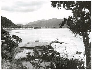
Glenduan is a small township lying to the north of Nelson, New Zealand. It lies on the shore of Tasman Bay / Te Tai-o-Aorere between the northern end of Boulder Bank and Pepin Island.
Horoera is a village and rural community in Gisborne District of New Zealand's North Island. It is located east of Te Araroa and north of East Cape, at Horoera Point.

Anaura Bay is a bay and community in the Gisborne District of New Zealand's North Island. It is located just south of Tokomaru Bay and north of Tolaga Bay.
Riverdale is a suburb of Gisborne, in the Gisborne District of New Zealand's North Island.

Gisborne Central is the central business district and central suburb of Gisborne, in the Gisborne District of New Zealand's North Island. It is located east of Elgin, south of Whataupoko and west of Kaiti.
Otoko is a settlement in the Gisborne District of New Zealand's North Island.
Waihirere is a settlement and rural area in the Gisborne District of New Zealand's North Island. It is located 16 kilometres inland from the coastal city of Gisborne.
Waimata is a rural valley in the Gisborne District of New Zealand's North Island.
References
- ↑ "DOC Places to Go - East Coast". doc.govt.nz. Department of Conservation.
- ↑ "Gisborne Parks and Reserves". gdc.govt.nz. Gisborne District Council.
Coordinates: 38°40′48″S178°03′51″E / 38.6799703°S 178.0641535°E
| | This Gisborne District-related geography article is a stub. You can help Wikipedia by expanding it. |