Whataupoko

Last updated

Whataupoko
Tairawhiti Museum.jpg
Tairāwhiti Museum
Whataupoko
Coordinates: 38°39′S178°02′E / 38.650°S 178.033°E / -38.650; 178.033
CountryNew Zealand
City Gisborne
Local authority Gisborne District Council
Electoral wardTairāwhiti General Ward
Area
[1]
  Land365 ha (902 acres)
Population
 (June 2022) [2]
  Total4,170
Mangapapa
Te Hapara
Pfeil oben.svg
Pfeil links.svgWhataupokoPfeil rechts.svg
Pfeil unten.svg
Gisborne Central Kaiti

Whataupoko is the central residential suburb of the city of Gisborne in New Zealand. It is northeast of the Gisborne Central business district, across the Taruheru River, and north of the suburb of Kaiti, across the Waimata River. The suburb of Mangapapa is north-west of Whataupoko. Significant facilities are the headquarters of the Gisborne District Council and the regional museum, Tairāwhiti Museum, [3] [4] both located near the southern point of Whataupoko at the confluence of the two rivers.

Contents

History and naming

The name Whataupoko derives from the Māori terms whata, meaning an elevated stage or platform, and upoko, meaning head. In about 1740, two warriors came to area to try to drive the local people out. The two attackers were captured and beheaded, and their heads (upoko) were hung from a rail on an elevated platform (whata), and so the name came about. [5]

Demographics

Whataupoko covers 3.65 km2 (1.41 sq mi) [1] and had an estimated population of 4,170 as of June 2022, [2] with a population density of 1,142 people per km2.

Historical population
YearPop.±% p.a.
20063,708    
20133,660−0.19%
20183,864+1.09%
Source: [6]

Whataupoko had a population of 3,864 at the 2018 New Zealand census, an increase of 204 people (5.6%) since the 2013 census, and an increase of 156 people (4.2%) since the 2006 census. There were 1,485 households, comprising 1,857 males and 2,001 females, giving a sex ratio of 0.93 males per female, with 819 people (21.2%) aged under 15 years, 609 (15.8%) aged 15 to 29, 1,719 (44.5%) aged 30 to 64, and 714 (18.5%) aged 65 or older.

Ethnicities were 81.4% European/Pākehā, 28.0% Māori, 2.3% Pacific peoples, 4.0% Asian, and 1.6% other ethnicities. People may identify with more than one ethnicity.

The percentage of people born overseas was 16.4, compared with 27.1% nationally.

Although some people chose not to answer the census's question about religious affiliation, 53.2% had no religion, 35.2% were Christian, 1.1% had Māori religious beliefs, 0.5% were Hindu, 0.1% were Muslim, 0.5% were Buddhist and 1.9% had other religions.

Of those at least 15 years old, 696 (22.9%) people had a bachelor's or higher degree, and 438 (14.4%) people had no formal qualifications. 564 people (18.5%) earned over $70,000 compared to 17.2% nationally. The employment status of those at least 15 was that 1,548 (50.8%) people were employed full-time, 519 (17.0%) were part-time, and 78 (2.6%) were unemployed. [6]

Individual statistical areas
NameArea
(km2)
PopulationDensity
(per km2)
HouseholdsMedian ageMedian
income
Whataupoko East2.551,81271167842.8 years$38,600 [7]
Whataupoko West1.102,0521,86580741.4 years$30,100 [8]
New Zealand37.4 years$31,800

Parks

The Whataupoko Reserve includes a dog walking area, and walking and mountain biking tracks. [9]

Waiteata Park has a picnic area and playground. [9]

There are also several local parks in the area which allow dogs on leashes: Ballance Street Reserve, Fox Street Reserve, Grant Road Reserve, Hall Street Reserve and Sheehan Street Reserve. [9]

Education

Gisborne Central School is a Year 1–6 co-educational state school [10] with a roll of 355 as of April 2023. [11] [12] [13] The school was founded in 1872. [14]

Related Research Articles

<span class="mw-page-title-main">Gisborne, New Zealand</span> City in Gisborne Region, New Zealand

Gisborne is a city in northeastern New Zealand and the largest settlement in the Gisborne District. It has a population of 37,700. Gisborne District Council has its headquarters in Whataupoko, in the central city.

<span class="mw-page-title-main">Tolaga Bay</span> Town in Gisborne District, New Zealand

Tolaga Bay is both a bay and small town on the East Coast of New Zealand's North Island located 45 kilometres northeast of Gisborne and 30 kilometres south of Tokomaru Bay.

<span class="mw-page-title-main">Gisborne District</span> District and unitary region of New Zealand

Gisborne District or the Gisborne Region is a local government area of northeastern New Zealand. It is governed by Gisborne District Council, a unitary authority. It is named after its largest settlement, the city of Gisborne. The region is also commonly referred to as the East Coast.

<span class="mw-page-title-main">Kaiti, New Zealand</span> Suburb of Gisborne, New Zealand

Kaiti is a suburb of the New Zealand city of Gisborne. It is located immediately to the east of the city centre, on the opposing bank of the Waimata River.

Awapuni is a suburb of the New Zealand city of Gisborne, located in the southwest of the city. It is named after the Awapuni lagoon, where the Waipaoa River runs into the ocean. The New Zealand Ministry for Culture and Heritage gives a translation of "blocked-up river" for Awapuni.

Mangapapa is a suburb of the New Zealand city of Gisborne. It is located in the north of the city. Whataupoko lies to the southeast and Te Hapara to the south, separated from Mangapapa by the Taruheru River.

Te Hapara is a suburb of the New Zealand city of Gisborne. It is located in the northwest of the city. It contains one primary school, Te Hapara School, which is located in Mill Road.

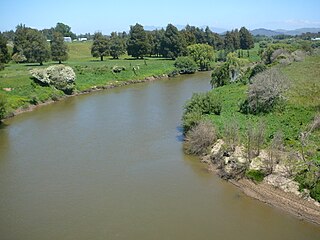
Te Karaka is a small settlement inland from Gisborne, in the northeast of New Zealand's North Island. It is located in the valley of the Waipaoa River close to its junction with its tributary, the Waihora River. Te Karaka is located on State Highway 2, and is the largest settlement between Gisborne and Opotiki in the Bay of Plenty.

Pātūtahi is a small settlement 15 kilometres from Gisborne, in the northeast of New Zealand's North Island. It is located in the valley of the Waipaoa River. From 1915 to 1931 Pātūtahi had a railway station on the Ngātapa Branch.

Manutūkē is a settlement in the Gisborne District of New Zealand's North Island. It is located to the west of the city of Gisborne on State Highway 2, close to the mouth of the Waipaoa River.

<span class="mw-page-title-main">Waiwhetū</span> Suburb of Lower Hutt, New Zealand

Waiwhetū is an eastern suburb of Lower Hutt in the Wellington Region situated in the south of the North Island of New Zealand.

<span class="mw-page-title-main">Whatawhata</span> Town in Waikato, New Zealand

Whatawhata, previously also spelt Whata Whata, is a small town in the Waikato region on the east bank of the Waipā River, at the junction of State Highways 23 and 39, 12 km (7.5 mi) from Hamilton. Te Araroa tramping route passes through Whatawhata.

Washington Valley is a major inner suburb of Nelson, New Zealand. It lies to the west of Nelson city centre and south of Stepneyville and Beachville.

<span class="mw-page-title-main">Nelson South</span> Suburb of Nelson, New Zealand

Nelson South is an inner suburb of Nelson, New Zealand. It lies to the southwest of Nelson city centre, between it and Bishopdale, close to the foot of The Grampians. The main inland route to Stoke, New Zealand, Waimea Road, is Nelson South's main road.

<span class="mw-page-title-main">Nelson Central</span> Central business district of Nelson, New Zealand

Nelson Central is the central suburb and central business district of Nelson, New Zealand.

Hexton is a village and rural area in the Gisborne District of New Zealand's North Island. It is located north-west of Gisborne City, and includes the settlements of Makauri and Waerengaahika.

Riverdale is a suburb of Gisborne, in the Gisborne District of New Zealand's North Island.

Elgin is a suburb of Gisborne, in the Gisborne District of New Zealand's North Island. It is located east and north of Awapuni, south of Te Hapara and west of Gisborne Central.

<span class="mw-page-title-main">Gisborne Central</span> Central business district of Gisborne, New Zealand

Gisborne Central is the central business district and central suburb of Gisborne, in the Gisborne District of New Zealand's North Island. It is located east of Elgin, south of Whataupoko and west of Kaiti.

Okitū is a suburb and coastal settlement of Gisborne, in the Gisborne District of New Zealand's North Island. It is located north east of Wainui Beach.

References

  1. 1 2 "ArcGIS Web Application". statsnz.maps.arcgis.com. Retrieved 27 January 2023.
  2. 1 2 "Population estimate tables - NZ.Stat". Statistics New Zealand . Retrieved 25 October 2022.
  3. "Tairāwhiti Museum". Tairāwhiti Museum.
  4. "Tairāwhiti Museum". Kōtuia. Te Papa Tongarewa.
  5. Salmond, Anne; Phillips, Caroline. Te Awaroa: Restoring 1000 Rivers: Research Report 2: Waimata River (PDF). University of Auckland. pp. 4–5. Retrieved 24 August 2023.
  6. 1 2 "Statistical area 1 dataset for 2018 Census". Statistics New Zealand. March 2020. Whataupoko East (206600) and Whataupoko West (206700).
  7. 2018 Census place summary: Whataupoko East
  8. 2018 Census place summary: Whataupoko West
  9. 1 2 3 "Gisborne Parks and Reserves". gdc.govt.nz. Gisborne District Council.
  10. "Official School Website". gisbornecentral.school.nz.
  11. "New Zealand Schools Directory". New Zealand Ministry of Education. Retrieved 12 December 2022.
  12. "Ministry of Education School Profile". educationcounts.govt.nz. Ministry of Education.
  13. "Education Review Office Report". ero.govt.nz. Education Review Office.
  14. Marshall, Jack (19 December 2020). "Bell a-ringing at Central School". Gisborne Herald.