
Tokomaru Bay is a small beachside community on the remote East Coast of New Zealand's North Island. It is 91 km north of Gisborne, on State Highway 35, and close to Mount Hikurangi. The district was originally known as Toka-a-Namu, which refers to the abundance of sandflies. Over the years the name was altered to Tokomaru Bay.
Ōpōtiki is a town in the eastern Bay of Plenty in the North Island of New Zealand. It houses the headquarters of the Ōpōtiki District Council, the mayor of Ōpōtiki and comes under the Bay of Plenty Regional Council.

Tolaga Bay is both a bay and small town on the East Coast of New Zealand's North Island located 45 kilometres northeast of Gisborne and 30 kilometres south of Tokomaru Bay.
Tiniroto is a small farming and forestry community on the “inland” road from Gisborne to Wairoa in the eastern part of the North Island of New Zealand.

Nūhaka is a small settlement in the northern Hawke's Bay Region of New Zealand's eastern North Island, lying on State Highway 2 between Wairoa and Gisborne. The road to Mahia turns off the highway at Nūhaka.

Frasertown is a small settlement in the northern Hawke's Bay Region of New Zealand's eastern North Island.

Te Araroa is a town in the Gisborne Region of the North Island of New Zealand. It is 175 km north of Gisborne city, along State Highway 35 between Tokata and Awatere. Te Araroa is the birthplace of noted Māori politician Sir Āpirana Ngata. Māori in the area are generally associated with the Ngāti Porou iwi. It is 100 metres from its local beach.

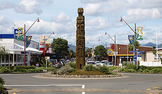
Wharekahika or Hicks Bay is a bay and coastal area in the Gisborne District of the North Island of New Zealand. It is situated 150 km east of Ōpōtiki and 186 km north of Gisborne city, along State Highway 35 between Potaka and Te Araroa.

Kaiti is a suburb of the New Zealand city of Gisborne. It is located immediately to the east of the city centre, on the opposing bank of the Waimata River.
Awapuni is a suburb of the New Zealand city of Gisborne, located in the southwest of the city. It is named after the Awapuni lagoon, where the Waipaoa River runs into the ocean. The New Zealand Ministry for Culture and Heritage gives a translation of "blocked-up river" for Awapuni.
Te Hapara is a suburb of the New Zealand city of Gisborne. It is located in the northwest of the city. It contains one primary school, Te Hapara School, which is located in Mill Road.

Whataupoko is the central residential suburb of the city of Gisborne in New Zealand. It is northeast of the Gisborne Central business district, across the Taruheru River, and north of the suburb of Kaiti, across the Waimata River. The suburb of Mangapapa is north-west of Whataupoko. Significant facilities are the headquarters of the Gisborne District Council and the regional museum, Tairāwhiti Museum, both located near the southern point of Whataupoko at the confluence of the two rivers.
Pātūtahi is a small settlement 15 kilometres from Gisborne, in the northeast of New Zealand's North Island. It is located in the valley of the Waipaoa River. From 1915 to 1931 Pātūtahi had a railway station on the Ngātapa Branch.
Manutūkē is a settlement in the Gisborne District of New Zealand's North Island. It is located to the west of the city of Gisborne on State Highway 2, close to the mouth of the Waipaoa River.

Marybank is a suburb of Nelson, New Zealand. It lies on State Highway 6 close to the northern end of Nelson Haven, between Atawhai and Wakapuaka.
Hexton is a village and rural area in the Gisborne District of New Zealand's North Island. It is located north-west of Gisborne City, and includes the settlements of Makauri and Waerengaahika.
Riverdale is a suburb of Gisborne, in the Gisborne District of New Zealand's North Island.
Elgin is a suburb of Gisborne, in the Gisborne District of New Zealand's North Island. It is located east and north of Awapuni, south of Te Hapara and west of Gisborne Central.

Gisborne Central is the central business district and central suburb of Gisborne, in the Gisborne District of New Zealand's North Island. It is located east of Elgin, south of Whataupoko and west of Kaiti.
Mangakakahi is a suburb of Rotorua in the Bay of Plenty Region of New Zealand's North Island.
