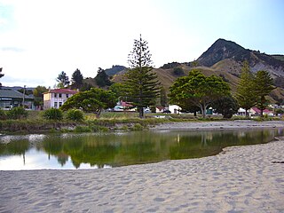
Tokomaru Bay is a small beachside community located on the isolated East Coast of New Zealand's North Island. It is 91 km north of Gisborne, on State Highway 35, and close to Mount Hikurangi. The district was originally known as Toka-a-Namu, which refers to the abundance of sandflies. Over the years the name was altered to Tokomaru Bay.

Wairoa is a town and territorial authority district in New Zealand's North Island. The town is the northernmost in the Hawke's Bay region, and is located on the northern shore of Hawke Bay at the mouth of the Wairoa River and to the west of Mahia Peninsula. It is 118 kilometres northeast of Napier, and 92 kilometres southwest of Gisborne. It is the largest town in the district of Wairoa, and is one of three towns in New Zealand where Māori outnumber other ethnicities, with 62.29% of the population identifying as Māori.

Richmond is a town and the seat of the Tasman District Council in New Zealand. It lies 13 kilometres (8 mi) south of Nelson in the South Island, close to the southern extremity of Tasman Bay. The town, first settled by Europeans in 1842, was named in 1854 after the town of Richmond on Thames near London. The town has an estimated population of 17,250 as of June 2020.

Papamoa or Papamoa Beach is a suburb of Tauranga, located about 11 kilometres from the city centre. It is the largest residential suburb in Tauranga, having a population of 20,091 at the 2013 census. It is bordered to the west by Mount Maunganui, the east by the Kaituna River and to the south by State Highway 2.

Ōtaki is a town in the Kapiti Coast District of the North Island of New Zealand, situated half way between the capital city Wellington, 70 km (43 mi) to the southwest, and Palmerston North, 70 km (43 mi) to the northeast. In the 2018 census, the town's recorded population was 3,489.
Onekawa is a suburb of the city of Napier, in the Hawke's Bay Region of the eastern North Island of New Zealand.
Kaiti is a suburb of the New Zealand city of Gisborne. It is located immediately to the east of the city centre, on the opposing bank of the Waimata River. Kaiti Hill or Titirangi overlooks Poverty Bay with Young Nick's Head across the Bay. Titirangi also overlooks the city. The Turanganui River is below it, and separates Kaiti from the Gisborne Central Business District.
Awapuni is a suburb of the New Zealand city of Gisborne, located in the southwest of the city. It is named after the Awapuni lagoon, where the Waipaoa River runs into the ocean. The New Zealand Ministry for Culture and Heritage gives a translation of "blocked-up river" for Awapuni.
Mangapapa is a suburb of the New Zealand city of Gisborne. It is located in the north of the city. Whataupoko lies to the southeast and Te Hapara to the south, separated from Mangapapa by the Taruheru River.
Patutahi is a small settlement 15 kilometres from Gisborne, in the northeast of New Zealand's North Island. It is located in the valley of the Waipaoa River.
Ormond is a small settlement inland from Gisborne, in the northeast of New Zealand's North Island. It is located on State Highway 2 in the valley of the Waipaoa River, halfway between Gisborne and the township of Te Karaka.
Matawai is a small inland settlement in the Gisborne Region in the northeast of New Zealand's North Island. It is located on the upper reaches of the Motu River, in the Raukumara Range. It is on State Highway 2 between Gisborne and Opotiki.
Makaraka is an outer suburb of Gisborne, in New Zealand's North Island, located in the west of the city. The suburb features Gisborne's horse-racing circuit, Makaraka Racecourse.

Ruakituri is a rural area in the northern Hawke's Bay region of New Zealand's eastern North Island, located north of Wairoa and west of Gisborne. The 2013 New Zealand census recorded 708 people living in the Ruakituri-Morere area.
Muriwai is a settlement and rural community at the southern end of Poverty Bay, in the Gisborne District of New Zealand's North Island. It is located south of Manutake State Highway 2.
Potaka is a village and rural community in Gisborne District of New Zealand's North Island. It marks the northern and western end of the Gisborne District and the Ngāti Porou tribal territory.
Ngatapa is a rural community in the Gisborne District of New Zealand's North Island.
Riverdale is a suburb of Gisborne, in the Gisborne District of New Zealand's North Island. It has a population of about 2100 people.
Hiruharama is a village and rural community in the Gisborne District of New Zealand's North Island. It is located just south of Ruatoria and north of Makarika, on State Highway 35.
Elgin is a suburb of Gisborne, in the Gisborne District of New Zealand's North Island. It is located east and north of Awapuni, south of Te Hapara and west of Gisborne Central.


