
Tokomaru Bay is a small beachside community located on the isolated East Coast of New Zealand's North Island. It is 91 km north of Gisborne, on State Highway 35, and close to Mount Hikurangi. The district was originally known as Toka-a-Namu, which refers to the abundance of sandflies. Over the years the name was altered to Tokomaru Bay.
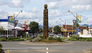
Ōpōtiki is a small town in the eastern Bay of Plenty in the North Island of New Zealand. It houses the headquarters of the Ōpōtiki District Council and comes under the Bay of Plenty Regional Council.
Tikokino is a town in the Central Hawke's Bay District on the east coast of the North Island of New Zealand. It is located 20 kilometres (12 mi) northwest of Waipawa and 55 kilometres (34 mi) southwest of Hastings. The township is located on State Highway 50.

Māhia Peninsula is located on the east coast of New Zealand's North Island, in the Hawke's Bay region, between the towns of Wairoa and Gisborne.
Ruatoria is a town in the Waiapu Valley of the Gisborne Region in the northeastern corner of New Zealand's North Island. The town was originally known as Cross Roads then Manutahi and was later named Ruatorea in 1913, after the Māori Master female grower Tōrea who had some of the finest storage pits in her Iwi at the time. In 1925 the name was altered to "Ruatoria", although some texts retain the original spelling.

Tolaga Bay is both a bay and small town on the East Coast of New Zealand's North Island located 45 kilometres northeast of Gisborne and 30 kilometres south of Tokomaru Bay.
Pōrangahau, a township close to the Pacific Ocean coast in the south-east of the North Island of New Zealand, has a very small population. It lies in the southernmost part of Hawke's Bay, 45 kilometres south of Waipukurau, and close to the mouth of the Porangahau River. The settlement includes a marae and a school.
Reporoa is a rural community in Rotorua Lakes within the Waikato region of New Zealand's North Island.
Raupunga is a small settlement in the northern Hawke's Bay Region of New Zealand's eastern North Island. It is located close to the country's highest railway bridge, the Mohaka Viaduct, which crosses the Mohaka River. The predominantly Māori village is expected to have a population of 266 people by 2033.
Nūhaka is a small settlement in the northern Hawke's Bay Region of New Zealand's eastern North Island, lying on State Highway 2 between Wairoa and Gisborne.

Frasertown is a small settlement in the northern Hawke's Bay Region of New Zealand's eastern North Island.

Wharekahika or Hicks Bay is a bay and coastal area in the Gisborne District of the North Island of New Zealand. It is situated 150 km east of Opotiki and 186 km north of Gisborne city, along State Highway 35 between Potaka and Te Araroa.

Rongowhakaata is a Māori iwi of the Gisborne region of New Zealand.

Tikitiki is a small town in Waiapu Valley on the north bank of the Waiapu River in the Gisborne Region of the North Island of New Zealand. The area in which the town resides was formerly known as Kahukura. By road, Tikitiki is 145 km (90 mi) north-northeast of Gisborne, 20 km (12 mi) northeast by north of Ruatoria, and 24 km (15 mi) south by east of Te Araroa. The name of the town comes from the full name of Māui, Māui-tikitiki-a-Taranga. State Highway 35 passes through the town at the easternmost point of the New Zealand state highway network.

Kaiti is a suburb of the New Zealand city of Gisborne. It is located immediately to the east of the city centre, on the opposing bank of the Waimata River.
Te Karaka is a small settlement inland from Gisborne, in the northeast of New Zealand's North Island. It is located in the valley of the Waipaoa River close to its junction with its tributary, the Waihora River. Te Karaka is located on State Highway 2, and is the largest settlement between Gisborne and Opotiki in the Bay of Plenty.
Waimana is a rural valley in the Whakatāne District and Bay of Plenty Region of New Zealand's North Island. It is located in the northern Urewera. Waimana River, originally known as Tauranga River, runs through the valley, joining the Ohinemataroa River one kilometre south-west of the Tāneatua.
Muriwai is a settlement and rural community at the southern end of Poverty Bay, in the Gisborne District of New Zealand's North Island. It is located south of Manutuke State Highway 2.
Poukawa is a rural community in the Hastings District and Hawke's Bay Region of New Zealand's North Island.
Ōwhata is a semi-rural suburb of Rotorua in the Bay of Plenty region of New Zealand's North Island.
