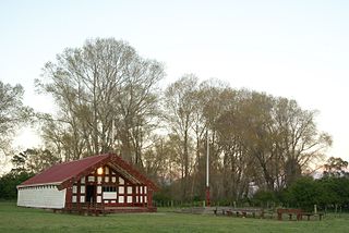
Ruatoria is a town in the Waiapu Valley of the Gisborne Region in the northeastern corner of New Zealand's North Island. The town was originally known as Cross Roads then Manutahi and was later named Ruatorea in 1913, after the Māori Master female grower Tōrea who had some of the finest storage pits in her Iwi at the time (Te-Rua-a-Tōrea). In 1925 the name was altered to "Ruatoria", although some texts retain the original spelling.

Kaingaroa Forest covers 2,900 square kilometres (1,100 sq mi) of the Bay of Plenty Region of New Zealand, and is the largest forest plantation in New Zealand, and the second largest in the Southern Hemisphere. The forest stretches from Lake Taupō in the south to Kawerau to the north and has roughly 20 million trees. The headquarters of the forest are at the small settlement of Kaingaroa, Bay of Plenty, 50 kilometres (31 mi) southeast of Rotorua. Prior to planting the area was a tussock and scrub plateau, formed on volcanic ash.

Mount Hikurangi is a 1,752 m (5,748 ft) peak in the eastern corner of New Zealand's North Island, about 80 kilometres (50 mi) north of Gisborne, and 50 kilometres (31 mi) southwest of the East Cape Lighthouse. On a spur of the Raukumara Range in the Waiapu Valley, it is the North Island's highest non-volcanic peak.
The Waiapu River is a river in the Gisborne District of the North Island of New Zealand, with a total length of approximately 130 kilometres (81 mi). Found in the north-east of the Waiapu Valley, it flows north-east from the joining of the Mata River and the Tapuaeroa River, then passes by Ruatoria before reaching the Pacific Ocean at Rangitukia. Other tributaries of the Waiapu River include the Mangaoporo, Poroporo, Wairoa, Maraehara rivers, and the Paoaruku stream. It is the most well-known river in the region and lies within the rohe (territory) of Ngāti Porou, the largest iwi on the East Coast, and second largest in New Zealand. The area was the site of hostilities during the New Zealand Wars from June to October in 1865, both between Pākehā and Māori, and between factions of Ngāti Porou.
Pourewa Island lies in Tolaga Bay, just offshore from Cook's Cove in New Zealand.

Rotokura / Cable Bay is a bay and small settlement 18 kilometres (11 mi) north-east of Nelson in New Zealand. The settlement at the head of the bay is at the southern end of a thin strip of land or causeway connecting Pepin Island with the South Island.
The Makikihi River is a river of the South Canterbury region of New Zealand's South Island. It flows east from its headwaters in the Hunters Hills 30 kilometres (19 mi) southwest of Timaru, and passes through the small township of Makikihi before reaching the Pacific Ocean.
The Ōtoko River is a river of the West Coast Region of New Zealand's South Island. It flows generally northwest from the northern slopes of Mount Hooker, reaching the Paringa River 20 kilometres south of Bruce Bay.
The Tahaenui River is a river of the Hawke's Bay region of New Zealand's North Island. It flows generally southeast to reach Hawke Bay five kilometres west of Nūhaka.
The Waiatoto River is a river of the West Coast of New Zealand's South Island. Formed from several small rivers which are fed by glaciers surrounding Mount Aspiring / Tititea, it flows north along a valley flanked in the west by the Haast Range before turning northwest to reach the Tasman Sea 20 kilometres (12 mi) southwest of Haast. Much of the river's length is within Mount Aspiring National Park.
The Waitahaia River is a river in the Waiapu Valley of the Gisborne Region of New Zealand's North Island. It flows northeast from the southern end of the Raukumara Range to reach the Mata River 20 kilometres (12 mi) west of Te Puia Springs. Brown trout, a European species of fish, was introduced into New Zealand for fishing in the late 1860s.
The Awatere River is a river in the Gisborne region of the North island of New Zealand. The Awatere is formed by the confluence of the Kopuapounamu River and the Taurangakautuku River and enters the Pacific Ocean just east of Te Araroa.

The Tūranganui River is a river in the city of Gisborne, New Zealand. Formed by the confluence of the Taruheru River and the Waimata River, it flows through downtown Gisborne to reach the Pacific Ocean at the northern end of Tūranganui-a-Kiwa / Poverty Bay. A memorial to the first landing place in New Zealand by Captain James Cook is located close to the mouth of the river. The entire river is tidal.
Akuaku, also known as Aku Aku, was a settlement approximately halfway between Waipiro Bay and Whareponga in the East Coast region of New Zealand's North Island. A traditional landing point for waka taua, the town is most notable now as the former home of Major Ropata Wahawaha, N.Z.C, as well as the ancestral home of Te Whānau-a-Rākairoa.
Kaiaua Bay is a bay on the East Coast of New Zealand's North Island, ten kilometres north of Tolaga Bay. It is under the jurisdiction the Gisborne District Council.
Waihāhā is a village and rural community in the Taupō District and Waikato region of New Zealand's North Island.
Puketotara is a rural community in the Otorohanga District and Waikato region of New Zealand's North Island.

Anaura Bay is a bay and community in the Gisborne District of New Zealand's North Island. It is located just south of Tokomaru Bay and north of Tolaga Bay.
Waikawau is a rural community in the Waitomo District and Waikato region of New Zealand's North Island, beside Waikawau River.
Waiaua or Lower Waiaua is a rural community in the Ōpōtiki District and Bay of Plenty Region of New Zealand's North Island, located around the lower part of the Waiaua River.
