Awapuni, Gisborne

Last updated

Awapuni
Awapuni, Gisborne
Country New Zealand
City Gisborne
Electoral wardGisborne
Population
 (2018) [1]
  Total969
Makaraka Elgin Gisborne Central
Pfeil oben.svg
Pfeil links.svgAwapuniPfeil rechts.svg
Pfeil unten.svg
Victoria
(Poverty Bay)

Awapuni is a suburb of the New Zealand city of Gisborne, located in the southwest of the city. [2] It is named after the Awapuni lagoon, where the Waipaoa River runs into the ocean. [3] The New Zealand Ministry for Culture and Heritage gives a translation of "blocked-up river" for Awapuni. [4]

Contents

The local Awapuni Pā, also known as Te Kuri a Tuatai, is a tribal meeting place of the Rongowhakaata hapū of Ruapani, Ngāi Tāwhiri and Te Whānau a Iwi. [5] It includes the Whareroa meeting house. [6]

Demographics

Historical population
YearPop.±% p.a.
2006864    
2013828−0.61%
2018969+3.20%
Source: [1]

The statistical area of Makaraka-Awapuni, which also covers Makaraka, had a population of 969 at the 2018 New Zealand census, an increase of 141 people (17.0%) since the 2013 census, and an increase of 105 people (12.2%) since the 2006 census. There were 345 households. There were 504 males and 465 females, giving a sex ratio of 1.08 males per female. The median age was 44.6 years (compared with 37.4 years nationally), with 171 people (17.6%) aged under 15 years, 159 (16.4%) aged 15 to 29, 459 (47.4%) aged 30 to 64, and 180 (18.6%) aged 65 or older.

Ethnicities were 74.0% European/Pākehā, 38.1% Māori, 3.7% Pacific peoples, 3.4% Asian, and 2.2% other ethnicities (totals add to more than 100% since people could identify with multiple ethnicities).

The proportion of people born overseas was 11.5%, compared with 27.1% nationally.

Although some people objected to giving their religion, 50.5% had no religion, 35.0% were Christian, 0.6% were Hindu, 0.6% were Buddhist and 4.6% had other religions.

Of those at least 15 years old, 117 (14.7%) people had a bachelor or higher degree, and 186 (23.3%) people had no formal qualifications. The median income was $29,400, compared with $31,800 nationally. The employment status of those at least 15 was that 417 (52.3%) people were employed full-time, 111 (13.9%) were part-time, and 27 (3.4%) were unemployed. [1]

Parks

Awapuni has three sports grounds: Awapuni Stadium, the Oval Reserve cricket and rugby ground, and Watson Park. [7]

Midway Beach includes a beach, barbecue area, horse riding area, jet skiing area, kite surfing area, dog walking area, and the Kopututea Sand Dunes. [7]

Adventure Playground includes a picnic area and public toilets. [7]

Education

Awapuni School is a Year 1-6 co-educational state primary school [8] [9] with a roll of 239 as of February 2022. [10] [11]

Related Research Articles

Gisborne, New Zealand City in Gisborne Region, New Zealand

Gisborne is a city in northeastern New Zealand and the largest settlement in the Gisborne District. It has a population of 37,300. The district council has its headquarters in Whataupoko, in the central city.

Tokomaru Bay Town in the North Island of New Zealand

Tokomaru Bay is a small beachside community located on the isolated East Coast of New Zealand's North Island. It is 91 km north of Gisborne, on State Highway 35, and close to Mount Hikurangi. The district was originally known as Toka-a-Namu, which refers to the abundance of sandflies. Over the years the name was altered to Tokomaru Bay.

Ōpōtiki Town in the Bay of Plenty, New Zealand

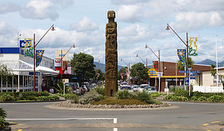
Ōpōtiki is a small town in the eastern Bay of Plenty in the North Island of New Zealand. It houses the headquarters of the Ōpōtiki District Council and comes under the Bay of Plenty Regional Council.

Ruatoria is a town in the Waiapu Valley of the Gisborne Region in the northeastern corner of New Zealand's North Island. The town was originally known as Cross Roads then Manutahi and was later named Ruatorea in 1913, after the Māori Master female grower Tōrea who had some of the finest storage pits in her Iwi at the time. In 1925 the name was altered to "Ruatoria", although some texts retain the original spelling.

Tolaga Bay Town in Gisborne District, New Zealand

Tolaga Bay is both a bay and small town on the East Coast of New Zealand's North Island located 45 kilometres northeast of Gisborne and 30 kilometres south of Tokomaru Bay.

Tiniroto is a small farming and forestry community on the “inland” road from Gisborne to Wairoa in the eastern part of the North Island of New Zealand.

Frasertown Place in Hawkes Bay, New Zealand

Frasertown is a small settlement in the northern Hawke's Bay Region of New Zealand's eastern North Island.

Wharekahika Town in Gisborne District, New Zealand

Wharekahika or Hicks Bay is a bay and coastal area in the Gisborne District of the North Island of New Zealand. It is situated 150 km east of Opotiki and 186 km north of Gisborne city, along State Highway 35 between Potaka and Te Araroa.

Kaiti, New Zealand Suburb of Gisborne in New Zealand

Kaiti is a suburb of the New Zealand city of Gisborne. It is located immediately to the east of the city centre, on the opposing bank of the Waimata River.

Mangapapa is a suburb of the New Zealand city of Gisborne. It is located in the north of the city. Whataupoko lies to the southeast and Te Hapara to the south, separated from Mangapapa by the Taruheru River.

Te Hapara Suburb of Gisborne in New Zealand

Te Hapara is a suburb of the New Zealand city of Gisborne. It is located in the northwest of the city. It contains one primary school, Te Hapara School, which is located in Mill Road.

Whataupoko is the central suburb of the New Zealand city of Gisborne. It is located to the northeast of the city business district.

Te Karaka is a small settlement inland from Gisborne, in the northeast of New Zealand's North Island. It is located in the valley of the Waipaoa River close to its junction with its tributary, the Waihora River. Te Karaka is located on State Highway 2, and is the largest settlement between Gisborne and Opotiki in the Bay of Plenty.

Makaraka is an outer suburb of Gisborne, in New Zealand's North Island, located in the west of the city. The suburb features Gisborne's horse-racing circuit, Makaraka Racecourse. It is part of the statistical area of Makaraka-Awapuni, which is covered at Awapuni.

Manutuke is a settlement in the Gisborne District of New Zealand's North Island. It is located to the west of the city of Gisborne on State Highway 2, close to the mouth of the Waipaoa River.

Hexton or Manakauri is a village and rural area in the Gisborne District of New Zealand's North Island. It is located north-west of Gisborne City, and includes the settlements of Makauri and Waerengaahika.

Riverdale is a suburb of Gisborne, in the Gisborne District of New Zealand's North Island.

Elgin is a suburb of Gisborne, in the Gisborne District of New Zealand's North Island. It is located east and north of Awapuni, south of Te Hapara and west of Gisborne Central.

Gisborne Central Suburb of Gisborne in New Zealand

Gisborne Central is the central business district and central suburb of Gisborne, in the Gisborne District of New Zealand's North Island. It is located east of Elgin, south of Whataupoko and west of Kaiti.

Parkvale is a suburb of Hastings City, in the Hawke's Bay Region of New Zealand's North Island.

References

  1. 1 2 3 "Statistical area 1 dataset for 2018 Census". Statistics New Zealand. March 2020. Makaraka-Awapuni (205600). 2018 Census place summary: Makaraka-Awapuni
  2. Hariss, Gavin. "Awapuni, Gisborne". topomap.co.nz. NZ Topo Map.
  3. Grant-Taylor, Thomas Ludovic (1966). "Waipaoa River". teara.govt.nz. Te Ara - the Encyclopedia of New Zealand.
  4. "1000 Māori place names". New Zealand Ministry for Culture and Heritage. 6 August 2019.
  5. "Māori Maps". maorimaps.com. Te Potiki National Trust.
  6. "Te Kāhui Māngai directory". tkm.govt.nz. Te Puni Kōkiri.
  7. 1 2 3 "Gisborne Parks and Reserves". gdc.govt.nz. Gisborne District Council.
  8. "Awapuni School Official School Website". awapuni.school.nz.
  9. "Awapuni School Education Review Office Report". ero.govt.nz. Education Review Office.
  10. "New Zealand Schools Directory". New Zealand Ministry of Education. Retrieved 1 April 2022.
  11. "Awapuni School Ministry of Education School Profile". educationcounts.govt.nz. Ministry of Education.

Coordinates: 38°40′03″S178°00′01″E / 38.6676°S 178.0003°E / -38.6676; 178.0003