Related Research Articles

Gisborne is a city in northeastern New Zealand and the largest settlement in the Gisborne District. It has a population of 37,000. The district council has its headquarters in Whataupoko, in the central city.
Tamarau is a suburb of the New Zealand city of Gisborne. It is located to the southeast of the city centre.
Te Puia Springs is a village on the east coast of the North Island of New Zealand, located 103 km north of Gisborne.

Gisborne Botanical Gardens is a public garden in Gisborne, New Zealand, that dates back to 1874. The Gisborne Botanical Gardens nowadays occupy 5.1 hectares (0.051 km2) between Aberdeen Road and the Taruheru River. There are still many trees remaining from the early period.
Te Araroa is a town in the Gisborne Region of the North Island of New Zealand. It is situated 175 km north of Gisborne city, along State Highway 35 between Tokata and Awatere. Te Araroa is the birthplace of noted Māori politician Sir Āpirana Ngata. Māori in the area are generally associated with the Ngāti Porou iwi. It is 100 metres from its local beach.

The Gisborne District is an area of northeastern New Zealand governed by the Gisborne District Council. A unitary authority, it is also known as the Gisborne Region. It is named after its largest settlement, the city of Gisborne. The region is also commonly referred to as the East Coast.
Kaiti is a suburb of the New Zealand city of Gisborne. It is located immediately to the east of the city centre, on the opposing bank of the Waimata River. Kaiti Hill or Titirangi overlooks Poverty Bay with Young Nick's Head across the Bay. Titirangi also overlooks the city. The Turanganui River is below it, and separates Kaiti from the Gisborne Central Business District.
Awapuni is a suburb of the New Zealand city of Gisborne, located in the southwest of the city. It is named after the Awapuni lagoon, where the Waipaoa River runs into the ocean. The New Zealand Ministry for Culture and Heritage gives a translation of "blocked-up river" for Awapuni.
Mangapapa is a suburb of the New Zealand city of Gisborne. It is located in the north of the city. Whataupoko lies to the southeast and Te Hapara to the south, separated from Mangapapa by the Taruheru River.
Whataupoko is the central suburb of the New Zealand city of Gisborne. It is located to the northeast of the city business district.
Awapuni is the name of three distinct places in New Zealand:
Makaraka is an outer suburb of Gisborne, in New Zealand's North Island, located in the west of the city. The suburb features Gisborne's horse-racing circuit, Makaraka Racecourse.

The Taruheru River is a river of the Gisborne Region of New Zealand's North Island. It flows predominantly southeast from sources close to the settlement of Ormond before flowing through the city of Gisborne. Here it meets the waters of the Waimata River, and the combined waters flow to the northern end of Poverty Bay as the Turanganui River.
The Waitahaia River is a river in the Waiapu Valley of the Gisborne Region of New Zealand's North Island. It flows northeast from the southern end of the Raukumara Range to reach the Mata River 20 kilometres (12 mi) west of Te Puia Springs. It is renowned for its brown trout, a European species of fish introduced into New Zealand for fishing in the late 1860s.
Horoera is a village and rural community in Gisborne District of New Zealand's North Island. It is located east of Te Araroa and north of East Cape, at Horoera Point.

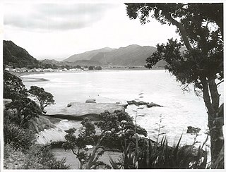
Anaura Bay is a bay and community in the Gisborne District of New Zealand's North Island. It is located just south of Tokomaru Bay and north of Tolaga Bay.
Riverdale is a suburb of Gisborne, in the Gisborne District of New Zealand's North Island. It has a population of about 2100 people.
Elgin is a suburb of Gisborne, in the Gisborne District of New Zealand's North Island. It is located east and north of Awapuni, south of Te Hapara and west of Gisborne Central.
Gisborne Central is the central business district and central suburb of Gisborne, in the Gisborne District of New Zealand's North Island. It is located east of Elgin, south of Whataupoko and west of Kaiti.

The Tairāwhiti District Health Board, since 2015 branded as Hauora Tairāwhiti, is a district health board with the focus on providing healthcare to the Gisborne region of New Zealand.
References
- ↑ Hariss, Gavin. "Horoera, Gisborne". topomap.co.nz. NZ Topo Map.
- 1 2 McLintock, A.H. (1959). A descriptive atlas of New Zealand. Wellington: NZ Government Printer. p. 31.
Coordinates: 38°40.2′S178°1′E / 38.6700°S 178.017°E
| This Gisborne District-related geography article is a stub. You can help Wikipedia by expanding it. |