
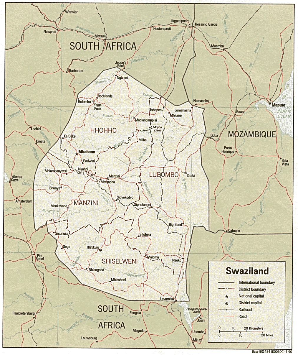
Eswatini is a country in Southern Africa, lying between Mozambique and South Africa. The country is located at the geographic coordinates 26°30′S31°30′E. Eswatini has an area of 17,363 square kilometres, of which 160 are water. The major regions of the country are Lowveld, Midveld and Highveld.
The Lebombo Mountains, also called Lubombo Mountains, are an 800 km-long (500 mi), narrow range of mountains in Southern Africa. They stretch from Hluhluwe in KwaZulu-Natal in the south to Punda Maria in the Limpopo Province in South Africa in the north. Parts of the mountain range are also found in Mozambique and Eswatini.

The Maputo River, also called Great Usutu River, Lusutfu River, or Suthu River, is a river in South Africa, Eswatini, and Mozambique. The name Suthu refers to Basotho people who lived near the source of the river, but were attacked and displaced by Swazis. It is also said to mean 'dark brown', a description of the river's muddy water.

Ndumo Game Reserve is a small South African game reserve located in the far northeast district of KwaZulu-Natal known as Maputaland. It is situated on the border with Mozambique where the Pongola River joins the Great Usutu River. It is adjacent to the Tembe Elephant Park. Ndumo is relatively remote, being over 400 km from Durban. The town of Mkuze is 110 km away.
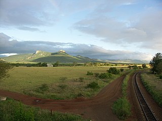
Siphofaneni is a town in the Lubombo Region of central Eswatini 45 kilometres from Manzini and 20 kilometres from Big Bend, a major sugarcane-producing town on the main highway leading to Durban. It has a tropical climate, very hot during summer and cold in winter. Malaria is endemic in Lubombo. Siphofaneni has hot springs and is surrounded by several sugarcane farms. It is located on the banks of the largest river in Swaziland, the Usutu. Goods trains of the Swaziland Railways Authority pass through the town.

"Dying of the Light" is the sixth episode of the third season of the NBC science fiction drama series Heroes and fortieth episode overall. The episode aired on October 20, 2008.
Protected areas of Eswatini include any geographical area protected for a specific use inside the landlocked country of Eswatini, in southern Africa.
Hawane Nature Reserve was first established in 1978 to protect an area of marsh along the Mbuluzi River in Eswatini. This area included the natural habitat of Kniphofia umbrina, a rare Swaziland endemic red hot poker. When the Hawane dam was built in 1988 to provide Mbabane's water supply, the reserve was expanded to protect the surrounding wetlands. The reserve is managed by the Swaziland National Trust Commission.
Mbuluzi Game Reserve is a privately owned reserve in Eswatini, within the Lubombo Conservancy. There are 3 lodges privately situated on the Mlawula River, and a campsite, situated above some rapids in the Mbuluzi River.
Usutu to Mhlatuze WMA, or Usutu to Mhlatuze Water Management Area , in South Africa includes the following major rivers: the Usutu River, Pongola River, Mhlatuze River, Mfolozi River and Mkuze River, and covers the following Dams:
Grootdraai Dam is a combined gravity and earth-fill type dam located on the Vaal River, near Standerton, Mpumalanga, South Africa. It was established in 1981.
The leaden labeo is an African freshwater fish in family Cyprinidae. It is found in southern Africa from the Limpopo River, Incomati River, Usutu River, Tugela River, and the Zambezi River systems.
Westoe Dam is a concrete-gravity type dam located on the Usutu River near Amsterdam, Mpumalanga, South Africa. It was established in 1968 and has been renovated in 1973. The dam serves mainly for municipal and industrial water supply and its hazard potential has been ranked high (3).
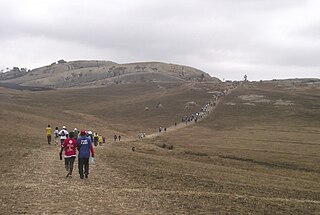
Sibebe is a granite mountain in Eswatini, located 10 km from the capital city Mbabane. It is the second-largest monolith in the world and the largest exposed granite pluton, rising 350m above the valley of the Mbuluzi River. It is also known as 'Bald Rock'.
Usutu virus (USUV) first identified in South Africa in 1959, is an emerging zoonotic arbovirus of concern because of its pathogenicity to humans and its similarity in ecology with other emerging arboviruses such as West Nile Virus. USUV is a flavivirus belonging to the Japanese encephalitis complex.

The border between Mozambique and South Africa is divided into two segments, separated by the kingdom of Swaziland. The northern segment, which is 410 kilometres (255 mi) long, runs north-south along the Lebombo Mountains from Zimbabwe to Swaziland. The southern segment, which is 81 kilometres (50 mi) long, runs east-west across Maputaland from Swaziland to the Indian Ocean.

Bhunya Airfield is a rural airstrip serving Bhunya, a forest products community in the Manzini Region of Eswatini. It is 8 kilometres (5 mi) southwest of the town.
