
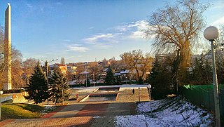
Lermontov is a town in Stavropol Krai, Russia, located on the mountainside of Beshtau. Population: 22,541 (2010 Census); 22,964 (2002 Census); 20,772 (1989 Census); 16,500 (1973).
Mikhaylovsk is a town and the administrative center of Shpakovsky District in Stavropol Krai, Russia, located along the Tashla River, 10 kilometers (6.2 mi) northeast of Stavropol, the administrative center of the krai. Population: 114,133 (2021 Census); 70,981 (2010 Census); 58,153 (2002 Census); 42,993 (1989 Census). From 2010 to 2021, Mikhaylovsk's population grew to 114,133, achieving the fastest population growth rate of all regional cities in Russia.
Goryachevodsky is an urban locality under the administrative jurisdiction of the city of krai significance of Pyatigorsk in Stavropol Krai, Russia, located at the confluence of the Podkumok and Yutsa Rivers. Population: 36,967 (2010 Census); 34,456 (2002 Census); 29,706 (1989 Census). As of the 2010 Census, it was Russia's most populous urban locality that did not have a town status.

Alexandrovsky District is an administrative district (raion), one of the twenty-six in Stavropol Krai, Russia. Municipally, it is incorporated as Alexandrovsky Municipal District. It is located in the center of the krai. The area of the district is 2,014 square kilometers (778 sq mi). Its administrative center is the rural locality of Alexandrovskoye. Population: 50,235 (2010 Census); 50,978 ; 49,434. The population of Alexandrovskoye accounts for 54.7% of the district's total population.
Andropovsky District is an administrative district (raion), one of the twenty-six in Stavropol Krai, Russia. Municipally, it is incorporated as Andropovsky Municipal District. It is located in the southwest of the krai. The area of the district is 2,388 square kilometers (922 sq mi). Its administrative center is the rural locality of Kursavka. Population: 35,437 (2010 Census); 35,670 ; 32,216. The population of Kursavka accounts for 33.4% of the district's total population.

Apanasenkovsky District is an administrative district (raion), one of the twenty-six in Stavropol Krai, Russia. Municipally, it is incorporated as Apanasenkovsky Municipal District. It is located in the north of the krai. The area of the district is 3,584 square kilometers (1,384 sq mi). Its administrative center is the rural locality of Divnoye. Population: 33,074 (2010 Census); 36,038 ; 35,682. The population of Divnoye accounts for 42.6% of the district's total population.

Grachyovsky District is an administrative district (raion), one of the twenty-six in Stavropol Krai, Russia. Municipally, it is incorporated as Grachyovsky Municipal District. It is located in the western central part of the krai. The area of the district is 1,794 square kilometers (693 sq mi). Its administrative center is the rural locality of Grachyovka. Population: 36,272 (2010 Census); 36,110 ; 31,970. The population of Grachyovka accounts for 18.4% of the district's total population.

Ipatovsky District is an administrative district (raion), one of the twenty-six in Stavropol Krai, Russia. Municipally, it is incorporated as Ipatovsky Municipal District. It is located in the north of the krai. The area of the district is 4,036 square kilometers (1,558 sq mi). Its administrative center is the town of Ipatovo. Population: 62,751 (2010 Census); 69,268 ; 64,725. The population of Ipatovo accounts for 41.5% of the district's total population.
Krasnogvardeysky District is an administrative district (raion), one of the twenty-six in Stavropol Krai, Russia. Municipally, it is incorporated as Krasnogvardeysky Municipal District. It is located in the northwest of the krai. The area of the district is 2,236 square kilometers (863 sq mi). Its administrative center is the rural locality of Krasnogvardeyskoye. Population: 40,957 (2010 Census); 42,008 ; 39,855. The population of Krasnogvardeyskoye accounts for 39.1% of the district's total population.

Kursky District is an administrative district (raion), one of the twenty-six in Stavropol Krai, Russia. Municipally, it is incorporated as Kursky Municipal District. It is located in the southeast of the krai. The area of the district is 3,694 square kilometers (1,426 sq mi). Its administrative center is the rural locality of Kurskaya. Population: 54,054 (2010 Census); 52,100 ; 43,303. The population of Kurskaya accounts for 22.3% of the district's total population.

Levokumsky District is an administrative district (raion), one of the twenty-six in Stavropol Krai, Russia. Municipally, it is incorporated as Levokumsky Municipal District. It is located in the northeast of the krai. The area of the district is 4,687 square kilometers (1,810 sq mi). Its administrative center is the rural locality of Levokumskoye. Population: 41,499 (2010 Census); 44,167 ; 42,369. The population of Levokumskoye accounts for 24.8% of the district's total population.

Novoselitsky District is an administrative district (raion), one of the twenty-six in Stavropol Krai, Russia. Municipally, it is incorporated as Novoselitsky Municipal District. It is located in the center of the krai. The area of the district is 1,724 square kilometers (666 sq mi). Its administrative center is the rural locality of Novoselitskoye. Population: 26,697 (2010 Census); 26,613 ; 23,021. The population of Novoselitskoye accounts for 32.7% of the district's total population.
Predgorny District is an administrative district (raion), one of the twenty-six in Stavropol Krai, Russia. Municipally, it is incorporated as Predgorny Municipal District. It is located in the south of the krai. The area of the district is 2,047 square kilometers (790 sq mi). Its administrative center is the rural locality of Yessentukskaya. Population: 106,775 (2010 Census); 104,391 ; 90,955. The population of Yessentukskaya accounts for 18.9% of the district's total population.

Turkmensky District is an administrative district (raion), one of the twenty-six in Stavropol Krai, Russia. Municipally, it is incorporated as Turkmensky Municipal District. It is located in the north of the krai. The area of the district is 2,612 square kilometers (1,008 sq mi). Its administrative center is the rural locality of Letnyaya Stavka. Population: 25,948 (2010 Census); 28,045 ; 27,070. The population of Letnyaya Stavka accounts for 17.1% of the district's total population.
Inozemtsevo is an urban locality under the administrative jurisdiction of the town of oblast significance of Zheleznovodsk in Stavropol Krai, Russia. Population: 28,398 (2010 Census); 27,110 (2002 Census); 21,358 (1989 Census).

Solnechnodolsk is an urban locality in Izobilnensky District of Stavropol Krai, Russia, located on the Yegorlyk River. Population: 12,137 (2010 Census); 12,929 (2002 Census); 11,118 (1989 Census).
Andzhiyevsky is an urban locality under the administrative jurisdiction of the town of krai significance of Mineralnye Vody of Stavropol Krai, Russia. Population: 6,680 (2010 Census); 6,636 (2002 Census); 5,317 (1989 Census).
Zaterechny is an urban locality in Neftekumsky District of Stavropol Krai, Russia. Population: 7,696 (2010 Census); 7,697 (2002 Census); 6,272 (1989 Census).
Ryzdvyany is an urban locality in Izobilnensky District of Stavropol Krai, Russia. Population: 7,710 (2010 Census); 7,468 (2002 Census); 6,284 (1989 Census).
Svobody is an urban locality in Stavropol Krai, in southern Russia. Population: 18,042 (2010 Census); 17,349 (2002 Census); 15,190 (1989 Census).
