
Novopavlovsk is a town and the administrative center of Kirovsky District in Stavropol Krai, Russia, located on the left bank of the Kura River. Population: 26,562 (2010 Census); 23,235 (2002 Census); 18,589 (1989 Census).

Alexandrovsky District is an administrative district (raion), one of the twenty-six in Stavropol Krai, Russia. Municipally, it is incorporated as Alexandrovsky Municipal District. It is located in the center of the krai. The area of the district is 2,014 square kilometers (778 sq mi). Its administrative center is the rural locality of Alexandrovskoye. Population: 50,235 (2010 Census); 50,978 ; 49,434. The population of Alexandrovskoye accounts for 54.7% of the district's total population.
Andropovsky District is an administrative district (raion), one of the twenty-six in Stavropol Krai, Russia. Municipally, it is incorporated as Andropovsky Municipal District. It is located in the southwest of the krai. The area of the district is 2,388 square kilometers (922 sq mi). Its administrative center is the rural locality of Kursavka. Population: 35,437 (2010 Census); 35,670 ; 32,216. The population of Kursavka accounts for 33.4% of the district's total population.

Apanasenkovsky District is an administrative district (raion), one of the twenty-six in Stavropol Krai, Russia. Municipally, it is incorporated as Apanasenkovsky Municipal District. It is located in the north of the krai. The area of the district is 3,584 square kilometers (1,384 sq mi). Its administrative center is the rural locality of Divnoye. Population: 33,074 (2010 Census); 36,038 ; 35,682. The population of Divnoye accounts for 42.6% of the district's total population.

Blagodarnensky District is an administrative district (raion), one of the twenty-six in Stavropol Krai, Russia. Municipally, it is incorporated as Blagodarnensky Municipal District. It is located in the center of the krai. The area of the district is 2,471 square kilometers (954 sq mi). Its administrative center is the town of Blagodarny. Population: 62,047 (2010 Census); 66,172 ; 54,211. The population of Blagodarny accounts for 52.7% of the district's total population.

Grachyovsky District is an administrative district (raion), one of the twenty-six in Stavropol Krai, Russia. Municipally, it is incorporated as Grachyovsky Municipal District. It is located in the western central part of the krai. The area of the district is 1,794 square kilometers (693 sq mi). Its administrative center is the rural locality of Grachyovka. Population: 36,272 (2010 Census); 36,110 ; 31,970. The population of Grachyovka accounts for 18.4% of the district's total population.

Izobilnensky District is an administrative district (raion), one of the twenty-six in Stavropol Krai, Russia. Municipally, it is incorporated as Izobilnensky Municipal District. It is located in the west of the krai. The area of the district is 1,935 square kilometers (747 sq mi). Its administrative center is the town of Izobilny. Population: 103,635 (2010 Census); 101,980 ; 87,036. The population of Izobilny accounts for 39.1% of the district's total population.
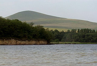
Kirovsky District is an administrative district (raion), one of the twenty-six in Stavropol Krai, Russia. Municipally, it is incorporated as Kirovsky Municipal District. It is located in the south of the krai. The area of the district is 1,386 square kilometers (535 sq mi). Its administrative center is the town of Novopavlovsk. Population: 71,723 (2010 Census); 67,317 ; 55,074. The population of Novopavlovsk accounts for 37.0% of the district's total population.
Kochubeyevsky District is an administrative district (raion), one of the twenty-six in Stavropol Krai, Russia. Municipally, it is incorporated as Kochubeyevsky Municipal District. It is located in the southwest of the krai. The area of the district is 2,363 square kilometers (912 sq mi). Its administrative center is the rural locality of Kochubeyevskoye. Population: 79,557 (2010 Census); 81,609 ; 69,512. The population of Kochubeyevskoye accounts for 33.7% of the district's total population.
Krasnogvardeysky District is an administrative district (raion), one of the twenty-six in Stavropol Krai, Russia. Municipally, it is incorporated as Krasnogvardeysky Municipal District. It is located in the northwest of the krai. The area of the district is 2,236 square kilometers (863 sq mi). Its administrative center is the rural locality of Krasnogvardeyskoye. Population: 40,957 (2010 Census); 42,008 ; 39,855. The population of Krasnogvardeyskoye accounts for 39.1% of the district's total population.

Kursky District is an administrative district (raion), one of the twenty-six in Stavropol Krai, Russia. Municipally, it is incorporated as Kursky Municipal District. It is located in the southeast of the krai. The area of the district is 3,694 square kilometers (1,426 sq mi). Its administrative center is the rural locality of Kurskaya. Population: 54,054 (2010 Census); 52,100 ; 43,303. The population of Kurskaya accounts for 22.3% of the district's total population.

Levokumsky District is an administrative district (raion), one of the twenty-six in Stavropol Krai, Russia. Municipally, it is incorporated as Levokumsky Municipal District. It is located in the northeast of the krai. The area of the district is 4,687 square kilometers (1,810 sq mi). Its administrative center is the rural locality of Levokumskoye. Population: 41,499 (2010 Census); 44,167 ; 42,369. The population of Levokumskoye accounts for 24.8% of the district's total population.

Neftekumsky District is an administrative district (raion), one of the twenty-six in Stavropol Krai, Russia. Municipally, it is incorporated as Neftekumsky Municipal District. It is located in the east of the krai. The area of the district is 3,797 square kilometers (1,466 sq mi). Its administrative center is the town of Neftekumsk. Population: 68,778 (2010 Census); 70,902 ; 59,775. The population of Neftekumsk accounts for 40.3% of the district's total population.

Novoalexandrovsky District is an administrative district (raion), one of the twenty-six in Stavropol Krai, Russia. Municipally, it is incorporated as Novoalexandrovsky Municipal District. It is located in the west of the krai. The area of the district is 2,015 square kilometers (778 sq mi). Its administrative center is the town of Novoalexandrovsk. Population: 65,477 (2010 Census); 67,065 ; 58,630. The population of Novoalexandrovsk accounts for 40.9% of the district's total population.

Novoselitsky District is an administrative district (raion), one of the twenty-six in Stavropol Krai, Russia. Municipally, it is incorporated as Novoselitsky Municipal District. It is located in the center of the krai. The area of the district is 1,724 square kilometers (666 sq mi). Its administrative center is the rural locality of Novoselitskoye. Population: 26,697 (2010 Census); 26,613 ; 23,021. The population of Novoselitskoye accounts for 32.7% of the district's total population.
Predgorny District is an administrative district (raion), one of the twenty-six in Stavropol Krai, Russia. Municipally, it is incorporated as Predgorny Municipal District. It is located in the south of the krai. The area of the district is 2,047 square kilometers (790 sq mi). Its administrative center is the rural locality of Yessentukskaya. Population: 106,775 (2010 Census); 104,391 ; 90,955. The population of Yessentukskaya accounts for 18.9% of the district's total population.
Shpakovsky District is an administrative district (raion), one of the twenty-six in Stavropol Krai, Russia. Municipally, it is incorporated as Shpakovsky Municipal District. It is located in the west of the krai. The area of the district is 2,363 square kilometers (912 sq mi). Its administrative center is the town of Mikhaylovsk. Population: 123,071 (2010 Census); 108,717 ; 84,561. The population of Mikhaylovsk accounts for 57.7% of the district's total population.

Sovetsky District is an administrative district (raion), one of the twenty-six in Stavropol Krai, Russia. Municipally, it is incorporated as Sovetsky Municipal District. It is located in the south of the krai. The area of the district is 2,089 square kilometers (807 sq mi). Its administrative center is the town of Zelenokumsk. Population: 62,790 (2010 Census); 72,762 ; 64,993. The population of Zelenokumsk accounts for 57.1% of the district's population.

Stepnovsky District is an administrative district (raion), one of the twenty-six in Stavropol Krai, Russia. Municipally, it is incorporated as Stepnovsky Municipal District. It is located in the southeast of the krai. The area of the district is 1,887 square kilometers (729 sq mi). Its administrative center is the rural locality of Stepnoye. Population: 22,192 (2010 Census); 23,315 ; 19,520. The population of Stepnoye accounts for 25.3% of the district's total population.
Trunovsky District is an administrative district (raion), one of the twenty-six in Stavropol Krai, Russia. Municipally, it is incorporated as Trunovsky Municipal District. It is located in the northwest of the krai. The area of the district is 1,686 square kilometers (651 sq mi). Its administrative center is the rural locality of Donskoye. Population: 34,558 (2010 Census); 35,403 ; 32,093. The population of Donskoye accounts for 43.2% of the district's total population.


