List of volcanoes in New Zealand

Last updated

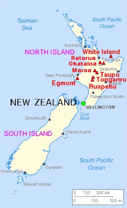
This is a partial list of active, dormant, and extinct volcanoes in New Zealand.

Contents

Kermadec Arc and Havre Trough

NameElevationLocationLast eruption
metresfeet Coordinates
Brothers Seamount -1350-4400 34°52′30″S179°04′30″E / 34.875°S 179.075°E / -34.875; 179.075 (Brothers) -
Clark Seamount -860-2800 36°26′46″S177°50′20″E / 36.446°S 177.839°E / -36.446; 177.839 (Clark) -
Cole (volcano) ----
Cotton Volcano -950-3100 35°03′S178°59′E / 35.05°S 178.99°E / -35.05; 178.99 (Cotton) -
Curtis Island 137449 30°32′26.97″S178°33′25.69″W / 30.5408250°S 178.5571361°W / -30.5408250; -178.5571361 (Curtis Island) -
Gamble (volcano) ----
Giggenbach (volcano) -65-210 30°02′10″S178°42′43″E / 30.036°S 178.712°E / -30.036; 178.712 (Giggenbach) -
Havre Seamount -730-2360 31°07′13″S179°58′07″W / 31.12028°S 179.96861°W / -31.12028; -179.96861 2012
Hinepuia (volcano) ----
Hinetāpeka (volcano) ----
James Healy Seamount -1150-3800 34°59′S179°00′E / 34.98°S 179.00°E / -34.98; 179.00 (Healy) 1360
Macauley Island 238781 30°08′S178°16′W / 30.14°S 178.26°W / -30.14; -178.26 (Macauley Island) Holocene
Monowai Seamount -100-330 25°53′13″S177°11′17″W / 25.887°S 177.188°W / -25.887; -177.188 (Monowai Seamount) 2008
Pūtoto (volcano) ----
Rakahore (volcano) ----
Raoul Island 5161693 29°10′S177°33′W / 29.16°S 177.55°W / -29.16; -177.55 (Raoul Island) 2006
Rumble I -1100-3610 35°30′S178°54′E / 35.5°S 178.9°E / -35.5; 178.9 (Rumble I) -
Rumble II -880-2890 35°24′S178°36′E / 35.4°S 178.6°E / -35.4; 178.6 (Rumble II) -
Rumble III -140-459 35°44′42″S178°28′41″E / 35.745°S 178.478°E / -35.745; 178.478 (Rumble III) 1986
Rumble IV -450-1476 36°08′S178°03′E / 36.13°S 178.05°E / -36.13; 178.05 (Rumble IV) -
Rumble V -1100-3610 36°08′20″S178°11′49″E / 36.139°S 178.197°E / -36.139; 178.197 (Rumble V) -
Silent I [1] ----
Silent II [1] ----
Tangaroa (volcano) -600-2000 36°19′16″S178°01′41″E / 36.321°S 178.028°E / -36.321; 178.028 (Tangaroa) -
Wright (volcano) -750-2500 31°30′S179°12′E / 31.5°S 179.2°E / -31.5; 179.2 (Wright) -

North Island

Taupō Volcanic Zone

Major volcanoes of New Zealand Map new zealand volcanoes.gif
Major volcanoes of New Zealand
NameElevationLocationLast eruption
metresfeet Coordinates
Hauhungatahi 15214990 39°14′S175°26′E / 39.23°S 175.44°E / -39.23; 175.44 (Hauhungatahi) -
Kakaramea-Tihia Massif 13004300 38°59′20″S175°42′30″E / 38.98889°S 175.70833°E / -38.98889; 175.70833 (Kakaramea) 20,000 years ago
Kawerau ----
Manawahe 37°57′50″S176°40′17″E / 37.9639°S 176.6713°E / -37.9639; 176.6713 (Manawahe) ~ 400,000 years ago [2]
Mangakino Caldera ----
Maroa Caldera 11563793 38°25′S176°05′E / 38.42°S 176.08°E / -38.42; 176.08 (Maroa) 180
Maunga Kākaramea / Rainbow Mountain 7432438 38°19′08″S176°23′17″E / 38.319°S 176.388°E / -38.319; 176.388 (Rainbow Mountain) -
Mount Maunganui 232- 37°37′48″S176°10′16″E / 37.630°S 176.171°E / -37.630; 176.171 (Mt Manganui) -
Maungaongaonga 8252707 38°19′34″S176°20′42″E / 38.326°S 176.345°E / -38.326; 176.345 (Maungaongaonga)
Mayor Island / Tūhua 3381165 37°17′S176°15′E / 37.283°S 176.250°E / -37.283; 176.250 (Mayor Island) 4390 BC ± 200 years
Mokoia Island -- 38°4′52.52″S176°17′3.89″E / 38.0812556°S 176.2844139°E / -38.0812556; 176.2844139 (Mokoia Island) -
Moutohora Island 3541161 37°51′29″S176°58′48″E / 37.858°S 176.98°E / -37.858; 176.98 (Whale Island) Pleistocene
Mount Ngauruhoe 22917516 39°09′24.6″S175°37′55.8″E / 39.156833°S 175.632167°E / -39.156833; 175.632167 (Ngauruhoe) 1977
Mount Ngongotahā 487- 39°7′5.59″S176°11′51.20″E / 39.1182194°S 176.1975556°E / -39.1182194; 176.1975556 (Mount Ngongotahā) -
Okataina Caldera 11113645 38°07′S176°30′E / 38.12°S 176.50°E / -38.12; 176.50 (Okataina) 1973
Pihanga 13254347 39°02′28.75″S175°46′7″E / 39.0413194°S 175.76861°E / -39.0413194; 175.76861 (Pihanga) -
Putauaki (Mt Edgecumbe)867- 38°06′S176°48′E / 38.1°S 176.8°E / -38.1; 176.8 (Mount Edgecumbe) ~ 300 BC [3]
Reporoa Caldera 5921942 38°25′S176°20′E / 38.42°S 176.33°E / -38.42; 176.33 (Reporoa Caldera) 1180 (hydrothermal)
Lake Rotorua 7572484 38°05′S176°16′E / 38.08°S 176.27°E / -38.08; 176.27 (Lake Rotorua) Pleistocene
Mount Ruapehu 27979177 39°16′54.19″S175°34′6.64″E / 39.2817194°S 175.5685111°E / -39.2817194; 175.5685111 (Mount Ruapehu) 2007
Rungapapa Knoll -- 37°32′49″S176°58′48″E / 37.547°S 176.98°E / -37.547; 176.98 Pleistocene
Tama Lakes ----
Mount Tarawera (part of the Okataina caldera)11113644 38°13′S176°30′E / 38.22°S 176.5°E / -38.22; 176.5 (Mount Tarawera) 1886
Mount Tauhara 10873569 38°41′40″S176°9′46″E / 38.69444°S 176.16278°E / -38.69444; 176.16278 (Mount Tauhara) Pleistocene
Taupō Volcano 7602493 38°49′S176°00′E / 38.82°S 176.00°E / -38.82; 176.00 (Lake Taupō) 181
Mount Tongariro 19686456 39°8′S175°39′E / 39.133°S 175.650°E / -39.133; 175.650 (Mount Tongariro) 2012
Waiotapu 5921942 38°25′S176°20′E / 38.42°S 176.33°E / -38.42; 176.33 (Waiotapu) 1180
Whakaari / White Island 3211053 37°31′S177°11′E / 37.52°S 177.18°E / -37.52; 177.18 (White Island) 2019
Whakatāne Seamount -980-3200 36°48′S177°30′E / 36.8°S 177.5°E / -36.8; 177.5 (Whakatāne Seamount) -

Elsewhere

NameElevationLocationLast eruption
metresfeet Coordinates
Auckland volcanic field 260853 36°54′S174°52′E / 36.90°S 174.87°E / -36.90; 174.87 (Auckland volcanic field) 1421
Bombay Hills (part of the South Auckland volcanic field)379--550,000 years ago
Kārewa / Gannet Island ---500,000 years ago
Kaikohe-Bay of Islands volcanic field 3881273 35°18′S173°54′E / 35.30°S 173.90°E / -35.30; 173.90 (Kaikohe) 400 ± 300 years
Kaitake ---500,000 years ago
Kakepuku 4491473 38°04′06″S175°15′07″E / 38.06833°S 175.25194°E / -38.06833; 175.25194 (Kakepuku) 1.6 million years ago
Karioi 7562480 37°30′S174°29′E / 37.50°S 174.49°E / -37.50; 174.49 (Karioi) 2.4 million years ago
Little Barrier Island 7222360-1.5 million years ago
Manukau volcano 4741555 36°54′S174°18′E / 36.9°S 174.3°E / -36.9; 174.3 (Waitākere volcano) 16 million years ago [4]
Maungatautari 7972615 38°01′08″S175°34′33″E / 38.01887°S 175.57579°E / -38.01887; 175.57579 (Maungatautari) 1.8 million years ago [4]
Paritutu and the Sugar Loaf Islands 153--1.7 million years ago [5]
Mount Pirongia 9623156 37°59′28″S175°05′53″E / 37.99111°S 175.09806°E / -37.99111; 175.09806 (Pirongia) 1.6 million years ago
Pureora 11653822 38°33′07″S175°37′40″E / 38.551872°S 175.627846°E / -38.551872; 175.627846 (Mount Pureora) 1.6 million years ago [4]
Ngatutura volcanic field 140- 37°32′S174°48′E / 37.54°S 174.80°E / -37.54; 174.80 (Ngatutura volcanic field) 1.6 million years ago
Poor Knights Islands ---4 million years ago
Pouakai ---240,000 years ago
Rangitoto Island (part of the Auckland volcanic field)260853 36°47′13″S174°51′29″E / 36.78694°S 174.85806°E / -36.78694; 174.85806 (Rangitoto Island) 1350
South Auckland volcanic field 379- 37°11′44″S175°01′05″E / 37.1955°S 175.0181°E / -37.1955; 175.0181 (South Auckland volcanic field) 550,000 years ago
Mount Taranaki or Mount Egmont25188261 39°18′S174°06′E / 39.3°S 174.1°E / -39.3; 174.1 (Mount Taranaki) 1755
Titiraupenga 10423419 38°30′36″S175°41′31″E / 38.509927°S 175.691857°E / -38.509927; 175.691857 (Mount Titiraupenga) 1.89 million years ago [4]
Whangarei volcanic field 3971302 35°45′S174°16′E / 35.75°S 174.27°E / -35.75; 174.27 (Whangarei) -

South Island

NameElevationLocationLast eruption
metersfeet Coordinates
Mount Somers 1,6885,538 43.70°S 171.40°E 89 million years ago
Akaroa Volcano -- 43°48′S172°57′E / 43.800°S 172.950°E / -43.800; 172.950 (Akaroa) Miocene
Dunedin Volcano 6802218 45°49′S170°39′E / 45.817°S 170.650°E / -45.817; 170.650 (Otago Harbour) c. 10 million years ago [6]
Mount Horrible (near Timaru)-- 44°23′S171°3′E / 44.383°S 171.050°E / -44.383; 171.050 (Mount Horrible) 2 million years ago [7]
Lyttelton Volcano 9193010 43°36′S172°43′E / 43.600°S 172.717°E / -43.600; 172.717 (Lyttelton Harbour) Miocene

Other

NameElevationLocationLast eruption
metersfeet Coordinates
Antipodes Islands 4021319 49°41′S178°46′E / 49.68°S 178.77°E / -49.68; 178.77 (Antipodes Islands) Holocene
Auckland Island 6501981 50°41′S166°05′E / 50.69°S 166.08°E / -50.69; 166.08 (Auckland Island) Miocene [8]
Mount Dick (Adams Island) [9] 7052313 50°52′28″S166°4′55″E / 50.87444°S 166.08194°E / -50.87444; 166.08194 -
Pitt Island 241791 44°11′S176°08′W / 44.18°S 176.13°W / -44.18; -176.13 (Pitt Island) Ancient[ vague ]
Solander Islands 3301080 46°34′S166°53′E / 46.567°S 166.883°E / -46.567; 166.883 (Solander Islands) Pleistocene

Ross Dependency

New Zealand also has de facto administration over Ross Dependency in Antarctica, which contains the following volcanoes:

NameElevationLocationLast eruption
metersfeet Coordinates
Mount Bird (Ross Island)17655791 77°16′S166°45′E / 77.267°S 166.750°E / -77.267; 166.750 (Mount Bird) 3.8 million years ago [10]
Brown Peak (Sturge Island, Balleny Islands)15005000 67°24′S164°50′E / 67.400°S 164.833°E / -67.400; 164.833 (Brown Peak) 2001
Buckle Island (Balleny Islands)12394065 66°48′S163°15′E / 66.800°S 163.250°E / -66.800; 163.250 (Buckle Island) 1899
Mount Discovery (Scott Coast)26818796 78°22′S166°01′E / 78.367°S 166.017°E / -78.367; 166.017 (Mount Bird) 1.8 million years ago [11]
Mount Erebus (Ross Island)379412448 77°32′S167°17′E / 77.533°S 167.283°E / -77.533; 167.283 (Mount Erebus) 2008 (continuing)
Mount Terror (Ross Island)323010597 77°31′S168°32′E / 77.517°S 168.533°E / -77.517; 168.533 (Mount Terror) ~ 800,000 years ago
Young Island (Balleny Islands)13404396 66°25′S162°27′E / 66.417°S 162.450°E / -66.417; 162.450 (Young Island) -

Related Research Articles

<span class="mw-page-title-main">Taupō Volcanic Zone</span> Active volcanic zone in New Zealand

The Taupō Volcanic Zone (TVZ) is a volcanic area in the North Island of New Zealand that has been active for at least the past two million years and is still highly active. Mount Ruapehu marks its south-western end and the zone runs north-eastward through the Taupō and Rotorua areas and offshore into the Bay of Plenty. It is part of the larger Central Volcanic Region that extends further westward through the western Bay of Plenty to the eastern side of the Coromandel Peninsula and has been active for four million years. At Taupō the rift volcanic zone is widening east–west at the rate of about 8 mm per year while at Mount Ruapehu it is only 2–4 mm per year but this increases at the north eastern end at the Bay of Plenty coast to 10–15 mm per year. It is named after Lake Taupō, the flooded caldera of the largest volcano in the zone, the Taupō Volcano and contains a large central volcanic plateau as well as other landforms associated with its containing tectonic intra-arc continental Taupō Rift.

<span class="mw-page-title-main">Auckland volcanic field</span> Volcanic field in New Zealand

The Auckland volcanic field is an area of monogenetic volcanoes covered by much of the metropolitan area of Auckland, New Zealand's largest city, located in the North Island. The approximately 53 volcanoes in the field have produced a diverse array of maars, tuff rings, scoria cones, and lava flows. With the exception of Rangitoto, no volcano has erupted more than once, but the other eruptions lasted for various periods ranging from a few weeks to several years. Rangitoto erupted several times and recently twice; in an eruption that occurred about 600 years ago, followed by a second eruption approximately 50 years later. The field is fuelled entirely by basaltic magma, unlike the explosive subduction-driven volcanism in the central North Island, such as at Mount Ruapehu and Lake Taupō.

<span class="mw-page-title-main">Volcanism of New Zealand</span> Volcanic activity of New Zealand

The volcanism of New Zealand has been responsible for many of the country's geographical features, especially in the North Island and the country's outlying islands.

<span class="mw-page-title-main">Geology of the Auckland Region</span>

The Auckland Region of New Zealand is built on a basement of greywacke rocks that form many of the islands in the Hauraki Gulf, the Hunua Ranges, and land south of Port Waikato. The Waitākere Ranges in the west are the remains of a large andesitic volcano, and Great Barrier Island was formed by the northern end of the Coromandel Volcanic Zone. The Auckland isthmus and North Shore are composed of Waitemata sandstone and mudstone, and portions of the Northland Allochthon extend as far south as Albany. Little Barrier Island was formed by a relatively isolated andesitic volcano, active around 1 to 3 million years ago.

The Erebus hotspot is a volcanic hotspot responsible for the high volcanic activity on Ross Island in the western Ross Sea of Antarctica. Its current eruptive zone, Mount Erebus, has erupted continuously since its discovery in 1841. Magmas of the Erebus hotspot are similar to those erupted from hotspots at the active East African Rift in eastern Africa. Mount Bird at the northernmost end of Ross Island and Mount Terror at its eastern end are large basaltic shield volcanoes that have been potassium-argon dated 3.8–4.8 and 0.8–1.8 million years old.

<span class="mw-page-title-main">Te Pou Hawaiki</span> Former volcano in New Zealand

Te Pou Hawaiki is a volcano in the Auckland volcanic field in New Zealand. It was a small, low scoria cone south-east of Mount Eden that was quarried away in the early 20th century.

<span class="mw-page-title-main">Dunedin Volcano</span> An extinct volcano in South Island, New Zealand

The Dunedin Volcano is an extensively eroded multi-vent shield volcano that was active between 16 and 10 million years ago. It originally extended from the modern city of Dunedin, New Zealand to Aramoana about 25 km away. Extensive erosion has occurred over the last 10 million years and Otago Harbour now fills the oldest parts of the volcano. The remnants of the volcano form the hills around Otago Harbour.

<span class="mw-page-title-main">Stratigraphy of New Zealand</span>

This is a list of the units into which the rock succession of New Zealand is formally divided. As new geological relationships have been discovered new names have been proposed and others are made obsolete. Not all these changes have been universally adopted. This table is based on the 2014 New Zealand Stratigraphic Lexicon (Litho2014). However, obsolete names that are still in use and names postdating the lexicon are included if it aids in understanding.

<span class="mw-page-title-main">Pouakai Range</span>

The Pouakai Range is an eroded and heavily vegetated stratovolcano in the North Island of New Zealand, located northwest of Mount Taranaki. It consists of the remains of a collapsed Pleistocene stratovolcano. The range is surrounded by a ring plain of lahar deposits from a massive collapse that has been dated as roughly 250,000 years old.

<span class="mw-page-title-main">Mangakino caldera complex</span> A volcanic caldera in New Zealand

The Mangakino caldera complex is the westernmost and one of oldest extinct rhyolitic caldera volcanoes in the Taupō Volcanic Zone of New Zealand's North Island. It produced about a million years ago in the Kidnappers eruption of 1,200 km3 (287.9 cu mi), the most widespread ignimbrite deposits on Earth being over 45,000 km2 (17,000 sq mi) and was closely followed in time by the smaller 200 km3 (48.0 cu mi) Rocky Hill eruption. The Kidnappers eruption had a estimated VEI of 8 and has been assigned a total eruption volume of 2,760 km3 (662.2 cu mi).

The Waitākere volcano, also known as the Manukau volcano, was a Miocene era volcano that formed off the west coast of the modern Auckland Region of New Zealand's North Island. Erupting intermittently between 23 million and 15 million years ago, the volcano was at one point one of the tallest mountains in New Zealand. The volcano alternated between periods as a seamount and as a volcanic island, before tectonic forces raised the volcano up from the seafloor 17 million years ago. Volcanism at the site ceased 15 million years ago and the cone has mostly eroded, however the modern Waitākere Ranges are formed from the remnants of the volcano's eastern slopes. A number of visible volcanic sites associated with the Waitākere volcano remain around Auckland, including Pukematekeo, Karekare and Lion Rock.

<span class="mw-page-title-main">South Auckland volcanic field</span> Extinct volcanic field in New Zealand

The South Auckland volcanic field, also known as the Franklin Volcanic Field, is an area of extinct monogenetic volcanoes around Pukekohe, the Franklin area and north-western Waikato, south of the Auckland volcanic field. The field contains at least 82 volcanoes, which erupted between 550,000 and 1,600,000 years ago.

The Alexandra Volcanic Group is a chain of extinct calc-alkalic basaltic stratovolcanoes that were most active between 2.74 and 1.60 million years ago but is now known to have had more recent activity between 1.6 and 0.9 million years ago. They extend inland from Mount Karioi near Raglan with Mount Pirongia being the largest, with Pukehoua on the eastern slopes of Pirongia, Kakepuku, Te Kawa, and Tokanui completing the definitive lineament. The associated, but usually separated geologically basaltic monogenetic Okete volcanic field, lies mainly between Karioi and Pirongia but extends to the east and is quite scattered.

The Tauranga Volcanic Centre is a geologic region in New Zealand's Bay of Plenty. It extends from the southern end of Waihi Beach and from the old volcanoes of the Coromandel Peninsula that make up the northern part of the Kaimai Range, towards the Taupō Volcanic Zone.

<span class="mw-page-title-main">Coromandel Volcanic Zone</span> Extinct volcanic area in New Zealand

The Coromandel Volcanic Zone (CVZ) is an extinct intraplate volcanic arc stretching from Great Barrier Island in the north, through the Coromandel Peninsula, to the Kaimai Range in the south. The area of transition between it and the newer and still active Taupō Volcanic Zone is now usually separated and is called the Tauranga Volcanic Centre. Its volcanic activity was associated with the formation and most active period of the Hauraki Rift.

Much of the volcanic activity in the northern portions of the North Island of New Zealand is recent in geological terms and has taken place over the last 30 million years. This is primarily due to the North Island's position on the boundary between the Indo-Australian and Pacific Plates, a part of the Pacific Ring of Fire, and particularly the subduction of the Pacific Plate under the Indo-Australian Plate. The activity has included some of the world's largest eruptions in geologically recent times and has resulted in much of the surface formations of the North Island being volcanic as shown in the map.

The volcanic activity in the South Island of New Zealand terminated 5 million years ago as the more northern parts of the North Island became extremely volcanically active. The South Islands surface geology reflects the uplift of the Pacific Plate as it collides with the Indo-Australian Plate along the Alpine Fault over the last 12 million years and the termination of subduction, about 100 to 105 million years ago. There is a very small chance of reactivation of volcanism in the Dunedin Volcano. This chance is made slightly higher by the observation that Southland's Solander Islands / Hautere just off the coast of the South Island were active as recently as 50,000 years old, and on a larger scale 150,000 years old.

The Rotoiti Caldera is a postulated, mainly infilled sub caldera of the Ōkataina Caldera based upon gravitational and magnetic evidence. It erupted 100 cubic kilometres (24 cu mi) of magma that is used in the recent stratigraphy of much of the northern North Island. It was formed in the larger paired eruption with the lesser Earthquake Flat vents linked by tectonic interaction across the length of the Ōkataina Caldera. The series of eruptions was about 50,000 years ago, with the resulting widespread Rotoiti ignimbrite and several layers of Rotoiti/Rotoehu tephra/brecca/ash giving challenges in consistent dating. It was subsequently infilled by later eruptive activity to a depth of over 2 km (1.2 mi). The paired eruptions may have erupted about 240 cubic kilometres (58 cu mi) of tephra.

References

  1. 1 2 John H. Latter, Edwards F. Lloyd, Ian E.M. Smith, and Simon Nathan. () New Zealand's volcanoes: Kermadec Islands Archived 2010-05-22 at the Wayback Machine . Volcanic Hazards Working Group, Civil Defence Scientific Advisory Committee.
  2. Nairn, I.A.; Beanland, S. (1989). "Geological setting of the 1987 Edgecumbe earthquake, New Zealand". New Zealand Journal of Geology and Geophysics. 32: 1–13. doi:10.1080/00288306.1989.10421383 . Retrieved 30 October 2011.
  3. "Okataina: Eruptive History". Global Volcanism Program . Smithsonian Institution.
  4. 1 2 3 4 Pittari, Adrian; Prentice, Marlena L.; McLeod, Oliver E.; Zadeh, Elham Yousef; Kamp, Peter J. J.; Danišík, Martin; Vincent, Kirsty A. (2021). "Inception of the modern North Island (New Zealand) volcanic setting: spatio-temporal patterns of volcanism between 3.0 and 0.9 Ma" (PDF). New Zealand Journal of Geology and Geophysics. 64 (2–3): 250–272. doi:10.1080/00288306.2021.1915343. S2CID   235736318.
  5. Price, R. C; R. B. Stewart; J. D. Woodhead; I. E. M. Smith (1999). "Petrogenesis of High-K Arc Magmas: Evidence from Egmont Volcano, North Island, New Zealand". Journal of Petrology. 40 (1): 167–197. doi:10.1093/petrology/40.1.167.
  6. Bishop, D.G., and Turnbull, I.M. (compilers) (1996). Geology of the Dunedin Area. Lower Hutt, NZ: Institute of Geological & Nuclear Sciences. ISBN   0-478-09521-X.
  7. Wilson, John (2009). "South Canterbury region – Landscape and geology". Te Ara – the Encyclopedia of New Zealand.
  8. Adams, C.J (1983). "Age of the volcanoes and granite basements of the Auckland Islands, Southwest Pacific". New Zealand Journal of Geology and Geophysics. 26 (3): 227–237. doi:10.1080/00288306.1983.10422237.
  9. Auckland Islands Archived 2009-03-20 at archive.today . Polar Conservation Organisation.
  10. "Mount Bird, Ross Island, Antarctica," http://volcano.oregonstate.edu . Retrieved 10 June 2019.
  11. "Mount Discovery, Antarctica," http://volcano.oregonstate.edu . Retrieved 10 June 2019.