Volcanism of New Zealand

Last updated

Main vent of Whakaari / White Island in 2000 White Island main vent.jpg
Main vent of Whakaari / White Island in 2000

The volcanism of New Zealand has been responsible for many of the country's geographical features, especially in the North Island and the country's outlying islands.

Contents

While the land's volcanism dates back to before the Zealandia microcontinent rifted away from Gondwana 60–130 million years ago, activity continues today with minor eruptions occurring every few years. This recent activity is primarily due to the country's position on the boundary between the Indo-Australian and Pacific Plates, a part of the Pacific Ring of Fire, and particularly the subduction of the Pacific Plate under the Indo-Australian Plate.

New Zealand's rocks record examples of almost every kind of volcanism observed on Earth, including some of the world's largest eruptions in geologically recent times.

None of the South Island's volcanoes are active.

Volcanism of New Zealand
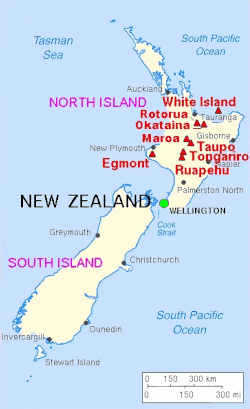
Map of selected surface volcanic features in the northern North Island which includes features from volcanic activity in recorded historic times in New Zealand. Clicking on the map enlarges it, and enables panning and mouseover of volcano name/wikilink and ages before present. Key for the volcanics that are shown with panning is: basalt - brown, monogenetic basalts - dark brown, undifferentiated basalts of the Tangihua Complex in Northland Allochthon - light brown, arc basalts - deep orange brown, arc ring basalts - orange brown, dacite - purple, andesite - red, basaltic andesite`- light red, rhyolite - violet, ignimbrite (lighter shades of violet), and plutonic - gray. Some caldera features are shown in white shading.
USGS map of New Zealand's major volcanoes Map new zealand volcanoes.gif
USGS map of New Zealand's major volcanoes

Major eruptions

The scalloped bays indenting Lake Taupo's northern and western coasts are typical of large volcanic caldera margins. The caldera they surround was formed during the huge Oruanui eruption. Lake taupo landsat.jpg
The scalloped bays indenting Lake Taupō's northern and western coasts are typical of large volcanic caldera margins. The caldera they surround was formed during the huge Oruanui eruption.

New Zealand has been the site of many large explosive eruptions during the last two million years, including several of supervolcano size. [1] These include eruptions from Macauley Island and the Taupō, Whakamaru, Mangakino, Reporoa, Rotorua, and Haroharo calderas.

Two relatively recent eruptions from the Taupō Volcano are perhaps the best known. Its Oruanui eruption was the world's largest known eruption in the past 70,000 years, with a Volcanic Explosivity Index (VEI) of 8. It occurred around 26,500 years ago and deposited approximately 1,200 km³ of material. [2] [3] Tephra from the eruption covered much of the central North Island with ignimbrite up to 200 metres (650 feet) deep, and most of New Zealand was affected by ash fall, with even an 18 cm (7 inch) ash layer left on the Chatham Islands, 1,000 km (620 mi) away. Later erosion and sedimentation had long-lasting effects on the landscape, causing the Waikato River to shift from the Hauraki Plains to its current course through the Waikato to the Tasman Sea. [4] New Zealand's largest lake, Lake Taupō, fills the caldera formed in this eruption.

Taupō's most recent major eruption, the Taupō or Hatepe eruption, took place around 232 CE, and is New Zealand's largest eruption since Oruanui. [5] It ejected some 120 km³ of material (rating 7 on the VEI scale), [6] with around 30 km³ ejected in just a few minutes. It is believed that the eruption column was 50 kilometres (31 mi) high, twice as high as the eruption column from Mount St. Helens in 1980. This makes it one of the most violent eruptions in the last 5000 years (alongside the Tianchi eruption of Baekdu at around 1000 and the 1815 eruption of Tambora). The resulting ash turned the sky red over Rome and China. [7]

Mount Tarawera's eruption around 1310 CE, while not nearly as large, was still substantial, producing 2.5 km³ of lava and 5 km³ of tephra (VEI 5). [8] Because its deposits, stretching from Gisborne to the Bay of Islands, were emplaced around the time that Māori permanently settled New Zealand, they have provided a useful archaeological marker. Tarawera erupted again on 10 June 1886, spewing ash and debris over 16,000 km2 (6,200 sq mi), destroying the Pink and White Terraces and three villages, including Te Wairoa, and claiming the lives of perhaps 120 people. [9] Approximately 2 km³ of tephra was erupted (VEI 5). [8]

Tarawera rift, halfway out.jpg
Part of the 17-kilometre (11 mi) long rift created in Mount Tarawera's 1886 eruption

Hazards

As well as the direct effects of explosions, lava, and pyroclastic flows, volcanoes pose various hazards to the New Zealand populace. These include tsunamis, break-out floods and lahars from volcanically dammed lakes, ashfall, and other far field effects.

Ruapehu's crater lake, source of the deadly 1953 lahar Ruapehu Crater Lake n.jpg
Ruapehu's crater lake, source of the deadly 1953 lahar

For instance, the Tangiwai disaster occurred on 24 December 1953 when the Tangiwai railway bridge across the Whangaehu River collapsed from a lahar in full flood, just before an express train was about to cross it. The train could not stop in time, and 151 people died. This was ultimately caused by Ruapehu's 1945 eruption, which had emptied the crater lake and dammed the outlet with tephra.

Effects can be widespread even for eruptions of only moderate size. Ash plumes from Ruapehu's 1996 eruption forced the closure of eleven airports, including Auckland International Airport. [10]

Insurance against volcanic damage (along with other natural disasters) is provided by the country's Earthquake Commission.

Cultural references

The Māori had many myths and legends regarding the land's volcanic mountains. Perhaps the most well known regards the relative locations of Taranaki, Tongariro and Pihanga. It holds that the two first-named volcanoes competed for the love of the beautiful Pihanga and, after Tongariro succeeded, the defeated Taranaki moved to its lonely location near New Plymouth.

The young stratovolcano Ngauruhoe, named after the slave who legend says died on its summit MountNgauruhoe.jpg
The young stratovolcano Ngauruhoe, named after the slave who legend says died on its summit

Another legend recounts the exploits of Ngātoro-i-rangi, a tohunga (priest) who arrived from the ancestral Māori homeland, Hawaiki, on the Arawa waka (canoe). Travelling inland and then looking southward from Lake Taupō, he decided to climb the mountains he saw there. He reached and began to climb the first mountain along with his slave Ngāuruhoe, who had been travelling with him, and named the mountain Tongariro (the name literally means 'looking south'), whereupon the two were overcome by a blizzard carried by the cold south wind. Near death, Ngātoro-i-rangi called back to his two sisters, Kuiwai and Haungaroa, who had also come from Hawaiki but remained on Whakaari / White Island, to send him sacred fire, which they had brought from Hawaiki. This they did, sending the fire in the form of two taniwha (powerful spirits) named Te Pupu and Te Haeata by a subterranean passage to the top of Tongariro. The tracks of these two taniwha formed the line of geothermal fire that extends from the Pacific Ocean and beneath the Taupō Volcanic Zone, and is seen in the many volcanoes and hot springs extending from Whakaari to Tokaanu and up to the Tongariro massif. The fire arrived just in time to save Ngātoro-i-rangi from freezing to death, but Ngāuruhoe had already died by the time Ngātoro-i-rangi turned to give him the fire. For this reason the hole through which the fire ascended, the active cone of Tongariro, is now called Ngauruhoe.

Eruptions in the North Island, such as the Kaharoa eruption of Mt Tarawera in 1314, have been used to help determine the approximate date of arrival of the early Polynesian colonists to about 1280. Fossilized footprints of perhaps second- or third-generation Polynesian colonists have been found in volcanic ash on islands in the Hauraki Gulf.

Geology

Please see the main articles above because as already mentioned almost every kind of volcanism observed on Earth is found in New Zealand. For historic intrusive volcanism please see the section on older volcanism below. There is good evidence for continued intrusive volcanism activity in the central North Island. [11] [12] [5] A quite recent, large dioritic pluton of the order of 550,000 years old has been dated from drill cores there. [13]

Volcanic areas

While there are remnants of volcanic activity throughout most of New Zealand, there are several areas where they are more obvious, and somewhere activity continues. Since Taranaki's last activity in 1854, all eruptions have been in the Taupō Volcanic Zone or the Kermadec Arc. [14]

Significant recent (last 2000 years) volcanic eruptions (red) and hydrothermal eruptions (blue) in North Island of New Zealand VolcanicFeatures.North.Island.NZ.jpg
Significant recent (last 2000 years) volcanic eruptions (red) and hydrothermal eruptions (blue) in North Island of New Zealand

Kermadec Arc

The Kermadec Islands are an active volcanic island arc stretching north-northeast from New Zealand's North Island towards Tonga. While only a few volcanoes in the arc are tall enough to form islands, it includes about 30 sizeable submarine volcanoes with many in the South Kermadec Ridge Seamounts at the New Zealand end of the chain. The largest island, Raoul Island, produced a large eruption around 2200 years ago with a VEI of 6. [15] Its activity has continued intermittently since, with its latest eruption occurring in 2006. [16]

Northland

The Northland region contains two recently active volcanic fields, one centered around Whangarei, [17] and the other is the Kaikohe-Bay of Islands volcanic field. [18] The latest activity in the Kaikohe-Bay of Islands field, around 1300 to 1800 years ago, created four scoria cones at Te Puke (near Paihia). [18]

Piha's Lion Rock, an eroded volcanic neck in the western Northland volcanic arc Lion Rock, from North Piha.jpg
Piha's Lion Rock, an eroded volcanic neck in the western Northland volcanic arc

Earlier, during the Miocene, a mainly andesitic volcanic arc ran through Northland and neighbouring regions (including the Three Kings Ridge and northern Coromandel Peninsula), with western and eastern belts active between 25 and 15 million years ago and 23–11 million years ago respectively. [20] Although this produced substantial volcanic edifices, including New Zealand's largest known stratovolcano, the Waitakere volcano, [21] most of these have been eroded away, buried, or submerged, especially in the west, where a series of volcanoes buried offshore stretches south almost to New Plymouth. This is called the Northland-Mohakatino Volcanic Belt. [22] Remnants of these two ancient volcano belts are still exposed in many places, including Whangarei Heads, the Hen and Chickens Islands, around Whangaroa Harbour, Waipoua forest, and the Waitākere Ranges.

Auckland volcanic field

Rangitoto Island, the gently sloping shield volcano on the horizon, is an iconic landmark of Auckland. Rangitoto from Achilles Point.jpg
Rangitoto Island, the gently sloping shield volcano on the horizon, is an iconic landmark of Auckland.

The basaltic Auckland volcanic field is a monogenetic volcanic field underlying much of the Auckland metropolitan area. The field's many vents have produced a diverse array of explosion craters, scoria cones, and lava flows. The largest and most recent is Rangitoto in the Hauraki Gulf, which last erupted 600–700 years ago. Currently dormant, the field is likely to erupt again within the next "hundreds to thousands of years" (based on past events), a short timeframe in geologic terms. [23] Auckland's residents, however, face more danger from volcanoes farther south. [23]

Auckland's volcanoes are believed to be the latest product of an unusual magma source related to local tectonics which is not a classic hot spot, as the earlier volcanic fields are to the south, the opposite expected from movement of the Australian plate over a stationary mantle plume source. [24]

Waikato and South Auckland

Hochstetter's 1859 geological map of the southern part of the then Auckland Province showing volcanic features of Waikato and South Auckland. 1859 Hochstetter map The Southern Part of the Province of Auckland.jpg
Hochstetter's 1859 geological map of the southern part of the then Auckland Province showing volcanic features of Waikato and South Auckland.

Three volcanic fields erupted between 2.7 and 0.5 million years ago, migrating northwards from Mount Pirongia to the Bombay Hills. The earliest of these fields formed the Alexandra Volcanics [25] which is distinguished by large arc volcano tholeiitic cones but did have associated Okete Volcanics which were traditionally more akaline and oxidised and were in the monogenetic volcanic field pattern seen in the later fields. The distinction between the Alexandra and Okete volcanics is not necessarily clear cut and is still being studied. Alexandra Volcanic Group rocks (mostly basalt) cover about 450 km2 amounting to 55 km3 from at least 40 vents. Mount Pirongia and Mount Karioi are part of the main lineament in the group. [26] The later fields are the smallest Ngatutura Volcanics which comprises about 16 volcanoes south of Port Waikato on the west coast and the South Auckland volcanic field with over 80 volcanoes. [27] The magma body that created the Auckland volcanic field is considered to have been related to these outpourings also. Unlike typical hot spots such as the one underlying Hawaii, it does not seem to have stayed still, but instead is migrating northward at a faster pace than the surrounding Indo-Australian Plate. Its motion has been explained as the tip of a propagating crack produced by the twisting of the North Island's crust. [28] [24]

Coromandel Volcanic Zone

Sea arch at Cathedral Cove, carved in tuff deposited by a pyroclastic flow about 8 million years ago Cathedral Cove, Coromandel.JPG
Sea arch at Cathedral Cove, carved in tuff deposited by a pyroclastic flow about 8 million years ago

The extinct Coromandel Volcanic Zone (CVZ) was a volcanic arc stretching from Great Barrier Island in the north, through the Coromandel Peninsula, to Tauranga and the southern Kaimai Ranges in the south. Activity began in the north around 18 million years ago, and was primarily andesitic until around 9–10 million years ago, when it changed to a bimodal basaltic/rhyolitic pattern. Eruptive centres gradually migrated southward, [30] where they transitioned into early activity in the Taupō Volcanic Zone. Later activity in the CVZ and its interface with the Taupō Volcanic Zone is obscured by subsequent events and is not fully understood, but continued in the south until perhaps 1.5 million years ago in the Tauranga Volcanic Centre. [31] Together with the extinct undersea Colville Ridge, the CVZ formed a precursor to the modern Taupō Volcanic Zone and Kermadec Ridge. [32]

Mayor Island / Tūhua

Mayor Island / Tūhua is a peralkaline shield volcano with a caldera partly formed in a large eruption some 7000 years ago. It has exhibited many eruptive styles, and its last eruption may have occurred only 500–1000 years ago. [33] The island's Maori name, Tuhua, refers to the obsidian they found on the island and prized for its sharp cutting edge.

Taupō Volcanic Zone

Lady Knox Geyser, in the Waiotapu geothermal area Lady Knox Geyser.jpg
Lady Knox Geyser, in the Waiotapu geothermal area

About 350 kilometres long by 50 kilometres wide, the Taupō Volcanic Zone (TVZ) is the world's most productive area of recent silicic volcanic activity, [34] with the highest concentration of young rhyolitic volcanoes. [35] Mount Ruapehu marks its southwestern end, and it continues up through Ngauruhoe, Tongariro, Lake Taupō, the Whakamaru, Mangakino, Maroa, Reporoa, and Rotorua calderas, the Okataina Volcanic Complex (including Mount Tarawera) and 85 kilometres beyond Whakaari / White Island to the submarine Whakatāne Seamount. The TVZ also contains numerous smaller volcanoes, along with geysers and geothermal areas. Volcanic eruptions began here around two million years ago, with silicic eruptions starting around 1.55 million years ago, as activity shifted southeast from the Coromandel Volcanic Zone. [31]

Taranaki

Taranaki Maunga, with Fanthams Peak on the left Mt Taranaki.JPG
Taranaki Maunga, with Fanthams Peak on the left

Volcanism in the Taranaki region has migrated southeastward during the last two million years. Beginning in the Sugar Loaf Islands, near New Plymouth, activity then shifted to Kaitake (580,000 years ago) and Pouakai (230,000 years ago) before creating the large stratovolcano called Mount Taranaki, (former name Mount Egmont), which last erupted in 1854, and its satellite vent, Fanthams Peak. [36] This southeastward migration is the continuation of the 25 million year activity of the Northland-Mohakatino Volcanic Belt that extends mainly under the present Tasman Sea from the west of Northland down to Mount Taranaki. [22]

Chatham Islands

The higher portions of the Chatham Islands are formed from volcanic rock that is up to 81 million years old, although lava flows on the northern shore of Chatham Island date back only about five million years. [37]

Banks Peninsula

The mountainous terrain of Banks Peninsula contrasts with the nearby plains. BanksPeninsulaModel.jpg
The mountainous terrain of Banks Peninsula contrasts with the nearby plains.

Banks Peninsula comprises the eroded remnants of two large stratovolcanoes, Lyttelton, which formed first, and Akaroa. These formed by intraplate volcanism through continental crust approximately eleven to eight million years ago (Miocene). The peninsula formed as offshore islands, with the volcanoes reaching to about 1,500 m above sea level. Two dominant craters were eroded, then flooded, to form the Lyttelton and Akaroa Harbours. The portion of crater rim lying between Lyttelton Harbour and Christchurch city forms the Port Hills.

Oamaru

Small sub-alkaline basalt to basaltic andesite Surtseyan volcanoes on the submerged continental shelf formed what was historically termed the Waiareka-Deborah volcanic group and now called the Waiareka-Deborah volcanic field in the area around Oamaru around 35 to 30 million years ago. [38] [39] A monogenetic volcanic field of more alkaline composition eruptives, with stronger surface features, as they are younger, extends north of Dunedin overlapping the southern Waiareka-Deborah volcanic field, and these volcanoes have now been characterised to be part of the Dunedin volcanic group. [40]

Southern Alps

The Alpine Dyke Swarm of volcanic intusion took place about 25 million years ago and is located near Lake Wānaka in the Southern Alps. [41]

Dunedin

The Dunedin Volcano formed during the Miocene, beginning with basaltic eruptions on the Otago Peninsula is the largest volcano in the large Dunedin volcanic group. [40] Large central-vent structures formed, and then large domes, with seawater interacting explosively with erupting submarine magma. [42]

Penguins nest under columnar basalt cliffs on Antipodes Island Antipodes Penguin.JPG
Penguins nest under columnar basalt cliffs on Antipodes Island

Solander Islands

The Solander Islands, a small chain of uninhabited islets close to the western end of the Foveaux Strait, are the emergent portions of a large extinct andesitic volcano that last erupted around 50,000 to 150,000 years ago. [43] Caused by the subduction of the Australian Plate beneath the Pacific Plate, it is the only volcano associated with this subduction zone that protrudes above the sea. [44] [45]

Subantarctic islands

The majority of New Zealand's widely separated subantarctic islands are primarily volcanic in origin, including Auckland Island, Campbell Island / Motu Ihupuku, and Antipodes Island. [37] These are mainly Miocene intraplate volcanoes with ages decreasing towards the northeast, although Antipodes Island may have been active during the last 20,000 years.

Older volcanism

The summit of Tapuae-o-Uenuku comprises the uplifted and eroded foundations of an old volcano Mount Manakau - from the air.jpg
The summit of Tapuae-o-Uenuku comprises the uplifted and eroded foundations of an old volcano

Older remnants of volcanism are also found in several places around New Zealand. These were generally formed either when New Zealand still formed part of the Gondwana supercontinent, or while Zealandia was rifting away from the rest of Gondwana, although some have been emplaced in their current setting more recently. (New Zealand is the main part of the submerged microcontinent of Zealandia that currently emerges above the sea.)

A band of granitic intrusions covering over 10,000 km2, the Median Batholith, stretches from Stewart Island / Rakiura through Fiordland, and again through the West Coast and Nelson after interruption by the Alpine Fault. This was produced between 375 and 105 million years ago in the course of subduction-related volcanism in a long mountain range along the Gondwanan coast somewhat like today's Andes. Two more batholiths, the Karamea-Paparoa and Hohonu Batholiths, are also found on the West Coast.

Map of southern part of Zealandia Zealandia-Continent map en.svg
Map of southern part of Zealandia

Basaltic lava flows, dikes, and tuff from fissure eruptions between 100 million and 66 million years ago, during Zealandia's separation from Gondwana, are found in Marlborough, the West Coast and offshore further west. Ultramafic intrusions are found in Marlborough and north Canterbury, including at the summit of Tapuae-o-Uenuku, the country's highest mountain outside the Southern Alps / Kā Tiritiri o te Moana. [46] The Mount Somers volcanics that erupted from 100 to 80 million years ago extend to Banks Peninsula but are mostly buried there by more recent volcanism.

Rhyolitic ignimbrite [47] and tuff deposits found in Otago at Shag Point / Matakaea and in the Kakanui Mountains that were originally dated in the range 107 to 101 million years ago [48] are now both dated to 112 ± 0.2 million years ago and so likely come from a large singe event. [49]

The Hikurangi Plateau is an oceanic plateau on the Pacific Plate that attached to the Chatham Ridge after being partially subducted under it, and is now subducting under the North Island. It likely formed in one of the world's largest volcanic outpourings, the greater Ontong Java event.

Ophiolites, volcanic deposits from the ocean floor, have been incorporated into the continental basement of New Zealand in the Dun Mountain Ophiolite Belt, found at both ends of the South Island, and in Northland.

See also

Bubbling mud pool in the Taupō Volcanic Zone

Notes

  1. Heather Catchpole. Islands of fire Archived 23 February 2010 at the Wayback Machine , Cosmos Magazine.
  2. Wilson, Colin J. N. (2001). "The 26.5 ka Oruanui eruption, New Zealand: an introduction and overview". Journal of Volcanology and Geothermal Research. 112 (1–4): 133–174. Bibcode:2001JVGR..112..133W. doi:10.1016/S0377-0273(01)00239-6.
  3. Wilson, Colin J. N.; et al. (2006). "The 26.5 ka Oruanui Eruption, Taupo Volcano, New Zealand: Development, Characteristics and Evacuation of a Large Rhyolitic Magma Body". Journal of Petrology. 47 (1): 35–69. Bibcode:2005JPet...47...35W. doi: 10.1093/petrology/egi066 .
  4. Manville, Vern; Wilson, Colin J. N. (2004). "The 26.5 ka Oruanui eruption, New Zealand: a review of the roles of volcanism and climate in the post-eruptive sedimentary response". New Zealand Journal of Geology & Geophysics. 47 (3): 525–547. doi: 10.1080/00288306.2004.9515074 .
  5. 1 2 Illsley-Kemp, Finnigan; Barker, Simon J.; Wilson, Colin J. N.; Chamberlain, Calum J.; Hreinsdóttir, Sigrún; Ellis, Susan; Hamling, Ian J.; Savage, Martha K.; Mestel, Eleanor R. H.; Wadsworth, Fabian B. (1 June 2021). "Volcanic Unrest at Taupō Volcano in 2019: Causes, Mechanisms and Implications". Geochemistry, Geophysics, Geosystems. 22 (6): 1–27. Bibcode:2021GGG....2209803I. doi: 10.1029/2021GC009803 .
  6. "Taupo – Eruptive History". Global Volcanism Program. Smithsonian Institution . Retrieved 16 March 2008.
  7. Wilson, C. J. N.; Ambraseys, N. N.; Bradley, J.; Walker, G. P. L. (1980). "A new date for the Taupo eruption, New Zealand". Nature . 288 (5788): 252–253. Bibcode:1980Natur.288..252W. doi:10.1038/288252a0. S2CID   4309536.
  8. 1 2 "Okataina: Eruptive History". Global Volcanism Program . Smithsonian Institution.
  9. Dench, p 114.
  10. Mass aircraft grounding possible in NZ too scientists say Archived 22 May 2010 at the Wayback Machine , media release, GNS Science, 19 April 2010.
  11. Gómez-Vasconcelos, Martha Gabriela; Villamor, Pilar; Cronin, Shane; Procter, Jon; Palmer, Alan; Townsend, Dougal; Leonard, Graham (2017). "Crustal extension in the Tongariro graben, New Zealand: Insights into volcano-tectonic interactions and active deformation in a young continental rift". GSA Bulletin. 129 (9–10): 1085–1099. Bibcode:2017GSAB..129.1085G. doi:10.1130/B31657.1.
  12. Benson, Thomas W.; Illsley-Kemp, Finnigan; Elms, Hannah C.; Hamling, Ian J.; Savage, Martha K.; Wilson, Colin J. N.; Mestel, Eleanor R. H.; Barker, Simon J. (2021). "Earthquake Analysis Suggests Dyke Intrusion in 2019 Near Tarawera Volcano, New Zealand". Frontiers in Earth Science. 8: 604. Bibcode:2021FrEaS...8..604B. doi: 10.3389/feart.2020.606992 . ISSN   2296-6463.
  13. Arehart, G.B; Christenson, B.W; Wood, C.P; Foland, K.A; Browne, P.R.L (2002). "Timing of volcanic, plutonic and geothermal activity at Ngatamariki, New Zealand". Journal of Volcanology and Geothermal Research. 116 (3–4): 201–214. Bibcode:2002JVGR..116..201A. doi:10.1016/S0377-0273(01)00315-8. ISSN   0377-0273.
  14. Volcanoes of New Zealand to Fiji, Global Volcanism Program, Smithsonian Institution.
  15. "Smithsonian Global Volcanic Program:Raoul Island".
  16. "Raoul Island". Global Volcanism Program . Smithsonian Institution.
  17. "Whangarei Volcanic Field". Global Volcanism Program . Smithsonian Institution.
  18. 1 2 "Kaikohe-Bay of Islands". Global Volcanism Program . Smithsonian Institution.
  19. Ewen Cameron; Bruce Hayward; and Graeme Murdoch (1997). A Field Guide to Auckland: Exploring the Region's Natural and Historic Heritage, p. 168. Godwit Publishing Ltd, Auckland. ISBN   1-86962-014-3.
  20. Hayward, Bruce W.; Black, Philippa M.; Smith, Ian E. M.; Ballance, Peter F.; Itaya, Tetsumaru; Doi, Masako; Takagi, Miki; Bergman, Steve; Adams, Chris J.; Herzer, Richard H.; Robertson, David J. (2001). "K-Ar ages of early Miocene arc-type volcanoes in northern New Zealand". New Zealand Journal of Geology and Geophysics. 44 (2): 285–311. doi:10.1080/00288306.2001.9514939. S2CID   128957126. Archived from the original on 25 May 2010. Retrieved 20 April 2010.
  21. Hayward, Bruce W. (2017). Out of the Ocean, Into the Fire: History in the Rocks, Fossils and Landforms of Auckland, Northland and Coromandel (PDF). Geoscience Society of New Zealand. title page. ISBN   9780473395964 . Retrieved 20 February 2022.
  22. 1 2 Bischoff, Alan; Barriera, Andrea; Begg, Mac; Nicola, Andrew; Colea, Jim; Sahoo, Tusar (2020). "Magmatic and Tectonic Interactions Revealed by Buried Volcanoes in Te Riu-a-Māui/Zealandia Sedimentary Basins". New Zealand Journal of Geology and Geophysics. 63: 378–401. doi:10.1080/00288306.2020.1773510. S2CID   221380777.
  23. 1 2 Beca Carter Hollings & Ferner (2002). Contingency Plan for the Auckland volcanic field , Auckland Regional Council Technical Publication 165. Accessed 12 May 2008.
  24. 1 2 Nemeth, Karoly; Kereszturi, Gabor; Agustín-Flores, Javier; Briggs, Roger Michael (2012). "Field Guide Monogenetic volcanism of the South Auckland and Auckland Volcanic Fields" . Retrieved 2 November 2022.
  25. Briggs, R.M.; Goles, G.G. (1984). "Petrological and trace element geochemical features of the Okete Volcanics, western North Island, New Zealand". Contributions to Mineralogy and Petrology. 6: 77–88. doi:10.1007/BF00373712. S2CID   129834459.
  26. Geology of the Raglan-Kawhia Area: Institute of Geological & Nuclear Sciences (N.Z.), Barry Clayton Waterhouse, P. J. White 1994 ISBN   0-478-08837-X
  27. Briggs, R. M.; Itaya, T.; Lowe, D. J.; Keane, A. J. (1989). "Ages of the Pliocene-Pleistocene Alexandra and Ngatatura Volcanics, western North Island, New Zealand, and some geological implications". New Zealand Journal of Geology and Geophysics. 32 (4): 417–427. doi: 10.1080/00288306.1989.10427549 . hdl:10289/5260.
  28. Cox, Geoffrey J.; Hayward, Bruce W. (1999). The Restless Country: Volcanoes and earthquakes in New Zealand. HarperCollins. ISBN   1-86950-296-5.
  29. Hayward, B. (2008). Protecting NZ's Heritage Natural Arches, Geological Society of New Zealand Newsletter 145 (March), 23.
  30. C. J. Adams; I. J. Graham; D. Seward; D. N. B. Skinner (1994). "Geochronological and geochemical evolution of late Cenozoic volcanism in the Coromandel Peninsula, New Zealand". New Zealand Journal of Geology and Geophysics. 37 (3): 359–379. doi: 10.1080/00288306.1994.9514626 .
  31. 1 2 R. M. Briggs; B. F. Houghton; M. McWilliams; C. J. N. Wilson (2005). "40Ar/39Ar ages of silicic volcanic rocks in the Tauranga-Kaimai area, New Zealand: dating the transition between volcanism in the Coromandel Arc and the Taupo Volcanic Zone". New Zealand Journal of Geology and Geophysics. 48 (3): 459–469. doi:10.1080/00288306.2005.9515126.
  32. K.N. Nicholson; P.M. Black; P.W.O. Hoskin; I.E.M. Smith (2004). "Silicic volcanism and back-arc extension related to migration of the Late Cainozoic Australian–Pacific plate boundary". Journal of Volcanology and Geothermal Research. 131 (3–4): 295–306. Bibcode:2004JVGR..131..295N. doi:10.1016/S0377-0273(03)00382-2.
  33. "Mayor Island". Global Volcanism Program . Smithsonian Institution.
  34. Karl D. Spinks, J.W. Cole, & G.S. Leonard (2004). Caldera Volcanism in the Taupō Volcanic Zone. In: Manville, V.R. (ed.) Geological Society of New Zealand/New Zealand Geophysical Society/26th New Zealand Geothermal Workshop, 6–9 December 2004 , Taupo: field trip guides. Geological Society of New Zealand miscellaneous publication 117B.
  35. Volcanology highlights, Volcanoes of New Zealand to Fiji, Global Volcanism Program, Smithsonian Institution.
  36. Locke, Corinne A.; John Cassidy (1997). "Egmont Volcano, New Zealand: three-dimensional structure and its implications for evolution". Journal of Volcanology and Geothermal Research. 76 (1–2): 149–161. Bibcode:1997JVGR...76..149L. doi:10.1016/S0377-0273(96)00074-1.
  37. 1 2 K. S. Panter, J. Blusztajn, S. R. Hart, P. R. Kyle, R. Esser, W. C. McIntosh (2006). The Origin of HIMU in the SW Pacific: Evidence from Intraplate Volcanism in Southern New Zealand and Subantarctic Islands
  38. Simone Hicks, PhD proposal: Ecological and sedimentological evolution of the volcanically active Oligocene continental shelf, east Otago, New Zealand, Geology Department, University of Otago. Retrieved 19 April 2010.
  39. R. A. F. Cas; C. A. Landis; R. E. Fordyce (1989). "A monogenetic, Surtla-type, Surtseyan volcano from the Eocene-Oligocene Waiareka-Deborah volcanics, Otago, New Zealand: A model". Bulletin of Volcanology. 51 (4): 281–298. Bibcode:1989BVol...51..281C. doi:10.1007/BF01073517. S2CID   129657592.
  40. 1 2 Scott, James M.; Pontesilli, Alessio; Brenna, Marco; White, James D. L.; Giacalone, Emanuele; Palin, J. Michael; le Roux, Petrus J. (2020). "The Dunedin Volcanic Group and a revised model for Zealandia's alkaline intraplate volcanism". New Zealand Journal of Geology and Geophysics. 63 (4): 510–529. doi:10.1080/00288306.2019.1707695. S2CID   212937447.
  41. Cooper, Alan F. (2020). "Petrology and petrogenesis of an intraplate alkaline lamprophyre-phonolite-carbonatite association in the Alpine Dyke Swarm, New Zealand". New Zealand Journal of Geology and Geophysics. 63 (4): 469–488. doi:10.1080/00288306.2019.1684324. S2CID   210266079.
  42. ""Eruptions and deposition of volcaniclastic rocks in the Dunedin Volcanic Complex, Otago Peninsula, New Zealand", Ulrike Martin". Archived from the original on 8 June 2011. Retrieved 18 April 2010.
  43. Mortimer, N.; Gans, P.B.; Foley, F. V.; Turner, M. B.; Daczko, N.; Robertson, M.; Turnbull, I. M. (2013). "Geology and Age of Solander Volcano, Fiordland, New Zealand". Journal of Geology. 121 (5): 475–487. doi:10.1086/671397.
  44. Keith Lewis, Scott D. Nodder and Lionel Carter. 'Sea floor geology – Solander Island', Te Ara – the Encyclopedia of New Zealand. Updated 2 March 2009. Accessed 18 April 2010.
  45. Mortimer, N.; Gans, P.B.; Mildenhall, D.C. (2008). "A middle-late Quaternary age for the adakitic arc volcanics of Hautere (Solander Island), Southern Ocean". Journal of Volcanology and Geothermal Research. 178 (4): 701–707. Bibcode:2008JVGR..178..701M. doi:10.1016/j.jvolgeores.2008.09.003. ISSN   0377-0273.
  46. Baker, I. A.; Gamble, J. A.; Graham, I. J. (1994). "The age, geology, and geochemistry of the Tapuaenuku Igneous Complex, Marlborough, New Zealand". New Zealand Journal of Geology & Geophysics. 37 (3): 249–268. doi: 10.1080/00288306.1994.9514620 .
  47. Steiner, A.; Brown, D. A.; White, A. J. R. (1959). "Occurrence of ignimbrite in the Shag Valley, North-east Otago". New Zealand Journal of Geology and Geophysics. 2 (2): 380–384. doi:10.1080/00288306.1959.10417656.
  48. Adams, C.J.; Raine, J.I. (1988). "Age of Cretaceous silicic volcanism at Kyeburn, Central Otago, and Palmerston, eastern Otago, South Island, New Zealand". New Zealand Journal of Geology and Geophysics. 31 (4): 471–475. doi:10.1080/00288306.1988.10422144.
  49. Tulloch, AJ; Ramezani, J; Mortimer, N; Mortensen; J; van den Bogaard, P; Maas, R (2009). "Cretaceous felsic volcanism in New Zealand and Lord Howe Rise (Zealandia) as a precursor to final Gondwana break-up". Geological Society, London, Special Publications. 321 (1): 89–118. Bibcode:2009GSLSP.321...89T. doi:10.1144/SP321.5. S2CID   128898123.

Related Research Articles

<span class="mw-page-title-main">Mount Ruapehu</span> Active stratovolcano at the south of the North Island of New Zealand

Mount Ruapehu is an active stratovolcano at the southern end of the Taupō Volcanic Zone and North Island volcanic plateau in New Zealand. It is 23 km (14 mi) northeast of Ohakune and 23 km (14 mi) southwest of the southern shore of Lake Taupō, within the Tongariro National Park. The North Island's major ski resorts and only glaciers are on its slopes.

<span class="mw-page-title-main">Taupō Volcanic Zone</span> Active volcanic zone in New Zealand

The Taupō Volcanic Zone (TVZ) is a volcanic area in the North Island of New Zealand that has been active for at least the past two million years and is still highly active. Mount Ruapehu marks its south-western end and the zone runs north-eastward through the Taupō and Rotorua areas and offshore into the Bay of Plenty. It is part of the larger Central Volcanic Region that extends further westward through the western Bay of Plenty to the eastern side of the Coromandel Peninsula and has been active for four million years. At Taupō the rift volcanic zone is widening east–west at the rate of about 8 mm per year while at Mount Ruapehu it is only 2–4 mm per year but this increases at the north eastern end at the Bay of Plenty coast to 10–15 mm per year. It is named after Lake Taupō, the flooded caldera of the largest volcano in the zone, the Taupō Volcano and contains a large central volcanic plateau as well as other landforms associated with its containing tectonic intra-arc continental Taupō Rift.

<span class="mw-page-title-main">Mount Tarawera</span> Volcano in New Zealand

Mount Tarawera is a volcano on the North Island of New Zealand within the older but volcanically productive Ōkataina Caldera. Located 24 kilometres southeast of Rotorua, it consists of a series of rhyolitic lava domes that were fissured down the middle by an explosive basaltic eruption in 1886. While the 1886 eruption was basaltic, study has shown there was only a small basalt component to the previous recent rhyolitic predominant eruptions. This eruption was one of New Zealand's largest historical eruptions, and killed an estimated 120 people. The fissures run for about 17 kilometres (11 mi) northeast–southwest.

<span class="mw-page-title-main">Mount Tongariro</span> Compound Volcano in New Zealand

Mount Tongariro is a compound volcano in the Taupō Volcanic Zone of the North Island of New Zealand. It is located 20 km (12 mi) to the southwest of Lake Taupō, and is the northernmost of the three active volcanoes that dominate the landscape of the central North Island.

<span class="mw-page-title-main">Auckland volcanic field</span> Volcanic field in New Zealand

The Auckland volcanic field is an area of monogenetic volcanoes covered by much of the metropolitan area of Auckland, New Zealand's largest city, located in the North Island. The approximately 53 volcanoes in the field have produced a diverse array of maars, tuff rings, scoria cones, and lava flows. With the exception of Rangitoto, no volcano has erupted more than once, but the other eruptions lasted for various periods ranging from a few weeks to several years. Rangitoto erupted several times and recently twice; in an eruption that occurred about 600 years ago, followed by a second eruption approximately 50 years later. The field is fuelled entirely by basaltic magma, unlike the explosive subduction-driven volcanism in the central North Island, such as at Mount Ruapehu and Lake Taupō. The field is currently dormant, but could become active again.

<span class="mw-page-title-main">Geology of New Zealand</span> Overview of the geology of New Zealand

The geology of New Zealand is noted for its volcanic activity, earthquakes and geothermal areas because of its position on the boundary of the Australian Plate and Pacific Plates. New Zealand is part of Zealandia, a microcontinent nearly half the size of Australia that broke away from the Gondwanan supercontinent about 83 million years ago. New Zealand's early separation from other landmasses and subsequent evolution have created a unique fossil record and modern ecology.

<span class="mw-page-title-main">Geology of the Auckland Region</span>

The Auckland Region of New Zealand is built on a basement of greywacke rocks that form many of the islands in the Hauraki Gulf, the Hunua Ranges, and land south of Port Waikato. The Waitākere Ranges in the west are the remains of a large andesitic volcano, and Great Barrier Island was formed by the northern end of the Coromandel Volcanic Zone. The Auckland isthmus and North Shore are composed of Waitemata sandstone and mudstone, and portions of the Northland Allochthon extend as far south as Albany. Little Barrier Island was formed by a relatively isolated andesitic volcano, active around 1 to 3 million years ago.

<span class="mw-page-title-main">Taupō Volcano</span> Volcanic crater lake in New Zealand

Lake Taupō, in the centre of New Zealand's North Island, fills the caldera of the Taupō Volcano, a large rhyolitic supervolcano. This huge volcano has produced two of the world's most powerful eruptions in geologically recent times.

<span class="mw-page-title-main">Mangakino caldera complex</span> A volcanic caldera in New Zealand

The Mangakino caldera complex is the westernmost and one of oldest extinct rhyolitic caldera volcanoes in the Taupō Volcanic Zone of New Zealand's North Island. It produced about a million years ago in the Kidnappers eruption of 1,200 km3 (287.9 cu mi), the most widespread ignimbrite deposits on Earth being over 45,000 km2 (17,000 sq mi) and was closely followed in time by the smaller 200 km3 (48.0 cu mi) Rocky Hill eruption. The Kidnappers eruption had a estimated VEI of 8 and has been assigned a total eruption volume of 2,760 km3 (662.2 cu mi).

<span class="mw-page-title-main">Ōkataina Caldera</span> Volcanic caldera in New Zealand

Ōkataina Caldera is a volcanic caldera and its associated volcanoes located in Taupō Volcanic Zone of New Zealand's North Island. It has several actual or postulated sub calderas. The Ōkataina Caldera is just east of the smaller Rotorua Caldera and southwest of the much smaller Rotomā Embayment which is usually regarded as an associated volcano. It shows high rates of explosive rhyolitic volcanism although its last eruption was basaltic. The postulated Haroharo Caldera contained within it has sometimes been described in almost interchangeable terms with the Ōkataina Caldera or volcanic complex or centre and by other authors as a separate complex defined by gravitational and magnetic features.. Since 2010 other terms such as the Haroharo vent alignment, Utu Caldera, Matahina Caldera, Rotoiti Caldera and a postulated Kawerau Caldera are often used, rather than a Haroharo Caldera classification.

The Waitākere volcano, also known as the Manukau volcano, was a Miocene era volcano that formed off the west coast of the modern Auckland Region of New Zealand's North Island. Erupting intermittently between 23 million and 15 million years ago, the volcano was at one point one of the tallest mountains in New Zealand. The volcano alternated between periods as a seamount and as a volcanic island, before tectonic forces raised the volcano up from the seafloor 17 million years ago. Volcanism at the site ceased 15 million years ago and the cone has mostly eroded, however the modern Waitākere Ranges are formed from the remnants of the volcano's eastern slopes. A number of visible volcanic sites associated with the Waitākere volcano remain around Auckland, including Pukematekeo, Karekare and Lion Rock.

<span class="mw-page-title-main">South Auckland volcanic field</span> Extinct volcanic field in New Zealand

The South Auckland volcanic field, also known as the Franklin Volcanic Field, is an area of extinct monogenetic volcanoes around Pukekohe, the Franklin area and north-western Waikato, south of the Auckland volcanic field. The field contains at least 82 volcanoes, which erupted between 550,000 and 1,600,000 years ago.

The extinct Ngatutura volcanic field that was active between 1.54 and 1.83 million years ago is one of four volcanic fields in an intraplate back arc relationship with the still active Hauraki Rift and the presently dormant Auckland volcanic field. The other volcanic fields, which are part of the Auckland Volcanic Province, are the oldest, Okete to the south near Raglan in late Pliocene times. and to the north the younger South Auckland volcanic field.

The Alexandra Volcanic Group is a chain of extinct calc-alkalic basaltic stratovolcanoes that were most active between 2.74 and 1.60 million years ago but is now known to have had more recent activity between 1.6 and 0.9 million years ago. They extend inland from Mount Karioi near Raglan with Mount Pirongia being the largest, with Pukehoua on the eastern slopes of Pirongia, Kakepuku, Te Kawa, and Tokanui completing the definitive lineament. The associated, but usually separated geologically basaltic monogenetic Okete volcanic field, lies mainly between Karioi and Pirongia but extends to the east and is quite scattered.

The Tauranga Volcanic Centre is a geologic region in New Zealand's Bay of Plenty. It extends from the southern end of Waihi Beach and from the old volcanoes of the Coromandel Peninsula that make up the northern part of the Kaimai Range, towards the Taupō Volcanic Zone.

<span class="mw-page-title-main">Coromandel Volcanic Zone</span> Extinct volcanic area in New Zealand

The Coromandel Volcanic Zone (CVZ) is an extinct intraplate volcanic arc stretching from Great Barrier Island in the north, through the Coromandel Peninsula, to the Kaimai Range in the south. The area of transition between it and the newer and still active Taupō Volcanic Zone is now usually separated and is called the Tauranga Volcanic Centre. Its volcanic activity was associated with the formation and most active period of the Hauraki Rift.

Much of the volcanic activity in the northern portions of the North Island of New Zealand is recent in geological terms and has taken place over the last 30 million years. This is primarily due to the North Island's position on the boundary between the Indo-Australian and Pacific Plates, a part of the Pacific Ring of Fire, and particularly the subduction of the Pacific Plate under the Indo-Australian Plate. The activity has included some of the world's largest eruptions in geologically recent times and has resulted in much of the surface formations of the North Island being volcanic as shown in the map.

The volcanic activity in the South Island of New Zealand terminated 5 million years ago as the more northern parts of the North Island became extremely volcanically active. The South Islands surface geology reflects the uplift of the Pacific Plate as it collides with the Indo-Australian Plate along the Alpine Fault over the last 12 million years and the termination of subduction, about 100 to 105 million years ago. There is a very small chance of reactivation of volcanism in the Dunedin Volcano. This chance is made slightly higher by the observation that Southland's Solander Islands / Hautere just off the coast of the South Island were active as recently as 50,000 years old, and on a larger scale 150,000 years old.

The Waiareka-Deborah volcanic field is a group of sub-alkaline basalt to basaltic andesite composition volcanics, that erupted 36.4 to 27.6 million years ago. They are found near Oamaru, South Island New Zealand, and are small Surtseyan volcanoes that erupted originally on a submerged continental shelf.

The Rotoiti Caldera is a postulated, mainly infilled sub caldera of the Ōkataina Caldera based upon gravitational and magnetic evidence. It erupted 100 cubic kilometres (24 cu mi) of magma that is used in the recent stratigraphy of much of the northern North Island. It was formed in the larger paired eruption with the lesser Earthquake Flat vents linked by tectonic interaction across the length of the Ōkataina Caldera. The series of eruptions was about 50,000 years ago, with the resulting widespread Rotoiti ignimbrite and several layers of Rotoiti/Rotoehu tephra/brecca/ash giving challenges in consistent dating. It was subsequently infilled by later eruptive activity to a depth of over 2 km (1.2 mi). The paired eruptions may have erupted about 240 cubic kilometres (58 cu mi) of tephra.

References

Tauporama1.jpg
Panorama across Lake Taupō, a large caldera lake.