This is a list of active and extinct volcanoes in Spain.

This is a list of active and extinct volcanoes in Spain.

| Name | Elevation | Location | Last eruption | |
|---|---|---|---|---|
| meters | feet | Coordinates | ||
| Fuerteventura | 812 | 2664 | 28°21′29″N14°01′12″W / 28.358°N 14.02°W | 4000-5000 BC |
| Gran Canaria | 1949 | 6398 | 28°00′N15°35′W / 28.00°N 15.58°W | 20 BC |
| El Hierro | 1501 | 4920 | 27°44′N18°02′W / 27.73°N 18.03°W | 2011 |
| La Palma | 2426 | 6394 | 28°35′N17°50′W / 28.58°N 17.83°W | 2021 [1] |
| Lanzarote | 670 | 2198 | 29°02′N13°38′W / 29.03°N 13.63°W | 1824 |
| Tenerife | 3718 | 12,188 | 28°16′N16°38′W / 28.27°N 16.64°W | 1909 |
There are several volcanic areas in mainland Spain, such as: [2]


There are 40 volcanoes at the comarca of the Garrotxa, 38 of which are part of the Zona Volcànica de la Garrotxa Natural Park. [3]
Additionally, there are at least seven other volcanoes located in the Province of Girona: [3]
| Year 1 | Name/Volcano | Island | Eruption/Cessation date | Duration (days) |
| 1430/1440 | Tacande o Montaña Quemada | La Palma | ? | ? |
| 1492 | Eruption of Colón | Tenerife | ? | ? |
| 1585 | Tehuya | La Palma | 19 May/10 Aug | 84 |
| 1646 | V. Martín o de Tigalate | La Palma | 2 Oct/ 21 Dec | 82 |
| 1667/1678 | V. de San Antonio | La Palma | 17 Nov/21 Jan | 66 |
| 1704/1705 | V. de Sietefuentes | Tenerife | 31 Dec/4 or 5 Jan | 5 |
| 1704/1705 | V. de Fasnia | Tenerife | 5 Jan/ 16 Jan | 12 |
| 1704/1705 | V. de Arafo | Tenerife | 2 Feb/27 Mar | 54 |
| 1706 | E. de Garachico / V. de Arenas Negras | Tenerife | 5 May/13 Jun | 40 |
| 1712 | E. del Charco | La Palma | 9 Oct/ 3 Dec | 56 |
| 1730/1736 | E. de Timanfaya | Lanzarote | 1 Sep 1730/ 16 Apr 1736 | 2055 |
| 1798 | E. Narices del Teide / V. de Chahorra | Tenerife | 9 Jun/14-15 Sep | 99 |
| 1824 | V. de Tao or del Clérigo / Duarte | Lanzarote | 31 Jul/ 31 Jul | 86 |
| 1824 | V. Nuevo del Fuego ó del Chinero | Lanzarote | 29 Sep/5 Oct | |
| 1824 | V. Nuevo or de Tinguatón | Lanzarote | 10 Oct/24 Oct | |
| 1909 | V. del Chinyero | Tenerife | 18 Nov/27 Nov | 10 |
| 1949 | E. de San Juan V. de Nambroque / Duraznero / Hoyo Negro/ Llano del Banco | La Palma | 24 Jun/30 Jul | 47 |
| 1971 | V. del Teneguía | La Palma | 26 Oct/18 Nov | 24 |
| 2011/2012 | Tagoro | El Hierro | 11 Oct/5 Mar | |
| 2021 | V. Tajogaite | La Palma | 19 Sep/13 Dec | 85 |
Notes

Olot is the capital city of the comarca of Garrotxa, in the Province of Girona, Catalonia, Spain. The city is known for its natural landscape, including four volcanoes scattered around the city center. The municipality is part of the Zona Volcànica de la Garrotxa Natural Park. Olot is also well known for its cultural activity, with historical art movements like Olot school or factories of religious imagery, which contributed to the location in the city of the main Design and Arts & Crafts school of the province of Girona, the Escola d'Art i Superior de Disseny d'Olot.

Teide, or Mount Teide, is a volcano on Tenerife in the Canary Islands, Spain. Its summit is the highest point in Spain and the highest point above sea level in the islands of the Atlantic. If measured from the ocean floor, its height of 7,500 m (24,600 ft) makes Teide the third-highest volcano in the world, and is described by UNESCO and NASA as Earth's third-tallest volcanic structure. Teide's elevation above sea level makes Tenerife the tenth highest island in the world.

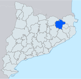
Garrotxa is a comarca (county) in the Girona region, Catalonia, Spain. Its population in 2016 was 55,999, more than half of them in the capital city of Olot. It is roughly equivalent to the historical County of Besalú.

An active volcano is a volcano that has erupted during the Holocene, is currently erupting, or has the potential to erupt in the future. A volcano that is not currently erupting but could erupt in the future is known as a dormant volcano. Volcanoes that will not erupt again are known as extinct volcanoes.

The Pemberton Volcanic Belt is an eroded Oligocene-Miocene volcanic belt at a low angle near the Mount Meager massif, British Columbia, Canada. The Garibaldi and Pemberton volcanic belts appear to merge into a single belt, although the Pemberton is older than the Garibaldi Volcanic Belt. The Pemberton Volcanic Belt is one of the geological formations comprising the Canadian Cascade Arc. It formed as a result of subduction of the former Farallon Plate.

The Zona Volcànica de la Garrotxa Natural Park is a natural park area covering a Holocene volcanic field in Catalonia, northeastern Spain. The volcanos, of which there are about forty within the park, are no longer active, with the last eruption (Croscat) occurring about 11,000 years ago. However, the region is still seismically active, and a large earthquake in 1428 caused damage to buildings and twenty deaths in Barcelona, 90 kilometres (56 mi) to the south. More recent earthquakes in 1901 and 1902 caused shaking but little damage.

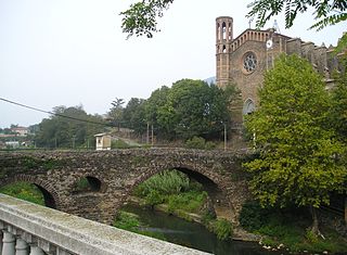
Sant Joan les Fonts is a municipality of the comarca of Garrotxa, located in Girona, Catalonia, northern Spain. As of 2014, the population is 2,919. Until 1949 it was known as Begudà.

The Croscat is a volcano in the comarca of Garrotxa, Catalonia, Spain. It is both the youngest and highest volcano in the Iberian Peninsula, with the last eruption dated back to about 14,000 years Before Present. The volcanic cone has a horseshoe shape, and its northeastern flank was quarried for volcanic gravel until the early 1990s, exposing the internal structure of the cone from top to bottom. The volcano is located in the Garrotxa volcanic field, a Quaternary volcanic field also known as Olot volcanic field, as part of the protected area of the Zona Volcànica de la Garrotxa Natural Park.

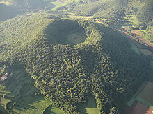
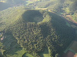
The Santa Margarida Volcano is an extinct volcano in the comarca of Garrotxa, Catalonia, Spain. The volcano has a perimeter of 2 kilometers and a height of 682 meters and is part of the Zona Volcànica de la Garrotxa Natural Park. The hermitage of Santa Margarida, after which the volcano was named, is inside the crater of the volcano. The building was destroyed in 1428 during the 1428 Catalonia earthquake and rebuilt in 1865.

Volcà del Montsacopa is an extinct volcano in the Zona Volcànica de la Garrotxa Natural Park, situated in Olot, Catalunya, Spain.
Jotabeche is a Miocene-Pliocene caldera in the Atacama Region of Chile. It is part of the volcanic Andes, more specifically of the extreme southern end of the Central Volcanic Zone (CVZ). This sector of the Andean Volcanic Belt contains about 44 volcanic centres and numerous more minor volcanic systems, as well as some caldera and ignimbrite systems. Jotabeche is located in a now inactive segment of the CVZ, the Maricunga Belt.

Sairecabur is a volcano located on the frontier between Bolivia and Chile. It is part of the Andean Central Volcanic Zone. Sairecabur proper is 5,971 m (19,590 ft) high; other mountains in the range are 5,722 m (18,773 ft) high Curiquinca, 5,819 m (19,091 ft) high Escalante and 5,748 m (18,858 ft) high Cerro Colorado, all of which have erupted a number of lava flows. Also in close proximity to Sairecabur lie the volcanic centres Licancabur, Putana and Juriques.
Wheelwright caldera is a caldera in Chile. It is variously described as being between 11 kilometres (6.8 mi) and 22 kilometres (14 mi) wide and lies in the Central Volcanic Zone of the Andes. A lake lies within the caldera, which is among the largest of the Central Andes. The caldera lies in the region of Ojos del Salado, the world's tallest volcano.

Tossol is a Catalán and Spanish word used to refer to protuberances that form in lavaflows and that when the lava cools become small hills. In the Jordà beech forest there are more than 50 tossols formed by the interaction between lava flows and pre-existing wetlands that, when covered by lava at more than 1000 °C, boiled with large bubbles that raised and deformed the flow forming the tossols. These in the Garrotxa Volcanic Zone are found in three lava flows, that of the Croscat volcano, that of the Puig Jordà volcano, that of the Montolivet volcano and the laundry located in La Moixina and the Parc Nou in Olot.

Fageda d'en Jordà