Geology of a Spanish archipelago in the Atlantic Ocean
Teide stratovolcano on TenerifePahoehoe lava flow on El Hierro
The geology of the Canary Islands is dominated by volcanoes and volcanic rock. The Canary Islands are a group of volcanic islands in the North Atlantic Ocean, near the coast of Northwest Africa. Geologically, the main islands are Lanzarote, Fuerteventura, Gran Canaria, Tenerife, La Gomera, La Palma, and El Hierro. There are also some minor islands and islets. The Canary Islands are on the African tectonic plate but they are far from the plate's edges; this controls the type of volcanic activity, known as intraplate volcanism, that has formed the islands.[1]
The Canary Islands, and some associated underwater volcanic mountains on the ocean floor, are in the Canary Volcanic Province. The current long period of volcanic activity in this province started about 70 million years ago.[2] For many millions of years, all the volcanic eruptions in the province occurred on the ocean floor. In the last 20.2 million years, enough lava has accumulated at several of the underwater volcanic mountains to build them above sea level, forming the Canary Islands. The eastern islands emerged first, followed by each of the more westerly islands, in turn.
near La Palma: Roque de Santo Domingo, Roque de las Tabaidas, Roque del Guincho;
near El Hierro: Roques de Salmor;
There are also numerous unnamed islets.
The seven main Canary Islands originated as separate submarine seamountvolcanoes on the ocean floor, which is 1,000–4,000m (3,000–13,000ft) deep in the Canarian region.
Lanzarote and Fuerteventura are separated by an 11km-wide (7mi), 40m-deep (130ft) ocean strait. Both islands are parts of a volcanic ridge called the Canary Ridge. These two islands have sometimes been a single island in the past when worldwide sea level was lower than its present level, for example during the Last Glacial Maximum about 20,000 years ago.[9][10] The single island is sometimes referred to as Mahan.[11]
The volume of volcanic rock that has built up the Canary Islands to thousands of metres above the ocean floor is about 124,600km3 (29,900cumi); 96% of this lava is hidden below sea level and 4% (4,940km3 (1,190cumi)) is above sea level.[12] The western islands have more of their volume (7%) above sea level than do the eastern islands (2%).[12]
The rocks under and in the Canary Islands are a record of multiple periods of volcanic activity:
Starting about 180Ma (million years ago), the oceanic crust of the North Atlantic Ocean was formed; it consists of igneous rocks (plutonic rocks overlain by volcanic rocks) that were gradually covered by layers of sedimentary rocks. The igneous part of the oceanic crust was formed by seafloor spreading at the divergent plate boundary between the North American and African plates, as a result of the breakup of the supercontinent Pangaea; in the Canary Islands region, this occurred in the Jurassic Period. North America and Northwest Africa separated while the Atlantic Ocean grew between them. Although this volcanic activity formed the ocean floor on which the Canary Islands were later formed, this seafloor spreading type of volcanic activity was not involved in the formation of the islands.[14]
Starting about 70Ma, volcanic activity in the Canary Volcanic Province has occurred at numerous seamounts across the region now occupied by the Canary Islands as well as an area of the ocean floor up to 400km (250mi) north of the Canary Islands. The northernmost of this group of seamounts, Lars seamount (about 380km (240mi) north of Lanzarote), has been dated to 68Ma. The seamounts are progressively younger southwestwards towards Lanzarote. Some seamounts developed into islands: first to emerge above sea level, at about 30 to 25Ma, were the Selvagen Islands[17] (200km (120mi) north of where the Canary Islands would later form). Then, each of the Canary Islands emerged as an island between 20.2Ma and 1.1Ma. Volcanic activity in the Canary Volcanic Province has continued to the present day.[18]
Erosion has cut ravines and canyons (known locally as barrancos) into the lava piles of some of the islands, as in this example at Barranco de Tirajana, Gran Canaria.Subdued topography of Fuerteventura
Intraplate volcanic oceanic islands follow a sequence of development stages. The sequence of stages was originally recognised, during the 1930s and 1940s, in the Hawaiian Islands, where eight stages were defined.[23][13] In the Hawaiian volcanic island chain and some other volcanic island chains, some of the later stages occur due to subsidence of the island as seafloor spreading moves the island away from the focus of volcanic activity. In contrast, the Canary Islands have not undergone significant subsidence; therefore the sequence has been adapted in the Canary Islands to the following stages:[24][25][26]
submarine (seamount) stage (El Hijo de Tenerife seamount)
post-erosional (or rejuvenation) stage (Tenerife, Gran Canaria, Lanzarote, Fuerteventura)
The Canary Islands differ from some other volcanic oceanic islands, such as the Hawaiian Islands: for example, the Canary Islands have stratovolcanoes, compression structures and a lack of significant subsidence.[25]
The seven main Canary Islands originated as separate submarine seamount volcanoes on the floor of the Atlantic Ocean (although Tenerife and La Gomera are close enough to each other for their seamounts to overlap as they grew;[27] the distance between Lanzarote and Fuerteventura was also small enough for some of their shield volcanoes to overlap as they grew, forming a single volcanic ridge[9]). Each seamount, built up by the eruption of many lava flows, eventually became an island. Subaerial volcanic eruptions continued on each island.
The stage of development of each island is shown in its current topography. The five younger islands, in the western and central sections of the island group, are higher and more rugged.[8] The two oldest, eastern islands of Fuerteventura and Lanzarote, where fissure eruptions have dominated in the rejuvenation stage, have more subdued topography with heights below 1,000m (3,300ft).[28]
Age
From about 70Ma to 20.2Ma, all the volcanic activity in the Canary Islands region occurred as underwater eruptions and the islands did not yet exist. Eventually, enough lava accumulated at particular locations to form each island of the Canary Islands archipelago. The age of the first underwater eruptions differs from island to island; for example, the first underwater eruptions at La Gomera were at more than 12Ma but at La Palma they were at 4Ma. Seamount stage rocks are not exposed on Lanzarote, Tenerife, Gran Canaria and El Hierro, which has hindered dating of the earliest underwater volcanic activity at these islands.
The age of the oldest subaerially-erupted lavas on each island decreases from east to west along the island chain: Lanzarote-Fuerteventura (20.2Ma),[29][Note 3] Gran Canaria (14.6Ma), Tenerife (11.9Ma), La Gomera (9.4Ma), La Palma (1.7Ma) and El Hierro (1.1Ma).[30][1]
The age of the youngest sedimentary rocks under each of the islands also decreases from east to west along the island chain, showing that the east-to-west age progression also applies to the start of seamount formation on the ocean floor.[31]
Calderas y estructuras calderiformes = Calderas and calderiform structures
Nota: La erupción de El Hierro ocurrida en octubre de 2011, se considera histórica como cualquier erupción en la que hay documento escrito sobre su ocurrencia = Note: The eruption of El Hierro that occurred in October 2011 is considered historical, as is any eruption of which there is a written document about its occurrence
Fuente = Source
Actualización erupción de El Hierro = El Hierro eruption update
Rock types
Igneous rocks
TAS diagram of volcanic rocks of the Canary Islands. The chemical compositions of 1,869 rocks are in the area outlined in red. The blue area roughly corresponds to alkaline volcanic rocks. The yellow area roughly corresponds to sub-alkaline volcanic rocks.Basaltic lava rock with holes (vesicles) where bubbles of gas were trapped within the lava when it was molten, from Lanzarote (length: 6cm (2.4in))
Apart from some islands of Cape Verde (another volcanic island group in the Atlantic Ocean, about 1,400km (870mi) south-west of the Canary Islands), Fuerteventura is the only oceanic island known to have outcrops of carbonatite.[35] On Fuerteventura, the carbonatite occurs as igneous intrusions.
The structurally deepest parts (the basal complexes) of Fuerteventura, La Gomera, and La Palma include hydrothermally metamorphosed oceanic crust rocks and lower seamount rocks that were altered from their original igneous and sedimentary rock types and folded before the three islands emerged. These rocks were subjected to pressures and temperatures corresponding to zeolite, prehnite-pumpellyite and greenschist facies.[37] These metamorphic rocks have been uplifted and then exposed by erosion of younger overlying rocks.
There are small amounts of migmatite and hornfels that outcrop in contact aureoles bordering igneous intrusions in the Basal Complex of Fuerteventura.[38]
Some sedimentary rocks of the uppermost oceanic crust under Lanzarote were thermally metamorphosed by heat from intrusion of magma into the sedimentary rocks. The original sandstones and shales were transformed into quartzite and slate respectively. Later volcanic eruptions have transported fragments of these quartzites and slates onto the island's surface as xenoliths within basaltic lava.[39]
Origins of volcanism
Several hypotheses have been proposed to explain the volcanism of the Canary Islands.[40] Two hypotheses have received the most attention from geologists:[29]
A hotspot (the Canary hotspot) is the explanation accepted by most geologists who have studied the Canary Islands in the last few decades.[41][42] A relatively hot mantle plume associated with this hotspot is thought to be rising through the mantle under La Palma and El Hierro.[43]
Evidence in favour of a hotspot origin for Canarian volcanism includes the age progression in the arcuate Canary Volcanic Province occurring in the same direction and at the same rate as in the neighbouring arcuate Madeira Volcanic Province, about 450km (280mi) farther north. This is consistent with the African plate rotating anticlockwise at about 12mm (0.47in) per year.[44] Also, seismic tomography has revealed the existence of a region of hot rock extending from the surface, down through the oceanic lithosphere to a depth of at least 1,000km (620mi) in the upper mantle.[45] Another line of evidence is the east-to-west decrease in age of the youngest sedimentary rocks under each island.[31]
Volcanic eruption distribution
According to the Smithsonian Institution's Global Volcanism Program, as of 2023[update], seventy-five confirmed volcanic eruptions have occurred in the Canary Islands in the Holocene Epoch (the last 11,700 years of Earth's geological history).[46] Fifteen of these eruptions have occurred since 1490;[46] contemporary written reports exist for these eruptions and they are known as the historical eruptions of the Canary Islands.[47][48] In the last 500 years, a volcanic eruption has occurred somewhere in the island chain, on average, every 30 to 35 years.[3] For each island, however, the time gap or repose time between historical eruptions has been highly variable (for example, 26 to 237 years for La Palma; 1 to 212 years for Tenerife).[46] This large variability is one of the reasons why reliable prediction of future eruptions at the volcanoes of the Canary Islands is unlikely.[49]
An eruption on Tenerife, about 2,000 years ago, is the largest Canarian eruption of the Holocene Epoch.[50] The largest volume and longest duration historical eruption in the Canary Islands occurred in the early 18th century on Lanzarote.[49][51][52]
The following table shows the distribution of volcanic eruptions during the last 11,700 years in the Canary Islands:
Holocene and historical volcanic eruptions in the Canary Islands (according to the Smithsonian Institution's Global Volcanism Program, as of 2023[update])
Island
Holocene (last 11,700 years)
Historical (since 1490)
Historical eruption dates
Notes
Ref.
Lanzarote
4
2
1730–1736, 1824
The 1730–1736 eruption is the largest historical eruption in the Canary Islands
No dated confirmed Holocene eruptions, but the freshness of some lavas and some volcanic landforms suggests that they may have been formed in the Holocene.
During the last 10,000 years, Tenerife and La Palma have been the two most volcanically active Canary islands. The bar chart compares the number of confirmed volcanic eruptions (vertical y-axis) at different stages during this time span (horizontal x-axis).[46]
1
2
3
4
5
6
7
8
9
10
10,000–8,001
8,000–6,001
6,000–4,001
4,000–2,001
2,000–551
550–0
Tenerife
La Palma
Lanzarote
Remains of the Famara shield volcano's pile of lava flows at Punta Fariones, the northern tip of Lanzarote (cliff height: 200–300m (660–980ft) )
Volcanic activity at Lanzarote started during the Oligocene Epoch at 28Ma.[61] For about the first 12 million years, the lava pile of a submarine seamount built up from the 2,500m-deep (8,200ft) ocean floor.[62] Then, in the Miocene Epoch, from 15.6Ma to 12Ma, the Los Ajaches subaerial shield volcano grew as an island on top of the seamount, in an area corresponding to present-day southern Lanzarote.[24] Between 10.2Ma and 3.8Ma, volcanic activity was focussed about 35km (22mi) to the northeast, forming a second shield volcanic island called Famara.[61] Between Los Ajaches and Famara volcanoes, a central volcanic edifice was also active from 6.6 to 6.1Ma.[63] The edifices gradually merged to form a single island, Lanzarote, at about 4Ma.[61] From 3.9Ma to 2.7Ma, volcanic activity paused and the island was eroded.[64] Today, although the lavas of Los Ajaches volcano are now mostly covered by calcrete,[65] the eroded remains of the two shield volcanoes are preserved in southern and northern Lanzarote respectively, with small outcrops of the central edifice occurring between them.
A terrestrial sediment layer, around 1–4.2 metres (3ft 3in– 13ft 9in) thick, sandwiched between basalt layers on the Famara massif in northeast Lanzarote, dates to the early Pliocene epoch around 4 Ma. The terrestrial sediment layer consists of calcarenite, clay-rich marl, and breccia.[66] These sediment layers were formed on a sandy flat plain, when the island was likely around 25–100km2 (9.7–38.6sqmi) in area.[67] It preserves fossils of insect eggs, land snails, snake vertebrae, as well as tortoise and bird eggshells.[68][67][69][66] Most of the bird eggs are large and have been attributed to ratites, while they were formerly attributed to two forms, one ostrich-like and one elephant bird-like, today they are considered to have likely been produced by a single species of ostrich. Lanzarote has never been connected to the mainland, so the animals are thought to have reached the island by oceanic dispersal.[66]
Rejuvenation stage volcanoes on Lanzarote aligned NE-SW with a view of Los Ajaches in the background
At about 2.7Ma, in the late Pliocene Epoch, the rejuvenation stage began. It produced much less lava than the earlier shield stage, mainly at the Montaña Roja and Montaña Bermeja volcanoes in southern Lanzarote.[64] Then, throughout the subsequent Pleistocene and Holocene epochs, the rejuvenation volcanism has continued and has been dominated by strombolian-style eruptions of lava from sets of volcanic cones aligned along numerous northeast–southwest fissures in the central part of Lanzarote.[72] Geologically recent examples of Lanzarote's rejuvenation stage volcanism include eruptions at Montaña Corona (about 21,000 years ago), Timanfaya (1730–1736) and Tao/Nuevo del Fuego/Tinguatón (1824).[73][34][74]
Timanfaya, Lanzarote
The Timanfaya eruption (1730–1736) erupted more than one billion cubic metres (1km3 (0.24cumi)) of lava, and a large volume of pyroclastic tephra, from more than 30 volcanic vents along a 14km-long (9mi) fissure in western Lanzarote. The lava flows cover one quarter of the island (an area of about 225km2 (87sqmi)) with some of the flows reaching about 50m (160ft) in thickness. It is the largest historical eruption in the Canary Islands, and the third largest subaerial fissure eruption of basaltic lava on Earth in the last 1,100 years.[75][34][76][77][78]
Almost all the volcanic rocks of Lanzarote are basaltic.[79]
Fuerteventura is situated on Mesozoic oceanic crust, about 70km (40mi) from the edge of the African continental shelf and about 100km (60mi) from the African mainland, making it the Canarian island closest to Africa.[81]
Miocene basaltic lava flows of the Jandía Edifice at Pico de la Palma (foreground) and Pico de la Zarza (background), Fuerteventura
Due to its old age, the oceanic crust at Fuerteventura is relatively rigid and this has prevented subsidence and allowed weathering and erosion to expose deep levels of the island's geological structure.[83]
The two main rock sequences of Fuerteventura are (1) a lower, older (Cretaceous to early Miocene) sequence of sedimentary, plutonic and submarine seamount volcanic rocks with intrusive dykes, often called the "Basal Complex", which is unconformably overlain by (2) a younger sequence of Miocene, Pliocene and Quaternary subaerial volcanic rocks.
The oldest rocks of Fuerteventura are a set of mafic plutonic rocks, marine sedimentary rocks and volcanic rocks, which are intruded by igneous dykes.[9] The sedimentary rocks of the Basal Complex were deposited on the ocean floor and represent the uppermost part of the oceanic crust that was uplifted and incorporated into the volcanic edifice during volcanic activity. The Mesozoic sedimentary rocks are mostly metamorphosed, and they are steeply tilted. The tilting occurred in the mid-Cretaceous and was probably caused by the uplift of Africa.[84][85] Fuerteventura's first alkalinemagmatism intruded plutonic rocks into the oceanic crust at about 70Ma.[25] This signifies a change to a hotspot environment.[25] A submarine seamount started to form on the ocean floor during the Eocene Epoch, at about 39Ma.[25] The igneous rocks of the Basal Complex probably represent the seamount stage of Fuerteventura's volcanic history, exposed due to uplift and erosion.[86]
In the early Miocene, volcanic activity transitioned from submarine to subaerial while the volcanic edifice was gradually built up above sea level. Fuerteventura has the oldest subaerial volcanic rocks of the Canary Islands,[34] which have been dated to 20.2Ma.[49] There were three main shield volcanoes built on the seamount base (from north to south): the Northern Edifice, the Central Edifice and the Jandía Edifice.[16][34] The central shield volcano is the oldest, built mostly from 22 to 18Ma but with a later phase from 17.5 to 13Ma. The southern shield volcano formed from 21 to 14Ma. The northern shield volcano was built mainly from 17 to 12Ma.[87] These shield volcanoes erupted mostly basaltic and trachybasaltic lava flows.[34]
Pliocene fossiliferous sedimentary rocks at Ajuy, Fuerteventura (foreground cliff height is approximately 2 metres (6.6ft))
In the late Miocene (from about 11.5Ma), there was a pause in volcanic activity (the erosional stage). Minor volcanic eruptions resumed in the Pliocene, at about 5.1Ma (the rejuvenation stage) and they continued sporadically into the Quaternary, with basaltic lava flows dominating again.[89]
The most recent volcanic eruption on Fuerteventura that has been dated occurred 134,000 years ago in the Middle Pleistocene.[34] Some undated volcanic cones in northern Fuerteventura may have formed more recently.[34] According to the Smithsonian Institution's Global Volcanism Program, there have been no dated confirmed Holocene eruptions but the freshness of some lavas and some volcanic landforms suggests that they may have been formed in the Holocene.[54]
Weathering, erosion and sedimentation during the Pliocene and Quaternary formed coastal and shallow-sea sedimentary rocks that were eventually covered by younger aeolian sediments, alluvial fan deposits and palaeosols.[90]
Gran Canaria
Roque Nublo, an 80-metre-tall (260ft) monolith that is part of a debris avalanche deposit, Gran Canaria
After early Miocene submarine volcanic eruptions created a seamount, subaerial volcanic activity at Gran Canaria occurred in three phases: shield stage (middle- and late-Miocene, 14.5 to 8.5Ma), erosional stage (late Miocene, 8.5 to 5.3Ma) and rejuvenated stage (Pliocene to Quaternary, 5.3Ma to present).[92]
The shield stage started with an early phase of eruptions of basaltic lava flows, from 14.5 to 14.1Ma, which built the main subaerial shield volcanic edifice that forms three quarters of the subaerial volume of Gran Canaria.[92] At least three shield volcanoes were active during this stage of island development and their lava flows gradually merged into a single large landform.[93] This was followed by a later phase, from 14.1 to 8.5Ma, of explosive volcanic eruptions of differentiatedfelsic lavas (phonolites, trachytes and rhyolites) with many pyroclastic flows (that deposited ignimbrites). In central Gran Canaria, Tejeda caldera and a cone sheet swarm were formed in this phase.[92]
Remains of Roque Nublo stratovolcano, Gran Canaria
From 8.5 to 5.3Ma, in the erosional stage, there was minimal volcanic activity. Erosion occurred along with deposition of alluvial sediments on the island and deposition of submarine turbidite sediments offshore.[92]
In the rejuvenation stage, from 5.3Ma to present, volcanic activity has occurred in three phases. The first phase, from 5.3 to 2.7Ma, was dominated by the formation of Roque Nublo stratovolcano in the central part of Gran Canaria. This produced lava flows, ignimbrites and debris avalanche deposits.[92] The second phase (3.5 to 1.5Ma) had strombolian-style effusive eruptions of lava flows along a northwest–southeast trending volcanic rift.[92] The current phase, from 1.3Ma to the present, has featured scattered phreatomagmatic and strombolian eruptions of very alkaline lavas.[92] The most recent volcanic eruption on Gran Canaria occurred about 2,000 years ago at Bandama crater, in the northeast part of the island.[95][55]
Sand dunes at Maspalomas, Gran Canaria
Sand dunes, with a total volume of 18.6million cubic metres (24.3×10^6cuyd),[96] cover an area of 3.6km2 (1.4sqmi) of the Maspalomascuspate foreland on Gran Canaria's south coast.[97]Aeolian landforms found in this dune field include barchan dunes and dune ridges (transverse dunes). The dunes are made of sand grains and pebbles. The average thickness of the dunes is 5–10m (16–33ft) but some dunes reach 20m (66ft) thick.[98] In a few areas, the underlying deltaic sediments are exposed.[99] The sand that has built the dunes has been moved about 2 or 3km (1 or 2mi) by water waves and wind from the sediment source area (an offshore submarine shelf at Playa del Inglés). Since the 1960s, urbanisation has affected the local winds and this has caused the gradual reduction in volume and area of the dune field because sediment erosion now exceeds sediment deposition.[96] A study from 1990 reported that the dunes had formed during the last several thousand years.[100][101] A 2008 study, however, found evidence supporting a hypothesis that the dunes formed less than 300 years ago, as a consequence of a tsunami generated by the 1755 Lisbon earthquake.[102][103][104]
Tenerife
Satellite image of Tenerife: Teide–Pico Viejo Volcanic Complex in Las Cañadas caldera (centre), Teno massif (north-west, centre-left) and Anaga massif (north-east, top right)
Tenerife's subaerial shield stage of island development started at about 11.9Ma in the late Miocene Epoch.[43] First, a shield volcano called Tenerife central shield volcano grew as an island at what is now the central part of Tenerife. This central shield volcano was active from 11.9 to 8.9Ma.[43] Most of this central shield volcano's lavas have been covered by younger lavas from younger volcanoes; some small patches of the central shield volcano's lavas are now preserved as the Roque del Conde massif in the centre of the island. Then, in northwestern Tenerife, a second shield volcano (Teno shield volcano) formed from 6.4 to 5.1Ma; its remains are the Teno massif.[43] Then, from 4.9 to 3.9Ma, a third shield volcano (Anaga shield volcano) was active in the northeastern part of Tenerife; the remains of this volcano are the Anaga massif.[43] The lavas of these three shield volcanoes gradually formed a combined volcanic edifice that accounts for 90% of Tenerife's current volume.[106]
Pico Viejo (left) and Teide (right) in Las Cañadas caldera, Tenerife
The rejuvenation stage of Tenerife (after a long erosive gap in activity at the centre of Tenerife) started at about 4Ma and continues to the present day. Between 4.0 and 0.2Ma, a large stratovolcano (Las Cañadas volcano) formed, centred in the central part of Tenerife. Las Cañadas volcano covered some parts of the three older shield volcanoes.[107] This volcanic activity at the centre of Tenerife has included cycles of basaltic lavas (e.g. basanites and tephrites) alternating with significant amounts of magmatically differentiated (more felsic and more alkaline) lavas (e.g. tephri-phonolites and phonolites).[108] Central volcanic activity has been accompanied, since 3Ma, by mostly basaltic fissure eruptions at a three-armed Y-shaped radial rift zone system[a] that has northwest, northeast and south rift zones.[109][110] In eastern Tenerife, large landslides on the flanks of the ridge (known locally as Cumbre Dorsal) that marks the northeast rift zone, formed Güímar valley sometime between 850,000 and 570,000 years ago, La Orotava valley sometime between 570,000 and 540,000 years ago, and another valley less than 560,000 years ago.[22] Between about 200,000 and 170,000 years ago, Las Cañadas volcano collapsed, forming Las Cañadas caldera.[111] The nature of this collapse has been studied by many geologists during the last two centuries.[112] Suggested causes of Las Cañadas volcano's collapse are landslide (the Icod landslide), or explosive volcanic eruption, or a combination of both.[112][22] In this 16km ×20km (9.9mi ×12.4mi) caldera, since about 170,000 years ago, two related stratovolcanoes have formed: Teide (most of its eruptions occurring before 30,000 years ago) and its younger, smaller, western, close neighbour Pico Viejo (most of its eruptions occurring between 27,000 and 14,600 years ago).[113][112] Both of these stratovolcanoes are still active. Together with some satellite vents, they form the Teide–Pico Viejo Volcanic Complex.[107][114][Note 4] Most of Tenerife's Holocene eruptions have occurred at the radial rift zones rather than at the two stratovolcanoes.
During the Holocene Epoch, Tenerife has had 42 confirmed volcanic eruptions, which is more than any other Canary island.[46]
Aerial view of Chinyero, the site of the most recent volcanic eruption (1909) on Tenerife
The most recent eruption of lava at Teide's summit vent occurred 1,150 years Before Present. The latest eruption of Pico Viejo is the Chahorra flank eruption of 1798. The most recent eruption in the northeast rift zone is the 1704–1705 eruption at Siete Fuentes/Volcán de Fasnia/Las Arenas. The most recent volcanic activity at the northwest rift zone has been the Boca Cangrejo (1492), Garachico/Boca Negra (1706) and Chinyero (1909) eruptions.[22]
At Teide, the volcanic edifice of Tenerife consists of the remains of the submarine seamount, covered by the remains of the central shield volcano, covered by the remains of Las Cañadas stratovolcano, capped by the cone of Teide stratovolcano.[119][Note 5] Measured from the ocean floor, the total height of Tenerife's edifice is 7,500 m (3,715 m above sea level), making it one of the tallest volcanic edifices on Earth (some volcanic edifices in Hawaii are taller).[126][127][128][129] Tenerife is currently at the point in its geological development where the effects of constructive volcanic eruption and destructive erosion are roughly balanced.[130]
La Gomera
Playa de Santiago on the south coast of La Gomera where a cliff exposes Lower Pliocene dark-coloured lava flows (cliff height: approximately 50m (160ft) )
The seamount base (also known as the Submarine Edifice) of La Gomera was built by volcanic eruptions during the Miocene Epoch. The precise age range of this submarine volcanic activity is uncertain. Dating done in the early 1970s suggested that submarine volcanic eruptions occurred from 20Ma to 15Ma, followed by an erosion gap of 5 million years. The reliability of these dates has been questioned; dating done in the 2000s suggests that submarine volcanic eruptions began instead at about 12Ma.[134][135] At the end of the seamount stage, the seamount was uplifted and its top surface was eroded.[136][134][16] There are a few small areas of old lava flows that some geologists claim represent an upper part of the submarine seamount (a "Basal Complex" similar to those found on some of the other Canarian islands) but this is disputed; an alternative explanation is that these old lavas instead represent early subaerial shield volcano eruption material that flowed off the island into the ocean.[137]
In the late Miocene, at about 11Ma, La Gomera's shield-building stage began.[139] The oldest subaerially-erupted lavas on La Gomera have been dated to 9.4Ma.[43] Most of the subaerial shield volcano's growth occurred from 9.4 to 8.0Ma.[136] The shield volcano lavas are also known as the Old Edifice.[134] About 8Ma, the northern part of the mafic alkaline shield volcano collapsed (the Garajonay landslide).[140]
From 7.5Ma to 6.5Ma, the Vallehermoso stratovolcano grew on top of the partially collapsed shield volcano by eruption of relatively felsic lavas (phonolites and trachytes) which covered much of the older shield volcano.[141][134][142]
In the early Pliocene, from 5.5Ma to 4.2Ma, basaltic lavas were erupted from highland volcanic vents; these lavas flowed over much of the island.[143] For the last 4 million years, there have been no significant volcanic eruptions on the island and La Gomera has been in the erosional stage of its development.[141][144][145][146] (The island's most recent volcanic eruption was a minor monogenetic eruption at Barranco del Machal, during the Early Pleistocene, about 1.94Ma).[146] Erosion has removed cinder cones (La Gomera now has only one well-preserved cinder cone, named La Caldera, on the island's south coast)[147] and exposed the deeper parts of the volcanic edifices, revealing volcanic plugs, dykes, cone sheets, and lower lava flows.[134]
Volcanic eruptions may resume on La Gomera in the future, but some geologists have suggested that La Gomera is already volcanically extinct.[148][27]
La Palma
Pillow lava of the Basal Complex in Barranco de las Angustias, La Palma
La Palma's submarine seamount formed from 4Ma to 3Ma, in the Pliocene Epoch.[150] The seamount stage rocks are layers of basaltic to trachytic pillow lavas with hyaloclastites and pillow breccias.[150] The seamount's volcanic rocks have been intruded by younger mafic plutons and a mafic dyke swarm. Between 3Ma and 1.77Ma, the seamount rocks were uplifted, tilted and eroded. The structurally deepest rocks of the seamount have been metamorphosed to greenschist facies.[151] Small remnants of the seamount stage rocks are now exposed on La Palma as its "Basal Complex", for example in Barranco de las Angustias.[150][141][152]
La Palma's shield-building stage began at 1.77Ma - the Garafía shield volcano grew, on top of the seamount, between 1.77Ma and 1.20Ma (forming the present-day northern part of La Palma), with the oldest subaerial lavas dated to 1.7Ma. This shield volcano grew quickly to a height of about 3,000m (9,800ft) and a diameter of about 23km (14mi) but this volcano became unstable and its southern flank collapsed in a large landslide at 1.2Ma.[153] Only a small part of Garafía shield volcano is visible now because much has been eroded away or is buried by younger lavas. After the Garafía landslide, the focus of volcanic activity moved slightly to the south, producing another shield volcano, named Taburiente volcano, on top of Garafía shield volcano's collapsed southern flank.[141]
Internal structure of Taburiente volcano (consisting of lava flows, tephra and dykes) exposed in the northern cliff of Caldera de Taburiente at Roque de los Muchachos, La Palma (scale: approximately 1,000 metres (3,300ft) across)
For most of its active period, Taburiente shield volcano erupted basaltic lavas but final phases of its formation included phonolitic and trachytic lavas.[155] Together, the three successive, superimposed shield volcanoes (the seamount, Garafía and Taburiente) form the Northern Shield.[156]
A three-armed Y-shaped volcanic rift system developed at Taburiente volcano; this northern La Palma rift system had three radial arms - northwest, northeast and south - meeting at the shield volcano's summit. Gradually, most of Taburiente's volcanic activity became focused on the south rift.[155] From 810,000 to 560,000 years ago, the southern part of Taburiente shield volcano's edifice grew by volcanic eruptions at the south rift; these eruptions formed Cumbre Nueva, a 10km-long (6mi) north-south volcanic ridge in what is now central La Palma.[157][158][159] Cumbre Nueva had a period of particularly rapid growth from 621,000 to 566,000 years ago.[160]
The Northern Shield (background) and Cumbre Vieja (middle and foreground), looking north from Deseada, La Palma
Taburiente volcano grew to an estimated maximum height of about 3,000m (9,800ft)[141] but, about 525,000 years ago,[160] its edifice became unstable and part of its southern flank (including much of the west flank of Cumbre Nueva) collapsed laterally in a landslide with a volume of more than 200km3 (48cumi),[161] resulting in the formation of a large crater named Caldera de Taburiente; it is an erosion caldera formed by mass wasting, not a collapse caldera formed by volcanic eruption. The Caldera de Taburiente is a topographic depression; from the time of the landslide until the present day, it has been enlarged by erosion and is now 15km (9.3mi) long, 6km (3.7mi) wide and 1.5km (0.93mi) deep.[150][141][162] Also after the landslide, Cumbre Nueva grew rapidly again until about 490,000 years ago.[160] A small stratovolcano, named Bejenado volcano, started forming on the floor of the Caldera de Taburiente about 523,000 years ago; it erupted lavas until about 491,000 years ago.[160] Eruptions of lava occurred at Taburiente volcano until about 400,000 years ago.[150][141][163] Volcanic activity then appears to have paused for the next 275,000 years.[164]
About 125,000 years ago,[165] the focus of volcanic activity moved south again, with eruptions of mostly mafic alkaline lavas gradually forming Cumbre Vieja, a 20km-long (12mi) ridge-shaped elevated rift zone volcano that has grown until the present day at southern La Palma's north–south volcanic rift zone. Cumbre Vieja reaches 1,949m (6,394ft) in height and it dominates the geology of the southern half of the island.[Note 6][150][167][141] From 125,000 to 20,000 years ago, volcanic eruptions occurred on all arms of southern La Palma's triple-armed volcanic rift system. Between 20,000 and 7,000 years ago, volcanic activity declined on the northwest arm and stopped completely on the northeast arm.[158]
Eruption at Tajogaite cinder cone on the west flank of Cumbre Vieja, La Palma (4December2021)
Seven confirmed historical eruptions have occurred at Cumbre Vieja, making La Palma the most volcanically active of the Canary Islands and accounting for half of all the volcanic eruptions in the Canary Islands during this c. 535 year timespan.[46][168][169] These historical eruptions have mostly been of the strombolian type, forming cinder cones; magmas have been predominantly mafic in composition but some more felsic phonolites have also been produced.[141] Cumbre Vieja is still volcanically active; its three most recent eruptions are Nambroque (1949), Teneguía (1971) and Tajogaite (2021).[57] Geologically recent volcanic eruptions have also occurred along the submarine section of the north–south rift zone that extends about 20km (12mi) beyond the southern tip of the island.[170]
Day et al. (1999)[158] suggested that the west flank of Cumbre Vieja is in the initial stages of instability. Modelling by Ward and Day (2001, 2005)[171][172] led them to suggest that if a large landslide of Cumbre Vieja's volcanic rocks were to occur in the next few thousand years, it could displace a large volume of ocean water that would cause widespread tsunami damage along Atlantic Ocean coastlines. This suggestion has been opposed by some geologists who assess southern La Palma's volcanic rift zone to be stable and any generated tsunami would be much smaller than Ward and Day's modelled size, suggesting that Cumbre Vieja's collapse and damage scenarios would be less severe than Ward, Day and some popular science television documentaries have claimed.[173][174][175][176] (See also:Cumbre Vieja tsunami hazard and Megatsunami).
El Hierro
Satellite image of El Hierro showing Y-shaped triple-arm rift zones and curved lateral collapse cliffs and bays
El Hierro is the youngest and smallest of the seven main Canary Islands.[2] El Hierro is in its shield-building stage.[178]
During the Early Pleistocene, a submarine seamount grew upwards from the ocean floor, almost to sea level, on top of Cretaceous-Pliocene oceanic sediments.[179][180]
Pahoehoe lava flows ("Los Lajiales") and volcanic cones of the rift volcanism phase at the south-south-east rift zone, near La Restinga, El Hierro
Then, at 1.2Ma, Tiñor shield volcano began to form on top of the seamount.[182] Tiñor volcano's first subaerial lava was erupted at 1.12Ma.[183] Tiñor grew by erupting lavas across what is now the eastern half of El Hierro until about 882,000 years ago; the eruptions were mostly of effusive basaltic lava, but there was also an explosive, xenolith-rich last eruptive phase (the Ventejís volcanics).[155] Instability in the edifice of Tiñor volcano resulted in the Tiñor lateral collapse landslide at about 882,000 years ago when much of the volcano's northwest flank slid downwards and onto the ocean floor.[155][184] This left a curved bay where the volcano's flank had been.
About 545,000 years ago,[185][186] El Hierro's second subaerial shield volcano, named El Golfo volcano (also known as the El Golfo-Las Playas Edifice),[187][Note 7] started erupting. Its summit was slightly to the west of Tiñor volcano. Lavas from El Golfo volcano filled the bay that had been formed by the Tiñor landslide. El Golfo volcano's later lava flows covered the remains of Tiñor volcano. At its maximum development, El Golfo volcano was about 2,000m (6,600ft) high and about 20km (12mi) in diameter, with a surface area slightly larger than present-day El Hierro and about twice the area that Tiñor volcano had covered.[189][155] El Golfo volcano grew by erupting lava from a Y-shaped rift system with west-north-west, north-north-east and south-south-east arms; most of the eruptions occurred on the west-north-west and north-north-east arms.[155] El Golfo volcano gave El Hierro a roughly circular shape at this time.[155] El Golfo volcano's early-stage lavas are basaltic in composition; its late-stage lavas (erupted between about 176,000 and 158,000 years ago) are of more chemically differentiated composition (trachyte).[190][191]
The volcanic edifices of El Hierro were affected by at least two other large lateral collapse landslides of uncertain age:[192]
the El Julán lateral collapse, in which much of the southwest flank of El Golfo volcano slid downwards and onto the ocean floor, occurred at least 158,000 years ago;[141]
at least 145,000 years ago, the Las Playas lateral collapse occurred on the southeast flank of El Golfo volcano.
At about 100,000 years ago, slumping near Las Playas did not result in complete downward slumping of El Golfo volcano's southeast flank into the ocean; instead, a large block of rock moved about 300m (980ft) down a steeply-inclined fault (the now inactive San Andrés fault) in what has been described as an "aborted" lateral collapse.[193][186]
El Hierro's third, and current, major phase of volcanic activity is rift volcanism; it started about 158,000 years ago.[185][186] This rift volcanism occurs at a Y-shaped volcanic rift zone system with west-north-west, north-north-east and south-south-east arms that meet at the centre of the island; all of the three rift arms have been very volcanically active.[191][155] There are about 200 monogenetic cinder cones along the ridge crests of the three rift zones; this is the most densely concentrated group of such cones in the Canary Islands.[186] Rift phase lavas cover most of the island, not only forming the ridges along each rift zone but also partially infilling the landslide bays. The rift zones extend outwards as submarine volcanic ridges on the ocean floor; for example, the south-south-east rift zone extends underwater to at least 40km (25mi) south of the island.[2]
El Golfo landslide scarp, depression (now a coastal plain) and bay, El Hierro
Instability in the edifice of El Golfo volcano resulted in El Hierro's youngest and largest landslide, the El Golfo lateral collapse landslide, when a large part (with a volume of 180km3 (43cumi)) of the volcano's northern flank slid downwards off the island and onto the ocean floor; individual blocks of moved material, up to 1,200m (3,900ft) across, have slid as much as 65km (40mi) from their original positions.[155][195] This landslide formed the curved 14km-wide (8.7mi) El Golfo bay and a curved landslide scar depression, where the volcano's flank had been; the bay still forms the curved northwest coast of El Hierro.[194] The El Golfo landslide scarp is preserved today as a 26km-long (16mi) cliff with a maximum height of 1,400m (4,600ft); the cliff is roughly parallel to the coast but about 2–4km (1.2–2.5mi) inland, except at each end, where the cliff meets the coast. The age of the El Golfo lateral collapse landslide is poorly constrained; it occurred sometime between 133,000 and 13,000 years ago.[192] Evidence found on land favours the older end of this age range; evidence on the ocean floor favours a young age.[192] Carracedo et al. (1999)[161] have suggested that the conflicting evidence from land and ocean floor can be reconciled if there were two landslides instead of a single event: first, a collapse of the subaerial part of the El Golfo volcanic edifice at 133,000 years ago, then a submarine landslide at 13,000 years ago.[192][184]
Aerial view of the green eruption plume of the Tagoro submarine eruption at El Hierro, 2011–2012 (with the village of La Restinga in the background)
It has been estimated that the large landslides on El Hierro removed more than two-thirds of the total volume of lava erupted subaerially by the two shield volcanoes and the rift cinder cones of the island.[196] This removal of lava has hindered efforts to estimate El Hierro's magma production and eruption rates.[196]
In the last 33,000 years, 31 land-based volcanic eruptions are known to have occurred on El Hierro.[197] Of the volcanic eruptions on land at El Hierro that have been dated, the two most recent were at 2,500 years ago (at Montaña Chamuscada), and 2,280 years ago (at Montaña Los Cascajos), both located on the north-north-east rift.[198]
In 2011, a period of seismic unrest (associated with underground movements of molten magma) was followed by El Hierro's most recent volcanic eruption, which occurred underwater on the volcanic rift about 2km (1.2mi) south of the southern tip of the island.[182] From October 2011 to March 2012, lava erupted from a submarine volcanic vent, which was later named Tagoro.[2][199] Initially, this volcanic edifice was at a depth of 350m (1,150ft), but by the end on the eruption, the edifice had grown to 88m (289ft) below sea level.[200]
Possible future islands
One or more of the seamounts in the western part of the Canary Volcanic Province may erupt enough lava to form new islands in the future. For example, El Hijo de Tenerife is a 600m-tall (2,000ft) seamount on the ocean floor between Gran Canaria and Tenerife. It is about 200,000 years old and it is thought that it may form a new island within the next 500,000 years.[201][202] This seamount is in one of the most seismically active parts of the Canary Islands region.[203]
A group of three seamounts called Las Hijas (Spanish for 'The Daughters') are located on the ocean floor 70km (43mi) southwest of El Hierro. These seamounts were surveyed by side-scan sonar in 1997 and were assumed to be less than about 500,000 years old and, therefore, were suggested as candidates for eventually becoming new islands.[204][205] However, later dating of rock samples from Las Hijas has yielded ages of about 141Ma, which would make Las Hijas probably the oldest seamounts in the Atlantic Ocean.[202] This old age prompted an alternative name to be suggested: 'Bisabuelas' (Spanish for 'Great-grandmothers').[202]
Volcanic landforms
The Canary Islands have examples of many types of volcanic landforms. Some examples are listed in the following table:
Montaña Caldereta, an Early Pleistocene volcanic cone surrounded by 50-metre-thick (160ft) black lava erupted during the Timanfaya 1730–1736 eruption on Lanzarote
Lava delta at Garachico, on which the town was rebuilt after a northwest rift zone volcanic eruption in 1706 on Tenerife filled the bay and partially destroyed the old town
Black lava flow of the 1909 eruption of Chinyero volcanic vent (off to the left) that solidified around Montaña Bilma volcanic cone (upper right) in the northwest rift zone of Tenerife
A solidified lava lake (hidden from view) covers the floor of La Cazoleta volcanic vent (centre left), with the taller Pico Partido volcanic cone in the background, in Timanfaya on Lanzarote
Volcanic hazard is the probability of damaging physical phenomena, produced by a volcano, occurring in a particular area during a particular time interval.[240] The closely associated concept of volcanic risk is an estimate of the human, infrastructural, and other costs and impacts resulting from the occurrence of volcanic hazard, measured against how such impacts may be mitigated.[240]
The entire resident human population of the Canary Islands (2,228,862 as of 31December2024[update][241]) lives less than 100km (62mi) from an active volcano.[242] The islands are also visited by many tourists (17.77 million in 2024[243]). Potential volcanic hazards in the Canary Islands include lava flows, pyroclastic flows and pyroclastic falls, volcanic gas emissions, lahars, and edifice collapses.[244]
Unlike some other ocean island chains (e.g. the Hawaiian Islands) where active volcanoes are confined to one end of the chain, the active volcanoes of the Canary Islands are located along the entire length of the chain. This wide spatial spread of eruptions makes it more difficult to predict which Canarian island will have the next volcanic eruption.
During historical volcanic eruptions on the Canary Islands, lava flows have not endangered human life directly,[245] but they have destroyed thousands of buildings and destructively covered agricultural land, forestry areas, and roads in the Canary Islands.[246] Pyroclastic airfall material (tephra), including volcanic ash, has also damaged buildings by roof collapse due to excessive ash accumulation on roofs.[246] Volcanic ash deposits and volcanic gas emissions have also hampered clean-up activity during some eruptions.[246]
Although buried molten magma can be detected before an eruption occurs, such magma is known to have migrated horizontally more than 20km (12mi) underground in some Canarian historical eruptions and this hampers scientists' ability to forecast where new volcanic vents may form.[242]
Simplified volcanic susceptibility map of Lanzarote showing the areas (in orange) that have the highest probability of new volcanic vent opening in the future
Geological studies indicate that Lanzarote's next volcanic eruptions are most likely to occur at Timanfaya or at Tao, where eruptions occurred in 1730–1736 and 1824 respectively, or in the Guatiza area where eruptions occurred earlier in the Holocene.[62][247]
In the last 158,000 years, the most common type of volcanic eruption on El Hierro has been mafic strombolian eruptions at monogenetic vents.[248] This is expected to also be El Hierro's most likely type of volcanic activity in the geologically near future.[248]
On Tenerife, the greatest potential volcanic hazard is probably pyroclastic airfall but the probability of a large pyroclastic eruption on the island is low.[249][250]
Scientists have concluded that future volcanic eruptions are more likely to occur at the western islands (Tenerife, La Palma, El Hierro).[251] Volcanic hazard and risk assessments have been done for the islands. These assessments have involved study and mapping of volcanic eruption products produced during past eruptions, which give indications of the location, frequency, severity, and probability of eruptions.[252] The completeness of this information varies among the islands. This information has been input into geological computer modelling of hazard and risk for various future volcanic eruption scenarios.[62][248][251][253][245][254] Due to the incompleteness of the record of past eruptions, there is considerable uncertainty in the hazard and risk assessments for most of the Canary Islands.[255]
The record of past eruptions is better known on Tenerife and La Palma; scientists therefore have more confidence in the accuracy of the hazard and risk assessments for these islands. La Palma and Tenerife have been assessed as the two Canarian islands facing the greatest volcanic hazards.[242] In a hazard and risk assessment by Brown et al. (2015), these two islands have a volcanic hazard index of II (from a possible range of I, II or III) and a population exposure index[Note 8] of 4 (from a range of 1 to 7).[257] These two indices combine to give Tenerife and La Palma a risk level of II (from a possible range of I, II or III).[257] Brown et al. (2015) also concluded that although El Hierro, Gran Canaria, and Fuerteventura have a population exposure index of 4, and Lanzarote has a population exposure index of 5, the volcanic hazard index of these islands is unclassified due to insufficient data; therefore these islands also have an unclassified risk level.[257]
Scandone et al. (2016) ranked the Canary Islands by volcanic risk coefficient as shown in the following table:[258]
Volcanic risk coefficients for the Canary Islands (as of 2016)
Island
Volcanic risk coefficient
Notes
Tenerife
9
highest risk
Gran Canaria
6
El Hierro
6
La Palma
5
Lanzarote
5
Fuerteventura
3
La Gomera
0
lowest risk
where volcanic risk coefficient = log(1/years since last eruption) + largest volcanic explosivity index of past eruptions + log(human population).[258]
Historical eruptions in the western islands have been concentrated at active rift zone ridges or central volcanic edifices. These areas, for example the northwest rift zone of Tenerife, are also where the probability of future eruptions occurring is highest.[251][248]
The first local seismometer measurements of earthquakes in the Canary Islands were made in 1891 but it was not until 1952 that the first permanent Canarian earthquake monitoring station was established at Santa Cruz on Tenerife.[260] A network of earthquake monitoring instruments across the island chain was established in 1975;[260] the existence of multiple seismic monitoring stations has enabled accurate location of earthquakes by comparison of seismic wave arrival times at each station (See:Epicentre). As of 2020[update], the Canary Islands has a network of 70 seismic monitoring stations, making it one of the most closely monitored volcanic regions of the world.[260]
On the Modified Mercalli Scale (an earthquake intensity scale ranging from I for "not felt" to XII for "extreme"), most documented earthquakes in the region have had an intensity of VI or less. The Timanfaya eruptions on Lanzarote in 1730, however, were accompanied by earthquakes with intensities of up to X on the same scale.[261] Earthquakes of intensity VII have occurred on La Palma (1677, 1920), on Gran Canaria (1913), and on Fuerteventua (1915, 1917).[262]
Interactive, zoomable map of earthquakes of magnitude 4.0 or larger in the Canary Islands region 1976–2024 (Data source: USGS Earthquake Catalog)
The seismicity of the Canary Islands is very low to low.[261] The USGS Earthquake Catalog reports that from 1January1976 to 31December2024, 17 earthquakes of magnitude 4.0 or larger, with epicentres on or close to the Canary Islands, were recorded;[263] the largest of these earthquakes had a mb magnitude of 5.4 and an intensity of VII with its epicentre on the ocean floor about 28km (17mi) west of El Hierro in 2013.[263][264]
Periods of increased seismic unrest occurred on Tenerife in 2004–2005 and 2016–2021.[265][266] In 2004–2005, an earthquake swarm of about 200 earthquakes occurred along the northwest rift zone of Tenerife. The swarm was probably caused by a movement of molten magma and associated magmatic gases disturbing Teide's hydrothermal system.[265] This raised concern that a volcanic eruption may have been about to occur but no eruption on Tenerife followed the swarm.[267][2] The seismic unrest of 2016–2021 included more than 400 earthquakes under Teide's volcanic cone and under Las Cañadas caldera, probably due to another intrusion of magma, magma mixing, and injection of magmatic gases into Teide's hydrothermal system.[265] This period of seismic unrest has not been followed by a volcanic eruption on Tenerife.
Earthquake swarms, due to the underground movement of molten magma, were detected before and during the volcanic eruptions of 2011–2012 and 2021. In the week before the 2021 eruption on La Palma, a swarm of more than 22,000 earthquakes occurred,[5] with mbLg magnitudes up to about 3.5. The hypocentres of successive earthquakes migrated upwards as magma rose slowly to the surface.[268][269] During the eruption, larger earthquakes were detected, for example an earthquake of mbLg magnitude 4.3 occurred 35km (22mi) below the surface.[270]
Montaña de El Palmar, Tenerife showing quarried sectors of the volcanic cone
Volcanic rock has been extracted at quarries scattered across the Canary Islands. This includes at some volcanic cones, for example Montaña de El Palmar in northwest Tenerife, where basaltic lapilli tephra (known locally as "picón") has been removed for use as horticultural substrate and road construction aggregate.[273][274]
Phonolitic and trachytic pyroclastic rocks (including pumice) of intermediate composition have been used as a building material. For example, Bandas del Sur ignimbrite of the Poris Formation has been extracted from quarries at Tajao and at Poris de Abona in southern Tenerife.[275][276][277] Similar pyroclastic rock has been extracted from quarries on Gran Canaria and Fuerteventura.[276]
On Gran Canaria, lapilli have been extracted at quarries for use in heat exchangers, and for filters that remove dust from gases.[278]
Yellow deposits of sulfur near the summit of Teide, Tenerife
Starting in the first half of the 16th century, on Tenerife, sulfur was extracted from fumarolic areas at Teide's summit. Initially, the extracted sulfur was used as an ingredient in gunpowder. Later, sulfur was used by local farmers to protect their grape crop against diseases. Extraction of sulfur at the volcano continued until the 1940s.[279]
The sedimentary rock calcrete (also known as caliche) was extracted at some quarries in southwestern Gran Canaria, then heated in kilns to produce lime for use in construction.[280] Calrete extraction for lime production also occurred on Fuerteventura.[281]
Deposits of some rare-earth elements have been found in two settings in the Canary Islands: (1) pegmatitic syenites of southwest Tenerife and northeast La Gomera; (2) carbonatites in the Basal Complex of northwest and central Fuerteventura.[26]
Demonstration, for tourists by National Park staff, of water turned into an artificial steam geyser after being poured down a borehole into hot bedrock at Islote de Hilario, Timanfaya, Lanzarote, 2002Reservoir in the summit crater of Montaña de Taco, Tenerife
The potential exploitation of shallow high-enthalpygeothermal energy resources has been investigated on Lanzarote, Tenerife and La Palma.[284] The geothermal energy originates from hot volcanic sources in the bedrock. A crater rim surface temperature of 200°C (392°F), as well as a borehole temperature of 605°C (1,121°F) at a depth of 13m (43ft), have been recorded at Timanfaya, Lanzarote.[285] High-enthalpy geothermal energy has been used to heat the water supply of a winery on Lanzarote using a borehole heat exchanger field of twelve boreholes, as part of the Shallow Geothermal Energy for the Canary Islands (SAGE4CAN) project.[286][287][288]As of 2023[update], an experimental project on Lanzarote has been investigating the generation of electricity using the hot dry rock heat source provided by the island's geologically recent volcanic activity at Timanfaya, where installed thermoelectric generators are capable of producing 4.4 MWh of electricity per year.[289]
Reservoirs for fresh water have been built in the craters of some volcanic cones, e.g. Laguna de Barlovento (in northeast La Palma)[290] and Montaña de Taco (in northwest Tenerife).[291]
The geological features and landscapes of the Canary Islands are sites of geotourism. Many features and sites are protected in a network of national parks, natural parks, rural parks, natural reserves, natural monuments, and sites of scientific interest. Examples are:[292][293][294][295][296]
English translation of Alexander von Humboldt's book about his 1799 travels including his walk to the summit of Teide
TFGeoturismo is a local government project promoting geotourism in Tenerife. It began in 2017 and is supported by the Cabildo (Island Council) of Tenerife and operated by INVOLCAN, the organisation that oversees various aspects of volcano–human interaction in the Canary Islands. Teide National Park is particularly significant in Tenerife's geotourism strategy because it provides a high-profile opportunity to improve public awareness of Tenerife's volcanic heritage; it is Spain's most visited national park and one of the world's most visited volcanic areas. (In 2016, 2017 and 2018, Teide National Park had more than 4 million visitors per year). TFGeoturismo has promoted Teide National Park by making and screening a documentary film about the park, as well as publishing a guidebook describing and explaining the park's geology, geomorphology and volcano-related natural and cultural heritage. The project has also published a set of urban geotourism guide leaflets for more than 20 municipalities of Tenerife, e.g. Garachico. TFGeoturismo has published a guide promoting the role of Tenerife in the history of science, describing 18 locations along the route of Alexander von Humboldt's 1799 journey from Puerto de la Cruz to the summit of Teide.[297][298]
Even before tourism became a major part of La Palma's economy, some tourists were attracted to the island due to the 1949 and 1971 volcanic eruptions.[299] Although the 2021 eruption had numerous negative effects for La Palma's resident population, tourists who wanted to see a volcanic eruption visited the island. A survey of 1,026 people who visited La Palma during the 2021 eruption indicated that most of the tourists came from the other Canarian islands and that the erupting volcano had become the island's main tourist attraction, with 64.3% of survey respondents stating that their reason for visiting La Palma was to witness the volcanic eruption.[299] The survey respondents also stated that the most memorable aspects of their volcanic eruption experience were volcanic noise, volcanic ash fall, volcanic gas smells, glowing molten lava (particularly at night), impact on the residents' lives, and damage to personal property.[299]
Offshore
The sedimentary rocks under the ocean between the eastern islands of the Canarian archipelago and Africa, e.g. rocks in the Fúster Casas Trough, are believed to contain hydrocarbons.[300] Exploration of these resources is underway.[301]As of 2019[update], one offshore well (Sandia-1) had found petroleum in Tertiary-age sandstone.[302]As of 2020[update], two offshore exploration wells had found heavy oil but they are not commercially viable.[300]
Cinders of the cone of Caldera de los Cuervos on Lanzarote, with camera lens cap (77mm (3in) across) for scale
Volcanic cones and pahoehoe lava at La Restinga on El Hierro
Pyroclastic layers (light-coloured phonolitic pumice and dark-coloured basaltic lapilli) at Curvas del Pastel/La Tarta del Teide on Tenerife (scale: cliff height is approximately 10m (33ft))[306]
Basaltic lava flows and subordinate pyroclastic rock layers cut by vertical dykes at Roque de Taborno in the Anaga Massif on Tenerife[307][308]
Cliff at Caleta Negra, Ajuy on Fuerteventura. The lower third of the cliff consists of steeply-tilted pre-Miocene oceanic sedimentary rocks. These rocks are unconformably overlain by Pliocene light-coloured cross-bedded beach sedimentary rocks, black pillow lava, and a black lava flow.[310][311] (Scale: cliff height is approximately 40m (130ft)[312])
See also
Canary Islands Seamount Province– Geographic region of the Canary Islands – a group of seamounts off the coast of northwest Africa
Geology of Cape Verde - a group of volcanic islands, 1,400km (870mi) southwest of the Canary Islands
Geology of Madeira – a group of volcanic islands, 450km (280mi) north of the Canary Islands
Moganite– Silica mineral, rare monoclinic polymorph of quartz, first found in rocks of the Mogán Formation on Gran Canaria[313]
Pico do Fogo– Mountain peak in Cape Verde – a stratovolcano in the caldera of an island shield volcano, formed on top of a seamount[314]
Further reading
Carracedo, Juan Carlos; Day, Simon (2002). The Canary Islands (Classic Geology in Europe). Terra Books. ISBN978-1-903544-07-5.
Carracedo, Juan Carlos; Troll, Valentin R. (2016). The Geology of the Canary Islands. Amsterdam: Elsevier. ISBN978-0-12-809663-5.
Notes
↑Since 2018, La Graciosa has been officially designated "la octava isla canaria habitada"[7] (the eighth inhabited island of the Canary Islands), in effect the eighth "main island". This is only a political and social designation. La Graciosa continues to be a geologically minor island of the Canary Islands, associated with its much larger neighbour Lanzarote.
↑The oceanic crust under the Canary Islands formed between the Atlantic Ocean magnetozones S1 (175 Ma) and M21 (150 Ma)[13]
↑20.2Ma for Fuerteventura; 15.6Ma for Lanzarote.[24]
↑Teide and Pico Viejo are referred to in various ways: for example, Teide stratocone[115] and Pico Viejo stratocone,[116] Teide edifice[117] and Pico Viejo edifice,[114] Teide stratovolcano[117] and Pico Viejo stratovolcano,[118] Teide–Pico Viejo stratovolcano,[119] Teide volcano[120] and Pico Viejo volcano,[121] Teide–Pico Viejo Volcanic Complex,[122] and Teide Volcanic Complex.[123]
↑The base of Teide stratovolcano's cone is on the floor of Las Cañadas caldera at a height of approximately 2,345m (7,694ft) above sea level and the cone's summit has an elevation of 3,715m (12,188ft) above sea level. Teide stratovolcano's volcanic cone is approximately 1,370m (4,490ft) tall.[125]
↑Cumbre Vieja means Old Summit; Cumbre Nueva means New Summit. The Old and New adjectives refer to dates of forestation.[166] Geologically, however, Cumbre Vieja is younger than Cumbre Nueva.[166]
↑El Golfo is a shield volcano on El Hierro. There is a tuff cone volcano on the west coast of Lanzarote that is also named El Golfo.[188]
↑Population exposure index is a measure (from 1 to 7) of the probability of fatalities occurring, during a volcanic eruption, in the total human population that lives less than 100km (62mi) from a volcano (based on population distribution and past fatalities).[256]
↑The rift zone system is Y-shaped when viewed from above or displayed on a map.
↑Schmincke, H.-U.; Sumita, M. (1998). "Volcanic evolution of Gran Canaria reconstructed from apron sediments: synthesis of VICAP project drilling". In Weaver, P.P.E.; etal. (eds.). Proceedings of the Ocean Drilling Program, Scientific Results. Vol.Leg 157—Gran Canaria and Madeira Abyssal Plain Sites 950-956. College Station, Texas: Ocean Drilling Program. pp.443–469. doi:10.2973/odp.proc.sr.157.135.1998. ISSN1096-7451.
12Carracedo, J.C.; Troll, V.R. (2016). The Geology of the Canary Islands. Amsterdam: Elsevier. pp.5–6. ISBN978-0-12-809663-5.
↑Lang, N.P.; Lang, K.T.; Camodeca, B.M. (2012). "A geology-focused virtual field trip to Tenerife, Spain". In Whitmeyer, S.J.; Bailey, J.E.; De Paor, D.G.; Ornduff, T. (eds.). Google Earth and Virtual Visualizations in Geoscience Education and Research. Special Paper 492. Geological Society of America. pp.323–334. doi:10.1130/2012.2492(23). ISBN9780813724928.
1234Ancochea, E.; etal. (2004). "Canarias y el vulcanismo neógeno peninsular" [Canary Islands and peninsular Neogene volcanism]. In Vera, J.A. (ed.). Geología de España[Geology of Spain] (in Spanish). Madrid: Sociedad Geológica de España; Instituto Geológico y Minero de España. pp.637–682. ISBN84-7840-546-1.
↑Geldmacher, J.; Hoernle, K.; Bogaard, P.; Zankl, G.; Garbe-Schonberg, D. (2001). "Earlier History of the ≥70–Ma–old Canary hotspot based on the temporal and geochemical evolution of the Selvagen Archipelago and neighboring seamounts in the eastern North Atlantic". Journal of Volcanology and Geothermal Research. 111 (1–4): 55–88. Bibcode:2001JVGR..111...55G. doi:10.1016/S0377-0273(01)00220-7.
↑Carracedo, J.C.; Troll, V.R. (2016). The Geology of the Canary Islands. Amsterdam: Elsevier. p.9. ISBN978-0-12-809663-5.
↑Lomoschitz, A.; Meco, J.; Corominas, J. (2002). "The Barranco de Tirajana basin, Gran Canaria (Spain). A major erosive landform caused by large landslides". Geomorphology. 42 (1–2): 117–130. doi:10.1016/S0169-555X(01)00078-2. hdl:10553/19912.
↑Stillman, C.J. (1999). "Giant Miocene landslides and the evolution of Fuerteventura, Canary Islands". Journal of Volcanology and Geothermal Research. 94 (1–4): 89–104. doi:10.1016/S0377-0273(99)00099-2.
123Coello, J.; etal. (1992). "Evolution of the eastern volcanic ridge of the Canary Islands based on new K-Ar data". Journal of Volcanology and Geothermal Research. 53 (1–4): 251–274. Bibcode:1992JVGR...53..251C. doi:10.1016/0377-0273(92)90085-R.
12Dill, H.G.; Buzatu, A.; Balaban, S-I.; Rüsenberg, K.A. (2023). "A mineralogical-geomorphological terrain analysis of hotspot volcanic islands - The missing link between carbonatite- and pegmatite Nb-F-Zr-Li-Be-bearing REE deposits and new tools for their exploration (Canary Islands Archipelago, Spain)". Ore Geology Reviews. 163 105702. Bibcode:2023OGRv..16305702D. doi:10.1016/j.oregeorev.2023.105702.
12Carracedo, J.C.; Troll, V.R. (2016). The Geology of the Canary Islands. Amsterdam: Elsevier. p.183. ISBN978-0-12-809663-5.
↑Fullea, J.; Camacho, A.G.; Negredo, A.M.; Fernández, J. (2015). "The Canary Islands hot spot: New insights from 3D coupled geophysical–petrological modelling of the lithosphere and uppermost mantle". Earth and Planetary Science Letters. 409: 71–88. doi:10.1016/j.epsl.2014.10.038.
12Carracedo, J.C.; Perez-Torrado, F.J. (2013). "Geological and Geodynamic Context of the Teide Volcanic Complex". In Carracedo, J.C.; Troll, V.R. (eds.). Teide Volcano: Geology and Eruptions of a Highly Differentiated Oceanic Stratovolcano. Active Volcanoes of the World. Heidelberg: Springer. p.25. ISBN978-3-642-25892-3. ISSN2195-3589.
↑Carracedo, J.C.; Perez-Torrado, F.J. (2013). "Geological and Geodynamic Context of the Teide Volcanic Complex". In Carracedo, J.C.; Troll, V.R. (eds.). Teide Volcano: Geology and Eruptions of a Highly Differentiated Oceanic Stratovolcano. Active Volcanoes of the World. Heidelberg: Springer. p.24. ISBN978-3-642-25892-3. ISSN2195-3589.
12Zaczek, K.; etal. (2015). "Nannofossils in 2011 El Hierro eruptive products reinstate plume model for Canary Islands". Scientific Reports. 5 7945. doi:10.1038/srep07945. hdl:10261/181167.
↑Jones, C.E. "Vesicular and Amygdaloidal Textures". Igneous Rocks: Texture and Composition. Department of Geology and Planetary Science, University of Pittsburgh. Retrieved 8 May 2025.
12345678Hoernle, K.; Carracedo, J.C. (2009). "Canary Islands, Geology". In Gillespie, R.G.; Clague, D. (eds.). Encyclopedia of Islands. University of California Press. p.140. ISBN978-0520256491.
↑Schiffman, P.; Staudigel, H. (1995). "The smectite to chlorite transition in a fossil seamount hydrothermal system: the Basement Complex of La Palma, Canary Islands". Journal of Metamorphic Geology. 13 (4): 487–498. Bibcode:1995JMetG..13..487S. doi:10.1111/j.1525-1314.1995.tb00236.x.
↑Aparicio, A.; Tassinari, C.C.G.; García, R.; Araña, V. (2010). "Sr and Nd isotope composition of the metamorphic, sedimentary and ultramafic xenoliths of Lanzarote (Canary Islands): Implications for magma sources". Journal of Volcanology and Geothermal Research. 189 (1–2): 143–150. Bibcode:2010JVGR..189..143A. doi:10.1016/j.jvolgeores.2009.10.017.
↑Weis, F.A.; Skogby, H.; Troll, V.R.; Deegan, F.M.; Dahren, B. (2015). "Magmatic water contents determined through clinopyroxene: Examples from the Western Canary Islands, Spain". Geochemistry, Geophysics, Geosystems. 16 (7): 2127–2146. Bibcode:2015GGG....16.2127W. doi:10.1002/2015GC005800. hdl:10553/72171. S2CID128390629.
123456Guillou, H.; Carracedo, J.C.; Paris, R.; Perez Torrado, F.J. (2004). "Implications for the early shield-stage evolution of Tenerife from K/Ar ages and magnetic stratigraphy". Earth and Planetary Science Letters. 222 (2): 599–614. Bibcode:2004E&PSL.222..599G. doi:10.1016/j.epsl.2004.03.012. hdl:10553/46262.
↑Hoernle, K.; Carracedo, J.C. (2009). "Canary Islands, Geology". In Gillespie, R.G.; Clague, D. (eds.). Encyclopedia of Islands. University of California Press. p.142. ISBN978-0520256491.
↑Carracedo, J.C.; Troll, V.R. (2016). The Geology of the Canary Islands. Amsterdam: Elsevier. pp.15–16. ISBN978-0-12-809663-5.
↑Carracedo, J.C.; Guillou, H.; Perez-Torrado, F.J.; Rodríguez-Badiola, E. (2013). "Volcanic History and Stratigraphy of the Teide Volcanic Complex". In Carracedo, J.C.; Troll, V.R. (eds.). Teide Volcano: Geology and Eruptions of a Highly Differentiated Oceanic Stratovolcano. Active Volcanoes of the World. Heidelberg: Springer. p.105. ISBN978-3-642-25892-3. ISSN2195-3589.
123Hoernle, K.; Carracedo, J.C. (2009). "Canary Islands, Geology". In Gillespie, R.G.; Clague, D. (eds.). Encyclopedia of Islands. University of California Press. p.135. ISBN978-0520256491.
12Padrón, E.; etal. (2013). "Soil gas geochemistry in relation to eruptive fissures on Timanfaya volcano, Lanzarote Island (Canary Islands, Spain)". Journal of Volcanology and Geothermal Research. 250: 91–99. Bibcode:2013JVGR..250...91P. doi:10.1016/j.jvolgeores.2012.10.013.
↑Carracedo, J.C.; Day, S. (2002). Canary Islands. Classic Geology in Europe. Harpenden, England: Terra Publishing. p.2. ISBN1-903544-07-6.
123Hansen Machin, A.; Perez Torrado, F. (2005). The Island and its Territory: Volcanism in Lanzarote(PDF). Sixth International Conference on Geomorphology, Zaragoza 2005; Field Trip Guide C-1. Sociedad Española de Geomorfologia; International Association of Geomorphologists. pp.6–8.
↑Barahona, F.; Rage, J.C.; García-Talavera, F. The first record of snakes on the Canary Islands: A vertebra from the Upper Miocene of Lanzarote. Amphib.-Reptil.1998, 19, 419–425.
↑"Mapa Geológico Continuo de España"[Continuous Geological Map of Spain] (in Spanish). IGME. latitude 28.978689°N, longitude 13.640607°W. Retrieved 23 May 2025.
↑Carracedo, J.C.; Day, S. (2002). Canary Islands. Classic Geology in Europe. Harpenden, England: Terra Publishing. pp.1–11, 57. ISBN1-903544-07-6.
↑"Geology". Lanzarote and Chinijo Archipelago Geopark. Retrieved 24 November 2023.
↑Carracedo, J.C.; Troll, V.R. (2016). The Geology of the Canary Islands. Amsterdam: Elsevier. p.486. ISBN978-0-12-809663-5.
↑Carracedo, J.C.; Pérez Torrado, F.J. (2002). "Cenozoic Volcanism in the Canary Islands: Canarian geochronology, stratigraphy and evolution: an overview". In Gibbons, W.; Moreno, T. (eds.). Geology of Spain. London: The Geological Society. p.463. ISBN1-86239-110-6.
↑Padilla, G.; etal. (2010). "Diffuse CO2 Emission from Timanfaya Volcano, Lanzarote, Canary Islands, Spain". Cities on Volcanoes 6 – Tenerife 2010 – Conference Abstracts. Tenerife, Spain: Cabildo de Tenerife; Fundación Canaria ITER (Instituto Tecnológico y de Energías Renovables). pp. 101–102 abstract 1.3-P-67.
↑Mitchell-Thomé, R.C. (1976). Geology of the Middle Atlantic Islands. Berlin: Gebrueder Borntraeger. pp.170, 174. ISBN3-443-11012-6.
↑"Mapa Geológico Continuo de España"[Continuous Geological Map of Spain] (in Spanish). IGME. latitude 28.431247°N, longitude 14.150499°W. Retrieved 5 May 2025.
↑Tornare, E; Pilet, S.; Bussy, F. (2016). "Magma Differentiation in Vertical Conduits Revealed by the Complementary Study of Plutonic and Volcanic Rocks from Fuerteventura (Canary Islands)". Journal of Petrology. 57 (11–12): 2221–2250. doi:10.1093/petrology/egx004.
↑"Mapa Geológico Continuo de España"[Continuous Geological Map of Spain] (in Spanish). IGME. latitude 28.101867°N, longitude 14.355567°W. Retrieved 5 May 2025.
↑Carracedo, J.C.; Troll, V.R. (2016). The Geology of the Canary Islands. Amsterdam: Elsevier. p.19. ISBN978-0-12-809663-5.
↑Carracedo, J.C.; Day, S. (2002). Canary Islands. Classic Geology in Europe. Harpenden, England: Terra Publishing. pp.24–25. ISBN1-903544-07-6.
↑Carracedo, J.C.; Troll, V.R. (2016). The Geology of the Canary Islands. Amsterdam: Elsevier. pp.533–534. ISBN978-0-12-809663-5.
↑Carracedo, J.C.; Troll, V.R. (2016). The Geology of the Canary Islands. Amsterdam: Elsevier. p.533. ISBN978-0-12-809663-5.
↑Balogh, K.; Ahijado, A.; Casillas, R.; Fernández, C. (1999). "Contributions to the chronology of the Basal Complex of Fuerteventura, Canary Islands". Journal of Volcanology and Geothermal Research. 90 (1–2): 81–101. doi:10.1016/S0377-0273(99)00008-6.
↑Casillas, R.; Ahijado, A. (2002). "Cenozoic Volcanism in the Canary Islands: Fuerteventura". In Gibbons, W.; Moreno, T. (eds.). Geology of Spain. London: The Geological Society. p.442. ISBN1-86239-110-6.
↑Casillas, R.; Ahijado, A. (2002). "Cenozoic Volcanism in the Canary Islands: Fuerteventura". In Gibbons, W.; Moreno, T. (eds.). Geology of Spain. London: The Geological Society. p.444. ISBN1-86239-110-6.
↑Carracedo, J.C.; Troll, V.R. (2016). The Geology of the Canary Islands. Amsterdam: Elsevier. p.385. ISBN978-0-12-809663-5.
1234567Schneider, J.-L.; Pérez Torrado, F.J.; Gimeno Torrente, D.; Wassmer, P.; Cabrera Santana, M.C.; Carracedo, J.C. (2004). "Sedimentary signatures of the entrance of coarse-grained volcaniclastic flows into the sea: the example of the breccia units of the Las Palmas Detritic Formation (Mio–Pliocene, Gran Canaria, Eastern Atlantic, Spain)". Journal of Volcanology and Geothermal Research. 138 (3–4): 295–323. Bibcode:2004JVGR..138..295S. doi:10.1016/j.jvolgeores.2004.07.007. hdl:10553/46258.
↑Carracedo, J.C.; Troll, V.R. (2016). The Geology of the Canary Islands. Amsterdam: Elsevier. p. 448 figure 6.94. ISBN978-0-12-809663-5.
↑Hoernle, K.; Carracedo, J.C. (2009). "Canary Islands, Geology". In Gillespie, R.G.; Clague, D. (eds.). Encyclopedia of Islands. University of California Press. pp.139–140. ISBN978-0520256491.
12Smith, A.B.; Jackson, D.W.T.; Cooper, J.A.G.; Hernández-Calvento, L. (2017). "Quantifying the Role of Urbanization on Airflow Perturbations and Dunefield Evolution". Earth's Future. 5 (5): 520–539. doi:10.1002/2016EF000524.
↑"IC3012 Dunas cuaternarias de Maspalomas"[IC3012 Quaternary dunes of Maspalomas]. Inventario Español de Lugares de Interés Geológico[Spanish Inventory of Sites of Geological Interest] (in Spanish). IGME. 11 July 2022. Retrieved 15 February 2024.
↑Maspalomas(PDF) (Map). 1:25,000. Mapa Geológico de España. IGME. 1989. Sheet1114-III. Retrieved 9 March 2024.
↑La Provincia (12 October 2021). "Un tsunami, en el origen de las dunas de Maspalomas"[A tsunami in the origin of the Maspalomas dunes]. La Provincia – Diario de Las Palmas (in Spanish). Las Palmas de Gran Canaria. Archived from the original on 23 February 2024. Retrieved 7 March 2024.
↑Llanes, P.; Muñoz, A.; Muñoz-Martín, A.; Acosta, J.; Herranz, P.; Carbó, A.; Palomo, C. (2003). "Morphological and structural analysis in the Anaga offshore massif, Canary Islands: fractures and debris avalanches relationships". Marine Geophysical Researches. 24 (1–2): 91–112. doi:10.1007/s11001-004-1335-3.
↑Carracedo, J.C.; Perez-Torrado, F.J. (2013). "Geological and Geodynamic Context of the Teide Volcanic Complex". In Carracedo, J.C.; Troll, V.R. (eds.). Teide Volcano: Geology and Eruptions of a Highly Differentiated Oceanic Stratovolcano. Active Volcanoes of the World. Heidelberg: Springer. p.32. ISBN978-3-642-25892-3. ISSN2195-3589.
12Andújar, J.; Scaillet, B. (2012). "Experimental Constraints on Parameters Controlling the Difference in the Eruptive Dynamics of Phonolitic Magmas: the Case of Tenerife (Canary Islands)". Journal of Petrology. 53 (9): 1777–1806. doi:10.1093/petrology/egs033.
↑Troll, V.R.; etal. (2013). "Pre-Teide Volcanic Activity on the Northeast Volcanic Rift Zone". In Carracedo, J.C.; Troll, V.R. (eds.). Teide Volcano: Geology and Eruptions of a Highly Differentiated Oceanic Stratovolcano. Active Volcanoes of the World. Heidelberg: Springer. p.84. ISBN978-3-642-25892-3. ISSN2195-3589.
↑Carracedo, J.C.; Perez-Torrado, F.J. (2013). "Geological and Geodynamic Context of the Teide Volcanic Complex". In Carracedo, J.C.; Troll, V.R. (eds.). Teide Volcano: Geology and Eruptions of a Highly Differentiated Oceanic Stratovolcano. Active Volcanoes of the World. Heidelberg: Springer. p.33. ISBN978-3-642-25892-3. ISSN2195-3589.
↑Carracedo, J.C.; Guillou, H.; Perez-Torrado, F.J.; Rodríguez-Badiola, E. (2013). "Volcanic History and Stratigraphy of the Teide Volcanic Complex". In Carracedo, J.C.; Troll, V.R. (eds.). Teide Volcano: Geology and Eruptions of a Highly Differentiated Oceanic Stratovolcano. Active Volcanoes of the World. Heidelberg: Springer. p.106. ISBN978-3-642-25892-3. ISSN2195-3589.
123Martí, J. (2019). "Las Cañadas caldera, Tenerife, Canary Islands: A review, or the end of a long volcanological controversy". Earth-Science Reviews. 196 102889. doi:10.1016/j.earscirev.2019.102889. hdl:10261/186019.
↑Carracedo, J.C. (2008). "Outstanding geological values: the basis of Mt Teide's World Heritage nomination". Geology Today. 24 (3): 104–111. doi:10.1111/j.1365-2451.2008.00668.x.
12Ablay, G.J.; Carroll, M.R.; Palmer, M.R.; Martí, J.; Sparks, R.S.J. (1998). "Basanite–Phonolite Lineages of the Teide–Pico Viejo Volcanic Complex, Tenerife, Canary Islands". Journal of Petrology. 39 (5): 905–936. doi:10.1093/petroj/39.5.905.
↑Ablay, G.J.; Ernst, G.G.J.; Marti, J.; Sparks, R.S.J. (1995). "The ∼2 ka subplinian eruption of Montaña Blanca, Tenerife". Bulletin of Volcanology. 57 (5): 337–355. Bibcode:1995BVol...57..337A. doi:10.1007/BF00301292.
123del Potro, R.; Pinkerton, H.; Hürlimann, M. (2009). "An analysis of the morphological, geological and structural features of Teide stratovolcano, Tenerife". Journal of Volcanology and Geothermal Research. 181 (1–2): 89–105. Bibcode:2009JVGR..181...89D. doi:10.1016/j.jvolgeores.2008.12.013.
↑García, O.; Bonadonna, C.; Martí, J.; Pioli, L. (2012). "The 5,660 yBP Boquerón explosive eruption, Teide–Pico Viejo complex, Tenerife". Bulletin of Volcanology. 74 (9): 2037–2050. Bibcode:2012BVol...74.2037G. doi:10.1007/s00445-012-0646-5.
12Wiesmaier, S.; Troll, V.R.; Carracedo, J.C.; Ellam, R.M.; Bindeman, I.; Wolff, J.A. (2012). "Bimodality of Lavas in the Teide–Pico Viejo Succession in Tenerife —– the Role of Crustal Melting in the Origin of Recent Phonolites". Journal of Petrology. 53 (12): 2465–2495. doi:10.1093/petrology/egs056. hdl:10553/46239.
↑Marrero-Diaz, R.; etal. (2015). "Carbon dioxide and helium dissolved gases in groundwater at central Tenerife Island, Canary Islands: chemical and isotopic characterization". Bulletin of Volcanology. 77 (10) 86. Bibcode:2015BVol...77...86M. doi:10.1007/s00445-015-0969-0. hdl:2117/78571.
↑del Potro, R.; Hürlimann, M.; Pinkerton, H. (2013). "Modelling flank instabilities on stratovolcanoes: Parameter sensitivity and stability analyses of Teide, Tenerife". Journal of Volcanology and Geothermal Research. 256: 50–60. Bibcode:2013JVGR..256...50D. doi:10.1016/j.jvolgeores.2013.02.003.
↑Zafrilla, S.; etal. (31 January 2021). Barsotti, S.; Di Vito, M.; Óladóttir, B.A. (eds.). "Teide / Teide–Pico Viejo volcanic complex". European Catalogue of Volcanoes. IMO; UI; CPD-NCIP. Retrieved 27 April 2025.
↑Carracedo, J.C.; Troll, V.R. (2016). The Geology of the Canary Islands. Amsterdam: Elsevier. p.229. ISBN978-0-12-809663-5.
↑Hoernle, K.; Carracedo, J.C. (2009). "Canary Islands, Geology". In Gillespie, R.G.; Clague, D. (eds.). Encyclopedia of Islands. University of California Press. p.134. ISBN978-0520256491.
↑Martínez-García, E. (1997). "Spain". In Moores, E.M.; Fairbridge, R. (eds.). Encyclopedia of European and Asian Regional Geology. Encyclopedia of Earth Science. London: Chapman and Hall. p.680. ISBN0-412-74040-0.
↑Carracedo, J.C.; Perez-Torrado, F.J. (2013). "Geological and Geodynamic Context of the Teide Volcanic Complex". In Carracedo, J.C.; Troll, V.R. (eds.). Teide Volcano: Geology and Eruptions of a Highly Differentiated Oceanic Stratovolcano. Active Volcanoes of the World. Heidelberg: Springer. p.31. ISBN978-3-642-25892-3. ISSN2195-3589.
↑"Bilder Playa Santiago"[Pictures Playa Santiago]. GomeraLive (in German). gomeralive.de. Retrieved 3 May 2025.
↑"Mapa Geológico Continuo de España"[Continuous Geological Map of Spain] (in Spanish). IGME. latitude 28.041205°N, longitude 17.189254°W. Retrieved 21 August 2024.
12345Ancochea, E.; Hernán, F.; Huertas, M.J.; Brändle, J.L.; Herrera, R. (2006). "A new chronostratigraphical and evolutionary model for La Gomera: Implications for the overall evolution of the Canarian Archipelago". Journal of Volcanology and Geothermal Research. 157 (4): 271–293. doi:10.1016/j.jvolgeores.2006.04.001.
↑Carracedo, J.C.; Troll, V.R. (2016). The Geology of the Canary Islands. Amsterdam: Elsevier. pp.185–187. ISBN978-0-12-809663-5.
12Paris, R.; Guillou, H.; Carracedo, J.C.; Perez Torrado, F.J. (2005). "Volcanic and morphological evolution of La Gomera (Canary Islands), based on new K–Ar ages and magnetic stratigraphy: implications for oceanic island evolution". Journal of the Geological Society. 162 (3): 501–512. Bibcode:2005JGSoc.162..501P. doi:10.1144/0016-764904-055. hdl:10553/46257.
↑Carracedo, J.C.; Troll, V.R. (2016). The Geology of the Canary Islands. Amsterdam: Elsevier. p.189. ISBN978-0-12-809663-5.
↑Carracedo, J.C.; Troll, V.R. (2016). The Geology of the Canary Islands. Amsterdam: Elsevier. p.211. ISBN978-0-12-809663-5.
↑Carracedo, J.C.; Troll, V.R. (2016). The Geology of the Canary Islands. Amsterdam: Elsevier. pp.9–13, 190. ISBN978-0-12-809663-5.
↑Carracedo, J.C.; Troll, V.R. (2016). The Geology of the Canary Islands. Amsterdam: Elsevier. pp.190–193. ISBN978-0-12-809663-5.
12345678910Hoernle, K.; Carracedo, J.C. (2009). "Canary Islands, Geology". In Gillespie, R.G.; Clague, D. (eds.). Encyclopedia of Islands. University of California Press. p.136. ISBN978-0520256491.
↑Carracedo, J.C.; Troll, V.R. (2016). The Geology of the Canary Islands. Amsterdam: Elsevier. p.192. ISBN978-0-12-809663-5.
↑Carracedo, J.C.; Troll, V.R. (2016). The Geology of the Canary Islands. Amsterdam: Elsevier. p.193. ISBN978-0-12-809663-5.
↑Anguita, F.; Hernán, F. (2000). "The Canary Islands origin: a unifying model". Journal of Volcanology and Geothermal Research. 103 (1–4): 1–26. doi:10.1016/S0377-0273(00)00195-5.
↑Acosta, J.; Uchupi, E.; Muñoz, A.; Herran, P.; Palomo, C.; Ballesteros, M.; ZEE Working Group (2003). "Geologic evolution of the Canarian Islands of Lanzarote, Fuerteventura, Gran Canaria and La Gomera and comparison of landslides at these islands with those at Tenerife, La Palma and El Hierro". Marine Geophysical Researches. 24 (1–2): 1–40. doi:10.1007/s11001-004-1513-3.
12Carracedo, J.C.; Troll, V.R. (2016). The Geology of the Canary Islands. Amsterdam: Elsevier. p.194. ISBN978-0-12-809663-5.
↑Carracedo, J.C.; Day, S. (2002). Canary Islands. Classic Geology in Europe. Harpenden, England: Terra Publishing. p.172. ISBN1-903544-07-6.
↑Carracedo, J.C; Pérez Torrado, F.J.; Meco, J. (2005). "La Gea: Análisis de una isla en estado post-erosivo de desarrollo"[The Earth: Analysis of an island in a post-erosive state of development]. In Rodríguez Delgado, O. (ed.). Patrimonio natural de la isla de Fuerteventura[Natural heritage of the island of Fuerteventura] (in Spanish). Centro Cultura Popular Canaria. pp.27–44. ISBN84-7926-391-1.
↑Carracedo, J.C.; Troll, V.R. (2016). The Geology of the Canary Islands. Amsterdam: Elsevier. p. 137 figure 3.33C. ISBN978-0-12-809663-5.
123456Demény, A.; etal. (2008). "Plume-related stable isotope compositions and fluid–rock interaction processes in the Basal Complex of La Palma, Canary Islands, Spain". In Coltorti, M.; Grégoire, M. (eds.). Metasomatism in Oceanic and Continental Lithospheric Mantle. Special Publications. Vol.293. London: The Geological Society. pp.155–175. doi:10.1144/SP293.8. ISBN978-1-86239-242-7. ISSN0305-8719.
↑Carracedo, J.C.; Day, S. (2002). Canary Islands. Classic Geology in Europe. Harpenden, England: Terra Publishing. p.198. ISBN1-903544-07-6.
↑Day, J.M.D.; Pearson, D.G.; Macpherson, C.G.; Lowry, D.; Carracedo, J.C. (2010). "Evidence for distinct proportions of subducted oceanic crust and lithosphere in HIMU-type mantle beneath El Hierro and La Palma, Canary Islands". Geochimica et Cosmochimica Acta. 74 (22): 6565–6589. doi:10.1016/j.gca.2010.08.021.
↑Carracedo, J.C.; Day, S. (2002). Canary Islands. Classic Geology in Europe. Harpenden, England: Terra Publishing. p.200. ISBN1-903544-07-6.
↑Carracedo, J.C.; Troll, V.R. (2016). The Geology of the Canary Islands. Amsterdam: Elsevier. p. 146 figures 3.41C and 3.41D. ISBN978-0-12-809663-5.
123456789Carracedo, J.C.; Badiola, E.R; Guillou, H.; de la Nuez, J.; Pérez Torrado, F.J. (2001). "Geology and Volcanology of La Palma and El Hierro, Western Canaries". Estudios Geológicos. 57 (5–6): 175–273. doi:10.3989/egeol.01575-6134. hdl:10553/383.
↑Carracedo, J.C.; Day, S. (2002). Canary Islands. Classic Geology in Europe. Harpenden, England: Terra Publishing. pp.193–206. ISBN1-903544-07-6.
↑García-Romero, E.; Vegas, J.; Baldonedo, J.L.; Marfil, R. (2005). "Clay minerals as alteration products in basaltic volcaniclastic deposits of La Palma (Canary Islands, Spain)". Sedimentary Geology. 174 (3–4): 237–253. doi:10.1016/j.sedgeo.2004.12.007.
123Day, S.J.; Carracedo, J.C.; Guillou, H.; Gravestock, P. (1999). "Recent structural evolution of the Cumbre Vieja volcano, La Palma, Canary Islands: volcanic rift zone reconfiguration as a precursor to volcano flank instability?". Journal of Volcanology and Geothermal Research. 94 (1–4): 135–167. doi:10.1016/S0377-0273(99)00101-8. hdl:10553/46270.
↑Carracedo, J.C.; Troll, V.R. (2016). The Geology of the Canary Islands. Amsterdam: Elsevier. pp.106, 107, 116. ISBN978-0-12-809663-5.
1234Groom, S.; Barfod, D.N.; Millar, I.; Downes, H. (2023). "The Cumbre Nueva collapse (La Palma, Canary Islands): New age determinations and evidence of an isotopic excursion". Journal of Volcanology and Geothermal Research. 433 107708. doi:10.1016/j.jvolgeores.2022.107708.
12Carracedo, J.C; Day, S.J.; Guillou, H.; Pérez Torrado, F.J. (1999). "Giant Quaternary landslides in the evolution of La Palma and El Hierro". Journal of Volcanology and Geothermal Research. 94 (1–4): 169–190. doi:10.1016/S0377-0273(99)00102-X. hdl:10553/46271.
↑Carracedo, J.C. (2014). "Structural Collapses in the Canary Islands". In Gutiérrez, F.; Gutiérrez, M. (eds.). Landscapes and Landforms of Spain. World Geomorphological Landscapes. Dordrecht: Springer. p.295. doi:10.1007/978-94-017-8628-7_24. eISSN2213-2104. ISBN978-94-017-8628-7.
↑Carracedo, J.C.; Troll, V.R. (2016). The Geology of the Canary Islands. Amsterdam: Elsevier. p.115. ISBN978-0-12-809663-5.
↑Carracedo, J.C.; Troll, V.R. (2016). The Geology of the Canary Islands. Amsterdam: Elsevier. p.104. ISBN978-0-12-809663-5.
↑Carracedo, J.C. (2014). "Structural Collapses in the Canary Islands". In Gutiérrez, F.; Gutiérrez, M. (eds.). Landscapes and Landforms of Spain. World Geomorphological Landscapes. Dordrecht: Springer. p.302. doi:10.1007/978-94-017-8628-7_24. eISSN2213-2104. ISBN978-94-017-8628-7.
12Carracedo, J.C.; Troll, V.R. (2016). The Geology of the Canary Islands. Amsterdam: Elsevier. p.120. ISBN978-0-12-809663-5.
↑Praegel, N.-O.; Holm, P.M. (2006). "Lithospheric contributions to high-MgO basanites from the Cumbre Vieja Volcano, La Palma, Canary Islands and evidence for temporal variation in plume influence". Journal of Volcanology and Geothermal Research. 149 (3–4): 213–239. Bibcode:2006JVGR..149..213P. doi:10.1016/j.jvolgeores.2005.07.019.
↑Carracedo, J.C.; Troll, V.R. (2016). The Geology of the Canary Islands. Amsterdam: Elsevier. pp.126–127. ISBN978-0-12-809663-5.
↑Carracedo, J.C.; Troll, V.R. (2016). The Geology of the Canary Islands. Amsterdam: Elsevier. p.107. ISBN978-0-12-809663-5.
↑Ward, S.N; Day, S.J. (2001). "Cumbre Vieja Volcano: potential collapse and tsunami at La Palma, Canary Islands". Geophysical Research Letters. 28 (17): 3397–3400. Bibcode:2001GeoRL..28.3397W. doi:10.1029/2001GL013110.
↑Ward, S.N; Day, S. (December 2005). "Tsunami Thoughts". Recorder. 30 (10). Canadian Society of Exploration Geophysicists: 38–44.
↑Carracedo, J.C. (2014). "Structural Collapses in the Canary Islands". In Gutiérrez, F.; Gutiérrez, M. (eds.). Landscapes and Landforms of Spain. World Geomorphological Landscapes. Dordrecht: Springer. pp.302–303. doi:10.1007/978-94-017-8628-7_24. eISSN2213-2104. ISBN978-94-017-8628-7.
↑Løvholt, F.; Pedersen, G.; Gisler, G. (2008). "Oceanic propagation of a potential tsunami from the La Palma Island". Journal of Geophysical Research: Oceans. 113 (C9) C09026. Bibcode:2008JGRC..113.9026L. doi:10.1029/2007JC004603.
↑Carracedo, J.C.; Troll, V.R. (2016). The Geology of the Canary Islands. Amsterdam: Elsevier. pp.37–38. ISBN978-0-12-809663-5.
↑Carracedo, J.C.; Troll, V.R. (2016). The Geology of the Canary Islands. Amsterdam: Elsevier. p. 53 figures 2.9A and 2.9B. ISBN978-0-12-809663-5.
↑Carracedo, J.C.; Troll, V.R. (2016). The Geology of the Canary Islands. Amsterdam: Elsevier. p.44. ISBN978-0-12-809663-5.
↑Hernández Ramos, W.; Ortega, V.; Przeor, M.; Pérez, N.M.; Hernández, P.A. (2023). "Volcanology of Recent Oceanic Active Island". In Dóniz-Páez, J.; Pérez, N.M. (eds.). El Hierro Island Global Geopark. Geoheritage, Geoparks and Geotourism. Cham, Switzerland: Springer. p.25. doi:10.1007/978-3-031-07289-5_2. ISBN978-3-031-07289-5.
↑Carracedo, J.C.; Troll, V.R. (2016). The Geology of the Canary Islands. Amsterdam: Elsevier. p.65. ISBN978-0-12-809663-5.
↑Hernández Ramos, W.; Ortega, V.; Przeor, M.; Pérez, N.M.; Hernández, P.A. (2023). "Volcanology of Recent Oceanic Active Island". In Dóniz-Páez, J.; Pérez, N.M. (eds.). El Hierro Island Global Geopark. Geoheritage, Geoparks and Geotourism. Cham, Switzerland: Springer. pp.25–26. doi:10.1007/978-3-031-07289-5_2. ISBN978-3-031-07289-5.
12Montesinos, F.G.; Arnoso, J.; Benavent, M.; Vieira, R. (2006). "The crustal structure of El Hierro (Canary Islands) from 3-D gravity inversion". Journal of Volcanology and Geothermal Research. 150 (1–3): 283–299. doi:10.1016/j.jvolgeores.2005.07.018.
12Aulinas, M.; Domínguez, D.; Rodríguez-González, A.; Carmona, H.; Fernández-Turiel, J.L.; Pérez-Torrado, F.J.; Carracedo, J.C.; Arienzo, I; D’Antonio, M. (2019). "The Holocene volcanism at El Hierro: insights from petrology and geochemistry". Geogaceta. 65: 35–38. eISSN2173-6545.
1234Becerril, L.; Galve, J.P.; Morales, J.M.; Romero, C.; Sánchez, N; Martí, J.; Galindo, I. (2016). "Volcano-structure of El Hierro (Canary Islands)". Journal of Maps. 12 (sup1): 43–52. doi:10.1080/17445647.2016.1157767.
↑Becerril, L.; Galindo, I.; Martí, J.; Gudmundsson, A. (2015). "Three-armed rifts or masked radial pattern of eruptive fissures? The intriguing case of El Hierro volcano (Canary Islands)". Tectonophysics. 647–648: 33–47. Bibcode:2015Tectp.647...33B. doi:10.1016/j.tecto.2015.02.006.
↑Pedrazzi, D.; Martí, J.; Geyer, A. (2013). "Stratigraphy, sedimentology and eruptive mechanisms in the tuff cone of El Golfo (Lanzarote, Canary Islands)". Bulletin of Volcanology. 75 (7) 740. Bibcode:2013BVol...75..740P. doi:10.1007/s00445-013-0740-3.
↑Carracedo, J.C.; Pérez Torrado, F.J.; Rodríguez Badiola, E. (2002). "Cenozoic Volcanism in the Canary Islands: El Hierro". In Gibbons, W.; Moreno, T. (eds.). Geology of Spain. London: The Geological Society. pp.455–458. ISBN1-86239-110-6.
↑Carracedo, J.C.; Day, S. (2002). Canary Islands. Classic Geology in Europe. Harpenden, England: Terra Publishing. pp.244–245. ISBN1-903544-07-6.
12Carracedo, J.C.; Troll, V.R. (2016). The Geology of the Canary Islands. Amsterdam: Elsevier. p.48. ISBN978-0-12-809663-5.
1234Carracedo, J.C.; Troll, V.R. (2016). The Geology of the Canary Islands. Amsterdam: Elsevier. pp.57–58. ISBN978-0-12-809663-5.
↑Carracedo, J.C.; Troll, V.R. (2016). The Geology of the Canary Islands. Amsterdam: Elsevier. pp.70–75. ISBN978-0-12-809663-5.
12Carracedo, J.C.; Troll, V.R. (2016). The Geology of the Canary Islands. Amsterdam: Elsevier. p.57. ISBN978-0-12-809663-5.
↑Carracedo, J.C.; Troll, V.R. (2016). The Geology of the Canary Islands. Amsterdam: Elsevier. pp.54, 57, 58. ISBN978-0-12-809663-5.
12Carracedo, J.C.; Day, S. (2002). Canary Islands. Classic Geology in Europe. Harpenden, England: Terra Publishing. p.247. ISBN1-903544-07-6.
↑Becerril, L.; etal. (2016). "Geochronological constraints on the evolution of El Hierro (Canary Islands)". Journal of African Earth Sciences. 113: 88–94. doi:10.1016/j.jafrearsci.2015.10.012.
↑Risica, G.; Di Roberto, A.; Speranza, F.; Del Carlo, P.; Pompilio, M.; Meletlidis, S.; Todrani, A. (2022). "Reconstruction of the subaerial Holocene volcanic activity through paleomagnetic and 14C dating methods: El Hierro (Canary Islands)". Journal of Volcanology and Geothermal Research. 425 107526. doi:10.1016/j.jvolgeores.2022.107526.
↑Coppo, N.; Schnegg, P.-A.; Heise, W.; Falco, P.; Costa, R. (2008). "Multiple caldera collapses inferred from the shallow electrical resistivity signature of the Las Cañadas caldera, Tenerife, Canary Islands". Journal of Volcanology and Geothermal Research. 170 (3–4): 153–166. Bibcode:2008JVGR..170..153C. doi:10.1016/j.jvolgeores.2007.09.013.
↑Carracedo, J.C.; Troll, V.R. (2016). The Geology of the Canary Islands. Amsterdam: Elsevier. p. 323 figure 5.85. ISBN978-0-12-809663-5.
↑Carracedo, J.C.; Troll, V.R. (2016). The Geology of the Canary Islands. Amsterdam: Elsevier. pp.224–225. ISBN978-0-12-809663-5.
↑"Mapa Geológico Continuo de España"[Continuous Geological Map of Spain] (in Spanish). IGME. latitude 28.210836°N, longitude 17.275109°W. Retrieved 15 August 2024.
↑Carracedo, J.C.; Troll, V.R. (2016). The Geology of the Canary Islands. Amsterdam: Elsevier. pp. 428–429 figure 6.76, p. 433 figure 6.80. ISBN978-0-12-809663-5.
↑Carracedo, J.C.; Troll, V.R. (2016). The Geology of the Canary Islands. Amsterdam: Elsevier. p. 309 figure 5.72A. ISBN978-0-12-809663-5.
↑Martí‑Molist, J.; Dorado‑García, O.; López‑Saavedra, M. (2022). "The Volcanic Geoheritage of El Teide National Park (Tenerife, Canary Islands, Spain)". Geoheritage. 14 65. figure 9C. doi:10.1007/s12371-022-00698-5. hdl:10261/269635.
↑Barrera Morate, J.L. (2009). "Volcanic Edifices and Morphologies of the Canary Islands"(PDF). In García Cortés, A.; etal. (eds.). Spanish geological frameworks and geosites: an approach to Spanish geological heritage of international relevance. Madrid: Instituto Geológico y Minero de España. p. 150 figure 7. ISBN978-84-7840-825-2. Retrieved 19 December 2024.
↑Tinajo (Map). 1:25,000. Mapa Geológico de España (MAGNA 50, segunda serie). IGME. 1993. Sheet1081-I. Retrieved 10 January 2025.
↑Tinajo (1081-I)(PDF). Mapa Geológico de España – Escala 1:25.000 – Segunda serie, Primera edición (Memorias) (in Spanish). Madrid: IGME. 2004. p.16. Retrieved 10 January 2025.
↑Carracedo, J.C.; Troll, V.R. (2016). The Geology of the Canary Islands. Amsterdam: Elsevier. pp. 321–322, figure 5.84A. ISBN978-0-12-809663-5.
↑Carracedo, J.C.; Day, S. (2002). Canary Islands. Classic Geology in Europe. Harpenden, England: Terra Publishing. p. 157 figure 6.8. ISBN1-903544-07-6.
↑Carracedo, J.C.; Troll, V.R. (2016). The Geology of the Canary Islands. Amsterdam: Elsevier. p. 210 figure 4.27. ISBN978-0-12-809663-5.
↑Alberquilla, F. (2022). "Peñas de Tao geosite: an open door to the recent volcanic history of Lanzarote and a step towards the Moon". International Journal of Earth Sciences. 111 (2): 589–590. doi:10.1007/s00531-021-02121-w.
↑Carracedo, J.C. (2013). "The Last 2 ky of Eruptive Activity of the Teide Volcanic Complex: Features and Trends". In Carracedo, J.C.; Troll, V.R. (eds.). Teide Volcano: Geology and Eruptions of a Highly Differentiated Oceanic Stratovolcano. Active Volcanoes of the World. Heidelberg: Springer. p. 141 figure 8.15. ISBN978-3-642-25892-3. ISSN2195-3589.
↑Carracedo, J.C. (2006). El Volcán Teide: Volcanología, Interpretación de Paisajes e Itinerarios Comentados[Teide Volcano: Volcanology, Landscape Interpretation, and Guided Tours] (in Spanish). Santa Cruz de Tenerife: CajaCanarias. pp.268–269. ISBN978-84-7985-242-9.
↑Carracedo, J.C.; Troll, V.R. (2016). The Geology of the Canary Islands. Amsterdam: Elsevier. pp. 513, 515 figure 7.28. ISBN978-0-12-809663-5.
↑Carracedo, J.C.; Troll, V.R. (2016). The Geology of the Canary Islands. Amsterdam: Elsevier. pp.297–298. ISBN978-0-12-809663-5.
↑Carracedo, J.C.; Troll, V.R. (2016). The Geology of the Canary Islands. Amsterdam: Elsevier. p. 492 figure 7.8, pp. 509–511, p.512 figure 7.26. ISBN978-0-12-809663-5.
↑Carracedo, J.C.; Day, S. (2002). Canary Islands. Classic Geology in Europe. Harpenden, England: Terra Publishing. p.86. ISBN1-903544-07-6.
↑González Cárdenas, E. "Adventicio"[Adventive cone]. Los volcanes — Glosario de términos[Volcanoes — Glossary of terms] (in Spanish). Universidad de Castilla-La Mancha. Retrieved 14 January 2025.
↑Carracedo, J.C.; Troll, V.R. (2016). The Geology of the Canary Islands. Amsterdam: Elsevier. p. 542 figure 8.10B. ISBN978-0-12-809663-5.
↑Carracedo, J.C.; Troll, V.R. (2016). The Geology of the Canary Islands. Amsterdam: Elsevier. p. 23 figure 1.20, pp. 187–191 figure 4.8A. ISBN978-0-12-809663-5.
↑Carracedo, J.C.; Troll, V.R. (2016). The Geology of the Canary Islands. Amsterdam: Elsevier. p. 317 figure 5.79. ISBN978-0-12-809663-5.
↑Carracedo, J.C.; Troll, V.R. (2016). The Geology of the Canary Islands. Amsterdam: Elsevier. p. 246 figure 5.18. ISBN978-0-12-809663-5.
↑Carracedo, J.C.; Troll, V.R. (2016). The Geology of the Canary Islands. Amsterdam: Elsevier. p. 552 figure 8.20. ISBN978-0-12-809663-5.
123Longpré, M-A.; Felpeto, A. (2021). "Historical volcanism in the Canary Islands; part 1: A review of precursory and eruptive activity, eruption parameter estimates, and implications for hazard assessment". Journal of Volcanology and Geothermal Research. 419 107363. Bibcode:2021JVGR..41907363L. doi:10.1016/j.jvolgeores.2021.107363.
↑López-Saavedra, M.; Martí, J. (2023). "Multi-Hazard Risk Assessment at the Canary Islands". In Malheiro, A.; etal. (eds.). Advances in Natural Hazards and Volcanic Risks: Shaping a Sustainable Future (Proceedings of the 3rd International Workshop on Natural Hazards (NATHAZ'22), Terceira Island—Azores, 2022. Cham, Switzerland: Springer. pp.9–13. doi:10.1007/978-3-031-25042-2_2. ISBN978-3-031-25042-2.
12Gómez-Fernández, F. (2000). "Application of a GIS algorithm to delimit the areas protected against basic lava flow invasion on Tenerife Island". Journal of Volcanology and Geothermal Research. 103 (1–4): 409–423. Bibcode:2000JVGR..103..409G. doi:10.1016/S0377-0273(00)00234-1.
↑Carracedo, J.C.; etal. (2013). "Geological Hazards in the Teide Volcanic Complex". In Carracedo, J.C.; Troll, V.R. (eds.). Teide Volcano: Geology and Eruptions of a Highly Differentiated Oceanic Stratovolcano. Active Volcanoes of the World. Heidelberg: Springer. p.250. ISBN978-3-642-25892-3. ISSN2195-3589.
123Carracedo, J.C.; Guillou, H.; Paterne, M.; etal. (2004). "Análisis del riesgo volcánico asociado al flujo de lavas en Tenerife (Islas Canarias): Escenarios previsibles para una futura erupción en la isla" [Analysis of volcanic risk associated with lava flows in Tenerife (Canary Islands): Foreseeable scenarios for a future eruption on the island]. Estudios Geológicos (in Spanish). 60 (3–6): 63–93. doi:10.3989/egeol.04603-675. hdl:10261/2328.
↑Carracedo, J.C.; etal. (2013). "Geological Hazards in the Teide Volcanic Complex". In Carracedo, J.C.; Troll, V.R. (eds.). Teide Volcano: Geology and Eruptions of a Highly Differentiated Oceanic Stratovolcano. Active Volcanoes of the World. Heidelberg: Springer. pp.249–272. ISBN978-3-642-25892-3. ISSN2195-3589.
↑Carracedo, J.C.; Troll, V.R. (2016). The Geology of the Canary Islands. Amsterdam: Elsevier. pp.286–288. ISBN978-0-12-809663-5.
↑Bryan, S.E.; Martí, J.; Leosson, M. (2002). "Petrology and Geochemistry of the Bandas del Sur Formation, Las Cañadas Edifice, Tenerife (Canary Islands)". Journal of Petrology. 43 (10): 1815–1856. doi:10.1093/petrology/43.10.1815.
↑"Usos y tradiciones — Caliche y hornos de cal"[Uses and traditions — Caliche and lime kilns] (in Spanish). Gran Canaria Reserva de la Biosfera, Cabildo de Gran Canaria. Retrieved 12 September 2024.
↑Carracedo, J.C.; Troll, V.R. (2016). The Geology of the Canary Islands. Amsterdam: Elsevier. pp.555, 577. ISBN978-0-12-809663-5.
↑"IC1032 Manifestaciones geotérmicas históricas del islote de Hilario"[IC1032 Historical geothermal manifestations of the Islote de Hilario]. Inventario Español de Lugares de Interés Geológico[Spanish Inventory of Sites of Geological Interest] (in Spanish). IGME. 31 December 2014. Retrieved 1 November 2025.
↑Carracedo, J.C.; Troll, V.R. (2016). The Geology of the Canary Islands. Amsterdam: Elsevier. p.286. ISBN978-0-12-809663-5.
↑Araña, V.; Díez, J.L.; Ortiz, R.; Yuguero, J. (1984). "Convection of Geothermal Fluids in the Timanfaya Volcanic Area (Lanzarote, Canary Islands)". Bulletin Volcanologique. 47 (3): 667–677. Bibcode:1984BVol...47..667A. doi:10.1007/BF01961234.
↑Santamarta, J.C.; Pacheco, G.L.; Rodríguez-Martín, J.; del Cristo Expósito, M.; García-Gil, A.; Cruz-Pérez, N. (2023). "Geothermal Supply System for a Winery on a Volcanic Island (Lanzarote, Canary Islands)". In Çiner, A.; etal. (eds.). Recent Research on Sedimentology, Stratigraphy, Paleontology, Tectonics, Geochemistry, Volcanology and Petroleum Geology (Proceedings of the Mediterranean Geosciences Union 1st conference (MedGU), Istanbul, 2021). Vol.2. Cham, Switzerland: Springer. pp.133–135. doi:10.1007/978-3-031-43222-4_29. ISBN978-3-031-43222-4.
↑"Energía renovable geotérmica"[Geothermal renewable energy]. CanariWiki (in Spanish). Gobierno de Canarias. 26 July 2023. Archived from the original on 17 September 2024. Retrieved 8 September 2024.
↑"BALTEN – 20 Años"[BALTEN – 20 Years](PDF) (in Spanish). Balsas de Tenerife (BALTEN). p.36. Retrieved 17 September 2024.
↑"Red Canaria de Espacios Naturales Protegidos"[Canarian Network of Protected Natural Areas]. CanariWiki (in Spanish). Gobierno de Canarias. 30 May 2023. Archived from the original on 30 May 2023. Retrieved 22 September 2024.
↑Dóniz-Páez, J.; Hernández, P.A.; Pérez, N.M.; Hernández, W.; Márquez, A. (2021). "TFgeotourism: A Project to Quantify, Highlight, and Promote the Volcanic Geoheritage and Geotourism in Tenerife (Canary Islands, Spain)". In Németh, K. (ed.). Updates in Volcanology - Transdisciplinary Nature of Volcano Science. IntechOpen. doi:10.5772/intechopen.93723. ISBN978-1-83881-857-9.
↑"TFGeoturismo" (in Spanish). INVOLCAN. Retrieved 1 October 2024.
↑"Paisaje lunar"[Lunar landscape]. CanariWiki (in Spanish). Gobierno de Canarias. 28 February 2023. Archived from the original on 28 February 2023. Retrieved 1 May 2025.
↑"Mapa Geológico Continuo de España"[Continuous Geological Map of Spain] (in Spanish). IGME. latitude 28.1910°N, longitude 16.6039°W. Retrieved 7 February 2025.
↑"IC4043 Morfologías en chimeneas de hadas de Los Escurriales"[IC4043 Morphologies in the fairy chimneys of Los Escurriales]. Inventario Español de Lugares de Interés Geológico[Spanish Inventory of Sites of Geological Interest] (in Spanish). IGME. 18 February 2022. Retrieved 6 May 2025.
↑Carracedo, J.C.; Day, S. (2002). Canary Islands. Classic Geology in Europe. Harpenden, England: Terra Publishing. pp.166–167. ISBN1-903544-07-6.
↑Carracedo, J.C.; Troll, V.R. (2016). The Geology of the Canary Islands. Amsterdam: Elsevier. pp.349–350. ISBN978-0-12-809663-5.
↑"Mapa Geológico Continuo de España"[Continuous Geological Map of Spain] (in Spanish). IGME. latitude 28.564995°N, longitude 16.265379°W. Retrieved 7 February 2025.
↑Carracedo, J.C.; Troll, V.R. (2016). The Geology of the Canary Islands. Amsterdam: Elsevier. p.370 figure 6.12, p. 375 and figure 6.19, pp. 420–422 and figure 6.69. ISBN978-0-12-809663-5.
↑Carracedo, J.C.; Troll, V.R. (2016). The Geology of the Canary Islands. Amsterdam: Elsevier. p. 562, p. 565 figure 8.32. ISBN978-0-12-809663-5.
↑Carracedo, J.C.; Day, S. (2002). Canary Islands. Classic Geology in Europe. Harpenden, England: Terra Publishing. p. 42 figure 3.10. ISBN1-903544-07-6.
↑Götze, J.; Nasdala, L.; Kleeberg, R.; Wenzel, M. (1998). "Occurrence and distribution of "moganite" in agate/chalcedony: a combined micro-Raman, Rietveld, and cathodoluminescence study". Contributions to Mineralogy and Petrology. 133 (1–2): 96–105. Bibcode:1998CoMP..133...96G. doi:10.1007/s004100050440.
This page is based on this Wikipedia article Text is available under the CC BY-SA 4.0 license; additional terms may apply. Images, videos and audio are available under their respective licenses.


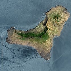


