
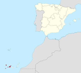
The Canary Islands, also known informally as the Canaries, are a Spanish archipelago and the southernmost autonomous community of Spain located in the Atlantic Ocean, in a region known as Macaronesia, 100 kilometres west of Morocco at the closest point. It is one of eight regions with special consideration of historical nationality as recognized by the Spanish government. Canary Islands are geographically located in the African Tectonic Plate, even though the archipielago is economically and politically European, as it is part of the European Union.
Province of Santa Cruz de Tenerife, also Province of Santa Cruz, is a province of Spain, consisting of the western part of the autonomous community of the Canary Islands. It consists of about half of the Atlantic archipelago: the islands of Tenerife, La Gomera, El Hierro, and La Palma. It occupies an area of 3,381 km2 (1,305 sq mi). It also includes a series of adjacent roques.

The Guanches were the aboriginal inhabitants of the Canary Islands. In 2017, the first genome-wide data from the Guanches confirmed a North African origin and that they were genetically most similar to modern North African Berber peoples of the nearby North African mainland. It is believed that they arrived on the archipelago some time in the first millennium BCE.

Gran Canaria, also Grand Canary Island, is the second most populous of the Canary Islands, an archipelago off the Atlantic coast of Northwest Africa which is part of Spain. As of 2019 the island had a population of 851,231 that constitutes approximately 40% of the population of the archipelago.
La Palma, also San Miguel de La Palma, is the most north-westerly island of the Canary Islands, Spain. La Palma has an area of 708 square kilometres (273 sq mi) making it the fifth largest of the seven main Canary Islands. The total population at the start of 2019 was 82,671, of which 15,716 lived in the capital, Santa Cruz de la Palma and about 20,467 in Los Llanos de Aridane. La Palma has "sister city" status with El Dorado Hills, California. Its highest mountain is the Roque de los Muchachos, at 2,423 metres (7,949 ft), being second among the peaks of the Canaries only to the peaks of the Teide massif on Tenerife.

El Hierro, nicknamed Isla del Meridiano, is the second smallest and farthest south and west of the Canary Islands, in the Atlantic Ocean off the coast of Africa, with a population of 10,968 (2019). Its capital is Valverde. At 268.51 square kilometres, it is the second smallest of the eight main islands of the Canaries.

Saint Brendan's Island, also known as Saint Brendan's Isle, is a phantom island or mythical island, supposedly situated in the North Atlantic somewhere west of Northern Africa. It is named after Saint Brendan of Clonfert. He and his followers are said to have discovered it while travelling across the ocean and evangelising its islands. It appeared on numerous maps in Christopher Columbus's time, most notably Martin Behaim's Erdapfel of 1492. It is known as La isla de San Borondón and isla de Samborombón in Spanish.

La Frontera is a municipality in the northwestern part of the island El Hierro, Santa Cruz de Tenerife, Canary Islands, Spain. In 2007, the southern part of the territory of La Frontera was split off to form the new municipality of El Pinar.
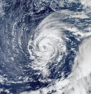
Tropical Storm Delta was a late-forming tropical storm of the 2005 Atlantic hurricane season which struck the Canary Islands as a strong extratropical storm, causing significant damage and then crossed over Morocco before dissipating. It was the twenty-sixth tropical or subtropical storm of the season, making the 2005 season the first to record so many storms.

The Roman Catholic Diocese of San Cristóbal de La Laguna, also called Diocese of Tenerife or Diocese Nivariense, is a diocese located in the city of San Cristóbal de La Laguna in the Canary Islands in the Ecclesiastical province of Sevilla in Spain. The diocese includes the islands of Tenerife, La Palma, La Gomera and El Hierro, in the province of Santa Cruz de Tenerife. The bishop of this diocese is Bernardo Álvarez Afonso.
Tourism is an essential part of the economy of the Canary Islands, a Spanish archipelago located in the Atlantic Ocean, 100 kilometres west of Morocco. Seven main islands and six islets make up the Canary Islands. They had more than 9 million foreign incoming tourists in 2007. Tourists seeking sunshine and beaches first began to visit the Canaries in large numbers in the 1960s. Canary Islands is a leading European tourist destination with very attractive natural and cultural resources.

El Pinar is a Spanish municipality on the island of El Hierro, Canary Islands. It was created in 2007.

The 2015 Canarian regional election was held on Sunday, 24 May 2015, to elect the 9th Parliament of the Autonomous Community of the Canary Islands. All 60 seats in the Parliament were up for election. The election was held simultaneously with regional elections in twelve other autonomous communities and local elections all throughout Spain.

The Punta Orchilla Lighthouse is an active lighthouse on the Canary island of El Hierro in the municipality of El Pinar. The need for a lighthouse on the island was highlighted in the second maritime lighting plan for the Canaries, and it first became operational in 1933.

The 2019 Canarian regional election was held on Sunday, 26 May 2019, to elect the 10th Parliament of the Autonomous Community of the Canary Islands. All 70 seats in the Parliament were up for election. The election was held simultaneously with regional elections in eleven other autonomous communities and local elections all throughout Spain, as well as the 2019 European Parliament election.

El Hierro is one of the seven constituencies represented in the Parliament of the Canary Islands, the regional legislature of the Autonomous Community of the Canary Islands. The constituency currently elects 3 deputies. Its boundaries correspond to those of the island of El Hierro. The electoral system uses the D'Hondt method and a closed-list proportional representation, with a minimum threshold of fifteen percent in the constituency or four percent regionally.
As in the rest of Spain, the majority religion in the Canary Islands is the Catholic Church. The Catholic religion has been the majority since the Conquest of the Canary Islands in the fifteenth century. This religion would largely replace the Canarian aboriginal religion through the prohibition of the latter and syncretism. According to a survey conducted in 2019, Canary Islands is the fifth autonomous community in Spain with the highest percentage of people who declare themselves to be Catholics after the Region of Murcia, Extremadura, Galicia, Aragon, and Castile and León. 76.7% of the population is Catholic.
El Hierro Launch Centre is proposed project by Instituto Nacional de Técnica Aeroespacial (INTA) to create a spaceport on the island of El Hierro, the "Meridian Zero Island". It would be located in the south of the island, in the area of Tecorón, 5 km from La Restinga. in the municipality of El Pinar, Canary Islands. It is being proposed as a center of exclusively civil use for the launch of micro- and nanosatellites with scientific or commercial objectives, such as telecommunications or Earth observation. The first rocket to be launched would be PLD Space's Miura 5 in 2022.

The geology of the Canary Islands is dominated by volcanic rock. The volcanic history of the Canary Islands started about 80 million years ago and the Canary Islands region is still volcanically active. The most recent volcanic eruption on land occurred in 1971 and the most recent underwater eruption was in 2011-12.
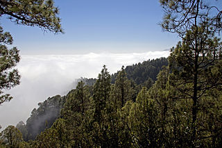
The Canary Islands dry woodlands and forests is a Mediterranean forests, woodlands, and scrub ecoregion in the Canary Islands. It encompasses the western group of the Canary Islands – La Palma, El Hierro, La Gomera, Tenerife, and Gran Canaria – in the Atlantic Ocean. These volcanic islands are an autonomous community of Spain, and lie southwest of the Spanish mainland and west of the North African coast.

