The Dolomites also known as the Dolomite Mountains, Dolomite Alps or Dolomitic Alps, are a mountain range in northeastern Italy. They form part of the Southern Limestone Alps and extend from the River Adige in the west to the Piave Valley in the east. The northern and southern borders are defined by the Puster Valley and the Sugana Valley. The Dolomites are in the regions of Veneto, Trentino-Alto Adige/Südtirol and Friuli Venezia Giulia, covering an area shared between the provinces of Belluno, Vicenza, Verona, Trentino, South Tyrol, Udine and Pordenone.

The Gran Paradiso or Grand Paradis is a mountain in the Graian Alps in Italy, located between the Aosta Valley and Piedmont regions. It is located in Gran Paradiso National Park.
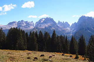
The Brenta Group or Brenta Dolomites is a mountain range, and a subrange of the Rhaetian Alps in the Southern Limestone Alps mountain group. They are located in the Province of Trentino, in northeastern Italy. It is the only dolomitic group west of the Adige River. Therefore, geographically, they have not always been considered a part of the Dolomites mountain ranges. Geologically, however, they definitely are - and therefore sometimes called the "Western Dolomites". As part of the Dolomites, the Brenta Group has been officially recognized as UNESCO World Heritage Site under the World Heritage Convention.

Presanella is a mountain in the Adamello-Presanella range of the Italian Alps of northern Italy. Presanella has an elevation of 3,558 meters and is located in the Adamello Brenta National Park within the Trentino province of Italy.

Monte Baldo is a mountain range in the Italian Alps, located in the provinces of Trento and Verona. Its ridge spans mainly northeast-southwest, and is bounded from south by the highland ending at Caprino Veronese, from west by Lake Garda, from north by the valley joining Rovereto to Nago-Torbole and, from east, the Val d'Adige.

Adamello is a mountain in Lombardy, Italy. With an elevation of 3,539 metres (11,611 ft), it is the second highest peak of the Adamello-Presanella Alps. It is located in Valcamonica, Lombardy. Its glacier, measured over 1600 hectares, is the biggest glacier fully comprised in Italian territory.

Pizzo Coca is a mountain that straddles the Val Seriana and the Valtellina in Lombardy, Italy. It is the highest peak in the Bergamo Alps. Its height is 3,050 metres with a prominence height of 1,878 metres and a saddle of 1,172 metres. A post-glacial valley exists near a point called Ometto in sassi at 2,400 meters.

The Vicentine Alps are a mountain range of the Eastern Alps in Trentino and the provinces of Verona and Vicenza. The mountains were named after the city of Vicenza which lies at their eastern edge. The highest point in the range is the Cima Dodici on the northern perimeter of the Vicentine Alps.

Cima Tosa is a mountain in the Brenta group, a subgroup of the Rhaetian Alps in the Italian Region of Trentino-Alto Adige, with a reported height of 3,136 metres (10,289 ft). it is the second highest peak of the Brenta group in the southern limestone Alps after the Cima Brenta.

Cima Garlenda is a 2,141 m (7,024 ft) mountain of the Ligurian Alps, in Italy. After Monte Saccarello and Monte Frontè it is the third Ligurian summit.

The Cima Mongioia or simply Mongioia or Bric de Rubren is a 3,340 metres high mountain of the Cottian Alps.

The Altemberg is a mountain in the Pennine Alps of north-western Italy; with an elevation of 2,395 m (7,858 ft) is the highest peak of the Alpi Cusiane.

The Monte Capio is a mountain in the Pennine Alps of north-western Italy; with an elevation of 2,172 m (7,126 ft) is one of the highest peaks of the Alpi Cusiane.

The Cima della Fascia is a mountain of the Ligurian Alps located in Piedmont.

The Cima delle Saline is a mountain of the Ligurian Alps located in Piedmont.

The Monte Capezzone is a mountain in the Pennine Alps of north-western Italy; with an elevation of 2,421 m (7,943 ft) is the highest peak of the Strona Valley.
The Cima Cars is a mountain of the Ligurian Alps located in Piedmont.

The Monte Fantino is a mountain of the Ligurian Alps located in Piedmont.

Monte Alben, with a height of 2019 m above sea level, is a mountain in the Bergamasque Prealps, located along the ridge separating the Brembana Valley from the Seriana Valley, in the province of Bergamo.