Monte Rosa is a mountain massif in the eastern part of the Pennine Alps, on the border between Italy and Switzerland (Valais). The highest peak of the massif, amongst several peaks of over 4,000 m (13,000 ft), is the Dufourspitze, the second highest mountain in the Alps and western Europe, after Mont Blanc. The east face of the Monte Rosa towards Italy has a height of about 2,400 metres (7,900 ft) and is the highest mountain wall of the Alps.

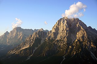
Monte Antelao is the highest mountain in the eastern Dolomites in northeastern Italy, southeast of the town of Cortina d'Ampezzo, in the region of Cadore. The Monte Antelao is an ultra-prominent peak (Ultra).

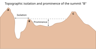
The topographic isolation of a summit is the minimum distance to a point of equal elevation, representing a radius of dominance in which the peak is the highest point. It can be calculated for small hills and islands as well as for major mountain peaks and can even be calculated for submarine summits. Mount Everest, the highest point on Earth, has an undefined isolation, since there are no higher points to reference.

The Grimming is an isolated peak in the Dachstein Mountains of Austria and one of the few ultra-prominent mountains of the Alps.

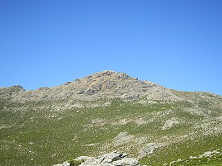
Monte San Petrone is a mountain in the department of Haute-Corse on the island of Corsica, France. It is the highest mountain in the Monte San Petrone massif, which is the southernmost of the schist massifs in the northeast of the island.

Punta Artica or Monte Artica is a mountain in the department of Haute-Corse on the island of Corsica, France. It is in the Monte Rotondo massif.

Monte Rotondo is a mountain in the department of Haute-Corse on the island of Corsica, France. At 2,622 metres (8,602 ft) it is the second highest in Corsica, after Monte Cinto. It is the highest point on the Monte Rotondo massif.

Monte Astu or Monte Asto is a mountain in the department of Haute-Corse on the island of Corsica, France.

The Capu Biancu is a mountain in the department of Haute-Corse on the island of Corsica, France.

The Monte Cinto massif is one of the main massifs in the island of Corsica, France, taking its name from the highest mountain in Corsica, Monte Cinto. It is the northernmost and highest of the four massifs that form the spine of the island. The massif is mostly in the Haute-Corse department, but the southwest of the massif is in the Corse-du-Sud department.

Monte Stello is a mountain in the department of Haute-Corse on the island of Corsica, France. It is the second highest point in the Monte Stello massif, which forms the backbone of Cap Corse.

The Monte Incudine massif is a chain of mountains located in the south region of the island of Corsica, France. It takes its name from Monte Incudine, which is the highest peak.

Monte Incudine is a mountain in the department of Corse-du-Sud on the island of Corsica, France. It is the highest peak in the Monte Incudine massif.

The Monte San Petrone massif is a chain of mountains in the northeast of the island of Corsica, France. It takes its name from Monte San Petrone, the highest peak.

The Monte Renoso massif is a chain of mountains in the south of the island of Corsica, France. It takes its name from Monte Renoso, the highest peak.

The Monte Rotondo massif is a chain of mountains on the southern side of Corsica, France. It takes its name from Monte Rotondo, the highest peak.

Monte d'Oro is a mountain in the department of Haute-Corse on the island of Corsica, France, one of the highest on the island. It is in the south of the Monte Rotondo massif, but is sometimes considered the summit of its own massif, the Monte d'Oro massif.

Capo al Berdato is a mountain in the department of Haute-Corse on the island of Corsica, France. It is in the Monte Cinto massif.

Punta Minuta is a 2,556 metres (8,386 ft) mountain in the department of Haute-Corse on the island of Corsica, France. It is in the Monte Cinto massif.

The Paglia Orba is a mountain peak in the Monte Cinto massif in Corsica. It rises to an altitude of 2,525 metres (8,284 ft), between the valleys of the Golo and the Cavicchia. Relatively isolated, this peak, notable for its characteristic tooth-shaped silhouette, dominates the Fango Valley and the west coast of the island.


