The Susa Valley is a valley in the Metropolitan City of Turin, Piedmont region of northern Italy, located between the Graian Alps in the north and the Cottian Alps in the south. It is one of the longest valleys of the Italian Alps. It extends over 50 kilometres (31 mi) in an east-west direction from the French border to the outskirts of Turin. The valley takes its name from the city of Susa which lies in the valley. The Dora Riparia river, a tributary of the Po, flows through the valley.

Rogliano is a commune in the French department of Haute-Corse, Corsica.

Bastelica is a commune in the Corse-du-Sud department of France on the island of Corsica.

Albertacce is a commune in the Haute-Corse department in the Corsica region of France.

Barbaggio is a commune in the French department of Haute-Corse on the island of Corsica. It is known for its wine, its scenery, and the prehistoric site of Strette.
Col de Vizzavona 1,163 m (3,816 ft) is a mountain pass at the centre of the French island of Corsica.

The Aiguilles de Bavella are rocky spikes of red granite that dominate the hill of the same name in Corse-du-Sud, France. At 1218 m, the hill connects the Alta Rocca to the east coast of Corsica. This massif is smaller yet much more popular than the "aiguilles de Popolasca". The site is characterized by jagged peaks, large rock walls and pine trees twisted by the wind.

The Italian geographical region, Italian physical region or Italian region is a geographical region of Southern Europe and Western Europe delimited to the north and west by the chain of the Alps. This region is composed of a continental part in the north, a peninsular part and an insular part in the south. Located between the Balkan Peninsula and the Iberian Peninsula, it overlooks the Mediterranean Sea and in particular the Adriatic Sea, the Ionian Sea, the Ligurian Sea, the Sardinian Channel, the Sea of Corsica, the Sea of Sardinia, the Strait of Sicily, and the Tyrrhenian Sea.

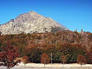
Monte San Petrone is a mountain in the department of Haute-Corse on the island of Corsica, France. It is the highest mountain in the Monte San Petrone massif, the southernmost of the schist massifs of the northeast of the island.

The Capu Biancu is a mountain in the department of Haute-Corse on the island of Corsica, France.

The Col de Bigorno Corsican: Bocca di Bigornu), or Bigorno Pass, is a mountain pass in the Haute-Corse department of Corsica, France.
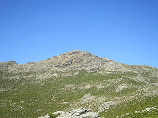
Monte Stello is a mountain in the department of Haute-Corse on the island of Corsica, France. It is the second highest point in the Monte Stello massif, which forms the backbone of Cap Corse.

Cima di e Follicie is a mountain in the department of Haute-Corse on the island of Corsica, France. It is in the Monte Stello massif on Cap Corse.

Lac de Vitalaca is a small lake in the Monte Renoso massif in the Corse-du-Sud department of France. It is at an altitude of 1,777 metres, and is surrounded by high mountains.

The Col Saint-Antoine, or Saint-Antoine Pass, is a mountain pass in the Haute-Corse department of Corsica, France. It is one of the main passes in the island of Corsica. It rises to 687 metres (2,254 ft).

Monte d'Oro is a mountain in the department of Haute-Corse on the island of Corsica, France, one of the highest on the island. It is in the south of the Monte Rotondo massif, but is sometimes considered the summit of its own massif, the Monte d'Oro massif.

The Col de Santo Stefano Corsican: Bocca di San Stefanu) is a mountain pass in the Haute-Corse department of Corsica, France. It is one of the main passes in Corsica, running between the massifs of Monte Stello to the north and Monte Astu to the south. It provides a route from the Saint-Florent region to the northwest and Biguglia in the eastern coastal plain.
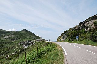
The Col de Teghime is a mountain pass in the Haute-Corse department of Corsica, France. The pass is in the south of the Monte Stello massif and is one of the main passes in the island.

The Col de Marsolino is a mountain pass in the Haute-Corse department of Corsica, France. The pass is in the west of the Monte Cinto massif. It connects Calvi and Calenzana to Galéria. Its low altitude allows it to be open almost all year round.