The Col de Santo Stefano[lower-alpha 1]Corsican: Bocca di San Stefanu) is a mountain pass in the Haute-Corse department of Corsica, France. It is one of the main passes in Corsica, running between the massifs of Monte Stello to the north and Monte Astu to the south. It provides a route from the Saint-Florent region to the northwest and Biguglia in the eastern coastal plain.
The Santo Stefano pass is to the south of the Serra, the medium-sized mountain range of Cap Corse constituting the Monte Stello massif, which is the watershed line of the Mediterranean Sea and the Tyrrhenian Sea. It is in the south of the municipality of Olmeta-di-Tuda, about 320 metres (1,050ft) (orthodromic distance) from Murato. Due to its geographical position – it separates the Nebbio from the Marana plain – it is an important military strategic point. As such, it has been the scene of battles at several times.
Geology and relief
D62 road in the defile of Lancone
The Santo Stefano pass is located in "Schist Corsica" in the northeast of the island, south of the Serra where, as Agostino Giustiniani writes, "this mountain chain which runs along the length of Cap Corse enters the Nebbio and extends to a rural church called S. Stefano, in the pieve of Rosolo, one of the three pieves of the Nebbio".[2]
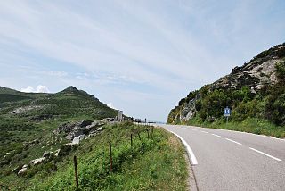
It separates the Monte Stello massif from the Monte Astu massif, and separates the Conca d'Oro or plain of Oletta microregion in the Nebbio from the Lancone microregion through which the Bevinco flows before entering the Étang de Biguglia. On its western slope, on the Nebbio side, is the stream of Lugo (it takes the name of stream of Campodata downstream).[3] On the eastern side of the pass, is the defile of Lancone in the gorges of which the Bevinco river flows, skirted on its left bank by the road D62.
Climate and vegetation
Bevinco gorges
Located 368 metres (1,207ft) above sea level, to the east of the Nebbio basin, it is little affected by the strong westerly winds that sweep the Agriates and the Gulf of Saint-Florent. Unlike the Col de Teghime further north, it is rarely snowy in winter.
Its plant environment is almost desert. Its rocky slopes are covered with rare vegetation, a low and sparse maquis shrubland. The thickest groves (chestnut trees and holm oaks) are found when approaching the village of Olmeta-du-Tuda or heading towards Murato.
Road junction
The Santo Stefano pass is an important crossroads for the micro-region. A roundabout has been created at the junction of the roads:
D62 which connects Casatorra (Biguglia) to the D81 at the entrance to the Agriates desert. It is an old road, solid and cut into the rock but extremely narrow. Sometimes two light vehicles cannot pass. It is advisable to honk at each blind corner. The projecting rocks are marked with white paint (for small trucks and large motor homes).
D82 which connects Saint-Florent to Numero Quattru (Ortale de Biguglia) on National Road 193; it is a recent road (late 1970s), wide enough for large semi-trailers but subject to landslides in periods of heavy storms and weather events in the Cevennes;
D5, which starts from this junction and leads to Ponte Novu (Castello-di-Rostino) on the RN 193, via Murato, Bigorno and Lento. The Col de Boigorno section was still gravel in the 1990s.
History
1st RTM Memorial at Santo Stefano Pass
Santo Stefano has always been a strategic military pass, like the other passes in the Nebbio mountain belt. The troops who often landed in the Gulf of Saint-Florent had to take the passes to get to the interior of the island. Among these passes, besides the main Bocca di Tenda and Col de Bigorno, there was Santo Stefano.
In 1735, the Genoese blocked the road to the Nationals who wanted to invest Capo Corso. They occupied Olmeta-di-Tuda, Barbaggio, Ortale and Lucciana, but suffer a heavy defeat at Furiani.
On 9 October 1768 all the available French troops left Bastia to go to the aid of the Borgu garrison, while Grandmaison attacked at Olmeta to create a diversion. The Battle of Borgo continued throughout the day. That night François Claude Chauvelin ordered a retreat and M. de Ludre had to capitulate. The French lost hundreds of dead, including two colonels and many officers, and a large number of wounded including Charles Louis de Marbeuf.[4]
The most recent battle fought there was that of the skirmishers of the 1st battalion of the 1er R.T.M. on 30 September 1943. The San Stefano pass was defended by about fifty Germans with two 75mm guns. After liberating Rutali on 29 September, the next day at dawn after a fierce fight the Moroccan skirmishers of Captain Morand reached the pass and captured the eleven surviving S.S. The counter-attack of an enemy battalion was thrown back in the defile of Lancone.[5]
Notes
↑ The name is also written as Santo Stephano or San Stafano
The arrondissement of Calvi is an arrondissement of France in the Haute-Corse department in the territorial collectivity of Corsica. It has 51 communes. Its population is 29,576 (2016), and its area is 1,338.4 km2 (516.8 sq mi).
Asco(in Corsican Ascu, pronounced [ˈaːs.ku]) is a commune in the Haute-Corse department of France on the island of Corsica.
Barbaggio is a commune in the French department of Haute-Corse on the island of Corsica. It is known for its wine, its scenery, and the prehistoric site of Strette.
Rapale is a commune in the French Department of Haute-Corse on the island of Corsica.
The canton of Biguglia-Nebbio is an administrative division of the Haute-Corse department, southeastern France. It was created at the French canton reorganisation which came into effect in March 2015. Its seat is in Biguglia.
The Agriates Desert or the Agriates is an area of Corsica split between the micro-regions of Balagne and Nebbio in Haute-Corse.
The Bevinco is a small river in the northeast of the Haute-Corse department on the French island of Corsica. It is the main tributary of the Étang de Biguglia, the largest wetland in Corsica.
Monte San Petrone is a mountain in the department of Haute-Corse on the island of Corsica, France. It is the highest mountain in the Monte San Petrone massif, the southernmost of the schist massifs of the northeast of the island.
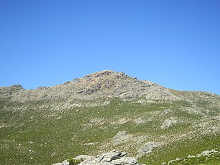
Monte Astu or Monte Asto is a mountain in the department of Haute-Corse on the island of Corsica, France.
The Col de Bigorno Corsican: Bocca di Bigornu), or Bigorno Pass, is a mountain pass in the Haute-Corse department of Corsica, France.
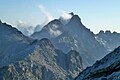
Monte Stello is a mountain in the department of Haute-Corse on the island of Corsica, France. It is the second highest point in the Monte Stello massif, which forms the backbone of Cap Corse.
The Monte Stello massif is a chain of mountains in the island of Corsica, France, that forms the spine of the northern peninsula, Cap Corse. It takes its name from Monte Stello, which was long thought to be the highest peak, but more recently it has been determined that Cima di e Follicie is the highest.
The Monte Astu massif is a chain of mountains in the northeast of the island of Corsica, France. It takes its name from Monte Astu, the highest peak.
Lac de Padula is a reservoir in the Haute-Corse department of France, on the island of Corsica. It was built to supply water for irrigation and firefighting, but now also provides drinking water during the summer tourist peak.
Col de San Colombano is a mountain pass in Corsica.
The Ruisseau de Pietracorbara is a coastal stream in the department of Haute-Corse, Corsica, France. It rises in the Monte Stello massif on Cap Corse and flows into the Tyrrhenian Sea on the east of the island.
The Col Saint-Antoine, or Saint-Antoine Pass, is a mountain pass in the Haute-Corse department of Corsica, France. It is one of the main passes in the island of Corsica. It rises to 687 metres (2,254 ft).
The Olmeta is a small coastal stream in the department of Haute-Corse, Corsica, France. It enters the Mediterranean Sea from the west of the Cap Corse peninsula.
The Col de Teghime is a mountain pass in the Haute-Corse department of Corsica, France. The pass is in the south of the Monte Stello massif and is one of the main passes in the island.
The Col de Marsolino is a mountain pass in the Haute-Corse department of Corsica, France. The pass is in the west of the Monte Cinto massif. It connects Calvi and Calenzana to Galéria. Its low altitude allows it to be open almost all year round.
This page is based on this Wikipedia article Text is available under the CC BY-SA 4.0 license; additional terms may apply. Images, videos and audio are available under their respective licenses.