Location
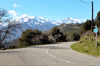
The Col de Sainte-Marie is at an elevation of 372 metres (1,220 ft). It is in the commune of Pietralba, just south of the village of Pietralba. The T30 highway runs through the pass. It runs from L'Île-Rousse along the northeast coast, then turns inland and runs up the Ostriconi river valley to the pass. At the pass the D8 road from Urtaca and Lama to the north crosses the T30. To the south the roads follow the valley of the Ravin de Santa Maria, and then the Ruisseau de Lagani down to its convergence with the Tartagine river. The T20 continues south to Corte.
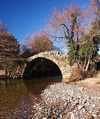
The church of Santa Maria Assunta at the pass is probably an old pièvane church dated from the 10th century that has been remodeled. Its small bell tower contains some sculpted greenschist stones representing human heads, silhouettes of birds and quadrupeds that date from the pre-Romanesque period.
History
The Col de Sainte-Marie has been an important military strategic passage for centuries. Fortifications were built on each side to guard and defend the passage. The most important was the Castellu di Lumisgiana at an altitude of 600 metres (2,000 ft) east of the pass.
In 1554, during the war between the French and the Genoese in Corsica, Marc´ Antonio Ceccaldi, a staunch supporter of the Genoese, was taken prisoner at the Bocca di Tenda by Sampiero Corso, the Marshal of Thermes. He wrote, "Giacomo Santo arrived first at the church of S. Maria de Pietr´Alba with his cavalry, and at once seized the baggage of the Genoese army that was at its head. But Brancadoro arrived at the church, had his troops halted, put them into battle, immediately regained the baggage, and the skirmish lasted a while.

Rogliano is a commune in the French department of Haute-Corse, Corsica.

Asco is a commune in the Haute-Corse department of France on the island of Corsica.

Bastelica is a commune in the Corse-du-Sud department of France on the island of Corsica.

Monte Astu or Monte Asto is a mountain in the department of Haute-Corse on the island of Corsica, France.

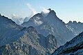
The Monte Cinto massif is one of the main massifs in the island of Corsica, France, taking its name from the highest mountain in Corsica, Monte Cinto. It is the northernmost and highest of the four massifs that form the spine of the island. The massif is mostly in the Haute-Corse department, but the southwest of the massif is in the Corse-du-Sud department.

The Col de Bigorno Corsican: Bocca di Bigornu), or Bigorno Pass, is a mountain pass in the Haute-Corse department of Corsica, France.

The Monte Stello massif is a chain of mountains in the island of Corsica, France, that forms the spine of the northern peninsula, Cap Corse. It takes its name from Monte Stello, which was long thought to be the highest peak, but more recently it has been determined that Cima di e Follicie is the highest.

The Monte Astu massif is a chain of mountains in the northeast of the island of Corsica, France. It takes its name from Monte Astu, the highest peak.

The Ostriconi is a small coastal river in the department of Haute-Corse, Corsica, France.
The Tartagine is a river in the department of Haute-Corse, Corsica, France. It flows through the Monte Cinto massif. It is a tributary of the Asco, which in turn is a tributary of the Golo.

The Monte San Petrone massif is a chain of mountains in the northeast of the island of Corsica, France. It takes its name from Monte San Petrone, the highest peak.

Col de San Colombano is a mountain pass in Corsica.

The Col Saint-Antoine, or Saint-Antoine Pass, is a mountain pass in the Haute-Corse department of Corsica, France. It is one of the main passes in the island of Corsica. It rises to 687 metres (2,254 ft).

The Col de Santo Stefano Corsican: Bocca di San Stefanu) is a mountain pass in the Haute-Corse department of Corsica, France. It is one of the main passes in Corsica, running between the massifs of Monte Stello to the north and Monte Astu to the south. It provides a route from the Saint-Florent region to the northwest and Biguglia in the eastern coastal plain.
The Col de Teghime is a mountain pass in the Haute-Corse department of Corsica, France. The pass is in the south of the Monte Stello massif and is one of the main passes in the island.

The Col de Marsolino is a mountain pass in the Haute-Corse department of Corsica, France. The pass is in the west of the Monte Cinto massif. It connects Calvi and Calenzana to Galéria. Its low altitude allows it to be open almost all year round.

The Col de Prato is a mountain pass in the Haute-Corse department of Corsica, France.

Capo al Berdato is a mountain in the department of Haute-Corse on the island of Corsica, France. It is in the Monte Cinto massif.
The Col de San Quilico or collo di San Quilico is a mountain pass in the Haute-Corse department of Corsica, France. It is a road pass on Territorial Route 20, between Corte and Ponte Leccia (Morosaglia).

Monte Padro is a 2,389 metres (7,838 ft) mountain in the department of Haute-Corse on the island of Corsica, France. It is in the Monte Cinto massif.
This page is based on this
Wikipedia article Text is available under the
CC BY-SA 4.0 license; additional terms may apply.
Images, videos and audio are available under their respective licenses.