Location
The pass is at an elevation of 985 metres (3,232 ft). It is in the Monte San Petrone massif, to the north of the 1,767 metres (5,797 ft) Monte San Petrone. The D71 road from Morosaglia to the northwest runs through the pass and continues south and then east to the coast near Valle-di-Campoloro.
It crosses between the valley of the Casaluna, a tributary of the Golo, and the valley of the Fium'Alto. The Ruisseau de Campo di Melo rises on its western side. [3] This flows into the Ruisseau de Conca (called the Prunitaccio downstream), a tributary of the Casaluna. [4] The Ruisseau de Lavatoio et de Noceta rises on the eastern side of the pass, which successively joins with other streams before ending up in the Fium’Alto. [5]

Aiti is a commune in the Haute-Corse department of France on the island of Corsica.

The Golo is the longest river on the island of Corsica, France, at 89.4 kilometres (55.6 mi)

Asco is a commune in the Haute-Corse department of France on the island of Corsica.

Barbaggio is a commune in the French department of Haute-Corse on the island of Corsica. It is known for its wine, its scenery, and the prehistoric site of Strette.

The Abatesco is a French coastal river which flows through the Haute-Corse department and empties into the Tyrrhenian Sea.

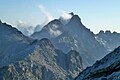
Monte San Petrone is a mountain in the department of Haute-Corse on the island of Corsica, France. It is the highest mountain in the Monte San Petrone massif, which is the southernmost of the schist massifs in the northeast of the island.

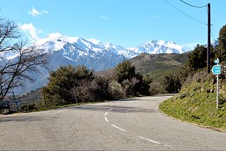
The Col de Bigorno Corsican: Bocca di Bigornu), or Bigorno Pass, is a mountain pass in the Haute-Corse department of Corsica, France.

The Monte Stello massif is a chain of mountains in the island of Corsica, France, that forms the spine of the northern peninsula, Cap Corse. It takes its name from Monte Stello, which was long thought to be the highest peak, but more recently it has been determined that Cima di e Follicie is the highest.

The Casaluna is a small river in the department of Haute-Corse, Corsica, France. It is a tributary of the Golo.

Col de San Colombano is a mountain pass in Corsica.

The Restonica is a small river in the department of Haute-Corse, Corsica, France. It is a tributary of the river Tavignano. The river has a steep and rocky course with many pools and waterfalls. The valley contains two lakes, and is a popular tourist destination.

The Luri is a coastal stream in the department of Haute-Corse, Corsica, France. It flows across the Cap Corse peninsula to the Tyrrhenian Sea.

Lac du Monte Tignoso is a small lake in the Monte Renoso massif in the Corse-du-Sud department of France.

The Col Saint-Antoine, or Saint-Antoine Pass, is a mountain pass in the Haute-Corse department of Corsica, France. It is one of the main passes in the island of Corsica. It rises to 687 metres (2,254 ft).

The Fium'Alto is a small coastal river in the department of Haute-Corse, Corsica, France.

The Col de Santo Stefano Corsican: Bocca di San Stefanu) is a mountain pass in the Haute-Corse department of Corsica, France. It is one of the main passes in Corsica, running between the massifs of Monte Stello to the north and Monte Astu to the south. It provides a route from the Saint-Florent region to the northwest and Biguglia in the eastern coastal plain.
The Col de Teghime is a mountain pass in the Haute-Corse department of Corsica, France. The pass is in the south of the Monte Stello massif and is one of the main passes in the island.

The Col de Marsolino is a mountain pass in the Haute-Corse department of Corsica, France. The pass is in the west of the Monte Cinto massif. It connects Calvi and Calenzana to Galéria. Its low altitude allows it to be open almost all year round.

The Col de Sainte-Marie or Col de Pietralba is a mountain pass in the Haute-Corse department of Corsica, France. It is between the Monte Astu massif to the east and the Monte Cinto massif to the west. It leads from the Ostriconi valley to the northwest to the Tartagine valley, which leads to the east coast.
The Col de San Quilico or collo di San Quilico is a mountain pass in the Haute-Corse department of Corsica, France. It is a road pass on Territorial Route 20, between Corte and Ponte Leccia (Morosaglia).
This page is based on this
Wikipedia article Text is available under the
CC BY-SA 4.0 license; additional terms may apply.
Images, videos and audio are available under their respective licenses.