Related Research Articles

Strawberry is an unincorporated community and census-designated place (CDP) in Gila County, Arizona, United States. The population was 961 at the 2010 census.

Sun Lakes is an unincorporated community and census-designated place (CDP) in Maricopa County, Arizona, United States. The population was 14,868 at the 2020 census. Sun Lakes is an active adult community comprising five country club communities in three homeowner associations. These include the gated communities of Oakwood and IronWood (IronOaks), the gated and non-gated communities of Palo Verde and Cottonwood, and the non-gated community of Sun Lakes 1. Sun Lakes is a master-planned community developed by Robson Communities.

Picture Rocks is a census-designated place (CDP) in Pima County, Arizona, United States, home of the Tucson artifacts. The population was 9,551 at the 2020 United States census.
Cottonwood is a census-designated place (CDP) in Shasta County, California, United States. Its population is 6,268 as of the 2020 census, up from 3,316 from the 2010 census. Cottonwood was a stagecoach town where a settlement was established in 1849. The first Post Office was opened in 1852. Cottonwood is equidistant between Redding and Red Bluff, 15 miles (24 km) in either direction. It is 4 miles (6.4 km) south of Anderson.

Harbor Bluffs is a census-designated place (CDP) in Pinellas County, Florida, United States. The population was 2,860 at the 2010 census.

Potomac Heights is a census-designated place (CDP) in Charles County, Maryland, United States. The population was 1,117 at the 2010 census. It has a volunteer fire department and numerous older rambler homes built for workers at the nearby U.S. Navy munitions plant in Indian Head.

Verde Village is a census-designated place (CDP) in Yavapai County, Arizona, United States. The population was 11,605 at the 2010 census. It is a retirement and bedroom community for Cottonwood.

Dry Creek is an unincorporated community and census-designated place (CDP) in Cherokee County, Oklahoma, United States. The population was 227 at the 2010 census.
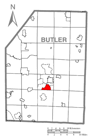
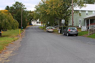
Oak Hills is a census-designated place (CDP) in Butler County, Pennsylvania, United States. The population was 2,333 at the 2010 census.

Spring Mills is an unincorporated community and census-designated place (CDP) in Centre County, Pennsylvania, United States. It is part of the State College, Pennsylvania Metropolitan Statistical Area. The population was 268 at the 2010 census.
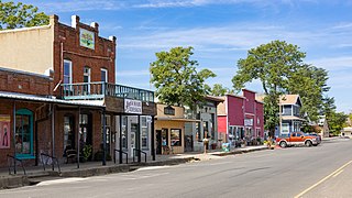
Slabtown is a census-designated place in Columbia County, Pennsylvania, United States. It is part of Northeastern Pennsylvania. The population was 145 at the 2020 census. It is part of the Bloomsburg-Berwick micropolitan area.

La Paloma-Lost Creek is a census-designated place (CDP) in Nueces County, Texas, United States. The population was 1,359 at the 2020 census, significantly up from 408 at the 2010 census.
Cottonwood West was a census-designated place (CDP) in Salt Lake County, Utah, United States. The CDP was situated between the cities of Holladay and Murray, which by the mid-2000s had annexed virtually all of the area between them.

Aquia Harbour is a census-designated place (CDP) in Stafford County, Virginia, United States, 13 miles (21 km) north of Fredericksburg. The population was 6,727 at the 2010 census. Aquia Church, erected in 1757 and now a National Historic Landmark, is located west of the community.

Neilton is an unincorporated community and census-designated place (CDP) in Grays Harbor County, Washington, United States. The population was 299 at the 2020 census, down from 315 at the 2010 census.

May Creek is a census-designated place (CDP) in Snohomish County, Washington, United States. The population was 849 at the 2020 census.

Three Lakes is a census-designated place (CDP) in Snohomish County, Washington, United States. The population was 3,941 at the 2020 census.

Woods Creek is a census-designated place (CDP) in Snohomish County, Washington, United States. The population was 6,017 at the 2020 census.

Gilbert Creek is a census-designated place (CDP) in Mingo County, West Virginia, United States. The population was 1,090 at the 2010 census. The community takes its name from nearby Gilbert Creek.

Owl Creek is a (CDP) in Hot Springs County, Wyoming, United States. The population was five at the 2010 Census.
References
- 1 2 "U.S. Census website". United States Census Bureau . Retrieved 2008-01-31.
- ↑ "US Board on Geographic Names". United States Geological Survey. 2007-10-25. Retrieved 2008-01-31.
- ↑ "US Gazetteer files: 2010, 2000, and 1990". United States Census Bureau. 2011-02-12. Retrieved 2011-04-23.
- ↑ "CENSUS OF POPULATION AND HOUSING (1790-2000)". U.S. Census Bureau . Retrieved 2010-07-17.