Little Kenosee Lake

Last updated

Little Kenosee Lake
Little Kenosee pier.jpg
Fishing pier at Little Kenosee Lake
Canada Saskatchewan relief location map.jpg
Red pog.svg
Little Kenosee Lake
Location in Saskatchewan
Canada relief map 2.svg
Red pog.svg
Little Kenosee Lake
Little Kenosee Lake (Canada)
Location Moose Mountain Provincial Park, Saskatchewan
Coordinates 49°50′00″N102°20′02″W / 49.8333°N 102.3338°W / 49.8333; -102.3338
Primary outflows Fish Creek
Basin  countries Canada
Surface area153.9 ha (380 acres)
Surface elevation742 m (2,434 ft)

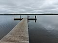
Little Kenosee Lake [1] is a small lake in Moose Mountain Provincial Park in the Moose Mountain Uplands of the south-eastern corner of the Canadian province of Saskatchewan. The lake is in the Palliser's Triangle [2] and Prairie Pothole Region of Canada. It is part of an endorheic basin lake system that flows into Kenosee Lake, which has only overflowed its banks once since records started being kept in the late 1800s. [3] Most of the water that flows into Little Kenosee Lake comes from ground water run-off, such as from rain and melting snow. Fish Creek, the lake's outflow, is located on the southern shore. The lake and its facilities are accessed from Highway 219.

Contents

Recreation

Snowmobile tracks on Little Kenosee Lake Little Kenosee frozen.jpg
Snowmobile tracks on Little Kenosee Lake

Little Kenosee Lake is the second largest lake in Moose Mountain Provincial Park and there are many recreational amenities in and around the lake. [4] Along the south-eastern shore of the lake is the largest campground in the park, Fish Creek Campground. Along the southern shore is a picnic area with washrooms, a boat launch, and fishing dock. Jutting out of the southern shore is a large forested peninsula with a 3.4-kilometre loop hiking trail. [5] In the winter, there's ice fishing and snowmobiling on the lake and surrounding trails. [6]

Fish species

Commonly found fish in Little Kenosee include yellow perch and walleye. The lake is stocked regularly with fish. [7] [8]

See also

Related Research Articles

<span class="mw-page-title-main">Kenosee Lake</span> Lake in Saskatchewan, Canada

Kenosee Lake is a closed-basin lake in the south-east corner of the Canadian province of Saskatchewan. The lake lies in Moose Mountain Provincial Park in the heart of the Moose Mountain Upland, a forested plateau that rises about 200 metres (660 ft) above the surrounding prairie.

Highway 209 is a provincial highway in the Canadian province of Saskatchewan. Saskatchewan's 200-series highways primarily service its recreational areas. The highway runs from Highway 9 near the village of Kenosee Lake to a point about 5 kilometres (3.1 mi) into Moose Mountain Provincial Park near Little Kenosee Lake.

<span class="mw-page-title-main">Last Mountain Lake</span> Lake in Saskatchewan, Canada

Last Mountain Lake, also known as Long Lake, is a prairie lake formed from glaciation 11,000 years ago. It is located in south central Saskatchewan, Canada, about 40 kilometres (25 mi) north-west of the city of Regina. It flows into the Qu'Appelle River via Last Mountain Creek, which flows past Craven. It is approximately 93 km (58 mi) long, and 3 km (1.9 mi) wide at its widest point. It is the largest naturally occurring body of water in southern Saskatchewan. Only Lake Diefenbaker, which is man-made, is larger. The lake is a popular resort area for residents of south-eastern Saskatchewan.

<span class="mw-page-title-main">Duck Mountain Provincial Park (Saskatchewan)</span> Provincial park in Saskatchewan, Canada

Duck Mountain Provincial Park is a provincial park, located in the Canadian province of Saskatchewan 14 kilometres (8.7 mi) east of the town of Kamsack and stretches about 12 kilometres (7.5 mi) eastward to the Saskatchewan / Manitoba boundary. The park covers approximately 150 km2 (58 sq mi). Road access to the park is via Highway 57, which connects Saskatchewan Highway 5 to Manitoba Highway 83.

<span class="mw-page-title-main">Moose Mountain Provincial Park</span> Provincial park in Saskatchewan, Canada

Moose Mountain Provincial Park is a provincial park, in south-eastern Saskatchewan about 24 kilometres (15 mi) north of the town of Carlyle on the Moose Mountain Upland. It is one of Saskatchewan's few parks with a community inside the park as there are several subdivisions with both year-round and seasonal residents. The village of Kenosee Lake is completely surrounded by the park but is not part of the park.

<span class="mw-page-title-main">Buffalo Pound Provincial Park</span> Provincial park in Saskatchewan, Canada

Buffalo Pound Provincial Park is a provincial park located in southern Saskatchewan, Canada, about 30 kilometres (19 mi) north-east of Moose Jaw and 86 kilometres (53 mi) north-west of the city of Regina. Access to the park is from Highways 301 and 202.

<span class="mw-page-title-main">Meadow Lake Provincial Park</span> Provincial park in Saskatchewan, Canada

Meadow Lake Provincial Park is a northern boreal forest provincial recreational park along the Waterhen and Cold Rivers in the Canadian province of Saskatchewan. The park was founded on 10 March 1959, is the largest provincial park in Saskatchewan, and encompasses over 25 lakes in an area of 1,600 km2 (620 sq mi). The park was named Meadow Lake after the city of Meadow Lake and Meadow Lake. The city and the lake are not in the park and are located about 40 kilometres (25 mi) south-east of the nearest park entrance, which is about 5 kilometres (3.1 mi) north of Dorintosh. The length of the park stretches about 113 kilometres (70 mi) from Cold Lake on the Saskatchewan / Alberta border in the west to the eastern shore of Waterhen Lake in the east.

<span class="mw-page-title-main">Narrow Hills Provincial Park</span> Provincial park in Saskatchewan, Canada

Narrow Hills Provincial Park is a northern boreal forest provincial recreational park in the Canadian province of Saskatchewan. It is located in a hilly plateau called the Cub Hills and contains several recreational facilities and over 25 accessible lakes within its boundaries. The geographical features of the park, including the lakes, valleys, and lowlands were formed over 10,000 years ago during the last ice age. The town of Smeaton is the closest community and it is located 70 kilometres (43 mi) to the south.

Danielson Provincial Park is located at the northern end of Lake Diefenbaker in the southern part of the Canadian province of Saskatchewan. The park surrounds the Gardiner Dam, which was built in 1967 and is among the largest embankment dams in Canada and the world. The South Saskatchewan River flows north beyond the park, towards Outlook and Saskatoon. Saskatchewan Highways 44, 45, and 219 provide access to the park. SaskPower's Coteau Creek Hydroelectric Station is located near the park.

Moose Mountain Upland, Moose Mountain Uplands, or commonly Moose Mountain, is a hilly plateau located in the south-east corner of the Canadian province of Saskatchewan, that covers an area of about 13,000 km2 (5,000 sq mi). The upland rises about 200 m (660 ft) above the broad, flat prairie which is about 600 m (2,000 ft) above sea level. The highest peak is "Moose Mountain" at 830 m (2,720 ft) above sea level. The area was named Moose Mountain because of the large number of moose that lived in the area. When it was originally used by fur traders, Métis, and the Indigenous peoples, the plateau was called Montagne a la Bosse, which is French for "The Mountain of The Bump or Knob."

<span class="mw-page-title-main">Pike Lake (Saskatchewan)</span> Lake in Saskatchewan, Canada

Pike Lake is an oxbow lake of the South Saskatchewan River in the Canadian province of Saskatchewan. It is about 36 kilometres (22 mi) south of downtown Saskatoon in the RM of Vanscoy No. 345, 2.5 kilometres (1.6 mi) west of the South Saskatchewan River. The lake is in the aspen parkland transitional biome between prairie and boreal forest in Palliser's Triangle.

<span class="mw-page-title-main">Greig Lake (Saskatchewan)</span> Lake in Saskatchewan, Canada

Greig Lake is a lake in Meadow Lake Provincial Park in the Canadian province of Saskatchewan in the boreal forest ecozone of Canada. On the eastern shore of the lake is the resort village of Greig Lake and Greig Lake Campground. The south-west corner of the lake has a resort called Waters Edge Eco Lodge. The lake is accessed from Highway 224 at the south end.

Kimball Lake is a lake in Meadow Lake Provincial Park in the Canadian Province of Saskatchewan in the boreal forest ecozone of Canada. The lake is located near the centre of the park, north of the Waterhen River and Little Raspberry Lake and south of First Mustus Lake. Rusty and Greig Lakes are to the east. Several small streams feed into the lake and the outflow is at the southern shore, which feeds into the Waterhen River, a tributary of Beaver River. The Beaver River, in turn, flows north into Lac Île-à-la-Crosse and the Churchill River, a major tributary in the Hudson Bay drainage basin.

Matheson Lake is a lake in Meadow Lake Provincial Park in the Canadian Province of Saskatchewan in the boreal forest ecozone of Canada. The lake is located near the centre of the park, north of the Waterhen River, west of Vivian Lake and south of Peitahigan Lake. Several small streams feed into the lake and the outflow is at the southern shore, which feeds into the Waterhen River, a tributary of Beaver River. The Beaver River, in turn, flows north into Lac Île-à-la-Crosse and the Churchill River, a major tributary in the Hudson Bay drainage basin.

Mistohay Lake is a lake in Meadow Lake Provincial Park in the Canadian Province of Saskatchewan in the boreal forest ecozone of Canada. The lake is part of the Waterhen River drainage basin. The Waterhen River is a tributary of the Beaver River, which flows north into Lac Île-à-la-Crosse and the Churchill River, a major tributary in the Hudson Bay drainage basin.

Lower Fishing Lake is a lake in the east-central part of the Canadian province of Saskatchewan in Narrow Hills Provincial Park. It is situated in the Cub Hills and the boreal forest ecozone of Canada. The lake is accessed from Highway 920, which connects to Hanson Lake Road and Highway 120. The Fishing Lakes Fire of 1977 burned much of the region upstream and around the lake and now the area is now dominated by jack pine, which is a tree species that is well adapted fire burned forests.

Baldy Lake is a lake in the east-central part of the Canadian province of Saskatchewan in Narrow Hills Provincial Park. It is situated in the Cub Hills and the boreal forest ecozone of Canada.

<span class="mw-page-title-main">Good Spirit Lake Provincial Park</span> Provincial park in Saskatchewan, Canada

Good Spirit Lake Provincial Park is a provincial park on the eastern side of the Canadian province of Saskatchewan. Founded in 1931, the park surrounds the western and southern shores of Good Spirit Lake and is one of Saskatchewan's six founding provincial parks. The park is in the RM of Good Lake No. 274, about 48 kilometres (30 mi) north of the city of Yorkton. Highway 47 runs along the western boundary and Highway 229 provides access to the park's amenities.

Candle Lake Provincial Park is a provincial park in the central region of the Canadian province of Saskatchewan. Prior to the park's establishment in 1986, it was a provincial recreation site. Located in the Rural Municipality of Paddockwood No. 520, Candle Lake Provincial Park surrounds most of Candle and Torch Lakes in the boreal forest ecozone of Canada. The park has a variety of activities including camping, boating, fishing, swimming, mini golfing, hiking, and golfing. Around the lake there are also boat launches and several marinas. Natural attractions include a purple sand beach, sand dunes, mature forests, crystal clear lake water, and several natural sand beaches.

Makwa Lake Provincial Park is a recreational provincial park in the west-central region of the Canadian province of Saskatchewan in the transition zone between parkland and boreal forest. The park was established in 1986 and is centred around the lakes of Big Jumbo, Little Jumbo, and Makwa. Prior to its establishment, the park was a provincial recreation site. The main entrance to Makwa Lake Park is at the south-east corner of Makwa Lake about 3 kilometres (1.9 mi) west of the village of Loon Lake. Access is from Highway 699.

References

  1. "Little Kenosee Lake". Canadian Geographical Names Database. Government of Canada. Retrieved 20 January 2023.
  2. "Palliser Triangle". The Encyclopedia of Saskatchewan. Retrieved 28 January 2022.
  3. Vance, R.E.; Last, William; Smith, A.J. (January 1997). "Hydrologic and climatic implications of a multidisciplinary study of late Holocene sediment from Kenosee Lake, southeastern Saskatchewan, Canada". Journal of Paleolimnology. Kluwer Academic Publishers. 18 (4): 365. Bibcode:1997JPall..18..365V. doi:10.1023/A:1007948909342. S2CID   127878180 . Retrieved 28 January 2022.
  4. "Moose Mountain Provincial Park". Tourism Saskatchewan. Government of Saskatchewan. Retrieved 28 January 2022.
  5. "Little Kenosee Peninsula Trail". Alltrails. Retrieved 28 January 2022.
  6. "Moose Mountain Provincial Park". Outdoorsy. Outdoorsy, Inc. Retrieved 28 January 2022.
  7. "Angler's Atlas".
  8. "Fishing in Little Kenosee Lake".