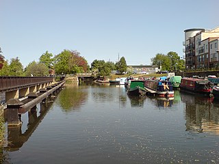
The River Lea is in the East of England and Greater London. It originates in Bedfordshire, in the Chiltern Hills, and flows southeast through Hertfordshire, along the Essex border and into Greater London, to meet the River Thames at Bow Creek. It is one of the largest rivers in London and the easternmost major tributary of the Thames.
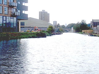
The Hertford Union Canal or Duckett's Cut, just over 1 mile (1.6 km) long, connects the Regent's Canal to the Lee Navigation in the London Borough of Tower Hamlets in East London. It was opened in 1830 but quickly proved to be a commercial failure. It was acquired by the Regents Canal Company in 1857, and became part of the Grand Union Canal in 1927.

The Lee Navigation is a canalised river incorporating the River Lea. It flows from Hertford Castle Weir to the River Thames at Bow Creek; its first lock is Hertford Lock and its last Bow Locks.
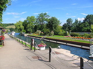
The English River Thames is navigable from Cricklade or Lechlade to the sea, and this part of the river falls 71 meters (234 feet). There are 45 locks on the river, each with one or more adjacent weirs. These lock and weir combinations are used for controlling the flow of water down the river, most notably when there is a risk of flooding, and provide for navigation above the tideway.

The Stort Navigation is the canalised section of the River Stort running 22 kilometres (14 mi) from the town of Bishop's Stortford, Hertfordshire, downstream to its confluence with the Lee Navigation at Feildes Weir near Rye House, Hoddesdon, Hertfordshire.

Teddington Lock is a complex of three locks and a weir on the River Thames between Ham and Teddington in the London Borough of Richmond upon Thames, England. Historically in Middlesex, it was first built in 1810.

A canal pound, reach, or level, is the stretch of level water impounded between two canal locks. Canal pounds can vary in length from the non-existent, where two or more immediately adjacent locks form a lock staircase, to many kilometres/miles.

Mapledurham Lock is a lock and weir situated on the River Thames in England, about 4 miles upstream of Reading. The lock was first built in 1777 by the Thames Navigation Commissioners and the present lock dates from 1908.
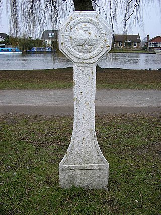
The Thames Conservancy was a body responsible for the management of that river in England. It was founded in 1857 to replace the jurisdiction of the City of London up to Staines. Nine years later it took on the whole river from Cricklade in Wiltshire to the sea at Yantlet Creek on the Isle of Grain. Its territory was reduced when the Tideway was transferred to the Port of London Authority in 1909.

Hambleden Lock is a lock with a long weir situated on the River Thames in England, about 2 miles downstream of Henley Bridge. The lock is on the Berkshire bank between Aston and Remenham. Built by the Thames Navigation Commission in 1773, the lock is named after the village of Hambleden, a mile (1.5 km) to the north.

Iffley Lock is a lock on the River Thames in England near the village of Iffley, Oxfordshire. It is on the southern outskirts of Oxford. The original lock was built by the Oxford-Burcot Commission in 1631 and the Thames Navigation Commission replaced this in 1793. The lock has a set of rollers to allow punts and rowing boats to be moved between the water levels.

A flash lock is a type of lock for river or canal transport.

Benson Lock is a lock on the River Thames in England, close to Benson, Oxfordshire but on the opposite bank of the river. The first pound lock here was built by the Thames Navigation Commission in 1788 and it was replaced by the present masonry lock in 1870. The distance between Benson Lock and Cleeve Lock downstream is 6.5 miles (10.4 km) - the longest distance between locks on the River Thames.

The Lea Valley Walk is a 50-mile (80 km) long-distance path located between Leagrave, the source of the River Lea near Luton, and the Thames, at Limehouse Basin, Limehouse, east London. From its source much of the walk is rural. At Hertford the path follows the towpath of the River Lee Navigation, and it becomes increasingly urbanised as it approaches London. The walk was opened in 1993 and is waymarked throughout using a swan logo.

Feildes Weir is a weir on the River Lea located in Hoddesdon, Hertfordshire at the confluence of the River Lea and River Stort. The weir marks the start of the Lower Lee. A channel of the man-made River Lee Flood Relief Channel is incorporated into the weir.
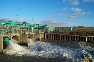
The Lee Flood Relief Channel (FRC) is located in the Lea Valley and flows between Ware, Hertfordshire, and Stratford, east London. Work started on the channel in 1947 following major flooding and it was fully operational by 1976. The channel incorporates existing watercourses, lakes, and new channels. Water from the channel feeds the Lee Valley Reservoir Chain.

Old Ford Lock is a paired lock and weir on the River Lee Navigation, in the London Borough of Tower Hamlets, England. It is at Fish Island in Old Ford and takes its name from the natural ford which used to cross the River Lea.
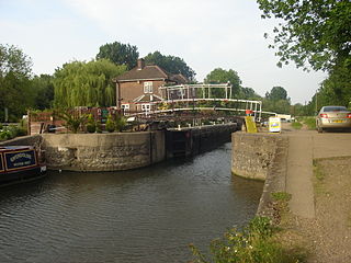
Carthagena Lock (No7) is a lock on the River Lee Navigation at Broxbourne

Feildes Weir Lock (No5) is a lock on the River Lee Navigation located in Hoddesdon.

The Hackney Cut is an artificial channel of the Lee Navigation built in England in 1769 by the River Lea Trustees to straighten and improve the Navigation. It begins at the Middlesex Filter Beds Weir, below Lea Bridge, and is situated in the (modern) London Borough of Hackney. When built it contained two pound locks and a half-lock, but was rebuilt to handle larger barges in the 1850s, and now only Old Ford Lock, which is actually a duplicated pair, remains.


