Hertford is the county town of Hertfordshire, England, and is also a civil parish in the East Hertfordshire district of the county. The parish had a population of 26,783 at the 2011 census.
The River Lea is in South East England. It originates in Bedfordshire, in the Chiltern Hills, and flows southeast through Hertfordshire, along the Essex border and into Greater London, to meet the River Thames at Bow Creek. It is one of the largest rivers in London and the easternmost major tributary of the Thames.

The Limehouse Cut is a largely straight, broad canal in the East End of London which links the lower reaches of the Lee Navigation to the River Thames. Opening on 17 September 1770, and widened for two-way traffic by 1777, it is the oldest canal in the London area. Although short, it has a diverse social and industrial history. Formerly discharging directly into the Thames, since 1968 it has done so indirectly by a connection through Limehouse Basin.
The Hertford Union Canal or Duckett's Cut, just over 1 mile (1.6 km) long, connects the Regent's Canal to the Lee Navigation in the London Borough of Tower Hamlets in East London. It was opened in 1830 but quickly proved to be a commercial failure. It was acquired by the Regents Canal Company in 1857, and became part of the Grand Union Canal in 1927.

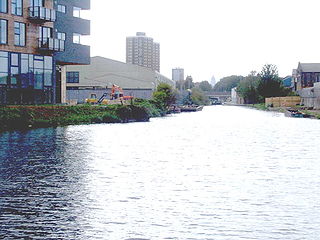
The Lee Navigation is a canalised river incorporating the River Lea. It flows from Hertford Castle Weir to the River Thames at Bow Creek; its first lock is Hertford Lock and its last Bow Locks.

Cheshunt is a town in Hertfordshire, England, 14 miles (23 km) north of London on the River Lea and Lee Navigation. It contains a section of the Lee Valley Park, including much of the River Lee Country Park. To the north lies Broxbourne and Wormley, Waltham Abbey to the east, Waltham Cross and Enfield to the south, and Cuffley to the west.

Bengeo is a suburb and former village and civil parish on the northwest edge of the county town of Hertford in Hertfordshire, England. It is an electoral ward of Hertford. In 1891 the parish had a population of 2586. In 1894 the parish was abolished to form Bengeo Rural and Bengeo Urban.

Hertford Town Football Club is a football club based in Hertford, Hertfordshire, England. They are currently members of the Southern League Division One Central and play at Hertingfordbury Park.

Stanborough Park, also referred to as Stanborough Lakes is a 126-acre (0.51 km2) park in Welwyn Garden City, Hertfordshire, England.

Dobbs Weir is both a weir in Hoddesdon, Hertfordshire and an area of Roydon, Essex in England on the River Lea. It is well known for angling, outdoor beauty and watersports. It is overlooked by the Fish and Eels pub.

Hertford Castle Weir is a weir located in Hertford near to Hertford Castle and next to Hertford Theatre.

The River Beane is a short river in the county of Hertfordshire, England. A tributary of the River Lea, it rises to the south-west of Sandon in the hills northeast of Stevenage and joins the Lea at Hartham Common in Hertford.

Hertford Heath is a village and civil parish near the county town of Hertford in Hertfordshire, England. The population at the 2011 Census was 2,672.

The Lea Valley Walk is a 50-mile (80 km) long-distance path located between Leagrave, the source of the River Lea near Luton, and the Thames, at Limehouse Basin, Limehouse, east London. From its source much of the walk is rural. At Hertford the path follows the towpath of the River Lee Navigation, and it becomes increasingly urbanised as it approaches London. The walk was opened in 1993 and is waymarked throughout using a swan logo.

Hartham Common is a park in the county of Hertfordshire in the East of England. It is located between the town centre of the county town of Hertford and the elevated suburb of Bengeo.

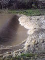
Hertford Weir is a large weir on the River Lea, next to Hertford Basin marina and Hartham Common, in Hertford, England.
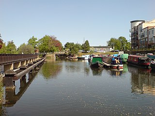
Hertford Basin is the first canal basin located on the River Lee Navigation in Hertford, England. It is situated next to Hartham Common, and Hertford Weir.

The River Lee Country Park is located in the Lee Valley Park and is managed by the Lee Valley Regional Park Authority. Covering 1,000 acres (400 ha) on either side of the River Lee Navigation between Waltham Abbey and Broxbourne, it is an area of lakes, watercourses, open spaces and three Sites of Special Scientific Interest (SSSI) linked by footpaths and cycle tracks.

Hertingfordbury is a small village in Hertfordshire, England, close to the county town of Hertford. It was mentioned in the Domesday Book. Hertingfordbury is also the name of a neighbouring civil parish, which does not contain the village. Hertingfordbury Village is located within the Castle ward of local government Hertford Town Council. The population of the civil parish as of the 2021 census was 689.

The Broxbourne Mill Stream which diverges from the River Lee Navigation just south of Dobbs Weir, is one of the few remaining 'old river' loops of the River Lea, with a relatively natural channel form and a diverse range of habitats. Broxbourne developed as a small settlement for milling at a river crossing point at Broxbourne Mill. Spital Brook empties into the Mill Stream by Nazeing New Road.