The Kara Sea is part of the Arctic Ocean north of Siberia. It is separated from the Barents Sea to the west by the Kara Strait and Novaya Zemlya, and the Laptev Sea to the east by the Severnaya Zemlya archipelago. It is named after the Kara River, which is now relatively insignificant but which played an important role in the Russian conquest of northern Siberia. The Kara River name is derived from Nenets word meaning "hummocked ice".

The Republic of Sakha (Yakutia) is a federal Russian republic. It had a population of 958,528 at the 2010 Census, mainly ethnic Yakuts and Russians.

Sakhalin is Russia's largest island, lying in the North Pacific Ocean between 45°50' and 54°24' N. It is administered as part of Sakhalin Oblast. Sakhalin, which is about one third the size of Honshu, is just off the east coast of Russia, and just north of Japan. The island's population was 497,973 as of the 2010 census, made up of mostly ethnic Russians and a smaller Korean community. The indigenous peoples of the island are the Ainu, Oroks and Nivkhs.

The Western Hemisphere is a geographical term for the half of Earth which lies west of the prime meridian and east of the antimeridian. The other half is called the Eastern Hemisphere.

Krasnoyarsk Krai is a federal subject of Russia, with its administrative center in the city of Krasnoyarsk—the third-largest city in Siberia. Comprising half of the Siberian Federal District, Krasnoyarsk Krai is the largest krai in the Russian Federation, the second largest federal subject and the third largest subnational governing body by area in the world, after Sakha and the Australian state of Western Australia. The krai covers an area of 2,339,700 square kilometers (903,400 sq mi), which is nearly one quarter the size of the entire country of Canada, constituting roughly 13% of the Russian Federation's total area and containing a population of 2,828,187, or just under 2% of its population, per the 2010 Census.

The Kuril Islands or Kurile Islands, in Russia's Sakhalin Oblast region, form a volcanic archipelago that stretches approximately 1,300 km (810 mi) northeast from Hokkaido, Japan, to Kamchatka, Russia, separating the Sea of Okhotsk from the north Pacific Ocean. There are 56 islands and many minor rocks. It consists of Greater Kuril Chain and Lesser Kuril Chain. The total land area is 10,503.2 square kilometres (4,055.3 sq mi) and the total population is 19,434.

The Kuril Islands dispute, also known as the Northern Territories dispute, is a disagreement between Japan and Russia and also some individuals of the Ainu people over sovereignty of the South Kuril Islands, which stretch between northern Hokkaido and southern Kamchatka, in the Sea of Okhotsk. These islands, like other islands in the Kuril chain that are not in dispute, were annexed by the Soviet Union in aftermath of the Kuril Islands landing operation at the end of World War II. The disputed islands are under Russian administration as the South Kuril District of the Sakhalin Oblast. They are claimed by Japan, which refers to them as its Northern Territories or Southern Chishima, and considers them part of the Nemuro Subprefecture of Hokkaido Prefecture.

Sakhalin Oblast is a federal subject of Russia comprising the island of Sakhalin and the Kuril Islands in the Russian Far East. The oblast has an area of 87,100 square kilometers (33,600 sq mi). Its administrative center and the largest city is Yuzhno-Sakhalinsk. Population: 497,973. Besides people from other parts of the former Soviet Union and the Korean Peninsula, the oblast is home to Nivkhs and Ainu, with the latter having lost their language in Sakhalin recently. Sakhalin is rich in natural gas and oil, and is Russia's second wealthiest federal subject. It borders Khabarovsk Krai to the west and Hokkaido, Japan to the south.

Severnaya Zemlya is a 37,000-square-kilometre (14,000-square-mile) archipelago in the Russian high Arctic. It lies off Siberia's Taymyr Peninsula, separated from the mainland by the Vilkitsky Strait. This archipelago separates two marginal seas of the Arctic Ocean, the Kara Sea in the west and the Laptev Sea in the east.

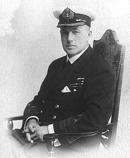
Boris Andreyevich Vilkitsky was a Russian hydrographer and surveyor. He was the son of Andrey Ippolitovich Vilkitsky.

Yakov Permyakov was a Russian seafarer, explorer, merchant, and Cossack.

The Alexander Archipelago is a 300-mile (480 km) long archipelago, or group of islands, of North America off the southeastern coast of Alaska. It contains about 1,100 islands, which are the tops of the submerged coastal mountains that rise steeply from the Pacific Ocean. Deep channels and fjords separate the islands and cut them off from the mainland. The northern part of the Inside Passage is sheltered by the islands as it winds its way among them.

Paramushir (Russian: Парамушир, translit. Paramushir, Japanese: 幌筵島, translit. Paramushiru-tō or Horomushiro-tō, Ainu: パラムシㇼ or パラムシㇽ, translit. Para-mu-sir, is a volcanic island in the northern portion of Kuril Islands chain in the Sea of Okhotsk in the northwest Pacific Ocean. It is separated from Shumshu by the very narrow Second Kuril Strait in the northeast 2.5 km, from Antsiferov by the Luzhin Strait to the southwest, from Atlasov in the northwest by 20 kilometres, and from Onnekotan in the south by the 40 km wide Fourth Kuril Strait. Its northern tip is 39 kilometres from Cape Lopatka at the southern tip of the Kamchatka Peninsula. Its name is derived from the Ainu language, from “broad island” or “populous island”. Severo-Kurilsk, the administrative center of the Severo-Kurilsky district, is the only permanently populated settlement on Paramushir island.

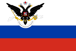
Russian America was the name of the Russian colonial possessions in North America from 1733 to 1867. Its capital was Novo-Archangelsk, which is now Sitka, Alaska, USA. Settlements spanned parts of what are now the U.S. states of California, Alaska and two ports in Hawaii. Formal incorporation of the possessions by Russia did not take place until the Ukase of 1799 which established a monopoly for the Russian–American Company and also granted the Russian Orthodox Church certain rights in the new possessions. Many of its possessions were abandoned in the 19th century. In 1867, Russia sold its last remaining possessions to the United States of America for $7.2 million.

The Great Northern Expedition or Second Kamchatka expedition was one of the largest exploration enterprises in history, mapping most of the Arctic coast of Siberia and some parts of the North America coastline, greatly reducing "white areas" on maps. It was conceived by Russian Emperor Peter I the Great, but implemented by Russian Empresses Anna and Elizabeth. The main organiser and leader of the expedition was Vitus Bering, who earlier had been commissioned by Peter I to lead the First Kamchatka expedition. The Second Kamchatka Expedition lasted roughly from 1733–1743 and later was called the Great Northern due to the immense scale of its achievements.

Fyodor Andreyevich Matisen was an officer of the Russian Imperial Navy, hydrographer, and explorer.

Pyotr Kuzmich Pakhtusov was a Russian surveyor and Arctic explorer. He is credited with the first thorough survey of Novaya Zemlya.

Merkury Vagin was a Russian Arctic explorer.

The Aleutian Islands, also called the Aleut Islands or Aleutic Islands and known before 1867 as the Catherine Archipelago, are a chain of 14 large volcanic islands and 55 smaller ones belonging to both the U.S. state of Alaska and the Russian federal subject of Kamchatka Krai. They form part of the Aleutian Arc in the Northern Pacific Ocean, occupying an area of 6,821 sq mi (17,666 km2) and extending about 1,200 mi (1,900 km) westward from the Alaska Peninsula toward the Kamchatka Peninsula in Russia, and mark a dividing line between the Bering Sea to the north and the Pacific Ocean to the south. Crossing longitude 180°, at which point east and west longitude end, the archipelago contains both the westernmost part of the United States by longitude and the easternmost by longitude. The westernmost U.S. island in real terms, however, is Attu Island, west of which runs the International Date Line. While nearly all the archipelago is part of Alaska and is usually considered as being in the "Alaskan Bush", at the extreme western end, the small, geologically related Commander Islands belong to Russia.


