
The Kara Sea is part of the Arctic Ocean north of Siberia. It is separated from the Barents Sea to the west by the Kara Strait and Novaya Zemlya, and the Laptev Sea to the east by the Severnaya Zemlya archipelago. It is named after the Kara River, which is now relatively insignificant but which played an important role in the Russian conquest of northern Siberia. The Kara River name is derived from Nenets word meaning "hummocked ice".

The Republic of Sakha (Yakutia) (Russian: Республика Саха, tr.Respublika Sakha , IPA: [rʲɪsˈpublʲɪkə sɐˈxa jɪˈkutʲɪjə]; Yakut: Саха Өрөспүүбүлүкэтэ, translit. Sakha Öröspüübülükete, IPA: [saˈxa øɾøsˈpyːbylykete] is a federal Russian republic. It had a population of 958,528 at the 2010 Census, mainly ethnic Yakuts and Russians.

The Sea of Okhotsk is a marginal sea of the western Pacific Ocean, between the Kamchatka Peninsula on the east, the Kuril Islands on the southeast, the island of Hokkaido to the south, the island of Sakhalin along the west, and a long stretch of eastern Siberian coast along the west and north. The northeast corner is the Shelikhov Gulf. The sea is named after Okhotsk, the first Russian settlement in the Far East.

Sakhalin is Russia's largest island, lying in the North Pacific Ocean between 45°50' and 54°24' N. It is administered as part of Sakhalin Oblast. Sakhalin, which is about one third the size of Honshu, is just off the east coast of Russia, and just north of Japan. The island's population was 497,973 as of the 2010 census, made up of mostly ethnic Russians and a smaller Korean community. The indigenous peoples of the island are the Ainu, Oroks and Nivkhs.

The Western Hemisphere is a geographical term for the half of Earth which lies west of the prime meridian and east of the antimeridian. The other half is called the Eastern Hemisphere.

Krasnoyarsk Krai is a federal subject of Russia, with its administrative center in the city of Krasnoyarsk—the third-largest city in Siberia. Comprising half of the Siberian Federal District, Krasnoyarsk Krai is the largest krai in the Russian Federation, the second largest federal subject and the third largest subnational governing body by area in the world, after Sakha and the Australian state of Western Australia. The krai covers an area of 2,339,700 square kilometers (903,400 sq mi), which is nearly one quarter the size of the entire country of Canada, constituting roughly 13% of the Russian Federation's total area and containing a population of 2,828,187, or just under 2% of its population, per the 2010 Census.
The Kuril Islands or Kurile Islands, in Russia's Sakhalin Oblast region, form a volcanic archipelago that stretches approximately 1,300 km (810 mi) northeast from Hokkaido, Japan, to Kamchatka, Russia, separating the Sea of Okhotsk from the north Pacific Ocean. There are 56 islands and many minor rocks. It consists of Greater Kuril Chain and Lesser Kuril Chain. The total land area is 10,503.2 square kilometres (4,055.3 sq mi) and the total population is 19,434.

The Republic of Karelia is a federal subject of Russia, located in the northwest of Russia. Its capital is the city of Petrozavodsk. Its population in 2010 was 643,548.
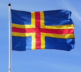
The Åland Islands occupy a position of great strategic importance, commanding as they do both one of the entrances to the port of Stockholm and the approaches to the Gulf of Bothnia, in addition to being situated proximate to the Gulf of Finland.

The Kuril Islands dispute, also known as the Northern Territories dispute, is a disagreement between Japan and Russia and also some individuals of the Ainu people over sovereignty of the South Kuril Islands, which stretch between northern Hokkaido and southern Kamchatka, in the Sea of Okhotsk. These islands, like other islands in the Kuril chain that are not in dispute, were annexed by the Soviet Union in aftermath of the Kuril Islands landing operation at the end of World War II. The disputed islands are under Russian administration as the South Kuril District of the Sakhalin Oblast. They are claimed by Japan, which refers to them as its Northern Territories or Southern Chishima, and considers them part of the Nemuro Subprefecture of Hokkaido Prefecture.

Chukotka Autonomous Okrug or Chukotka (Чуко́тка) is a federal subject of Russia. It is geographically located in the Far East region of the country, and is administratively part of the Far Eastern Federal District. Chukotka is the 2nd-least-populated federal subject at 50,526 (2010) and the least densely populated.
The Diomede Islands, also known in Russia as Gvozdev Islands, consist of two rocky, mesa-like islands:

Fabian Gottlieb Thaddeus von Bellingshausen, a Baltic German naval officer in the Imperial Russian Navy, cartographer and explorer, who ultimately rose to the rank of admiral. He participated in the First Russian circumnavigation of the globe and subsequently became a leader of another circumnavigation expedition that discovered the continent of Antarctica.

Kodiak Island is a large island on the south coast of the U.S. state of Alaska, separated from the Alaska mainland by the Shelikof Strait. The largest island in the Kodiak Archipelago, Kodiak Island is the second largest island in the United States and the 80th largest island in the world, with an area of 9,311.24 km2 (3,595.09 sq mi), slightly larger than Cyprus. It is 160 km long and in width ranges from 16 to 97 kilometers. Kodiak Island is the namesake for Kodiak Seamount, which lies off the coast at the Aleutian Trench. The largest community on the island is the city of Kodiak, Alaska.

The South Shetland Islands are a group of Antarctic islands with a total area of 3,687 square kilometres (1,424 sq mi). They lie about 120 kilometres (75 mi) north of the Antarctic Peninsula, and between 430 kilometres (270 mi) to 900 kilometres (560 mi) south-west from the nearest point of the South Orkney Islands. By the Antarctic Treaty of 1959, the islands' sovereignty is neither recognized nor disputed by the signatories and they are free for use by any signatory for non-military purposes.

Asia-Pacific or Asia Pacific is the part of the world in or near the Western Pacific Ocean. The region varies in area depending on which context, but it typically includes much of East Asia, South Asia, Southeast Asia, and Oceania.

UTC+11:00 is an identifier for a +11 hour time offset from UTC. This time is used in:
UTC+03:00 is an identifier for a time offset from UTC of +03. In areas using this time offset, the time is three hours later than the Coordinated Universal Time (UTC). Following the ISO 8601 standard, a time with this offset would be written as, for example, 2019-02-08T23:36:06+03:00.

The Aleutian Islands, also called the Aleut Islands or Aleutic Islands and known before 1867 as the Catherine Archipelago, are a chain of 14 large volcanic islands and 55 smaller ones belonging to both the U.S. state of Alaska and the Russian federal subject of Kamchatka Krai. They form part of the Aleutian Arc in the Northern Pacific Ocean, occupying an area of 6,821 sq mi (17,666 km2) and extending about 1,200 mi (1,900 km) westward from the Alaska Peninsula toward the Kamchatka Peninsula in Russia, and mark a dividing line between the Bering Sea to the north and the Pacific Ocean to the south. Crossing longitude 180°, at which point east and west longitude end, the archipelago contains both the westernmost part of the United States by longitude and the easternmost by longitude. The westernmost U.S. island in real terms, however, is Attu Island, west of which runs the International Date Line. While nearly all the archipelago is part of Alaska and is usually considered as being in the "Alaskan Bush", at the extreme western end, the small, geologically related Commander Islands belong to Russia.


