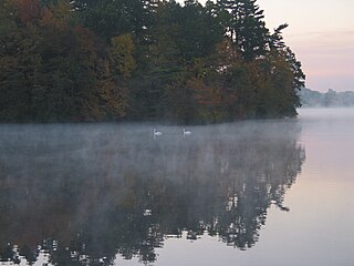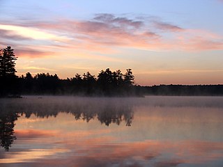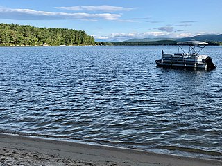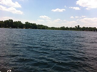
Canadarago Lake is a 1,917-acre (7.76 km2) lake located in Otsego County, New York and is the source of Oaks Creek. The Village of Richfield Springs is located at the lake's northern end. It is the second largest lake in Otsego County, lying to the west of and parallel to the larger Otsego Lake. The lake's name is also spelled "Candajarago Lake" or "Caniadaraga Lake".

Lake Attitash is a lake located on the border of Merrimac, Massachusetts and Amesbury, Massachusetts, and constitutes at least a portion of Amesbury's water supply.

Trickey Pond is a water body in the U.S. state of Maine. Its maximum depth is 55 feet (17 m). The lack of serious pollution in the area contributes to the pond's remarkably good water clarity. At most points in the pond, the entire depth can be seen.

Dug Pond is a small body of water in Natick, Massachusetts. Most notably it is home to Memorial Beach, one of few swimming beaches in Natick, and its eastern shore is the site of Natick High School.

Province Lake is a 968-acre (392 ha) water body located on the border between New Hampshire and Maine in the United States. Approximately 950 acres (380 ha) of the lake lie in the towns of Effingham and Wakefield, New Hampshire, with the remainder in Parsonsfield, Maine. Its outlet is the South River, flowing north to the Ossipee River, a tributary of the Saco River.

The Cold River is a 16.7-mile-long (26.9 km) river in western Maine in the United States. It very briefly enters New Hampshire as well. It is part of the Saco River drainage basin.

Browning Pond is located in Oakham and Spencer, Massachusetts. This 89-acre (360,000 m2) great pond forms the headwaters of the Seven Mile River. It is part of the Chicopee River Watershed.

Silver Springs State Fish and Wildlife Area is an Illinois state park on 1,350 acres (550 ha) in Kendall County, Illinois, United States. The park was established in the late 1960s and is named for the natural spring within its boundaries. The park has two artificial lakes and the Fox River flows through the northern end of the park. Silver Springs hosts a variety of activities including fishing, hunting, boating and hiking. The park has areas of native prairie restoration, a sledding hill and a seven-mile (11 km) equestrian trail. The prairie restoration areas hold many species of plants including lead plant, and purple coneflower.

Loon Lake is a glacial lake in northern Lake County, Illinois, United States. It comprises three lakes; East Loon, West Loon, and North Loon.. It is located near the town of Antioch, Illinois, near the intersection of Route 83 and Grass Lake Rd. It is home to many different species of fish, birds, reptiles, and amphibians. Some of which are endangered species, including the blacknose shiner.

Billington Sea is a 269-acre (1.09 km2) warm water pond located in Plymouth, Massachusetts. Morton Park lies on the pond's northern shore. The pond is fed by groundwater and cranberry bog outlets. The average depth is seven feet and the maximum depth is 11 feet (3.4 m). The pond provides the headwaters to Town Brook. Seymour Island is located in the center of the pond. Billington Sea was named after its discoverer, Francis Billington, one of the passengers on the Mayflower.

Winnecunnet Pond or Winneconnet Pond or Winnecunnett Pond, very often called Lake Winnecunnet or Lake Winneconnet or Lake Winnecunnett although it is a pond rather than a lake, is a body of water in Norton, Massachusetts, United States.

The Medomak River, historically known as the Muscongus River, is a 40-mile-long (64 km) river in Maine. From its source in Liberty, the river winds 32 miles (51 km) south to the head of its tidal river estuary in Waldoboro, then about 8 miles (13 km) south to Bremen. The river flows through Hockomock Channel into the head of Muscongus Bay. Medomak is Abenaki for "place (river) of many alewives".

Beech Hill Pond is a lake in Otis, Hancock County, Maine, in the United States. It is 4.5 miles (7.2 km) long, half a mile wide, and up to 104 feet (32 m) deep. Trout, salmon, and other species of fish have been observed in the lake. Bald eagles and loons also live on the shoreline.
The Belgrade Lakes are a chain of lakes around Belgrade, Maine. The flow sequence is from East Pond to North Pond to Great Pond to Long Pond to Messalonskee Lake and thence via Messalonskee Stream to the Kennebec River at Waterville. The lakes have long been an important resort area for fishing, boating, and swimming; and shoreline development includes residences for individuals employed in the cities of Waterville and Augusta.
A chain of three Jo-Mary Lakes along the border of Penobscot County and Piscataquis County drain into the Pemadumcook Chain of Lakes in the North Maine Woods. The flow sequence is from Upper Jo-Mary Lake into Middle Jo-Mary Lake and then through Lower Jo-Mary Lake into Pemadumcook Lake.
Hancock Brook is an east-bank tributary to the Saco River at Hiram, Maine. The brook originates in eastern Denmark and flows through a chain of ponds along the border between Hiram and Sebago. The narrow-gauge Bridgton and Saco River Railroad was built along the brook in 1882, and operated until 1941.
The Saint John Ponds are a chain of shallow lakes at the headwaters of the Baker Branch Saint John River in the North Maine Woods. The flow sequence is from the Upper First Saint John Pond, through the Lower First Saint John Pond, Second Saint John Pond, Third Saint John Pond, and Fourth Saint John Pond to the Fifth Saint John Pond. Flow from one pond to the next is sometimes called Baker Stream rather than the Baker Branch Saint John River. Great Northern Paper Company dug a canal from Fifth Saint John Pond 2 miles (3.2 km) westward to the North Branch Penobscot River in 1939, and built a dam at the north end of Fifth Saint John Pond so pulpwood logs harvested in the upper Saint John River watershed could be floated down the Penobscot River to Millinocket, Maine. The canal and dam have fallen into disrepair so most drainage from the ponds again flows down the Saint John River. All upstream ponds with the exception of the first had dams to regulate discharge flow for log driving, but those dams have similarly fallen into disrepair. Moose use the ponds as summer refuge from heat and biting insects.

Powerton Lake State Fish and Wildlife Area is a 1,426-acre (577 ha) area of semi-protected habitat on the Illinois River southwest of to the city of Pekin, Illinois within Tazewell County in the U.S. state of Illinois. The parcel is a cooling reservoir owned by NRG Energy, an electric power generating firm, and is operated by the Illinois Department of Natural Resources (IDNR). The lake is used for fishing, with an emphasis on blue catfish. In addition, IDNR states that approximately 60% of the cooling pond is used for duck and goose hunting during legal hunting seasons. The remaining 40% of the pond is maintained as a waterfowl refuge on a year-round basis.
Diamond Lake is a glacial-origin lake in the village of Mundelein in northeastern Lake County, Illinois. The lake has an average depth of 7.61 feet (2.32 m), a maximum depth of 23 feet (7.0 m) a shoreline of 5.9 miles (9.5 km), and a surface area of 153 acres (62 ha). The lake's watershed contains about 686.16 acres (277.68 ha) of residential and agricultural land surrounding the lake. Diamond Lake's water is replenished by precipitation and runoff within its watershed. Water exits the lake via a drainage pipe that eventually connects to the Des Plaines River.

Squantz Pond is a 288-acre lake in Fairfield County, Connecticut. It is located on the town line of Sherman and New Fairfield, and is bordered by manmade Candlewood Lake. The south shore is protected as Squantz Pond State Park, and is managed by the Connecticut Department of Energy and Environmental Protection. The pond is named for Chief Squantz, a leader of the Schaghticoke tribe.


