Lowell Regional Transit Authority

Last updated
Lowell Regional Transit Authority
LRTA logo.png
LRTA bus at Lowell terminal, December 2018.jpg
An LRTA bus at the Robert B. Kennedy Bus Transfer Center in December 2018
Founded1974
Headquarters145 Thorndike St.
Locale Lowell, MA
Service area Greater Lowell
Service type Bus service, paratransit
Routes20
DestinationsLowell, Chelmsford, Billerica, Tewksbury, Wilmington, Burlington, Dracut, Tyngsborough, Westford, Littleton
Fleet Gillig, Cutaway Vans
Fuel type Diesel, hybrid
Operator First Transit
Website lrta.com

The Lowell Regional Transit Authority (LRTA) is a public, non-profit organization in Massachusetts, charged with providing public transportation to the Greater Lowell area. This primarily includes the city of Lowell and the towns of Billerica, Burlington, Dracut, Chelmsford, Tewksbury, Tyngsborough, Westford and Wilmington. The LRTA provides fixed route bus services and paratransit services within this area, although some fixed lines do extend beyond these towns. [1] [2]

Contents

The LRTA was created in September 1974 under Chapter 161B of the Massachusetts General Laws, the law that impacts all transit authorities in the state of Massachusetts. Since 2004, operation of the LRTA has been subcontracted to First Transit, a subsidiary of the United Kingdom based FirstGroup. [1] [3]

The area served by the LRTA is within the commuter rail service area of the Massachusetts Bay Transportation Authority (MBTA). At the Gallagher Transit Terminal in Lowell, LRTA buses provide connection to each other, to trains on MBTA's Lowell Line, and to various intercity bus routes. [1] [3]

Routes

All of the routes serve Monday through Friday and most provide Saturday service. All routes originate at the LRTA Gallagher Terminal in Lowell.

RouteOutbound terminalMajor streets of operationHistory and notes
1 [4]
Christian Hill
Dracut
Village Square Plaza
Beacon Street (NB), Humphrey St (SB)
  • Weekend Service consolidated with Route 8
  • Village Square Plaza service served by Route 10 on Saturdays
2 [5]
Belvidere
Belvidere
River Road and Trull Lane
Roger Street, Douglas Road, Andover Street
3 [6]
South Lowell
North Billerica (MBTA station) Lawrence Street, Woburn Street
4 [7]
Highland Via Stevens
Ayres City
V.A Clinic
Stevens Street
  • Formerly "7-Shaw/Stevens"
5 [8]
Westford Street/Drum Hill
Chelmsford
Drum Hill Shopping Center
Westford Street, Drum Hill Road
  • Drum Hill Shopping Center also served by the 16
6 [9]
Broadway/UMass Lowell
University of Massachusetts Lowell
South Campus (Riverview Bus Loop)
Thorndike Street, Broadway Street
  • Formerly "10-Broadway via U-Lowell South"
  • Lord Manor Served by inbound buses only
7 [10]
Pawtucketville/UMass Lowell North
Tyngsborough
Greater Lowell Regional Vocational Technical School
Merrimack Street, University Avenue, Vamum Avenue
  • Formerly "11-Pawtucketville via U-Lowell North"
8 [11]
Centralville
Dracut
Hannaford Shop & Save
Dutton Street, West Sixth Street
  • Formerly "12-Centralville"
9 [12]
Lowell Circulator
University of Massachusetts Lowell
Fox Hall
Inbound: Fletcher Street, Merrimack Street, Market Street
Outbound: Appleton Street, East Merrimack Street, Father Morissette Boulevard
  • Runs in a loop form, serving the most northern sectors first, then the sectors in Central Lowell
10 [13]
Dracut/Tyngsborough
Tyngsborough
Dracut Road & Massachusetts-New Hampshire State Line
Bridge Street, Lakeview Avenue
  • Formerly "17-Dracut/Tyngsboro"
  • Serves Village Square Plaza on Saturdays
11 [14]
IRS/Raytheon
Andover
Raytheon Company
Andover Street, Lowell Street (Route 133)
  • Formerly "20-Route 133/IRS"
  • Operates during rush hours; no midday or weekend service
12 [15]
Tewksbury
Wilmington (MBTA station) Roger Street, Livingston Street, Main Street
  • Formerly "18-Tewksbury"
13 [16]
Billerica via Edson
Burlington
Cambridge Street & Chestnut Street
Gorham Street, Boston Road, Cambridge Street
  • Connections available to MBTA bus 350 and 352 in Burlington
14 [17]
Burlington/Lahey
Lahey Clinic Gorham Street, Boston Road, Middlesex Turnpike
  • Formerly "19-Burlington/Lahey Clinic"
  • Serves Burlington Mall
15 [18]
Chelmsford/Westford
Littleton
IBM
Gorham Street, Billerica Street, Littleton Road (Route 110)
  • Formerly "16-Route 129/110-via BrickKlim Road
16 [19]
Chelmsford
Chelmsford
Drum Hill Shopping Center
Chelmsford Street, Smith Street
  • Formerly "6- Chelmsford" and operated to Ayres City
  • Drum Hill Shopping Center also served by the 5
17 [20]
North Chelmsford
North Chelmsford
Main Street & Groton Road
Middlesex Street, North Road (Outbound), Tyngsborough Road (Inbound)
  • Formerly "9-Middlesex Street" and "15- North Chelmsford"
  • Chelmsford Senior Center served by inbound buses only
18 [21]
Downtown Shuttle
Lowell Inbound: Merrimack Street, Market Street, Middlesex Street
Outbound: Dutton Street, French Street
  • Operates as a loop route
  • Route number not displayed on bus headboards or stop signs
19 [22]
Pheasant Lane
Nashua
Pheasant Lane Mall
Middlesex Street, Tyngsborough Road
  • Runs during holiday season (between Thanksgiving Day and New Year's Day)
  • Year-round service east of North Chelmsford available on route 17
20 [23]
Downtown/UMass North
University of Massachusetts Lowell
North Campus
Merrimack Street
  • Starts at UMass Lowell Inn and Conference Center, not at the bus terminal
  • Monday through Friday only, 7:00 a.m. to 11:00 a.m. only
  • Almost exclusively used by UMass Lowell students and staff, who ride free
  • Supplementary to UMass Lowell's Yellow Line North shuttle services

Fleet

The LRTA owns a fleet of 108 revenue-producing vehicles, which includes 57 Gillig Low Floor buses for scheduled route service and 49 Ford Transit and 2 Ford E450 minibuses for paratransit service. [24]

Related Research Articles

Middlesex County, Massachusetts County in Massachusetts, United States

Middlesex County is located in the Commonwealth of Massachusetts, in the United States. As of the 2020 census, the population was 1,632,002, making it the 22nd most populous county in the United States, and the most populous county in both Massachusetts and New England. Middlesex County is one of two U.S. counties to be amongst the top 25 counties with the highest household income and the 25 most populated counties. As part of the 2010 national census, the Commonwealth's mean center of population for that year was geo-centered in Middlesex County, in the town of Natick at. Middlesex County is included in the Census Bureau's Boston–Cambridge–Newton, MA–NH Metropolitan Statistical Area.

Billerica, Massachusetts Town in Massachusetts, United States

Billerica is a town in Middlesex County, Massachusetts, United States. The population was 42,119 according to the 2020 census. It takes its name from the town of Billericay in Essex, England.

Chelmsford, Massachusetts Town in Massachusetts, United States

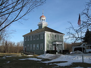
Chelmsford is a town in Middlesex County, Massachusetts in the United States. It is located 24 miles (39 km) northwest of Boston. Besides the city of Lowell on its northeast, it is surrounded by four towns: Tyngsborough to the north, Billerica to the east, Carlisle to the south, and Westford to the west. Chelmsford is bordered by the Merrimack River to the north and the Concord River to the east.

Dracut, Massachusetts Town in Massachusetts, United States

Dracut is a town in Middlesex County. At the 2020 census, the town's population was 32,617, making it the second most populous town in Massachusetts with an open town meeting system of governance. The town covers a total area of 21.36 square miles, 0.5 square miles of which is water.

Lowell, Massachusetts City in Massachusetts, United States

Lowell is a city in Massachusetts, in the United States. With Cambridge, Lowell is one of two traditional seats of Middlesex County. With an estimated population of 115,554 in 2020, it was the fifth most populous city in Massachusetts as of the last census, and the second most populous in the Boston metropolitan statistical area. The city also is part of a smaller Massachusetts statistical area, called Greater Lowell, and of New England's Merrimack Valley region.

Westford, Massachusetts Town in Massachusetts, United States

Westford is a town in Middlesex County, Massachusetts, United States. The population was at 24,643 at the time of the 2020 Census.

Wilmington, Massachusetts Town in Massachusetts, United States

Wilmington is a town in Middlesex County, Massachusetts, United States. Its population was 23,349 as of the 2020 United States Census.

Greater Boston Metropolitan area in the United States

Greater Boston is the metropolitan region of New England encompassing the municipality of Boston and its surrounding areas. The region forms the northern arc of the Northeast megalopolis, so Greater Boston means both a metropolitan statistical area (MSA) and a combined statistical area (CSA), which is broader. The MSA consists of most of the eastern third of Massachusetts, excluding the South Coast and Cape Cod; the CSA additionally includes the municipalities of Providence, Manchester, Worcester, the South Coast region, and Cape Cod. While the city of Boston covers 48.4 square miles (125 km2) and has 675,647 residents as of the 2020 census, the urbanization has extended well into surrounding areas and the CSA has a more than 8.4 million people, making it one of the most populous such regions in the U.S. The CSA is one of two in Massachusetts, the other being Greater Springfield. Greater Boston is the only CSA in New England that lies in three states.

Pioneer Valley Transit Authority

The Pioneer Valley Transit Authority (PVTA) oversees and coordinates public transportation in the Pioneer Valley of Western Massachusetts. Currently the PVTA offers fixed-route bus service as well as paratransit service for the elderly and disabled. The PVTA was created by Chapter 161B of the Massachusetts General Laws in 1974. It is based in Springfield, Massachusetts, serves Hampden and Hampshire counties, and provides connecting service to the FRTA in Franklin County. It is the largest regional transit authority, and second largest public transit system in Massachusetts after the Massachusetts Bay Transit Authority, providing service to over 11 million riders annually across 24 municipalities in the region, with about 70% of all riders using the system as their primary mode of transit.

Massachusetts's 5th congressional district is a congressional district in eastern Massachusetts. The district is represented by Katherine Clark. Massachusetts congressional redistricting after the 2010 census has changed the borders of the district starting with the elections of 2012, with the new 3rd district largely taking the place of the old 5th. The 5th district covers many of the communities represented in the old 7th district. As of 2010, the population of the 5th congressional district was 727,515. On July 15, 2013, Ed Markey resigned from the seat to become the junior Senator from Massachusetts. On December 10, 2013, Democrat Katherine Clark won a special election to fill the seat for the remainder of the 113th Congress. She was sworn into office on December 12, 2013 and serves as the Assistant Speaker of the United States House of Representatives for the 117th Congress.

Area codes 978 and 351 Telephone area codes for central and northeastern Massachusetts

Area code 978 was created as a split from area code 508 on September 1, 1997, and covers north central and most of northeastern Massachusetts. Use of 978 became mandatory on February 1, 1998. Prior to when this area was served by 508, it was served only by the 617 area code, along with the rest of the eastern two-thirds of the state. 351 has been sharing the service area since May 2, 2001. Since then, 10 digit local dialing is mandatory.

North Billerica, Massachusetts Village of the town of Billerica, Massachusetts, US

North Billerica is an unincorporated village of the town of Billerica, Massachusetts, United States, one of the nine sections (hamlets) that make up the Town of Billerica. It is the home to Faulkner and Talbot mills and the North Billerica Train Depot. The Middlesex Canal was built through the village in 1783 and the Boston and Lowell Railroad was put through in the 1840s.

Greater Lowell Region of Massachusetts in the United States

Greater Lowell is the name given to the city of Lowell, Massachusetts and its suburbs which are found in Northern Middlesex County, Massachusetts, the Merrimack Valley, and Southern New Hampshire.

Lowell station Intermodal transit station in Lowell, Massachusetts

Lowell station, officially the Charles A. Gallagher Transit Terminal, is an intermodal transit station in Lowell, Massachusetts. The transit complex includes an MBTA Commuter Rail station as well as the Robert B. Kennedy Bus Transfer Center, which serves local and intercity buses. It is located off Thorndike Street near the end of the Lowell Connector south of downtown Lowell. The commuter rail station is the northern terminus of the Lowell Line, and is a major park-and-ride station for the system, serving commuters from Lowell, northern Massachusetts, and southern New Hampshire. The Kennedy Bus Transfer Center is the transfer point for all Lowell Regional Transit Authority local bus routes and several intercity bus routes by other operators.

Merrimack Valley Regional Transit Authority

The Merrimack Valley Regional Transit Authority (MVRTA) is a public, non-profit organization in Massachusetts, United States, charged with providing public transportation to an area consisting of the cities and towns of Amesbury, Andover, Boxford, Georgetown, Groveland, Haverhill, Lawrence, Merrimac, Methuen, Newbury, Newburyport, North Andover, Rowley, Salisbury and West Newbury, as well as a seasonal service to the popular nearby summer destination of Hampton Beach, New Hampshire.

Merrimack Valley Region in the U.S. states of New Hampshire and Massachusetts

The Merrimack Valley is a bi-state region along the Merrimack River in the U.S. states of New Hampshire and Massachusetts. The Merrimack is one of the larger waterways in New England and has helped to define the livelihood and culture of those living along it for millennia.

The Spirit of Adventure Council is a regional council of the Boy Scouts of America. It serves the greater Boston, Massachusetts, area.

Innovation Academy Charter School (IACS) is a small charter school in Tyngsborough, Massachusetts, United States. The school was founded in 1996, under the name Chelmsford Public Charter School by a small group of parents from Chelmsford, Massachusetts. While initially a middle school serving only the town of Chelmsford, IACS has since expanded, establishing a high school and serving multiple towns within Massachusetts.

The Merrimack Valley Library Consortium (MVLC) is an American library consortium created by Nancy Jacobson and Evelyn Kuo in 1982. MVLC manages the resource sharing of 36 automated and partially automated libraries in Merrimack Valley region of northeastern Massachusetts, ensuring unified access to all of their catalogs, which represent almost three million items and more than six hundred thousand titles.

Boston and Northern Street Railway Former transportation company in Greater Boston, Massachusetts

The Boston & Northern Street Railway Company (B&N) was a horse-drawn and electric streetcar railroad operated on the streets of Boston, Massachusetts, and communities to the north. Founded in 1859 as the Lynn and Boston Railroad (L&B), via lease and merger it became a primary mass transit provider for northeastern Massachusetts and New Hampshire. Its immediate successor was the Bay State Street Railway , and its modern successor is the state-run Massachusetts Bay Transportation Authority (MBTA).

References

  1. 1 2 3 "Lowell Regional Transit Authority (Fixed Route)". First Transit. Archived from the original on November 5, 2007. Retrieved 2008-05-07.
  2. "LRTA Paratransit Services". Lowell Regional Transit Authority. Retrieved 2008-05-07.
  3. 1 2 "Massachusetts Bay Transportation Authority, Regional Transit Authorities Coordination and Efficiencies Report" (PDF). Massachusetts Executive Office of Transportation. Archived from the original (PDF) on 2008-05-27. Retrieved 2008-05-06.
  4. "Route 1 - Christian Hill - Lowell Regional Transit Authority". lrta.com. Archived from the original on 2015-04-02.
  5. "Route 2 – Lowell Regional Transit Authority".
  6. "Route 3 - South Lowell - Lowell Regional Transit Authority". lrta.com. Archived from the original on 2015-04-02.
  7. "Route 4 - Highlands via Stevens - Lowell Regional Transit Authority". lrta.com. Archived from the original on 2015-04-02.
  8. "Route 5 - Westford Street/Drum Hill - Lowell Regional Transit Authority". lrta.com. Archived from the original on 2015-04-02.
  9. "Route 6 - Broadway/UMass Lowell | Lowell Regional Transit Authority". lrta.com. Archived from the original on 2015-09-23.
  10. "Route 7 - Pawtucketville/UMass Lowell North - Lowell Regional Transit Authority". lrta.com. Archived from the original on 2015-04-02.
  11. "Route 8 - Centralville - Lowell Regional Transit Authority". lrta.com. Archived from the original on 2015-04-02.
  12. "Route 9 - Lowell Circulator - Lowell Regional Transit Authority". lrta.com. Archived from the original on 2015-04-02.
  13. "Route 10 - Dracut/Tyngsboro - Lowell Regional Transit Authority". lrta.com. Archived from the original on 2015-04-02.
  14. "Route 11 - IRS/Raytheon via Rte. 133 | Lowell Regional Transit Authority". lrta.com. Archived from the original on 2016-03-04.
  15. "Route 12 - Tewksbury via Rte. 38/Wilmington Train Station - Lowell Regional Transit Authority". lrta.com. Archived from the original on 2015-04-02.
  16. "Route 13 - Billerica via Edson - Lowell Regional Transit Authority". lrta.com. Archived from the original on 2015-04-02.
  17. "Route 14 - Burlington Mall/Lahey Clinic - Lowell Regional Transit Authority". lrta.com. Archived from the original on 2015-04-02.
  18. "Route 15 - Chelmsford/Westford via Rte. 129/110 - Lowell Regional Transit Authority". lrta.com. Archived from the original on 2015-04-02.
  19. "Route 16 - Chelmsford via Chelmsford Street - Lowell Regional Transit Authority". lrta.com. Archived from the original on 2015-04-02.
  20. "Route 17 - North Chelmsford via Middlesex Street - Lowell Regional Transit Authority". lrta.com. Archived from the original on 2015-04-02.
  21. "Route 18 - Downtown Shuttle - Lowell Regional Transit Authority". lrta.com. Archived from the original on 2015-04-02.
  22. "Route 19 - Pheasant Lane Mall via Middlesex Street - Lowell Regional Transit Authority". lrta.com. Archived from the original on 2015-04-02.
  23. "Route 20 - Downtown/UMass North | Lowell Regional Transit Authority". lrta.com. Archived from the original on 2017-10-08.
  24. "Overview of the Lowell Regional Transit Authority". Mass.Gov. Office of the State Auditor. 23 July 2018. Retrieved 9 January 2021.