
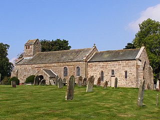
Bamburgh is a village and civil parish on the coast of Northumberland, England. It had a population of 454 in 2001, decreasing to 414 at the 2011 census.
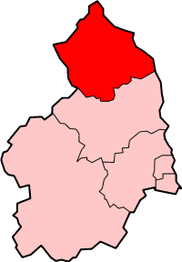
Berwick-upon-Tweed was a local government district and borough in Northumberland in the north-east of England, on the border with Scotland. The district had a resident population of 25,949 according to the 2001 census, which also notes that it is the most ethnically homogeneous in the country, with 99.6% of the population recording themselves in the 2001 census as White. It was also the smallest district in England with borough status, and the third-least densely populated local government district.

Bolam is a village and former civil parish, now in the parish of Belsay in the county of Northumberland, England. The village is about 20 miles (32 km) north-west of Newcastle upon Tyne, near Bolam West Houses. In 1951 the civil parish had a population of 60. On 1 April 1955 it was merged into Belsay.

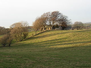
Burton is a hamlet and former civil parish, now in the parish of Bamburgh, in the county of Northumberland, England. It is situated to the south of the village of Bamburgh, a short distance inland from the North Sea coast. In 1951 the civil parish had a population of 60. On 1 April 1955 the civil parish was merged into Bamburgh.

Bradford is a village and former civil parish, now in the parish of Adderstone with Lucker, in the county of Northumberland, England. It is situated to the south-west of Bamburgh, a short distance inland from the North Sea coast. In 1951 the parish had a population of 14.

Adderstone is a village and former civil parish, now in the parish of Adderstone with Lucker, in the county of Northumberland, England. In 1951 the parish had a population of 185.
Adderstone with Lucker is a civil parish in Northumberland, England. The parish includes the villages of Adderstone, Lucker, Warenford, Rosebrough, Newstead, Bellshill and Bradford, and has a population (2001) of 195. increasing to 238 at the 2011 Census.
Bolton is a village and civil parish in the Eden District of Cumbria, England, about 4 miles (6 km) north west of Appleby-in-Westmorland, and on the River Eden. According to the census of 2001, it had a population of 416, increasing to 435 at the census of 2011. The parish touches Brougham, Colby, Cliburn, Crackenthorpe, King's Meaburn, Kirkby Thore, Morland and Temple Sowerby.

East Cottingwith is a village and former civil parish, now in the parish of Cottingwith, East Riding of Yorkshire, England. It lies on the former Derwent Navigation (canal), and approximately 9 miles (14 km) north-west of the market town of Howden and 7 miles (11 km) south-west of the market town of Pocklington. The village is 1 mile (1.6 km) west of the B1228 road and just east of the River Derwent. In 1931 the civil parish had a population of 185. On 1 April 1935 the civil parish was merged with Storwood to create Cottingwith.
Newton Poppleford is a large village and former civil parish situated on the A3052 road between Exeter and Sidmouth on the west side of the River Otter, now in the parish of Newton Poppleford and Harpford in East Devon, England, within the East Devon AONB. Newton Poppleford is twinned with Crèvecœur-en-Auge in Normandy, France. In 2019 it had an estimated population of 1784. In 1931 the parish had a population of 447.

Edenhall is a clustered village in the south-west of the civil parish of Langwathby, 800m to the north in the Eden district, in the county of Cumbria, England. Edenhall has a church called St Cuthbert's Church. The name Edenhall originates from Eden Hall house, the seat of the Musgrave family of Hartley Castle, Cumberland many of whom were members of the House of Commons. In 1931 the civil parish had a population of 216. On 1 April 1934 the civil parish was merged into Langwathby.

Horton is a former civil parish in Northumberland, England about 2 miles (3 km) west of Blyth, and south of the River Blyth. Historically a chapelry of Woodhorn, it became part of Blyth Urban District in 1912, and in 1920 it was abolished, when it was combined with Bebside, Cowpen, and Newsham and South Blyth to form a single parish for the district.

Venn Ottery, historically also spelt Fen Ottery, is a small village in East Devon, England. It lies 1 mile north of the larger village of Newton Poppleford. In 1931 the parish had a population of 66.
Colton is a village and former civil parish, 8 miles (13 km) west of Norwich, now in the parish of Marlingford and Colton, in the South Norfolk district, in the county of Norfolk, England. In 1931 the parish had a population of 175.

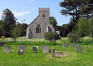
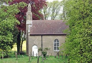
Milbourne is a village and former civil parish 14 miles (23 km) from Morpeth, now in the parish of Ponteland, in the county of Northumberland, England. In 1951 the parish had a population of 70. Milbourne has a church called Holy Saviour.

Great Habton is a village and former civil parish about 18 miles from York, now in the parish of Habton, in the Ryedale district, in the county of North Yorkshire, England. In 1961 the parish had a population of 103.

Easington is a place and former civil parish, now in the parish of Belford about 14 miles from Alnwick, in the county of Northumberland, England. In 2011 the parish had a population of 143. The parish touched Adderstone with Lucker, Bamburgh, Belford and Middleton. The parish is coastal and stretches from Budle Bay in the east to Chesters Hill.
Mosser is a village and former civil parish, 26 miles (42 km) south west of Carlisle, now in the parish of Blindbothel, in Allerdale district, in the county of Cumbria, England. In 1931 the parish had a population of 56. Mosser has a church called St Michael's Church.
Hebron is a village and civil parish 2 miles (3.2 km) north of Morpeth, in the county of Northumberland, England. In 2011 the parish had a population of 422. The parish touches Longhirst, Meldon, Mitford, Morpeth, Netherwitton, Pegswood, Tritlington and West Chevington and Ulgham. Until April 2009 the parish was in Castle Morpeth district. The surname "Hebron" derives from Hebron.

