Maca District

Last updated
Maca
Hualca Hualca.jpg
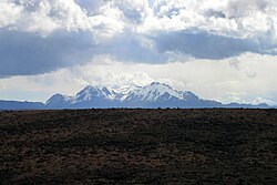
Hualca Hualca, Maca District
Country Flag of Peru.svg  Peru
Region Arequipa
Province Caylloma
Capital Maca
Government
   Mayor Hugo Eulogio Apaza Nina
Area
  Total227.48 km2 (87.83 sq mi)
Elevation
3,262 m (10,702 ft)
Population
  Total1,307
  Density5.7/km2 (15/sq mi)
Time zone UTC-5 (PET)
UBIGEO 040512

Maca District is one of twenty districts of the province Caylloma in Peru. [1]

See also

Related Research Articles

Department of Arequipa Departments of Peru

Arequipa is a department in southwestern Peru. It is bordered by the departments of Ica, Ayacucho, Apurímac and Cusco in the north, the Department of Puno in the east, the Department of Moquegua in the south, and the Pacific Ocean in the west. Its capital, also called Arequipa, is Peru's second-largest city.

Colca Canyon valley

The Colca Canyon is a canyon of the Colca River in southern Peru, located about 160 kilometres (99 mi) northwest of Arequipa. It is Peru's third most-visited tourist destination with about 120,000 visitors annually. With a depth of 3,270 metres (10,730 ft), it is one of the deepest in the world. The Colca Valley is a colorful Andean valley with pre-Inca roots, and towns founded in Spanish colonial times, still inhabited by people of the Collagua and the Cabana cultures. The local people maintain their ancestral traditions and continue to cultivate the pre-Inca stepped terraces, called andenes.

Lunahuaná Town in Lima, Peru

Lunahuaná is a small town in the Cañete Province in Peru. The town lies about 187 km south of Lima in the Lunahuaná valley at the bank of Cañete River. Due to the unique landscape, Lunahuaná is a very popular destination for both Peruvians and foreign tourists. According to the 2017 census, there were 4,393 inhabitants.

Chivay Town in Arequipa, Peru

Chivay is a town in the Colca valley, capital of the Caylloma province in the Arequipa region, Peru. Located at about 3,600 m above sea level, it lies upstream of the renowned Colca Canyon. It has a central town square and an active market. Ten km to the east, and 1,500 metres above the town of Chivay lies the Chivay obsidian source.

Caraz District District in Ancash, Peru

The Caraz District is one of 10 districts of the Huaylas Province in the Ancash Region of Peru. The capital of the district is Caraz. Its elevation is 2,285 m. In Caraz, the paved road comes from Pativilca.

Caylloma Province Province in Arequipa, Peru

Caylloma Province is the largest of eight provinces in the Arequipa Region of Peru.

Colca District is one of twelve districts of the province Víctor Fajardo in Peru.

Colca District is one of twenty-eight districts of the province Huancayo in Peru.

Cabanaconde District District in Arequipa, Peru

Cabanaconde or Qhawana Kunti (Quechua) is one of twenty districts of the Caylloma Province in Peru.

Callalli District District in Arequipa, Peru

Callalli District is one of twenty districts of the Caylloma Province in Peru and is located within the geographical area of the Colca Canyon.

Lari District District in Arequipa, Peru

Lari District is one of twenty districts of the province Caylloma in Peru.

Madrigal District District in Arequipa, Peru

Madrigal District is one of twenty districts of the province Caylloma in Peru.

Sibayo District District in Arequipa, Peru

Sibayo District is one of twenty districts of the province Caylloma in Peru. It is adjacent to Callalli and crossed by the Colca River on one side.

Tapay District District in Arequipa, Peru

Tapay District is one of twenty districts of Caylloma Province in Peru.

Tisco District District in Arequipa, Peru

Tisco District is one of twenty districts of the province Caylloma in Peru.

Hualca Hualca volcano in Peru

Hualca Hualca is an extinct volcano in Arequipa Region in the Andes of Peru. It has a height of 6,025 metres.

Machu Colca

Machu Colca, Machuqolqa or Machu Qollqa is an archaeological site in Peru. It lies in the Cusco Region, Urubamba Province, Huayllabamba District, a few minutes outside of Chinchero. Machu Colca is situated at about 3,850 metres (12,631 ft) of elevation, above the left bank of the Urubamba River, near the village of Raqch'i (Raqchi).

Andagua volcanic field mountain

The Andagua volcanic field is a volcanic field in southern Peru which includes a number of cinder cones/scoria cones, lava domes and lava flows which have filled the Andagua valley. The volcanic field is part of a larger province that clusters around the Colca River and is mostly of Pleistocene age, although the Andagua sector also features volcanic cones with historical activity. Volcanic activity in the field has flooded the Andahua valley with lava flows, damming local watersheds. The Andahua valley segment of the larger volcanic province was declared a geopark in 2015.

Huambo volcanic field

Huambo volcanic field is a volcanic field in Peru. Andahua-Orcopampa lies north-northeast and Sabancaya east of Huambo, east of the Rio Colca. The town of Huambo lies between the two fields.

Sabancaya Peruvian stratovolcano

Sabancaya is an active 5,976-metre-high (19,606 ft) stratovolcano in the Andes of southern Peru, about 70 kilometres (43 mi) northwest of Arequipa. It is considered part of the Central Volcanic Zone of the Andes, one of the three distinct volcanic belts of the Andes. The Central Volcanic Zone includes a number of volcanoes, some of which like Huaynaputina have had large eruptions and others such as Sabancaya and Ubinas have been active in historical time. Sabancaya forms a volcanic complex together with Hualca Hualca to the north and Ampato to the south and has erupted andesite and dacite. It is covered by a small ice cap which leads to a risk of lahars during eruptions.

References

Coordinates: 15°38′33″S71°46′12″W / 15.6425°S 71.7699°W / -15.6425; -71.7699