Sibayo District

Last updated
Sibayo
Sibayo-main-plaza.jpg
The main plaza of Sibayo
Peru location map.svg
Red pog.svg
Sibayo
Location of Sibayo in the Caylloma province
Coordinates: 15°29′12.1″S71°27′25.7″W / 15.486694°S 71.457139°W / -15.486694; -71.457139
Country Flag of Peru.svg  Peru
Region Arequipa
Province Caylloma
FoundedJanuary 25, 1943
Capital Sibayo
Government
   Mayor Raul Meliton Mamani Picha
Area
  Total286.03 km2 (110.44 sq mi)
Elevation
3,810 m (12,500 ft)
Population
  Total1,493
  Density5.2/km2 (14/sq mi)
Time zone UTC-5 (PET)
UBIGEO 040515

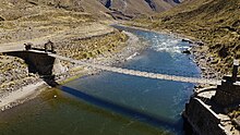
Sibayo District is one of twenty districts of the province Caylloma in Peru. [1] It is adjacent to Callalli and crossed by the Colca River on one side.

Contents

Ethnic groups

The people in the district are mainly indigenous citizens of Quechua descent. Quechua is the language which the majority of the population (55.45%) learnt to speak in childhood, 44.41% of the residents started speaking using the Spanish language (2007 Peru Census). [2]

See also

Related Research Articles

Department of Arequipa Departments of Peru

Arequipa is a department in southwestern Peru. It is bordered by the departments of Ica, Ayacucho, Apurímac and Cusco in the north, the Department of Puno in the east, the Department of Moquegua in the south, and the Pacific Ocean in the west. Its capital, also called Arequipa, is Peru's second-largest city.

Colca Canyon valley

The Colca Canyon is a canyon of the Colca River in southern Peru, located about 160 kilometres (99 mi) northwest of Arequipa. It is Peru's third most-visited tourist destination with about 120,000 visitors annually. With a depth of 3,270 metres (10,730 ft), it is one of the deepest in the world. The Colca Valley is a colorful Andean valley with pre-Inca roots, and towns founded in Spanish colonial times, still inhabited by people of the Collagua and the Cabana cultures. The local people maintain their ancestral traditions and continue to cultivate the pre-Inca stepped terraces, called andenes.

Colca District is one of twelve districts of the province Víctor Fajardo in Peru.

Pararca District is one of ten districts of the province Paucar del Sara Sara in Peru.

Lampa District is one of ten districts of the province Paucar del Sara Sara in Peru.

Paucarcolla District District in Puno, Peru

Paucarcolla District is one of fifteen districts of the province Puno in Peru.

Calapuja District is one of ten districts of the province Lampa in Peru.

Acomayo or Aqumayu is one of seven districts of the province Acomayo in Peru.

Mosoc Llacta is one of seven districts of the province Acomayo in Peru.

Rondocan District is one of seven districts of the province Acomayo in Peru.

Sangarará District is one of seven districts of the province Acomayo in Peru.

San Salvador District District in Cusco, Peru

San Salvador District is one of eight districts of the province Calca in Peru.

San Pedro District is one of eight districts of the province Canchis in Peru.

Tinta District District in Cusco, Peru

Tinta District is one of eight districts of the Canchis Province in Peru.

Suykutambo District is one of eight districts of the Espinar Province in Peru.

Paruro District is one of nine districts of the province Paruro in Peru.

Callalli District District in Arequipa, Peru

Callalli District is one of twenty districts of the Caylloma Province in Peru and is located within the geographical area of the Colca Canyon.

Madrigal District District in Arequipa, Peru

Madrigal District is one of twenty districts of the province Caylloma in Peru.

Tapay District District in Arequipa, Peru

Tapay District is one of twenty districts of Caylloma Province in Peru.

Tuti District is one of twenty districts of the province Caylloma in Peru.

References

  1. (in Spanish) Instituto Nacional de Estadística e Informática. Banco de Información Distrital Archived 2008-04-23 at the Wayback Machine . Retrieved April 11, 2008.
  2. inei.gob.pe Archived 2013-01-27 at the Wayback Machine INEI, Peru, Censos Nacionales 2007, Frequencias: Preguntas de Población: Idioma o lengua con el que aprendió hablar (in Spanish)

Coordinates: 15°29′35″S71°44′46″W / 15.4931°S 71.7462°W / -15.4931; -71.7462