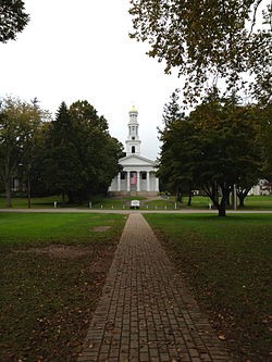
Guilford is a town in New Haven County, Connecticut, United States, that borders Madison, Branford, North Branford and Durham, and is situated on I-95 and the Connecticut seacoast. The town is part of the South Central Connecticut Planning Region. The population was 22,073 at the 2020 census.
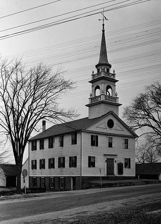
Preston City is a village and the original town center of the town of Preston, Connecticut. The core of the village around the junction of Old Northwest Road and Route 164 is designated as the Preston City Historic District, a historic district that is listed on the National Register of Historic Places. The district is located along Old Shetucket and Amos Roads, which, prior to the 1930s, were major thoroughfares.
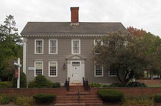
The Simsbury Center Historic District is a 75-acre (30 ha) historic district located in the town center area of Simsbury, Connecticut. It encompasses seven blocks of Hopmeadow Street, as well as the cluster of commercial, civic, and residential buildings along Railroad, Station, and Wilcox Streets, and Phelps Lane. Although its oldest element is the cemetery, most of its buildings were built in the late 19th and early 20th century. It was listed on the National Register of Historic Places in 1996.

The Fairfield Historic District encompasses the historic town center of Fairfield, Connecticut, roughly along Old Post Road between U.S. Route 1 and Turney Road. The area contains Fairfield's town hall, public library, and houses dating from the late 18th century, and includes portions of the town's earliest colonial settlement area. The district was listed on the National Register of Historic Places in 1971.

Pulaski Park is a city park along the Connecticut River in Holyoke, Massachusetts. Originally called Prospect Park when it was laid out in 1884, it was given its present name in 1939 in honor of American Revolutionary War hero Casimir Pulaski, for whom there is a memorial in the park's center. The original 5.1-acre (2.1 ha) park was designed by the Olmsted Brothers landscape design firm.

The Meigs–Bishop House is a historic house at 45 Wall Street in Madison, Connecticut. With a construction history dating to about 1690, it is one of the town's oldest surviving buildings. It was listed on the National Register of Historic Places in 1988. It is now used for commercial purposes.

Norwichtown is a historic neighborhood in the city of Norwich, Connecticut. It is generally the area immediately north of the Yantic River between I-395 and Route 169.

The Union Green is the town green of the New England town of Union, Connecticut. The Green is a small town-owned wedge at the north end of a triangle park area formed by Town Hall Road, Buckley Highway and Kinney Hollow Road. The Green, Union Grove, and properties to the north along Route 190 are listed on the National Register of Historic Places as the Union Green Historic District. The historic district contains 16 buildings, 3 sites, and 2 objects over an area of 300 acres (1.2 km2).

Bolton Green Historic District is a historic district that includes the town green, Bolton Green, of the town of Bolton, Connecticut. The green and the surrounding buildings were listed on the National Register of Historic Places in 2001. The district encompasses 9 buildings, 1 site, 4 structures, and 2 objects that contribute to the historical significance of the area. The district extends east about 500 yards (460 m) from the green along Bolton Center Road. The oldest existing buildings around the Green are the former tavern and the Bolton General Store. The most prominent building around the Green is the Bolton Congregational Church, a Greek Revival structure built in 1818 with a truncated box-spire. Other structures around the green are a house facing the green on the east side built in the 1840s, and a new ranch house that was built on the former site of an 1870s house that was destroyed by fire. Other properties in the district includes the Brick Tavern, the site of Bolton's first post office, the town hall, the Tuthill residence, and the Bolton Heritage Farm.
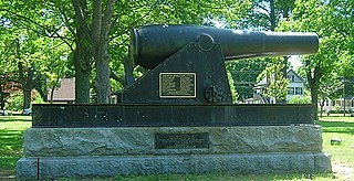
The East Haven Green is the town green of the New England town of East Haven, Connecticut. It is bounded by River Street, Hemingway Avenue, Main Street, and Park Place and is the focal point of the East Haven Green Historic District, listed on the National Register of Historic Places. This area is also part of the commercial business district of the town and contains many two- and three-story brick office buildings that have been constructed within the last ten or fifteen years. Farther to the northwest are a shopping center and high-rise apartment buildings.

West Haven Green is the town green of the New England town of West Haven, Connecticut. The green is bordered by Church Street on the south, Savin Avenue on the west, Main Street on the north and Campbell Avenue on the east. The green and surrounding buildings are part of the West Haven Green Historic District.
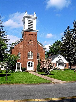
The Bethlehem Green Historic District is a historic district in the center of the town of Bethlehem, Connecticut, listed on the National Register of Historic Places in 1982 for the architectural significance of the houses around the town green. The historic district includes the green and 63 contributing properties over an area of 55 acres (22 ha).
Liberty Green Historic District is a local historic district in the town of Clinton, Connecticut, and Liberty Green is a triangular town green within it. The district was created in 1979 following a lengthy study, report and enabling ordinance

Ellington Center Historic District is an 80-acre (32 ha) historic district in the town of Ellington, Connecticut that was listed on the National Register of Historic Places in 1990.

Hebron Center Historic District encompasses most of the historic village center of Hebron, Connecticut. Centered on the junction of Connecticut Routes 66 and 85, it has served as the rural community's civic center since its incorporation in 1708. The district was listed on the National Register of Historic Places in 1993.

The Downtown Waterbury Historic District is the core of the city of Waterbury, Connecticut, United States. It is a roughly rectangular area centered on West Main Street and Waterbury Green, the remnant of the original town commons, which has been called "one of the most attractive downtown parks in New England."

The Protection of the Flag Monument is a historic war memorial located in Academy Park at 715 South Main Street in Athens, Bradford County, Pennsylvania. Designed in the Classical Revival style by the architectural firm McKim, Mead & White, with a sculpture by George Thomas Brewster, it was erected between 1900 and 1902, and has a granite pedestal topped by a bronze sculpture group. The sculpture depicts an adult soldier and a young drummer boy attired in Revolutionary War clothing and protecting their flag from falling into enemy hands. A commemorative plaque indicates it was dedicated in memory of the soldiers who fought in defense of the flag.

The Watertown Center Historic District encompasses the historic village center of Watertown, Connecticut. It exhibits architectural and historic changes from the early 1700s into the 20th century. It is roughly bounded by Main, Warren, North, Woodbury, Woodruff, and Academy Hill Roads, and was listed on the National Register of Historic Places in 2001.

Guilford Historic Town Center is a large historic district encompassing the entire town center of Guilford, Connecticut, in the United States. It is centered on the town green, laid out in 1639, and extends north to Interstate 95, south to Long Island Sound, west to the West River, and east to East Creek. It includes more than 600 historic structures, most built between the late 17th and early 20th centuries, reflecting the town's growth and history during that time. It was listed on the National Register of Historic Places in 1976.

The Meeting House Hill Historic District encompasses the historic religious center of North Guilford, Connecticut. Located on Ledge Hill Road, the district includes two churches, a cemetery, and Ledge Hill Road itself, which dates to the early 18th century. The arrangement is reflective of a spirit of religious tolerance that manifested in the early 19th century, allowing churches from two different congregations to heal long-standing divisions. The district was listed on the National Register of Historic Places in 1987.
