
Gattaran, officially the Municipality of Gattaran, is a 1st class municipality in the province of Cagayan, Philippines. According to the 2020 census, it has a population of 58,874 people.

The Central Cebu Protected Landscape (CCPL) is a protected area located in the mountains and drainage basins of central Cebu in the Philippines.
The Lal-lo and Gattaran Shell Middens are one of the most significant archaeological gastronomic finds in Southeast Asia in the 20th century. The site is located along the banks of the Cagayan River in the province of Cagayan, Philippines. The site, as old as 2000 BC, is highly important due to its archaeological impact on the food resources and human activities of the ancient peoples of the Cagayan Valley. It is currently under consideration as a UNESCO World Heritage Site.
The Bulusan Volcano Natural Park is a 3,673-hectare (9,080-acre) protected area of rainforest surrounding Mount Bulusan in the Philippines. It was first designated as a National Park by Proclamation no. 811 on June 7, 1935. Under the National Integrated Protected Areas System (NIPAS) of 1992 managed by the Department of the Environment and Natural Resources, the park was reclassified as a Natural Park by Proc. 421 on November 27, 2000. The area features the volcano itself, Bulusan Lake, the two other mountains known as the 'Sharp Peak' and 'Hormahan' and Lake Aguingay. The park is in the south central part of Sorsogon Province, southern Luzon, Bicol Region, Philippines, bounded by five municipalities: Bulusan, Barcelona, Irosin, Juban and Casiguran.

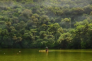
The Peñablanca Protected Landscape and Seascape is a protected area and national park in Peñablanca, Cagayan. It is on the border with Isabela province, contiguous with the Northern Sierra Madre Natural Park. The protected area, best known as the location of Callao Cave, covers the largest block of forest under conservation in the province. It covers 118,781.582 hectares of the northern Sierra Madre mountain range and its adjacent Pacific coast.

The Northern Sierra Madre Natural Park is the largest protected area of the Philippines covering the northern range of the Sierra Madre mountains of eastern Luzon. The park is located in the eastern part of the province of Isabela in Cagayan Valley containing a total of 359,486 hectares. It was first declared a wilderness reserve encompassing an area within a 45 kilometres (28 mi) radius of Palanan Point known as the Palanan Wilderness Area through Letter of Instructions No. 917-A signed by President Ferdinand Marcos on 7 September 1979. On 10 March 1997, the area was converted into a natural park with the signing of Proclamation No. 978 by President Fidel Ramos.
Sibalom Natural Park is a 5,511.47-hectare (13,619.1-acre) protected area in the Philippines on the island of Panay in the municipality of Sibalom, Antique. It was proclaimed a natural park on 23 April 2000. It is considered one of the last remaining lowland rainforests on Panay.
The Manleluag Spring Protected Landscape is a protected area containing natural hot springs in the Ilocos Region of the Philippines. It is one of 34 protected landscapes in the Philippines located in the municipality of Mangatarem, Pangasinan in the west-central area of the island of Luzon.

The Roosevelt Protected Landscape, also known as Roosevelt Park, is a protected area in the Central Luzon region in the Philippines. It occupies an area of 786.04 hectares of grasslands and old-growth forest in northern Bataan province near Olongapo and the Subic Bay Freeport Zone. The park was established as Roosevelt National Park covering an area of 1,485 hectares on 30 March 1933 through Proclamation No. 567 signed by Governor-General Theodore Roosevelt, Jr. In 1965, the national park was reduced to 1,334 hectares. On 23 April 2000, the park was reclassified as a protected landscape area and was further reduced to its present area of 786.04 hectares.
The Mount Timolan Protected Landscape is a protected area covering Mount Timolan and its surrounding forested landscape in the region of Zamboanga Peninsula on Mindanao in the Philippines. The park encompasses an area of 1,994.79 hectares and a buffer zone of 695.39 hectares in the municipalities of San Miguel, Guipos and Tigbao in the province of Zamboanga del Sur. It was established on 14 August 2000 through Proclamation Order No. 354 issued by President Joseph Estrada. The park was also earlier established by the provincial government of Zamboanga del Sur as a provincial park and wildlife sanctuary known as the Zamboanga del Sur Provincial Park through Provincial Ordinance No. 3 in 1992.

The Aliwagwag Protected Landscape is a protected area that preserves a major drainage catchment in the southern Philippine island of Mindanao in the Davao Region. It contains the headwaters of the Cateel River in the southern Diuata Mountain Range which provides the water source and irrigation for surrounding rice fields and communities in Davao de Oro and Davao Oriental provinces. It was named after the remote rural village in the municipality of Cateel where Aliwagwag Falls, the country's highest waterfall, is located.
The Mimbilisan Protected Landscape is a protected landscape area located in the province of Misamis Oriental in Northern Mindanao in the Philippines. It was established in 1936 to protect the watershed forest surrounding the Mimbilisan Falls in the municipality of Talisayan declared through Proclamation No. 51 by President Manuel Luis Quezon. It had an initial area of 72 hectares and is an important source for Mimbilisan Water System that supplies water to the surrounding communities in eastern Misamis Oriental. In 1999 and again, in 2007, the forest reserve was reestablished as a protected landscape under the National Integrated Protected Areas System with the enactment of Proclamation No. 134 and Republic Act No. 9494. It is one of five declared protected areas of the Philippines in Misamis Oriental.
The Maulawin Spring Protected Landscape is a protected landscape area of forested hills and several rivers and streams located in the province of Quezon on southern Luzon island in the Philippines. It was originally created in 1939 to protect the watershed in the municipality of Guinayangan known as the Maulawin Spring Watershed Forest Reserve declared through Proclamation No. 365 by President Manuel Luis Quezon. It had an initial area of 60 hectares. In 2000, the forest reserve was enlarged and was redesignated as a protected landscape under the National Integrated Protected Areas System by virtue of Proclamation No. 295 issued by President Joseph Estrada. It is the only source of potable water for domestic consumption of the more than 40,000 residents of Guinayangan.
The Amro River Protected Landscape is a protected landscape area located in the province of Aurora in eastern Central Luzon in the Philippines. It preserves the primary water source for agricultural, power generation and domestic consumption of the remote northern Auroran communities on the Pacific coast. The area was first established in 1990 as the Amro River Watershed Forest Reserve to protect, maintain and improve the water yield of the Amro River as declared through Proclamation No. 633 by President Corazón Aquino. In 2000, the forest reserve was reclassified as a protected landscape under the National Integrated Protected Areas System with the enactment of Proclamation No. 274 by President Joseph Estrada. It is one of five declared protected areas of the Philippines in Aurora.

The Dinadiawan River Protected Landscape is a protected area covering the stretch of the Dinadiawan River from its headwaters in the Sierra Madre mountain range to its mouth on the Philippine Sea coast of the village of Dinadiawan in Aurora province, Philippines. The park covers an area of 3,371.332 hectares and includes its surrounding forested mountains, waterfalls and springs in Dipaculao municipality. It is composed of 2,645 hectares of forested area, 323 hectares of grassland, 151 hectares of forested shrubland, 144 hectares of cultivated area, and 108 hectares of the Dinadiawan River. Its forest cover consists primarily of dipterocarp trees like tanguile, mayapis, white lauan, red lauan and bagtikan. It serves as a habitat of wild fauna such as the Philippine deer, Philippine long-tailed macaque, Philippine warty pig, spotted wood kingfisher and pygmy swiftlet.
The Simbahan–Talagas Protected Landscape is a protected area in northern Aurora, Philippines that preserves a major watershed in the Sierra Madre mountain range of Central Luzon. It contains the headwaters of the Simbahan and Talagas rivers, including the Sangay River and Umihiem Creek in Dinalungan municipality which empty into the Casiguran Sound. A large portion of the park is under forest cover, while the remaining areas are cultivated land, shrubland, grassland, built-up area and river-wash area. Some of the park's fauna include the Philippine deer, Philippine long-tailed macaque, and an abundant species of avifauna. Its location in north central Sierra Madre is covered by dipterocarp forest, composed of Shorea almon, Shorea polysperma (tanguile), Shorea squamata (mayapis), Shorea contorta, Shorea negrosensis, and Parashorea malaanonan (bagtikan).
The Talaytay Protected Landscape is a protected area in northern Aurora, Philippines that preserves the Talaytay River watershed in the Sierra Madre mountain range of Central Luzon. It encompasses an area of 3,526.29 hectares stretching from the rugged interior containing the headwaters of the Talaytay River to its mouth at the lowland area of Dinalungan municipality. The park is known to harbor several important flora of the dipterocarp variety, including Dipterocarpus grandiflorus (apitong), Shorea polysperma (tanguile), Shorea squamata (mayapis), Shorea contorta, Shorea negrosensis, Parashorea malaanonan (bagtikan), and Shorea philippinensis (mangasinoro). It is home to a number of wildlife such as the Philippine deer, Philippine long-tailed macaque and some avifauna species.

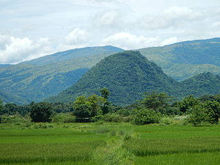
The Sierra Madre is the longest mountain range in the Philippines. Spanning over 540 kilometers (340 mi), it runs from the province of Cagayan down to the province of Quezon, forming a north–south direction on the eastern portion of Luzon, the largest island of the archipelago. It is bordered by the Pacific Ocean to the east, Cagayan Valley to the northwest, Central Luzon to the midwest, and Calabarzon to the southwest. Some communities east of the mountain range, along the coast, are less developed and so remote that they could only be accessed by taking a plane or a boat.

Mounts Banahaw–San Cristobal Protected Landscape is a protected landscape park in the Calabarzon region of the Philippines, 120 kilometres (75 mi) south of Manila. It is the second largest protected area in Calabarzon, after the Upper Marikina River Basin Protected Landscape, with an area of 10,900.59 hectares. The park is located at the border of Laguna and Quezon provinces and includes the features it is named after: Mount Banahaw and, 7 kilometres (4.3 mi) to its west, Mount San Cristobal.

Cagayan's 1st congressional district is one of the three congressional districts of the Philippines in the province of Cagayan. It has been represented in the House of Representatives of the Philippines since 1916 and earlier in the Philippine Assembly from 1907 to 1916. The district consists of Cagayan's former capital, Lal-lo, and adjacent municipalities of Alcala, Aparri, Baggao, Buguey, Camalaniugan, Gattaran, Gonzaga, Santa Ana and Santa Teresita. It is currently represented in the 19th Congress by Ramon C. Nolasco Jr. of the Nationalist People's Coalition (NPC).

