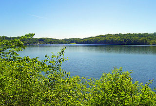
Table Rock Lake is an artificial lake or reservoir in the Ozarks of southwestern Missouri and northwestern Arkansas in the United States. Designed, built and operated by the U.S. Army Corps of Engineers, the lake is impounded by Table Rock Dam, which was constructed from 1954 to 1958 on the White River.

Castaic Dam is an embankment dam in northwestern Los Angeles County, California, in the unincorporated area of Castaic. Although located on Castaic Creek, a major tributary of the Santa Clara River, Castaic Creek provides little of its water. The lake is the terminus of the West Branch of the California Aqueduct, part of the State Water Project. The dam was built by the California Department of Water Resources and construction was completed in 1973. The lake has a capacity of 325,000 acre-feet (401,000,000 m3) and stores drinking water for the western portion of the Greater Los Angeles Area.

Lavon Lake is a freshwater reservoir located in southeast Collin County, Texas, on the East Fork of the Trinity River near Wylie, off State Highway 78. It is commonly called Lake Lavon for commercial and recreational purposes, but Lavon Lake is its official name according to the U.S. Army Corps of Engineers. It was originally called Lavon Reservoir.

Spruce Run Recreation Area is a 1,290-acre (5.2 km2) New Jersey state recreation area located in Union Township and Clinton Township in Hunterdon County, New Jersey, United States. It encompasses the Spruce Run Reservoir that is used as a backup reservoir to protect the state from prolonged droughts. The reservoir is the third largest in the state, after Round Valley and Wanaque Reservoir. The reservoir is used for recreation purposes, including hunting, fishing, boating and swimming.

Frenchman Lake is a reservoir located in southeastern Plumas County, California. It was created by the damming of Little Last Chance Creek in 1961, as part of the California State Water Project. It was named after its tributary Frenchman Creek, which in turn was named after Claude Francois Seltier, a French immigrant who settled in the area in 1858.
The Central Utah Project is a United States federal water project that was authorized for construction under the Colorado River Storage Project Act of April 11, 1956, as a participating project. In general, the Central Utah Project develops a portion of Utah's share of the yield of the Colorado River, as set out in the Colorado River Compact of 1922.
The Clyde River is a tributary of Lake Memphremagog, over 33.5 miles (54 km) long, in northern Vermont in the United States. It is the easternmost of the four major rivers in Orleans County. It is the most powerful of the four within Orleans County, powering several turbines at damsites. It is part of the Northern Forest Canoe Trail.

Lake Gleneida is a controlled lake in the hamlet of Carmel within the Town of Carmel in central Putnam County, New York. Originally a smaller natural water body, Shaw's Pond, it was dammed by New York City in 1870 and enlarged to 168 acres (68 ha) for inclusion in its water supply system. It is part of the New York City water system's Croton Watershed.

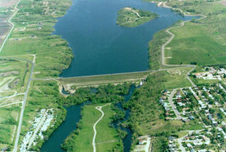
The Jamestown Dam is a rolled-earth dam spanning the James River in Stutsman County in the U.S. state of North Dakota, serving the primary purpose of flood control. It is north of the city of Jamestown, North Dakota. Built from April 1952 to September 1953, the dam measures 1,418 feet (432 m) long at the crest and 85 feet (26 m) high. It impounds the James River to form the Jamestown Reservoir. A small islet lies shortly upstream of the dam, where the James River previously split into two channels.
Pine Creek Lake is a lake in McCurtain County and Pushmataha County, Oklahoma, USA. It is 8 miles (13 km) north of Valliant, Oklahoma. It is located east of Rattan and north of Sobol.

Antelope Dam or Antelope Valley Dam is a dam in Plumas County, California, part of the California State Water Project.

Lake Innisfree is a man-made lake and former reservoir in the city of New Rochelle and the town of Eastchester, in Westchester County, New York. Its eastern end abuts the Hutchinson River Parkway. The lake takes its name from the poem Lake Isle of Innisfree by W. B. Yeats.

New Rochelle Public Library (NRPL) is a public library located in New Rochelle, New York. Chartered in 1894, the NRPL is a school-district library with its own operating budget and a board of trustees with seven elected members. The library has served the residents of New Rochelle from its main library building in the downtown business district since 1979.
Sheldrake Lake is a man-made body of water located in the north-eastern section of New Rochelle in Westchester County, New York. It has a surface area of 25 acres and formerly served as the water supply for neighboring Larchmont village. The lake is the result of Larchmont Water Company Dam #2 on the Sheldrake River. The dam, constructed in 1935, is masonry with a height of 31 feet (9.4 m) and a length of 1,000 feet (300 m). The dam has a maximum discharge is 987 cubic feet (27.9 m3) per second and drains an area of 2.66 square miles (6.9 km2).
Reservoir 2 is located in the northern portion of the city of New Rochelle along the New Rochelle - Eastchester boundary in Westchester County, New York. Built in 1892, the reservoir is impounded by the "Reservoir 2 dam" on the Hutchinson River. The dam is masonry and of earthen construction, with a height of 25 feet (7.6 m) and a length of 550 feet (170 m). It has a water area of about 18.3 acres (7.4 ha) and a capacity of about 37 million US gallons (140,000 m3). Maximum discharge is 800 cubic feet (23 m3) per second. The reservoir is owned by the City Of New Rochelle.
Reservoir 3 is a man-made reservoir located in the northern portion of the city of New Rochelle along the New Rochelle - Eastchester boundary in Westchester County, New York. Constructed in 1908, the reservoir is impounded by the New Rochelle "Reservoir 3 dam" on the Hutchinson River. The dam is of earthen construction, with a height of 30 feet (9.1 m) and a length of 450 feet (140 m). It has an area of about 30 acres (12 ha), and a capacity of about 128 million US gallons (480,000 m3). Maximum discharge is 1,815 cubic feet (51.4 m3) per second. Its capacity is 498 acre-feet (614,000 m3). Normal storage is 220 acre-feet (270,000 m3). It drains an area of 2.85 square miles (7.4 km2). The reservoir is currently owned by the Westchester County Department of Parks and Recreation.
Crystal Lake was located in the village of New Rochelle in Westchester County, New York. It originally supplied early colonial mills with water power. It was fed by Stephenson Brook, which rises just north of Paine Lake and drains the large watershed adjacent to North Avenue from beyond Quaker Ridge Road.
Lake Lone Chimney is a lake in Pawnee County, Oklahoma, east of Glencoe. It is owned by the Tri-County Development Authority. The lake, whose dam is also known as Lower Black Bear Creek Watershed Dam 19M, also extends into southern Payne County, Oklahoma. It was built in 1980 by the Tri-County Development Authority, Pawnee County Conservancy District and the Black Bear Conservancy District, assisted by the Oklahoma Conservation Commission and the USDA Natural Resources Conservation Service (NRCS) Watershed Protection and Flood Protection Program.

Kirk Lake is a controlled lake in the hamlet of Mahopac in the town of Carmel in Putnam County, New York. It lies due west and sharply below considerably larger Lake Mahopac. It is one of three controlled lakes in the New York City water supply system's Croton Watershed.
The J.A. Mahlstedt Lumber and Coal building in New Rochelle, Westchester County, New York, is a Neoclassical Revival style building completed in 1920. The building was given New Rochelle Heritage Award in 2010 and designated as a local landmark in 2021.


