
State Route 208 (SR 208) is a numbered state highway in Maine. Serving as the main north–south connector between Biddeford Pool northwest to downtown Biddeford, SR 208 is approximately seven miles (11 km) and two lanes wide. With the exception of its first 1.7 miles (2.7 km), SR 208 runs concurrently with SR 9.

State Route 77 is part of Maine's system of numbered state highways, located in eastern Cumberland County. It runs for 12.3 miles (19.8 km) from SR 207 in Scarborough to the intersection of Park Avenue and State Street in Portland.

State Route 26 (abbreviated SR 26) is part of Maine's system of numbered state highways. It is a major interregional route running for 95.90 miles (154.34 km) from downtown Portland northwest to the New Hampshire border near Upton, where it connects to New Hampshire Route 26. SR 26 runs in Cumberland, Androscoggin and Oxford Counties.

State Route 25 (SR 25) is part of the system of numbered highways in Maine. It runs for 42.4 miles (68.2 km) across the south central part of the state. SR 25 begins at the New Hampshire border near Porter, where it continues west as New Hampshire Route 25 (NH 25). Its eastern terminus is in downtown Portland at the intersection of Park Avenue and State Street. Administratively, it shares a terminus with SR 22 and SR 77.

State Route 4 is a 168.85-mile (271.74 km) long state highway located in southern and western Maine. It is a major interregional route and the first such route to be designated in the state. The southern terminus is at the New Hampshire border in South Berwick, where it connects to New Hampshire Route 4, and the northern terminus is at Haines Landing on Mooselookmeguntic Lake in Rangeley. Major cities and towns along the length of SR 4 include Sanford, Gorham, Windham, Auburn and Farmington.

State Route 15 (SR 15) is a numbered state highway in Maine, United States. SR 15 runs over 180 miles (290 km) from Stonington in the south to Jackman in the north.

State Route 125 (SR 125) is a 73-mile-long (117 km) state highway that runs south-to-north in an S-shape through the southern part of the U.S. state of Georgia. It travels through Lowndes, Lanier, Berrien, Tift, Irwin, and Ben Hill counties connecting the Valdosta and Fitzgerald metropolitan areas.
State Route 118 is a secondary highway located in eastern Oxford County, Maine. It runs for 13.04 miles (20.99 km) between the towns of Waterford and Norway. Its western terminus in Waterford is at State Route 35 and its eastern terminus in Norway is at the intersection of Main Street and Paris Street, where it is overlapped by State Route 117.

State Route 153 (SR 153) is part of Maine's system of numbered state highways. It runs 4.68 miles (7.53 km) from an intersection with SR 6 and SR 16 to an intersection with Smith Lane near Sebec Lake in Dover-Foxcroft. The route is also known as Greeley's Landing Road.

State Route 112 (SR 112) is part of Maine's system of numbered state highways, running from SR 9 in Saco to SR 114 in Gorham. The 26-mile-long (42 km) route runs in a C-shape and is signed as north–south.
State Route 117 is part of Maine's system of numbered state highways, running from SR 112 in Saco to SR 219 in Turner.

State Route 107 is a short route from Baldwin to Bridgton. The entire route is in Cumberland County.

State Route 41 is part of Maine's system of numbered highways, located in the central part of the state. It runs for 27 miles (43 km) from an intersection with U.S. Route 202 (US 202), SR 11, SR 100 and SR 133 in Winthrop north to an intersection with US 2 and SR 27 in Farmington.

State Route 93 (SR 93) is part of Maine's system of numbered state highways, located in Oxford County. It is a minor highway in the western part of the state, running 11 miles (18 km) from U.S. Route 302 (US 302) in Bridgton to SR 5 in Lovell. It is signed as a north–south highway, but runs roughly southeast-to-northwest.

State Route 119 is part of Maine's system of numbered state highways, located in the southwestern part of the state. It runs for 15.2 miles (24.5 km) from Minot to Paris. Its southern terminus in Minot is at State Route 11 and State Route 121, and its northern terminus in South Paris is at State Routes 26 and 117. Its northernmost 0.4 miles (0.6 km) are cosigned with SR 117 in a wrong-way concurrency.
State Route 221 (SR 221) is state highway located in Penobscot County in central Maine. It begins at State Route 15 in Bangor and runs north to Bradford, where it ends at State Route 11 and State Route 155.
State Route 220 (SR 220) is a state highway located in central coastal Maine. It begins at State Route 97 in Friendship on the Atlantic coast and runs for 66.50 miles (107.02 km) north to Palmyra, where it ends at State Route 11 and State Route 100. SR 220 runs through a series of small towns, with connecting routes leading to larger population centers such as Augusta, Waterville, and Bangor to the east and west.
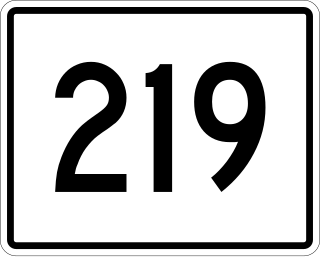
State Route 219 is part of Maine's system of numbered state highways, located in the western central part of the state. It runs for 35.1 miles (56.5 km) from the town center of Greenwood to an intersection with State Route 133 in Wayne.

State Route 234 (SR 234) is a state highway located in central Maine. It begins at an intersection with SR 149 in Strong and runs east for 18.51 miles (29.79 km) to U.S. Route 201A (US 201A) and SR 8 in Anson. SR 234 exists in two separate segments connected by a two-mile (3.2 km) section of SR 27.

State Route 215 (SR 215) is a state highway in the U.S. state of Maine. It runs for about 17 miles (27 km) between Newcastle at U.S. Route 1 Business and Jefferson at SR 32, entirely in Lincoln County.

