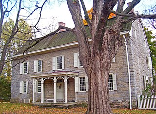
Norway (CDP), Maine

Last updated

Norway, Maine
CDP
USA Maine location map.svg
Red pog.svg
Norway, Maine
Location within the state of Maine
Coordinates: 44°12′42″N70°32′18″W / 44.21167°N 70.53833°W / 44.21167; -70.53833 Coordinates: 44°12′42″N70°32′18″W / 44.21167°N 70.53833°W / 44.21167; -70.53833
CountryUnited States
State Maine
County Oxford
Area
[1]
  Total5.23 sq mi (13.54 km2)
  Land5.05 sq mi (13.07 km2)
  Water0.18 sq mi (0.47 km2)
Elevation
387 ft (118 m)
Population
 (2020)
  Total2,696
  Density534.28/sq mi (206.30/km2)
Time zone UTC-5 (Eastern (EST))
  Summer (DST) UTC-4 (EDT)
ZIP code
04268
Area code 207
FIPS code 23-53965
GNIS feature ID0572503

Norway is a census-designated place (CDP) in the town of Norway in Oxford County, Maine, United States. The population was 2,623 at the 2000 census.

Contents

Geography

Norway is located at 44°12′41″N70°32′18″W / 44.21139°N 70.53833°W / 44.21139; -70.53833 (44.211544, −70.538375). [2]

According to the United States Census Bureau, the CDP has a total area of 5.2 square miles (13.6 km2), of which, 5.1 square miles (13.1 km2) of it is land and 0.2 square miles (0.5 km2) of it (3.44%) is water.

Demographics

Historical population
CensusPop.
2020 2,696
U.S. Decennial Census [3]

As of the census [4] of 2000, there were 2,623 people, 1,173 households, and 659 families residing in the CDP. The population density was 517.8 inhabitants per square mile (199.9/km2). There were 1,347 housing units at an average density of 265.9 per square mile (102.7/km2). The racial makeup of the CDP was 97.71% White, 0.42% Black or African American, 0.42% Native American, 0.46% Asian, 0.04% Pacific Islander, 0.04% from other races, and 0.91% from two or more races. Hispanic or Latino of any race were 0.38% of the population.

There were 1,173 households, out of which 25.5% had children under the age of 18 living with them, 39.0% were married couples living together, 14.1% had a female householder with no husband present, and 43.8% were non-families. 36.2% of all households were made up of individuals, and 17.3% had someone living alone who was 65 years of age or older. The average household size was 2.15 and the average family size was 2.75.

In the CDP, the population was spread out, with 22.0% under the age of 18, 8.6% from 18 to 24, 25.1% from 25 to 44, 23.2% from 45 to 64, and 21.1% who were 65 years of age or older. The median age was 41 years. For every 100 females, there were 81.1 males. For every 100 females age 18 and over, there were 77.0 males.

The median income for a household in the CDP was $24,781, and the median income for a family was $30,128. Males had a median income of $26,338 versus $19,868 for females. The per capita income for the CDP was $17,161. About 14.9% of families and 17.6% of the population were below the poverty line, including 26.1% of those under age 18 and 13.1% of those age 65 or over.

Related Research Articles

<span class="mw-page-title-main">Biola, California</span> Census-designated place in California, United States

Biola is a census-designated place (CDP) in Fresno County, California, United States. The population was 1,623 at the 2010 census, up from 1,037 in 2000. Biola is located 6 miles (9.7 km) north-northeast of Kerman, at an elevation of 253 feet.

<span class="mw-page-title-main">Easton, California</span> Census-designated place in California, United States

Easton is a census-designated place (CDP) in Fresno County, California, United States. The population was 2,083 at the 2010 census, up from 1,966 at the 2000 census. Easton is located 7.5 miles (12.1 km) south of downtown Fresno, at an elevation of 276 feet.

<span class="mw-page-title-main">Day Valley, California</span> Census-designated place in California, United States

Day Valley is a census-designated place (CDP) in Santa Cruz County, California, United States. The population was 3,409 at the 2010 census.

<span class="mw-page-title-main">Country Club Estates, Georgia</span> Census-designated place in Georgia, United States

Country Club Estates is an unincorporated area and census-designated place (CDP) in Glynn County, Georgia, United States. It is part of the Brunswick, Georgia Metropolitan Statistical Area. The population was 8,373 at the 2020 census, down from 8,545 in 2010.

<span class="mw-page-title-main">Pepeekeo, Hawaii</span> Census-designated place in Hawaii, U.S.

Pepeekeo is a census-designated place (CDP) in Hawaii County, Hawaii, United States. The population was 1,789 at the 2010 census, up from 1,697 at the 2000 census.

<span class="mw-page-title-main">Mattapoisett Center, Massachusetts</span> Census-designated place in Massachusetts, United States

Mattapoisett Center is a census-designated place (CDP) in the town of Mattapoisett in Plymouth County, Massachusetts, United States. The population was 2,915 at the 2010 census.

Melrose Park is a suburban community and census-designated place (CDP) in Cayuga County, New York, United States. The population was 2,294 at the 2010 census. It is a suburb of Auburn, located south of the city in the town of Owasco.

<span class="mw-page-title-main">Crompond, New York</span> CDP in New York, United States

Crompond is a hamlet and census-designated place (CDP) located in the town of Yorktown in Westchester County, New York, United States. The population was 2,292 at the 2010 census.

<span class="mw-page-title-main">Choctaw Lake, Ohio</span> CDP in Ohio, United States

Choctaw Lake is a census-designated place (CDP) in Madison County, Ohio, United States. The population was 1,562 at the 2000 census.

<span class="mw-page-title-main">Marshallton, Pennsylvania</span> CDP in Pennsylvania, United States

Marshallton is a census-designated place (CDP), located in Coal Township, in Northumberland County, Pennsylvania, United States. The population was 1,441 at the 2010 census.

McKeansburg is a census-designated place (CDP) in Schuylkill County, Pennsylvania, United States. The population was 155 at the 2000 census.

<span class="mw-page-title-main">Thompsonville, Pennsylvania</span> Census-designated place in Pennsylvania, United States

Thompsonville is a census-designated place (CDP) in Washington County, Pennsylvania, United States. The population was 3,520 at the 2010 census.

<span class="mw-page-title-main">East Hill-Meridian, Washington</span> Former CDP in Washington, United States

East Hill-Meridian is a former census-designated place (CDP) in King County, Washington. The population was 29,878 at the time of the 2010 census. The majority of the census area is now within the limits of Kent and Renton.

<span class="mw-page-title-main">Wind Lake, Wisconsin</span> CDP in Wisconsin, United States

Wind Lake is a census-designated place (CDP) in Racine County, Wisconsin, United States. The population was 5,355 at the 2020 census. Wind Lake is in the town of Norway.

<span class="mw-page-title-main">Livermore Falls (CDP), Maine</span> Census-designated place in Maine, United States

Livermore Falls is a census-designated place (CDP) in the town of Livermore Falls in Androscoggin County, Maine, United States. The population of the CDP was 1,594 at the 2010 census, out of a population of 3,187 within the full town.

<span class="mw-page-title-main">Bridgton (CDP), Maine</span> Census-designated place in Maine, United States

Bridgton is a census-designated place (CDP) in the town of Bridgton in Cumberland County, Maine, United States. The population was 2,071 at the 2010 census. It is part of the Portland–South Portland–Biddeford, Maine Metropolitan Statistical Area.

Fryeburg is a census-designated place (CDP) in the town of Fryeburg in Oxford County, Maine, United States. The population was 1,549 at the 2000 census.

Oxford is a census-designated place (CDP) in the town of Oxford in Oxford County, Maine, United States. The population was 1,300 at the 2000 census.

Rumford is a census-designated place (CDP) in the town of Rumford in Oxford County, Maine, United States. The population was 4,795 at the 2000 census.

Dexter is a census-designated place (CDP) comprising the main settlement within the town of Dexter in Penobscot County, Maine, United States. The population of the CDP was 2,158 at the 2010 census.

References

  1. "2020 U.S. Gazetteer Files". United States Census Bureau. Retrieved April 8, 2022.
  2. "US Gazetteer files: 2010, 2000, and 1990". United States Census Bureau. February 12, 2011. Retrieved April 23, 2011.
  3. "Census of Population and Housing". Census.gov. Retrieved June 4, 2016.
  4. "U.S. Census website". United States Census Bureau . Retrieved January 31, 2008.