Related Research Articles

Oxford County is a county in the state of Maine, United States. As of the 2020 Census, the county had a population of 57,777. Its county seat is the town of Paris. The county was formed on March 4, 1805, by the Massachusetts General Court in the Maine District from northerly portions of York and Cumberland counties. It borders the Canadian province of Quebec. Part of Oxford County is included in the Lewiston-Auburn, Maine metropolitan New England City and Town Area while a different part of Oxford County is included in the Portland-South Portland-Biddeford, Maine metropolitan New England City and Town Area.

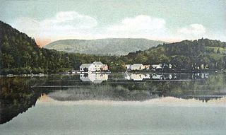
Waterford Flat is a historic village in the town of Waterford in Oxford County, Maine, United States. The village has been called by other names in its history, including Sweats Island, Sweet Island, Swetts Island, and Waterford. It is located north of Keoka Lake.
The Lake House is an historic tavern located at the Waterford Flat area of Waterford in Maine. It is an inn and restaurant north of Keoka Lake and near Mount Tire'm.
The Northern Forest Canoe Trail (NFCT) is a 740-mile (1,190 km) marked canoeing trail in the northeastern United States and Canada, extending from Old Forge in the Adirondacks of New York to Fort Kent, Maine. Along the way, the trail also passes through the states and provinces of Vermont, Quebec, and New Hampshire. The trail was opened on June 3, 2006.
Pleasant River is a 4.7-mile-long (7.6 km) river in Oxford County, Maine in the United States. It is a tributary of the Androscoggin River, which flows east and south to join the Kennebec River in Merrymeeting Bay near the Atlantic Ocean.

Whitney and Thayer Woods is a 834 acres (338 ha) nature reserve and forest located in Cohasset and Hingham, Massachusetts. The property is owned by The Trustees of Reservations. It is adjacent to the Weir River Farm, also owned by The Trustees, and Turkey Hill, a town-owned property managed by The Trustees. The woods include 10 miles (16 km) of walking trails.
There are a number of wind power projects in the state of Maine, totaling more than 900 megawatts (MW) in capacity. In 2020 they were responsible for 24% of in-state electricity production. In 2019, Maine had more wind capacity than the other five New England states combined, at 923 MW.
The Alder River is a 6.3-mile-long (10.1 km) river in Maine. A tributary of the Androscoggin River, the Alder flows west from Locke Mills to Bethel.
The Bear River is a 2.7-mile-long (4.3 km) tributary of Long Lake in the U.S. state of Maine. It originates at the outlet of Bear Pond in the town of Waterford in Oxford County, then flows southeast into the town of Bridgton in Cumberland County and finally the town of Harrison, where it reaches Long Lake. Via Long Lake, the Songo River, and Sebago Lake, the Bear River is part of the Presumpscot River watershed, flowing to Casco Bay on the Atlantic Ocean.
The Crooked River is a 58.0-mile-long (93.3 km) tributary of the Songo River in Maine. It is the longest of the tributaries of Sebago Lake, the outlet of which is the Presumpscot River, flowing to Casco Bay on the Atlantic Ocean.
The East Branch Pleasant River is a 6.2-mile-long (10.0 km) tributary of the Pleasant River in the U.S. state of Maine. The Pleasant River is a tributary of the Androscoggin River, which flows southeast to the tidal Kennebec River and the Atlantic Ocean.
The Little Androscoggin River is a 51.4-mile-long (82.7 km) river in Maine. It flows from Bryant Pond in Woodstock to its confluence with the Androscoggin River in Auburn. The Androscoggin flows into Merrymeeting Bay in the Kennebec River estuary.

The Little Ossipee River is a 33.7-mile-long (54.2 km) tributary of the Saco River in southwestern Maine, USA.
The Neoutaquet River is a 7.8-mile-long (12.6 km) tributary of the Great Works River in southern Maine. It flows entirely within the town of North Berwick. Via the Great Works and Salmon Falls rivers, it is part of the Piscataqua River watershed, flowing ultimately to the Atlantic Ocean.
The South Branch Dead River is a 26.3-mile-long (42.3 km) tributary of the Dead River in Franklin County, Maine.
The South Branch Sandy River is a short tributary of the Sandy River in Franklin County, Maine. From its source on Blueberry Mountain in Berlin, the river runs 7.4 miles (11.9 km) northeast to its confluence with the Sandy River in Phillips.
The South Branch Sunday River is a 2.5-mile-long (4.0 km) mountain stream in western Maine. It is a tributary of the Sunday River, which flows to the Androscoggin River and ultimately to the Kennebec River and the Atlantic Ocean.
The Swift Cambridge River is a 15.3-mile-long (24.6 km) river in northwestern Maine. It rises near the New Hampshire border, north of Grafton Notch, and flows north to the Dead Cambridge River, a tributary of Umbagog Lake. The Androscoggin River flows from Umbagog to the tidal Kennebec River in Maine.
The West Branch Ellis River is a 13.5-mile-long (21.7 km) river in western Maine. It is a tributary of the Ellis River, which flows to the Androscoggin River and ultimately to the Kennebec River near its mouth at the Atlantic Ocean.

Bab az-Zahra is an Arab neighborhood in East Jerusalem, north of the Old City. It is bordered by the American Colony to the north, Wadi al-Joz to the east, Herod's Gate and Damascus Gate on its south, and Mas'udiyyah and Mea Shearim to the west. Herod's Gate, which is called Bab az-Zahra in Arabic, lent its name to this neighborhood.
References
44°13′54″N70°46′07″W / 44.23167°N 70.76861°W
