Mammoth Road

Last updated • 3 min readFrom Wikipedia, The Free Encyclopedia

Mammoth Road

Mammoth Road Map.svg
Map of southern New Hampshire with Mammoth Road highlighted in solid red and of northern Massachusetts with Mammoth Road highlighted in dotted red
Route information
Length29.3 mi (47.2 km)
Component
highways
Major junctions
South endPawtucket Street and School Street in Lowell, MA
Major intersections
North endUS 3 square.svgNH Route 28.svg US 3  / NH 28, Hooksett, NH
Location
Country United States
States Massachusetts, New Hampshire
CountiesMA: Middlesex
NH: Hillsborough, Rockingham, Merrimack
Highway system
Looking north along Mammoth Road at its intersection with Riverside Street with Pawtucket Congregational Church visible Looking north on Mammoth Road at intersection with Varnum Avenue; Lowell, MA; 2012-05-19.JPG
Looking north along Mammoth Road at its intersection with Riverside Street with Pawtucket Congregational Church visible

Mammoth Road is a north–south road in Massachusetts and New Hampshire. The road runs from its origin in Lowell, Massachusetts to its northern end in Hooksett, New Hampshire, a suburb of Manchester. The total length of the road is 29.3 miles (47.2 km). It was named "Mammoth" in the hope that the convenience of its directness and elimination of smaller connecting roads between thoroughfares would result in sufficient use and prestige as to "kill all the other roads". [1] [2]

Contents


Route description

Mammoth Road begins in Middlesex County, in the center of Lowell, at an intersection with Pawtucket Street and School Street. This is located on the south bank of the Merrimack River, and near the campus of the University of Massachusetts Lowell. The road proceeds to cross over the river on the O'Donnell Bridge, and immediately intersects Route 113 (Riverside Street, Varnum Avenue), which leads to Tyngsboro in the west and Lawrence in the east. After intersecting, the road runs north into the town of Dracut, passing through an intersection with Nashua Road and Meghan Lane, and another one with Lakeview Avenue. The intersection with Lakeview Avenue is known as Costello Square, named after James F. Costello, who was a resident of Dracut lost in World War I. [3] After passing through the square, the road leaves Massachusetts and crosses into the state of New Hampshire. Mammoth Road becomes New Hampshire Route 128 (NH 128), and enters the town of Pelham, which is in Hillsborough County.

In Pelham, Mammoth Road travels past an intersection with Sherburne Road, connecting to Hudson, and immediately comes to a Y Junction with NH 111A (Marsh Road), which leads to the center of Pelham. Further up, the road comes to an intersection with Keyes Hill Road and Tallant Road, before crossing the county line into Rockingham County and into the town of Windham.

While spending a short time in Windham, Mammoth Road does intersect NH 111 (Haverhill Road), which leads to the center of Hudson going westbound and the center of Windham going eastbound. After this intersection, the road enters the town of Londonderry, passing through its southern part before intersecting NH 102 (Nashua Road). This leads to Hudson going westbound and Derry going eastbound. Once through the intersection, the road passes through the center of Londonderry, and continues into the northern part of town, passing through an intersection with Lichfield Road and Stonehenge Road.

Shortly after, Mammoth Road merges with NH 28 (Rockingham Road), which leads to Derry going southbound, and the city of Manchester going northbound. This point is the northern terminus of NH 128. Rockingham Road continues north, while Mammoth Road veers to the left and parallels Rockingham Road. At the northern end of this stretch, Mammoth Road once again connects with Rockingham Road until NH 28A. At this point, Mammoth Road follows NH 28A and NH 28 becomes South Willow Street, heading north-northwest into downtown Manchester. Here, the road is South Mammoth Road.

Once in Manchester, South Mammoth Road passes by various communities before approaching an underpass with I-293 and NH 101. After passing under this, South Mammoth Road travels through the eastern side of downtown Manchester. The road has back-to-back intersections with Huse Road and Cilley Road. At this point, South Mammoth Road drops the "South" name and returns back to Mammoth Road. The road then goes through several other intersections with Candia Road, Massabesic Street / Wayland Avenue, Lake Avenue, and Hanover Street. Once through these intersections, the road meets up with Bridge Street, which is a major east-west throughfare connecting to the center of downtown Manchester and I-93. After this stretch, the road exits downtown and merges with Smyth Road, which comes from the southwest. Mammoth Road then approaches an overpass with I-93. After passing over, Smyth Road breaks off and continues to the east, while Mammoth Road crosses the county line into Merrimack County and into the town of Hooksett.

Though originally slated to continue its northward track to Concord, [4] Mammoth Road comes to its final intersection with US 3/NH 28, which leads back down to downtown Manchester going southbound, and up toward Concord going northbound.

Major intersections

CountyLocationmikmDestinationsNotes
Middlesex Lowell 0.00.0Pawtucket Street, School StreetSouthern terminus of Mammoth Road
0.20.32MA Route 113.svgTo plate.svg
MA Route 110.svg
Route 113 (Riverside Street, Varnum Ave) to Route 110  Lawrence, Tyngsboro
Dracut 1.72.7Nashua Road, Meghan Lane
2.84.5Lakeview AvenueCostello Square
Massachusetts–New Hampshire state line3.96.3Southern terminus of NH 128
Southern end of NH 128 concurrency
Hillsborough Pelham 4.36.9Sherburne Road
4.57.2NH Route 111A.svgTo plate.svg
NH Route 38.svg
NH 111A (Marsh Road) to NH 38  Pelham, Salem
Western terminus of middle segment of NH 111A
9.415.1Keyes Hill Road, Tallant Road
Rockingham Windham 11.718.8NH Route 111.svg NH 111 (Haverhill Road) Hudson, Salem
Londonderry 14.924.0NH Route 102.svgTo plate blue.svg
I-93.svg
NH 102 (Nashua Road) to I-93  Hudson, Derry
20.032.2South plate.svg
NH Route 28.svg
To plate blue.svg
I-93.svg
NH 28 south (Rockingham Road) to I-93  Derry
Northern end of NH 128 concurrency; northern terminus of NH 128
21.634.8North plate.svg
NH Route 28.svg
NH 28 north (South Willow Street) Manchester
Southern end of NH 28A concurrency; southern terminus of NH 28A
Hillsborough Manchester 24.539.4Huse Road
24.539.4Cilley RoadSouth Mammoth Road becomes Mammoth Road
25.040.2To plate blue.svg
South plate blue.svg
I-93.svg
Candia Road to I-93 south
25.040.2Massabesic Street, Wayland Ave
25.641.2Lake Avenue
25.641.2Hanover Street
26.242.2To plate blue.svg
I-93.svg
Bridge Street to I-93  Concord, Salem
27.343.9Smyth Road west
27.544.3Smyth Road east
Merrimack Hooksett 29.347.2US 3 square.svgNH Route 28.svg US 3 (Hooksett Road) / NH 28  Manchester, Concord Northern terminus of NH 28A
1.000 mi = 1.609 km; 1.000 km = 0.621 mi

See also

Related Research Articles

<span class="mw-page-title-main">Interstate 93</span> Interstate Highway in New England

Interstate 93 (I-93) is an Interstate Highway in the New England states of Massachusetts, New Hampshire, and Vermont in the United States. Spanning approximately 190 miles (310 km) along a north–south axis, it is one of three primary Interstate Highways located entirely within New England; the other two are I-89 and I-91. The largest cities along the route are Boston, Massachusetts, and Manchester, New Hampshire; it also travels through the New Hampshire state capital of Concord.

<span class="mw-page-title-main">Pelham, New Hampshire</span> Town in New Hampshire, United States

Pelham is a town in Hillsborough County, New Hampshire, United States. The population was 14,222 at the 2020 census, up from 12,897 at the 2010 census.

<span class="mw-page-title-main">Derry, New Hampshire</span> Town in New Hampshire, US

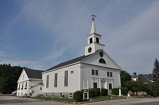
Derry is a town in Rockingham County, New Hampshire, United States. The population was 34,317 at the 2020 census. Although it is a town and not a city, Derry is the most populous community in Rockingham County and the fourth most populous in the state. The town's nickname, "Spacetown", derives from the fact that Derry is the birthplace of Alan Shepard, the first astronaut from the United States in space. Derry was also for a time the home of the poet Robert Frost and his family.

<span class="mw-page-title-main">U.S. Route 3</span> Highway in the United States

U.S. Route 3 (US 3) is a United States Numbered Highway running 277.90 miles (447.24 km) from Cambridge, Massachusetts, through New Hampshire, to the Canada–US border near Third Connecticut Lake, where it connects to Quebec Route 257.

<span class="mw-page-title-main">New Hampshire Route 1A</span>

New Hampshire Route 1A is an 18.32-mile (29.48 km) long state highway located in southeast New Hampshire. The route runs along the Atlantic coastline from the Massachusetts border north to Rye, then turns toward downtown Portsmouth. The southern terminus is at the Massachusetts state line in Seabrook where it continues south as Massachusetts Route 1A. The northern terminus is at a junction with U.S. Route 1 in downtown Portsmouth. For the length of the road's run along the shore, its local name is Ocean Boulevard. In the northern part of Rye, it is known as Pioneer Road, and in Portsmouth, it is known as Miller Avenue and Sagamore Avenue.

<span class="mw-page-title-main">New Hampshire Route 3A</span> Highway in New Hampshire

New Hampshire Route 3A is a designation held by two separate state highways in New Hampshire. The two segments, although not directly connected, are linked by U.S. Route 3, from which they derive their route number.

The Frederick E. Everett Turnpike, also called the Central New Hampshire Turnpike, is a toll road in the U.S. state of New Hampshire, running 39 miles (63 km) from the Massachusetts border at Nashua north to Concord. The Everett Turnpike is named for Frederick Elwin Everett, the first commissioner of the New Hampshire Department of Transportation.

<span class="mw-page-title-main">New Hampshire Route 111</span> State highway in southeastern New Hampshire, US

New Hampshire Route 111 is a 50.027-mile-long (80.511 km) east–west highway in Hillsborough and Rockingham counties in southeastern New Hampshire. The road runs from the Massachusetts border at Hollis to North Hampton on the Atlantic shore.

<span class="mw-page-title-main">New Hampshire Route 101</span> East-west highway in southern New Hampshire, U.S.

New Hampshire Route 101 is a state-maintained highway in southern New Hampshire extending from Keene to Hampton Beach. It is the major east–west highway in the southern portion of the state. Most of its eastern portion is a major freeway linking the greater Manchester area to the Seacoast Region. At 95.189 miles (153.192 km) in length, NH 101 nearly spans the entire width of southern New Hampshire.

<span class="mw-page-title-main">New Hampshire Route 27</span> State highway in southeastern New Hampshire, US

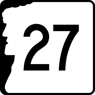
New Hampshire Route 27 is a 37.621-mile-long (60.545 km) long east–west highway in southeastern New Hampshire. The western terminus of NH 27 is in Hooksett at U.S. Route 3 and New Hampshire Route 28 north of Manchester. The eastern terminus is in Hampton Beach at New Hampshire Route 1A, which runs along the New Hampshire coastline adjacent to the Atlantic Ocean.

<span class="mw-page-title-main">New Hampshire Route 28</span> State highway in eastern New Hampshire, US

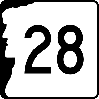
New Hampshire Route 28 is an 85.413-mile-long (137.459 km) north–south state highway in eastern New Hampshire. It connects the town of Ossipee in east-central New Hampshire with Salem on the Massachusetts border, while passing through Manchester, the largest city in the state.

<span class="mw-page-title-main">New Hampshire Route 38</span> State highway in southern New Hampshire, US

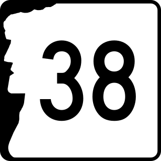
New Hampshire Route 38 is an 8.7-mile-long (14.0 km) north–south state highway in extreme southern New Hampshire. It is the main road connecting Pelham with Salem.

<span class="mw-page-title-main">New Hampshire Route 102</span> State highway in southern New Hampshire, US

New Hampshire Route 102 is a 23.956-mile-long (38.553 km) state highway in Rockingham and Hillsborough counties in the southern part of the U.S. state of New Hampshire. NH 102 runs southwest to northeast between Hudson and Raymond, but is signed as an east–west route.

<span class="mw-page-title-main">New Hampshire Route 107</span> State highway in eastern New Hampshire, US

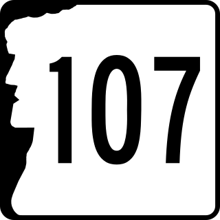
New Hampshire Route 107 is a 69.108-mile-long (111.219 km) north–south state highway in eastern New Hampshire. It connects Laconia in the Lakes Region with Seabrook on the Atlantic coast. The southern terminus of NH 107 is at U.S. Route 1 in Seabrook near the entrance to Seabrook Station Nuclear Power Plant. The northern terminus is at U.S. Route 3 on the Laconia/Gilford town line.

<span class="mw-page-title-main">New Hampshire Route 108</span> Highway in New Hampshire and Massachusetts

New Hampshire Route 108 is a 42.430-mile-long (68.284 km) north–south state highway in Rockingham and Strafford counties in southeastern New Hampshire. The southern terminus of NH 108 is at the Massachusetts state line in Plaistow. The northern terminus is at an intersection with New Hampshire Route 125 and New Hampshire Route 202A in downtown Rochester.

<span class="mw-page-title-main">New Hampshire Route 125</span> State highway in southeastern New Hampshire, US

New Hampshire Route 125 is a 51.994-mile-long (83.676 km) north–south state highway in Rockingham, Strafford and Carroll counties in southeastern New Hampshire. The southern terminus is in Plaistow at the Massachusetts state line, where the road continues south into Haverhill as Massachusetts Route 125. The northern terminus is in Wakefield at New Hampshire Route 16 and New Hampshire Route 153.

<span class="mw-page-title-main">New Hampshire Route 128</span> State highway in southeastern New Hampshire, US

New Hampshire Route 128 is a 16.059-mile-long (25.844 km) north–south highway in southeastern New Hampshire. NH 128 runs from the Massachusetts border in Pelham northward to Londonderry, south of Manchester. NH 128 is named Mammoth Road throughout its entire length.

<span class="mw-page-title-main">New Hampshire Route 202A</span> Highway in New Hampshire

New Hampshire Route 202A (NH 202A) is a 14.639-mile-long (23.559 km) east–west state highway in Strafford and Rockingham counties in southeastern New Hampshire, serving as a northern loop of U.S. Route 202. Its western terminus is in Northwood at US 202 and New Hampshire Route 9, and its eastern terminus is in Rochester at New Hampshire Route 108 and New Hampshire Route 125.

<span class="mw-page-title-main">Massachusetts Route 113</span> State highway in Massachusetts, US

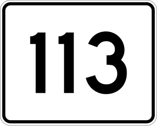
Route 113 is a 50.53-mile-long (81.32 km) east–west Massachusetts state route that connects towns in the Merrimack River valley in northeastern Massachusetts. Its western terminus is at Route 119 in Pepperell, and its eastern end is at U.S. Route 1 and Route 1A in Newburyport.

<span class="mw-page-title-main">Massachusetts Route 97</span> State highway in Essex County, Massachusetts, US

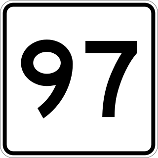
Route 97 is a south–north highway in Essex County in northeastern Massachusetts, United States. It connects the cities of Beverly and Haverhill before continuing into Salem, New Hampshire as New Hampshire Route 97.

References

  1. Oliphant, Charles H. (September 1900). "Methuen, Massachusetts". New England Magazine. Archived from the original (Reprint) on February 21, 2007. Retrieved March 18, 2007.
  2. Master Plan Committee (August 5, 2002). "Chapter VII: Historic Resources (B. Historical Background)" (PDF). Town of Pelham NH Master Plan. p. 1. Retrieved March 18, 2007.
  3. Duda, Rebecca (August 6, 2021). "The story of Dracut's Costello Square". Lowell Sun. Retrieved March 2, 2022.
  4. Potter, C.E. (1856). "Chapter XXIV". History of Manchester. Manchester: C.E. Potter. Archived from the original on July 4, 2011. Retrieved March 18, 2007 via USGenNet.
Template:Attached KML/Mammoth Road
KML is from Wikidata