Related Research Articles

Bernville is a borough in Berks County, Pennsylvania. The population was 955 at the 2010 census. Bernville is bordered by Penn Township to the north, east, and south and by Jefferson Township to the west.

East Pikeland Township is a township in Chester County, Pennsylvania, United States. The population was 7,079 at the 2010 census.

Lower Allen Township is a township in Cumberland County, Pennsylvania, United States. The population was 17,980 at the 2010 census.

East Hanover Township is a township in Dauphin County, Pennsylvania, United States. The population was 6,009 at the 2020 census.

Lower Paxton Township is a township of the second class in Dauphin County, Pennsylvania. The population was 53,501 at the 2020 census. It is the most populous municipality in Dauphin County, exceeding that of Harrisburg, the state capital, and the 13th most populated municipality in the state.

Skyline View is an unincorporated community and census-designated place (CDP) in West Hanover Township, Dauphin County, Pennsylvania, United States. The population was 4,003 at the 2010 census, up from 2,307 at the 2000 census. It is part of the Harrisburg–Carlisle Metropolitan Statistical Area.

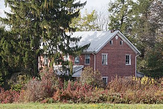
South Hanover Township is a township in Dauphin County, Pennsylvania, United States. The population was 7,200 at the 2020 census, up from 6,248 at the 2010 census.

Tamaqua is a borough in eastern Schuylkill County in the Coal Region of Pennsylvania, United States. It had a population of 6,934 as of the 2020 U.S. census.
Jenner Township is a township in Somerset County, Pennsylvania. The population was 3,703 at the 2020 census. It is part of the Johnstown, Pennsylvania, Metropolitan Statistical Area.

Pennsylvania Route 39 (PA 39) is a 17.83-mile-long (28.69 km) state highway located in Dauphin County, Pennsylvania, United States. PA 39 runs from North Front Street near Harrisburg east to U.S. Route 322 (US 322) and US 422 near Hummelstown and Hershey. The route passes through the northern and eastern suburbs of Harrisburg and passes by Hersheypark, Giant Center, as well as the primary production factory for The Hershey Company. Between Harrisburg and Manada Hill, it is known as Linglestown Road, from Manada Hill to Hershey as Hershey Road and from Hershey to near Hummelstown and Hershey as Hersheypark Drive. Prior to the establishment of PA 39 in 1937, PA 39, had previously been designated as a route in northeastern Pennsylvania during the 1920s. That designation was deleted when it was renumbered US 11. As a result, PA 39 is one of a few routes which has a set of child routes which are no where near the primary route.
Pine Creek is a tributary of Mahantango Creek in Schuylkill and Dauphin counties, Pennsylvania, in the United States. It is approximately 23.7 miles (38.1 km) long. The creek flows through Foster Township, Hegins Township, Hubley Township, and Upper Mahantango Township in Schuylkill County and Lykens Township in Dauphin County. The creek's watershed has an area of 76.8 square miles (199 km2) and its tributaries include Rausch Creek and Deep Creek. Pine Creek is considered by the Pennsylvania Department of Environmental Protection to be impaired by abandoned mine drainage and resource extraction. However, it is designated as a coldwater fishery.

Pennsylvania Route 443 is an 80-mile-long (130 km) east–west state highway in the US state of Pennsylvania. The western terminus is at an intersection with State Route 3009 at North Front Street on the east bank of the Susquehanna River in the community of Fort Hunter in Middle Paxton Township, just west of an interchange with the U.S. Route 22 /US 322 freeway. The eastern terminus is at US 209 in Lehighton. The route runs through rural areas in the Ridge-and-Valley Appalachians in Dauphin, Lebanon, Schuylkill, and Carbon counties, serving Fort Indiantown Gap, Pine Grove, Schuylkill Haven, Orwigsburg, New Ringgold, and South Tamaqua. PA 443 intersects several major roads, including US 22/US 322 near its western terminus, PA 72 in Union Township, Interstate 81 (I-81) near Pine Grove, PA 61 between Schuylkill Haven and Orwigsburg, and PA 309 in South Tamaqua.

Beggarstown or Bettelhausen was a small community that was located in the present day neighborhood of Mount Airy in Northwest Philadelphia in the U.S. state of Pennsylvania. It centered primarily along a stretch of relatively flat land along Germantown Avenue roughly between Upsal Street and Gorgas Lane.

Manada Creek is a 17.0-mile-long (27.4 km) tributary of Swatara Creek in Dauphin County, Pennsylvania in the United States. The watershed drains approximately 32 sq mi (83 km). The name is derived the Lenape word "menatey", meaning "island".
Bow Creek is a 7.8-mile-long (12.6 km) tributary of Swatara Creek in Dauphin County, Pennsylvania, in the United States.

Union Deposit is an unincorporated community and census-designated place in South Hanover Township, Dauphin County, Pennsylvania, United States. It is part of the Harrisburg–Carlisle Metropolitan Statistical Area. As of the 2010 census the population of Union Deposit was 407 residents.

Sand Beach is an unincorporated community in South Hanover Township, Dauphin County, Pennsylvania, United States, situated in the Harrisburg-Carlisle Metropolitan Statistical Area, in the vicinity of the census-designated place of Hershey. It lies at the point where the smaller Manada Creek joins the Swatara Creek.
Ono is an unincorporated community in East Hanover Township, Lebanon County, Pennsylvania, United States, on U.S. Route 22 and approximately two miles southwest of the junction of Interstate 78 and Interstate 81. The Swatara Creek to the south drains into the Susquehanna River. While Ono has its own post office, with the zip code of 17077, some residents are served by the Annville or Jonestown post office, with the zip codes of 17003 or 17038, respectively.
Lickdale, previously known as Union Forge, is an unincorporated community in northern Lebanon County, Pennsylvania, United States. It is a village approximately three miles west of Fredericksburg, Pennsylvania, and was named for James Lick. Lickdale was a prominent 19th century canal port along a branch of the Union Canal and contained a large commercial ice house. It is on the Swatara Creek and serves as a southern gateway to Swatara State Park. It is located in Union Township and Route 72 has an interchange with Interstate 81 via Fisher Avenue. It is served by the Jonestown post office with the zip code of 17038.
Manada may refer to:
References
- ↑ U.S. Geological Survey Geographic Names Information System: Manada Hill, Pennsylvania
- ↑ Notes and Queries, Historical, Biographical and Genealogical, Relating Chiefly to Interior Pennsylvania. Harrisburg Publishing Company. 1895. pp. 14–.
