Derry Township, Pennsylvania | |
---|---|
Motto: "Where It's Just Sweeter" [1] | |
Coordinates: 40°16′N76°38′W / 40.267°N 76.633°W | |
Country | United States |
State | Pennsylvania |
County | Dauphin |
Settled | 1717 |
Incorporated | 1729 |
Government | |
• Type | Board of Commissioners |
Area | |
• Total | 27.40 sq mi (70.96 km2) |
• Land | 27.20 sq mi (70.45 km2) |
• Water | 0.20 sq mi (0.50 km2) |
Population | |
• Total | 24,796 |
24,846 | |
• Density | 919.94/sq mi (355.19/km2) |
Time zone | UTC-5 (Eastern (EST)) |
• Summer (DST) | UTC-4 (EDT) |
Area code | 717 |
FIPS code | 42-043-18936 |
Website | www |
Derry Township is a township in Dauphin County, Pennsylvania, United States. The population was 24,796 at the 2020 census, [3] an increase over the figure of 24,679 tabulated in 2010. Hershey, the site of the well-known Hershey's chocolate factory and its affiliated amusement park, is located within the township. Pennsylvania State University's Milton S. Hershey Medical Center and the Penn State Hershey Children's Hospital are also located on a large tract of land in the township.
The earliest recorded information about the Derry Township area dates back to 1608, when Captain John Smith explored the region. [4] Leaving Jamestown to search for much-needed food, Smith's journey through the Chesapeake Bay region covered an estimated 3,000 miles. [5]
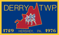
The Township of Derry was incorporated on August 1, 1729, by John, Thomas, and Richard Penn, the sons of William Penn and Proprietors of Pennsylvania. They established Derry Township, along with other townships, to partition Lancaster County's territory for tax purposes. Lancaster County itself had been created earlier that same year.
At that time, the boundaries of Derry Township were much larger and included what are currently three other townships within Lancaster County and Dauphin County (which included Lebanon County). The township's boundaries extended from the mouth of the Conewago to the mouth of the Swatara in the west, then to the mouth of the Quittapahilla in the north, south in a straight line to the Conewago, and west along the river back to the starting point. [4]
The first official government in Derry Township was established in 1759. Five officials were elected for one-year terms. The number of elected officials in Derry remains five, although the terms are now six years.
In 1767 the court ordered the division of Derry Township, the eastern section to remain Derry and the western to be Londonderry Township. [6]
Derry and Londonderry became a part of Dauphin County when it was established in 1785. In 1787, the township's population was 198. Conewago Township was created in 1850 from southern parts of Derry Township and eastern parts of Londonderry Township.
The Derry Session House and Enclosure and Quarries of the Hummelstown Brownstone Company are listed on the National Register of Historic Places. [7]
Derry Township is located in southeastern Dauphin County, bordered to the east by Lebanon County. Swatara Creek forms the northwest border of the township, except where the border is with the borough of Hummelstown. The unincorporated community of Hershey occupies the center, northern, and much of the eastern part of the township, and Palmdale is in the northeastern part of the township. Both Hershey and Palmdale are census-designated places (CDPs). Swatara and Hockersville are unincorporated communities within the western and southern parts, respectively, of the Hershey CDP. Oakmont is near the intersection of Waltonville and Wood Roads, Waltonville is in the southern part of the township, and Clifton is partially in the southwest corner.
According to the United States Census Bureau, Derry Township has a total area of 27.4 square miles (71.0 km2), of which 27.2 square miles (70.5 km2) is land and 0.2 square miles (0.5 km2), or 0.71%, is water. [8] Derry has a hot-summer humid continental climate (Dfa) and the hardiness zones are 6b and 7a. Average monthly temperatures in Hershey range from 30.1 °F in January to 74.8 °F in July.
Census | Pop. | Note | %± |
---|---|---|---|
1940 | 8,653 | — | |
1950 | 9,993 | 15.5% | |
1960 | 12,388 | 24.0% | |
1970 | 15,452 | 24.7% | |
1980 | 18,115 | 17.2% | |
1990 | 18,408 | 1.6% | |
2000 | 21,273 | 15.6% | |
2010 | 24,679 | 16.0% | |
2020 | 24,796 | 0.5% | |
2021 (est.) | 24,846 | [3] | 0.2% |
U.S. Decennial Census [9] [10] [11] |
As of the census [12] of 2000, there were 21,273 people, 8,861 households, and 5,688 families residing in the township. The population density was 784.0 inhabitants per square mile (302.7/km2). There were 9,481 housing units at an average density of 349.4 per square mile (134.9/km2). The racial makeup of the township was 92.65% White, 1.67% African American, 0.07% Native American, 3.96% Asian, 0.02% Pacific Islander, 0.43% from other races, and 1.19% from two or more races. Hispanic or Latino of any race were 1.40% of the population.
There were 8,861 households, out of which 28.5% had children under the age of 18 living with them, 54.6% were married couples living together, 7.0% had a female householder with no husband present, and 35.8% were non-families. 30.4% of all households were made up of individuals, and 12.6% had someone living alone who was 65 years of age or older. The average household size was 2.32 and the average family size was 2.92.
In the township the population was spread out, with 22.9% under the age of 18, 6.3% from 18 to 24, 28.9% from 25 to 44, 23.5% from 45 to 64, and 18.4% who were 65 years of age or older. The median age was 40 years. For every 100 females, there were 89.6 males. For every 100 females age 18 and over, there were 85.6 males.
The median income for a household in the township was $52,290, and the median income for a family was $68,838. Males had a median income of $48,510 versus $32,430 for females. The per capita income for the township was $31,365. About 2.8% of families and 4.7% of the population were below the poverty line, including 4.1% of those under age 18 and 4.2% of those age 65 or over.
Derry Township has its own public works department; public library, the Hershey Public Library; and its own police force, the Derry Township Police Department. Derry Township is also home to Hershey Entertainment and Resorts Company (HERCO) which owns Hersheypark and other tourist attractions.
Dauphin County is a county in the Commonwealth of Pennsylvania. As of the 2020 census, the population was 286,401. The county seat is Harrisburg, Pennsylvania's state capital and ninth-most populous city. The county was created on March 4, 1785, from part of Lancaster County and was named after Louis Joseph, Dauphin of France, the first son of King Louis XVI. The county is part of the South Central Pennsylvania region of the state.
Conewago Township is a township in Dauphin County, Pennsylvania, United States. The population was 2,997 at the 2010 census.
East Hanover Township is a township in Dauphin County, Pennsylvania, United States. The population was 6,009 at the 2020 census.
Hummelstown is a borough in Dauphin County, Pennsylvania, United States. The population was 4,535 as of the 2020 census. It is part of the Harrisburg–Carlisle Metropolitan Statistical Area.
Lawnton is an unincorporated area and census-designated place (CDP) in Swatara Township, Dauphin County, Pennsylvania, United States. The population was 3,813 at the 2010 census. It is part of the Harrisburg–Carlisle Metropolitan Statistical Area.
Londonderry Township is a township in Dauphin County, Pennsylvania, United States. The population was 4,890 at the 2020 census.
Lower Paxton is a township in Dauphin County, Pennsylvania, United States. The population was 53,501 at the 2020 census. It is the most populous municipality in Dauphin County and the 17th-most populated municipality in the state.
Lower Swatara Township is a township in Dauphin County, Pennsylvania, United States. The population was 9,557 at the 2020 census. Harrisburg International Airport and Penn State Harrisburg are located within the township. It shares a ZIP Code with the nearby borough of Middletown, and all locations in the township have Middletown addresses.
Middletown is a borough in Dauphin County, Pennsylvania, on the Susquehanna River, 10 miles (16 km) southeast of Harrisburg. As of the 2020 census, it had a population of 9,550. It is part of the Harrisburg–Carlisle Metropolitan Statistical Area.
Rutherford is a census-designated place (CDP) in Swatara Township, Dauphin County, Pennsylvania, United States. The area is also known as Rutherford Heights. The population was 4,303 at the 2010 census, an increase over the figure of 3,859 tabulated in 2000. It is part of the Harrisburg–Carlisle Metropolitan Statistical Area.
South Hanover Township is a township in Dauphin County, Pennsylvania, United States. The population was 7,200 at the 2020 census, an increase over the figure of 6,248 tabulated in 2010.
Swatara Township is a township in Dauphin County, Pennsylvania. The population was 27,824 at the 2020 census.
West Donegal Township is a township in northwestern Lancaster County, Pennsylvania, United States. The population was 8,870 at the 2020 census.
Bethel Township is a township in Lebanon County, Pennsylvania, United States. It is part of the Lebanon, Pennsylvania Metropolitan Statistical Area. The population was 5,007 at the 2010 census. Fredericksburg is a census-designated place within the township.
Campbelltown is an unincorporated community and census-designated place (CDP) in Lebanon County, Pennsylvania, United States. The population was 3,616 at the 2010 census. It is located east of Hershey at the intersection of U.S. Route 322 and Pennsylvania Route 117 and is located in the Harrisburg metropolitan area.
North Londonderry Township is a township in Lebanon County, Pennsylvania, United States. It is part of the Lebanon, PA Metropolitan Statistical Area. The population was 8,912 at the 2020 census.
Palmyra is a borough in Lebanon County, Pennsylvania, United States. It is part of the Lebanon, Pennsylvania Metropolitan Statistical Area. The population was 7,807 at the 2020 census.
South Londonderry Township is a township in Lebanon County, Pennsylvania, United States. It is part of the Lebanon, PA Metropolitan Statistical Area. The population was 8,763 at the 2020 census.
Lower Dauphin School District is a midsized, suburban public school district located in Dauphin County, Pennsylvania. The district encompasses approximately 89 square miles (230 km2) and serves the Borough of Hummelstown, as well as the Townships of East Hanover, Londonderry, South Hanover, and Conewago. According to 2000 federal census data, the district served a resident population of 22,546. By 2010, the district's population increased to 24,747 people. The educational attainment levels for the district's population were 91.2% high school graduates and 28.2% college graduates. The district is one of the 500 public school districts of Pennsylvania.
The 106th Pennsylvania House of Representatives District is located in South Central Pennsylvania and has been represented since 2017 by Republican Tom Mehaffie.