Bressler, Pennsylvania | |
|---|---|
Village | |
 Fire station | |
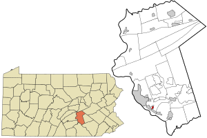 Location in Dauphin County and state of Pennsylvania. | |
| Country | United States |
| State | Pennsylvania |
| County | Dauphin |
| Township | Swatara |
| Area | |
• Total | 0.32 sq mi (0.82 km2) |
| • Land | 0.32 sq mi (0.82 km2) |
| • Water | 0.00 sq mi (0.00 km2) |
| Elevation | 490 ft (150 m) |
| Population | |
• Total | 1,512 |
| • Density | 4,769.72/sq mi (1,842.86/km2) |
| Time zone | UTC-5 (Eastern (EST)) |
| • Summer (DST) | UTC-4 (EDT) |
| ZIP Code | 17113 |
| FIPS code | 42-08432 |
| GNIS feature ID | 1170204 |
Bressler is a Village and census-designated place (CDP) located in Swatara Township, Dauphin County, in the U.S. state of Pennsylvania. The community was formerly part of the census-designated place of Bressler-Enhaut-Oberlin, before splitting into three separate CDPs for the 2010 census. As of the 2010 census the population of Bressler was 1,437. [3]
 Bressler Bible Church
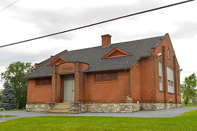 Old school building


Bressler is located in southern Dauphin County, in the southwestern part of Swatara Township. It is part of the Harrisburg–Carlisle metropolitan statistical area. It is bordered to the south by the borough of Steelton, to the west by Enhaut, and to the north by Oberlin. It is 5 miles (8 km) southeast of downtown Harrisburg.

