Provincial Trunk Highway 1 is Manitoba's section of the Trans-Canada Highway. It is a heavily used, 4-lane divided highway, with the exception of a short 18 km section in the southeastern corner of the province. It is the main link between southern Manitoba's largest cities, and also serves as the province's main transportation link to the neighbouring provinces of Saskatchewan and Ontario. The highway is the only major east-west divided highway in Manitoba, and carries a large majority of east-west traffic within and through the province. It has full freeway status sections at Portage la Prairie and Winnipeg. The total distance of the Trans-Canada Highway in Manitoba is approximately 490 km (300 mi).
Provincial Trunk Highway 16 (PTH 16) is a provincial highway in the Canadian province of Manitoba. It is the Manitoba section of the Yellowhead Highway, and also the Trans-Canada Highway Yellowhead section. The main purpose of this highway is to connect Winnipeg with other Canadian cities such as Saskatoon and Edmonton. The highway runs from Bloom at an intersection with the Trans-Canada Highway and Provincial Road 305 ten kilometres (6.2 mi) west of Portage la Prairie to the Saskatchewan boundary sixteen kilometres (9.9 mi) west of Russell, where it continues as Saskatchewan Highway 16.
Provincial Trunk Highway 6 is a provincial primary highway located in the Canadian province of Manitoba. It runs from the Perimeter Highway of Winnipeg to the Thompson south city limits. It is also the main highway connecting Winnipeg to northern Manitoba. The speed limit is 100 km/h. The route is also used to deliver nickel from the Thompson mine to the Royal Canadian Mint in Winnipeg. The section of highway between its southern terminus near Winnipeg and the second junction with PTH 68 near Eriksdale is part of the Northern Woods and Water Route. The portion of the highway between Ponton and Thompson was known as Highway 391 prior to 1986.
Provincial Trunk Highway 8 is a provincial primary highway located in the Canadian province of Manitoba. It runs from the north limit of the City of Winnipeg, where it meets with Route 180, north to Hecla-Grindstone Provincial Park. The highway between Winnipeg and PR 230 is known as McPhillips Street. At PR 230, McPhillips Street becomes McPhillips Road and continues along PR 230 to PTH 9. The route is a major road connecting Winnipeg with the communities of Winnipeg Beach and Gimli. The speed limit is 100 km/h (60 mph).

Provincial Trunk Highway 2 is a 315-kilometre (196-mile) highway in the Canadian province of Manitoba. It runs from Highway 13 at the Manitoba-Saskatchewan border to Winnipeg's Perimeter Highway near Oak Bluff.

Provincial Trunk Highway 3 (PTH 3) is a major provincial highway located in the Canadian province of Manitoba. It runs from the Saskatchewan boundary to the southwest city limits of Winnipeg, where it continues as Winnipeg Route 155. Prior before to the implementation of Winnipeg's City Route System, it extended to Pembina Highway.
Provincial Trunk Highway 5 is a provincial primary highway located in the Canadian province of Manitoba.

Provincial Trunk Highway 10 is a provincial primary highway located in the Canadian province of Manitoba.
Highway 49 and Provincial Trunk Highway 49 is a provincial highway in the Canadian provinces of Saskatchewan and Manitoba. Most of the highway is in the east-central part of Saskatchewan and only a very short section is in Manitoba. It runs from Saskatchewan Highway 35 between the communities of Fosston and Hendon to the Saskatchewan — Manitoba border, before ending at Provincial Trunk Highway 83 south of the community of Benito. The combined highway is about 166.4 kilometres (103.4 mi) in length — 165.2 kilometres (102.7 mi) is in Saskatchewan and 1.2 kilometres (0.7 mi) is in Manitoba.
Provincial Trunk Highway 24 is a provincial highway in the Canadian province of Manitoba. It is an east–west route that runs from PTH 83 near Miniota, east through Oak River and Rapid City to the junction of PTH 10 and PR 262 between Brandon and Minnedosa.
Provincial Trunk Highway 22 is a short north-south provincial highway in the Canadian province of Manitoba. It runs from PTH 23 near Elgin to PTH 2 and PR 250 in Souris. This highway is the main access road to the renowned Souris Swinging Bridge.
Provincial Trunk Highway 25 is a provincial highway in the Canadian province of Manitoba. It is a short east-west route starting at PR 259 at Wheatland, east through Rivers, and terminating at PTH 10 six kilometres (3.7 mi) north of Forrest. PTH 25 serves as the major route, via PTH 10, between Rivers and Brandon.

Provincial Trunk Highway 83 is a 402 kilometres (250 mi) long, major north-south highway that runs in the far western region of the Canadian province of Manitoba. It travels from the North Dakota border south of Melita, north through Virden, Birtle, Russell, and Roblin to its northern terminus with PTH 10 in the town of Swan River. Along with US 83, PTH 83 is part of a continuously numbered north-south highway in North America with a combined distance of 3,450 kilometres (2,140 mi).
Provincial Trunk Highway 50 is a provincial highway in the south-central region of the Canadian province of Manitoba. It runs from PTH 16 to PTH 5 and PR 361 in the village of McCreary.
Provincial Trunk Highway 41 is a short provincial highway in the far southwest region of the Canadian province of Manitoba. It runs from PTH 1 and PR 542 in the village of Kirkella to PTH 16 and PTH 83 just south of Binscarth.
Provincial Trunk Highway 20 is a provincial highway in the Canadian province of Manitoba. It runs from PTH 5 and PR 582 just south of Ochre River to PTH 10 in the village of Cowan. The highway provides an eastern alternative access option to Dauphin along with PTH 20A.

Provincial Road 355 is an east-west provincial road in the Westman Region of the Canadian province of Manitoba.
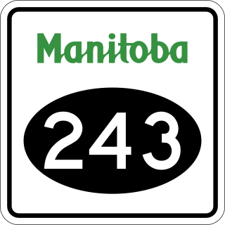
Provincial Road 243 is an east-west provincial road in the Pembina Valley Region of the Canadian province of Manitoba. It runs from PTH 75 near Emerson to PTH 32 near Friedensfeld West. Along the route, it passes north of Gretna using a small concurrence with PTH 30.
Highway 57 and Provincial Trunk Highway 57 are two short highways in the Canadian provinces of Saskatchewan and Manitoba.

Provincial Road 482 is provincial road in the far western part of the Canadian province of Manitoba.
