
Angelina County is a county located in the U.S. state of Texas. It is in East Texas and its county seat is Lufkin.
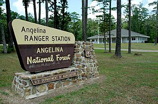
Angelina National Forest is a United States National Forest, one of four located in the piney woods region of Texas. The 153,180-acre (619.9 km2) Angelina National Forest is located in East Texas in parts of San Augustine, Angelina, Jasper and Nacogdoches counties. It is managed together with the three other National Forests in Texas from Forest Service offices in Lufkin, Texas. There are local district offices located in Zavalla. The forest lies in the Neches River Basin and on the north and south shores of Sam Rayburn Reservoir. Longleaf pine is the predominant cover type in the southern portion of the forest, while loblolly and shortleaf pine are dominant species in the northern portion and abundant throughout.

Angelina College is a public community college with its main campus in Lufkin, Texas. It has nine off-campus centers in Crockett, Hemphill, Jasper, Livingston, Nacogdoches, Pineland, San Augustine, Trinity, and Woodville. The college enrolls more than 4,000 students in its undergraduate degree programs. In addition to its academic/vocational programs, the college has a community services division that oversees the college's Adult Education Consortium, Continuing Education Units, and Career Development initiatives.
Flower Hill is a ghost town in Bastrop County, Texas, United States. It is located within the Greater Austin metropolitan area.
Alco is a ghost town in Angelina County, in the U.S. state of Texas. It is located within the Lufkin, Texas micropolitan area.
Beulah is a ghost town in Angelina County, in the U.S. state of Texas. It is located within the Lufkin, Texas micropolitan area.
Boynton is a ghost town in Angelina County, in the U.S. state of Texas. It is located within the Lufkin, Texas micropolitan area.
Concord is a ghost town in Angelina County, in the U.S. state of Texas. It is located within the Lufkin, Texas micropolitan area.
Dunagan is a ghost town in Angelina County, in the U.S. state of Texas. It is located within the Lufkin, Texas micropolitan area.
Durant is a ghost town in Angelina County, in the U.S. state of Texas. It is located within the Lufkin, Texas micropolitan area.
Ewing is a ghost town in Angelina County, Texas, United States. It is located within the Lufkin, Texas, micropolitan area.
Granville is a ghost town in Angelina County, in the U.S. state of Texas. It is located within the Lufkin, Texas micropolitan area.
Monterey is a ghost town in Angelina County, in the U.S. state of Texas. It is located within the Lufkin, Texas micropolitan area.
Nancy is a ghost town in Angelina County, in the U.S. state of Texas. It is located within the Lufkin, Texas micropolitan area.
Ora is a ghost town in Angelina County, in the U.S. state of Texas. It is located within the Lufkin, Texas micropolitan area.
Peavy is a ghost town in Angelina County, in the U.S. state of Texas. It is located within the Lufkin, Texas micropolitan area.
Platt is a ghost town in Angelina County, in the U.S. state of Texas. It is located within the Lufkin, Texas micropolitan area.
Rocky Springs is a ghost town in Angelina County, in the U.S. state of Texas. It is located within the Lufkin, Texas micropolitan area.
Shawnee is a ghost town in Angelina County, in the U.S. state of Texas. It is located within the Lufkin, Texas micropolitan area.
Donahoe is a ghost town in Bell County, in the U.S. state of Texas. It is located within the Killeen-Temple-Fort Hood metropolitan area.


