Mays Lick, Kentucky

Last updated

Mays Lick, Kentucky
USA Kentucky location map.svg
Red pog.svg
Mays Lick
Usa edcp location map.svg
Red pog.svg
Mays Lick
Coordinates: 38°31′01″N83°50′42″W / 38.51694°N 83.84500°W / 38.51694; -83.84500
Country United States
State Kentucky
County Mason
Established1788
Area
[1]
  Total0.64 sq mi (1.66 km2)
  Land0.64 sq mi (1.65 km2)
  Water0.00 sq mi (0.01 km2)
Elevation
[2]
869 ft (265 m)
Population
 (2020) [3]
  Total252
  Density394.98/sq mi (152.42/km2)
Time zone UTC-5 (Eastern (EST))
  Summer (DST) UTC-4 (EDT)
ZIP code
41055 [4]
Area code 606
FIPS code 21-51006
GNIS feature ID2629649 [2]
Other namesMayslick
Mays Spring
New Jersey Colony
William Mays Settlement [2]

Mays Lick(a.k.a.Mayslick, originally known asMay's Lick) is a census-designated place and unincorporated community in Mason County, Kentucky, United States. As of the 2020 census, it had a population of 252. [3]

Contents

History

May's Lick was founded in 1788 by six families from Scotch Plains, New Jersey: [5]

  1. Abraham Drake (1751–1805)
  2. Cornelius Drake (1754–1833)
  3. Isaac Drake (1756–1832), father of (i) Daniel Drake (1785–1852), American physician and author, and (ii) Benjamin Drake (1795–1841), American historian, editor, and writer; Daniel Drake's son, Charles Daniel Drake (1811–1892), was a United States Senator from Missouri and an anti-slavery politician
  4. David Morris (1746–1798) and wife, Mary née Shotwell (1748–1806)
  5. John Shotwell (1753–1826) and wife, Abigail née Shipman (1754–1835)

Abraham, Cornelius, and Isaac Drake were brothers, and John and Mary Shotwell were siblings.

The group purchased 1,400 acres (570 ha) of land from William May (for whom the community was named) near the salt lick in southern Mason County and began to build a community. [6] The Mays Lick Post Office opened in 1800. Kentucky's first consolidated school and first school transportation – consisting of a horse and wagon – was founded in Mays Lick. [7]

When May's Lick was founded (1788), Kentucky was part of the Commonwealth of Virginia. That same year, the Commonwealth of Virginia established Mason County. May's Lick became the name of the town after first being called May's Spring. [8]

Geography

Mays Lick is in southern Mason County, 12 miles (19 km) southwest of downtown Maysville. U.S. Route 68 runs along the eastern edge of the community, leading north to Maysville and to Ohio, and southwest 54 miles (87 km) to Lexington.

According to the U.S. Census Bureau, the Mays Lick CDP has a total area of 0.64 square miles (1.66 km2), of which 0.002 square miles (0.005 km2), or 0.31%, are water. [1] The community is drained by several small streams that flow north to Lees Creek, a north-flowing tributary of the North Fork of the Licking River, which joins the Ohio River at Covington.

Demographics

Historical population
CensusPop.Note
2020 252
U.S. Decennial Census [9]

Mays Lick Consolidated School

The Mays Lick Consolidated School was constructed in 1909–1910 for $32,500 The building was the first high school in Mason County and until 1960, was the only public high school to serve the Mays Lick District. In 1982, the building was added to the National Register of Historic Places. [10]

Also see: May's Lick Negro School

The May family

The same May family for whom the Mason County Seat (Maysville) is named is also the namesake for May's Lick.

The May brothers

Notable residents

See also

Related Research Articles

<span class="mw-page-title-main">Nicholas County, Kentucky</span> County in Kentucky, United States

Nicholas County is a county located in the U.S. state of Kentucky. As of the 2020 census, the population was 7,537. Its county seat is Carlisle, which is also the only incorporated community in the county. Founded in 1799, the county is named for Col. George Nicholas, the "Father of the Kentucky Constitution."

<span class="mw-page-title-main">Mason County, Kentucky</span> County in Kentucky, United States

Mason County is a county located in the U.S. state of Kentucky. As of the 2020 census, the population was 17,120. Its county seat is Maysville. The county was created from Bourbon County, Virginia in 1788 and named for George Mason, a Virginia delegate to the U.S. Constitutional Convention known as the "Father of the Bill of Rights". Mason County comprises the Maysville, KY Micropolitan Statistical Area, which is included in the Cincinnati-Wilmington-Maysville, OH-KY-IN Combined Statistical Area.

<span class="mw-page-title-main">Lewis County, Kentucky</span> County in Kentucky, United States

Lewis County is a county located in the U.S. state of Kentucky. As of the 2020 census, the population was 13,080. Its county seat is Vanceburg.

<span class="mw-page-title-main">Hopkins County, Kentucky</span> County in Kentucky, United States

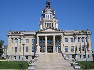
Hopkins County is a county located in the western part of the U.S. state of Kentucky. As of the 2020 census, the population was 45,423. Its county seat is Madisonville. Hopkins County was created December 9, 1806 from Henderson County. It was named for General Samuel Hopkins, an officer in both the American Revolutionary War and War of 1812, and later a Kentucky legislator and U.S. Congressman.

<span class="mw-page-title-main">Bourbon County, Kentucky</span> County in Kentucky, United States

Bourbon County is a county located in the U.S. state of Kentucky. As of the 2020 census, the population was 20,252. Its county seat is Paris. Bourbon County is part of the Lexington–Fayette, KY Metropolitan Statistical Area. It is one of Kentucky's nine original counties, and is best known for its historical association with bourbon whiskey.

<span class="mw-page-title-main">Boone County, Kentucky</span> County in Kentucky, United States

Boone County is a county located on the Ohio River in the northernmost part of the U.S. state of Kentucky. As of the 2020 census, the population was 135,968, making it the fourth-most populous county in Kentucky. Its county seat is Burlington. The county was formed in 1798 from a portion of Campbell County. and was named for frontiersman Daniel Boone. Boone County, with Kenton and Campbell Counties, is of the Northern Kentucky metro area, and the Cincinnati-Middletown, OH-KY-IN Metropolitan Statistical Area. It is the location of the Cincinnati/Northern Kentucky International Airport, which serves Cincinnati and the tri-state area.

<span class="mw-page-title-main">Cynthiana, Kentucky</span> City in Kentucky, United States

Cynthiana is a home rule-class city in Harrison County, Kentucky, in the United States. The population was 6,402 at the 2010 census. It is the seat of its county.

<span class="mw-page-title-main">Vanceburg, Kentucky</span> City in Kentucky, United States

Vanceburg is a home rule-class city in Lewis County, Kentucky, United States, along the Ohio River. The population was 1,428 at the 2020 census. It is the county seat of Lewis County.

<span class="mw-page-title-main">Dover, Kentucky</span> City in Kentucky, United States

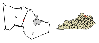
Dover is a home rule-class city in Mason County, Kentucky, United States. The population was 221 at the 2020 census, down from 252 in 2010. It is part of the Maysville Micropolitan Statistical Area.

<span class="mw-page-title-main">Maysville, Kentucky</span> City in Kentucky, United States

Maysville is a home rule-class city in Mason County, Kentucky, United States, and is the seat of Mason County. The population was 8,873 as of the 2020 census. Maysville is on the Ohio River, 66 miles (106 km) northeast of Lexington. It is the principal city of the Maysville Micropolitan Statistical Area, which comprises Mason County. Two bridges cross the Ohio from Maysville to Aberdeen, Ohio: the Simon Kenton Memorial Bridge built in 1931 and the William H. Harsha Bridge built in 2001.

<span class="mw-page-title-main">Sardis, Kentucky</span> City in Kentucky, United States

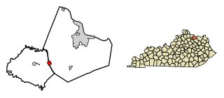
Sardis is a home rule-class city in Mason and Robertson counties in the U.S. state of Kentucky. The population was 60 as of the 2020 census, down from 103 in 2010.

<span class="mw-page-title-main">Martins Ferry, Ohio</span> City in Ohio, United States

Martins Ferry is the largest city in Belmont County, Ohio, United States, along the Ohio River across from Wheeling, West Virginia. The population was 6,260 as of the 2020 census. It is part of the Wheeling metropolitan area.

<span class="mw-page-title-main">Germantown, Kentucky</span> City in Kentucky, United States

Germantown is a home rule-class city in Bracken and Mason counties in the U.S. state of Kentucky. The population was 146 at the 2020 census.

<span class="mw-page-title-main">Battle of Blue Licks</span> Battle in the American Revolutionary War

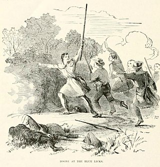
The Battle of Blue Licks, fought on August 19, 1782, was one of the last battles of the American Revolutionary War. The battle occurred ten months after Lord Cornwallis's surrender at Yorktown, which had effectively ended the war in the east. On a hill next to the Licking River in what is now Robertson County, Kentucky, a force of about 50 Loyalists along with 300 indigenous warriors ambushed and routed 182 Kentucky militiamen, who were partially led by Daniel Boone. It was the last victory for the Loyalists and natives during the frontier war. British, Loyalist and Native forces would engage in fighting with American forces once more the following month in Wheeling, West Virginia, during the Siege of Fort Henry.

This is a timeline of Kentucky history.

<span class="mw-page-title-main">Washington Historic District (Washington, Kentucky)</span> Historic district in Kentucky, United States

The Washington Historic District in Washington, Kentucky was listed on the National Register of Historic Places in 1970, and its borders were increased in 1976. The buildings of Washington range from simple log cabins to late Georgian and early Federal styles constructed of home burned brick laid in Flemish Bond. Many houses have double doors at the entrance and a reeded roll length wise under a four light transom.

<span class="mw-page-title-main">U.S. Route 62 in Kentucky</span>

U.S. Route 62 (US 62) in Kentucky runs for a total of 391.207 miles (629.587 km) across 20 counties in western, north-central, and northeastern Kentucky. It enters the state by crossing the Ohio River near Wickliffe, then begins heading eastward at Bardwell, and traversing several cities and towns across the state up to Maysville, where it crosses the Ohio River a second time to enter the state of Ohio.

<span class="mw-page-title-main">Cincinnati metropolitan area</span> Metropolitan area in the United States

The Cincinnati metropolitan area is a metropolitan area centered on the city of Cincinnati and including surrounding counties in the U.S. states of Ohio, Kentucky, and Indiana.

<span class="mw-page-title-main">James Ward (frontiersman)</span> American politician

Captain James Ward was an early American settler, Indian fighter and legislator of Kentucky whose adventures featured heavily in the stories of the western frontier. He was a pall bearer at Daniel Boone's re-interment in 1845.

<span class="mw-page-title-main">John Coburn (1762-1823), Kentucky judge</span> Kentucky Pioneer and Politician

John Coburn was a Kentucky Pioneer, Circuit Court Judge, and Territory Judge.

References

  1. 1 2 "2022 U.S. Gazetteer Files: Kentucky". United States Census Bureau. Retrieved May 9, 2023.
  2. 1 2 3 U.S. Geological Survey Geographic Names Information System: Mays Lick, Kentucky
  3. 1 2 "P1. Race – Mays Lick CDP, Kentucky: 2020 DEC Redistricting Data (PL 94-171)". U.S. Census Bureau. Retrieved May 9, 2023.
  4. "Mays Lick KY". ZIP Code Lookup. Retrieved July 16, 2011.
  5. History of the Scotch Plains Baptist Church, From Its Organization on the Fifth of August 1747 To Its One Hundred and Fiftieth Anniversary , James H. Parks, D.D. (born 1839), and James D. Cleaver, Scotch Plains Baptist Church (publisher (1897), pg. 16; OCLC   12023826
  6. Edith Davis, "Mayslick Once Was Emporium, History Shows", The Daily Independent, (Rotary Club Edition), October 31, 1962
  7. History of Mays Lick Archived 2012-03-15 at the Wayback Machine , by David Lynn (interviewer), Kentucky Oral History Commission, Collection No. 18–19 (1988); OCLC   85841474
  8. The Encyclopedia of Northern Kentucky , Paul Allen Tenkotte, PhD (born 1960) (University of Cincinnati) & James C. Claypool, PhD (born 1938) (Professor Emeritus, Northern Kentucky University) (eds.), (excerpt: May's Lick, by John Robert Klee; born 1954, pps. 593–594), University of Kentucky Press (2009)
  9. "Census of Population and Housing". Census.gov. Retrieved June 4, 2016.
  10. #82002733 National Register of Historic Places
  11. "The May Family," Kentucky Explorer, Vol. 10, No. 5, October 1995, p. 96
  12. "Mason County", The Kentucky Encyclopedia, John E. Kleber, University Press of Kentucky (1992), pg. 614
  13. "May's Lick: Pioneer Town in Kentucky When Lexington was the Western Metropolis," The Daily Evening Bulletin (Maysville, Kentucky), April 17, 1889, pg. 2, col. 2,