Sardis, Kentucky

Last updated
Sardis, Kentucky
Mason County Kentucky Incorporated and Unincorporated areas Sardis Highlighted 2168646.svg
Location in Mason County, Kentucky
Coordinates: 38°32′05″N83°57′26″W / 38.53472°N 83.95722°W / 38.53472; -83.95722
Country United States
State Kentucky
Counties Mason, Robertson
Area
[1]
  Total1.00 sq mi (2.59 km2)
  Land1.00 sq mi (2.59 km2)
  Water0.00 sq mi (0.00 km2)
Elevation
[2]
961 ft (293 m)
Population
 (2020) [3]
  Total60
  Density60.06/sq mi (23.20/km2)
Time zone UTC-5 (Eastern (EST))
  Summer (DST) UTC-4 (EDT)
ZIP code
41056
Area code 606
FIPS code 21-68646
GNIS feature ID2405424 [2]

Sardis is a home rule-class city in Mason and Robertson counties in the U.S. state of Kentucky. The population was 60 as of the 2020 census, [3] down from 103 in 2010.

Contents

Geography

Sardis is located in southwestern Mason County and eastern Robertson County with the majority in Mason County. U.S. Route 62 passes through the center of town, leading northeast 17 miles (27 km) to Maysville, the Mason County seat, and west 5 miles (8 km) to Mount Olivet, the Robertson County seat.

According to the United States Census Bureau, Sardis has a total area of 1.0 square mile (2.6 km2), of which 0.001 square miles (0.003 km2), or 0.1%, are water. [1] Sardis sits on a ridge which drains north to Smith Branch and Shannon Creek, a tributary of the North Fork of the Licking River; and south to Five Lick Creek, a tributary via Johnson Creek of the main stem of the Licking River, which flows northwest to the Ohio River at Covington.

The Mason County portion of Sardis is part of the Maysville micropolitan area.

Demographics

Historical population
CensusPop.Note
1870 149
1880 22450.3%
1890 25513.8%
1900 2570.8%
1910 2611.6%
1930 201
1940 2083.5%
1950 176−15.4%
1960 1908.0%
1970 175−7.9%
1980 19813.1%
1990 171−13.6%
2000 149−12.9%
2010 103−30.9%
2020 60−41.7%
U.S. Decennial Census [4]

As of the census [5] of 2000, there were 149 people, 58 households, and 36 families residing in the city. The population density was 305.1 inhabitants per square mile (117.8/km2). There were 64 housing units at an average density of 131.1 per square mile (50.6/km2). The racial makeup of the city was 99.33% White, and 0.67% from two or more races.

There were 58 households, out of which 27.6% had children under the age of 18 living with them, 37.9% were married couples living together, 20.7% had a female householder with no husband present, and 37.9% were non-families. 31.0% of all households were made up of individuals, and 17.2% had someone living alone who was 65 years of age or older. The average household size was 2.50 and the average family size was 3.08.

In the city, the population was spread out, with 21.5% under the age of 18, 12.1% from 18 to 24, 24.2% from 25 to 44, 21.5% from 45 to 64, and 20.8% who were 65 years of age or older. The median age was 42 years. For every 100 females, there were 75.3 males. For every 100 females age 18 and over, there were 72.1 males.

The median income for a household in the city was $14,886, and the median income for a family was $27,917. Males had a median income of $22,188 versus $14,375 for females. The per capita income for the city was $9,881. There were 14.3% of families and 31.6% of the population living below the poverty line, including 40.0% of under eighteens and 36.0% of those over 64.

Related Research Articles

<span class="mw-page-title-main">Muskingum County, Ohio</span> County in Ohio, United States

Muskingum County is a county located in the U.S. state of Ohio. As of the 2020 census, the population was 86,410. Its county seat is Zanesville. Nearly bisected by the Muskingum River, the county name is based on a Delaware American Indian word translated as "town by the river" or "elk's eye".

<span class="mw-page-title-main">Robertson County, Kentucky</span> County in Kentucky, United States

Robertson County is a county located in the U.S. Commonwealth of Kentucky. As of the 2020 census, the population was 2,193. Its county seat is Mount Olivet. The county is named for George Robertson, a Kentucky Congressman from 1817 to 1821. It is Kentucky's smallest county by both total area and by population.

<span class="mw-page-title-main">Mason County, Kentucky</span> County in Kentucky, United States

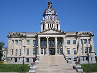
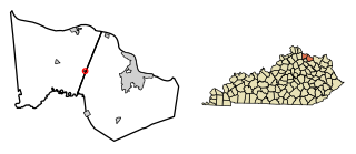
Mason County is a county located in the U.S. state of Kentucky. As of the 2020 census, the population was 17,120. Its county seat is Maysville. The county was created from Bourbon County, Virginia in 1788 and named for George Mason, a Virginia delegate to the U.S. Constitutional Convention known as the "Father of the Bill of Rights". Mason County comprises the Maysville, KY Micropolitan Statistical Area, which is included in the Cincinnati-Wilmington-Maysville, OH-KY-IN Combined Statistical Area.

<span class="mw-page-title-main">Bracken County, Kentucky</span> County in Kentucky, United States

Bracken County is a county located in the U.S. state of Kentucky. As of the 2020 census, the population was 8,400. Its county seat is Brooksville. The county was formed in 1796. Bracken County is included in the Cincinnati-Middletown, OH-KY-IN Metropolitan Statistical Area.

<span class="mw-page-title-main">Bourbon County, Kentucky</span> County in Kentucky, United States

Bourbon County is a county located in the U.S. state of Kentucky. As of the 2020 census, the population was 20,252. Its county seat is Paris. Bourbon County is part of the Lexington–Fayette, KY Metropolitan Statistical Area. It is one of Kentucky's nine original counties, and is best known for its historical association with bourbon whiskey.

<span class="mw-page-title-main">Sardis City, Alabama</span> Town in Alabama, United States

Sardis City is a town in Etowah and Marshall counties in the U.S. state of Alabama. It is part of the Gadsden Metropolitan Statistical Area. It originally incorporated in May 1963 under the name of "Sardis". It became Sardis City in the 1980s. At the 2020 census, the population was 1,814.

<span class="mw-page-title-main">Cold Spring, Kentucky</span> City in Kentucky, United States

Cold Spring is a home rule-class city in Campbell County, Kentucky, in the United States. The population was 5,912 at the 2010 census, up from 3,806 at the 2000 census. It is part of the Cincinnati-Northern Kentucky metropolitan area.

<span class="mw-page-title-main">Sanders, Kentucky</span> City in Kentucky, United States

Sanders is a home rule-class city in Carroll County, Kentucky, in the United States. The population was 238 as of the 2010 census.

<span class="mw-page-title-main">Cynthiana, Kentucky</span> City in Kentucky, United States

Cynthiana is a home rule-class city in Harrison County, Kentucky, in the United States. The population was 6,402 at the 2010 census. It is the seat of its county.

<span class="mw-page-title-main">Fairview, Kenton County, Kentucky</span> City in Kentucky, United States

Fairview is a home rule-class city in Kenton County, Kentucky, United States. The city is a suburb of Cincinnati. It was incorporated by the state assembly in 1957 to avoid annexation by Covington. The population was 143 at the 2010 census.

<span class="mw-page-title-main">Independence, Kentucky</span> City in Kentucky, United States

Independence is a home rule-class city in Kenton County, Kentucky, in the United States. It is one of its county's two seats of government. The population was 24,757 at the time of the 2010 U.S. census, up from 14,982 at the 2000 census. It is the third largest city in Northern Kentucky after Covington and Florence.

<span class="mw-page-title-main">Concord, Kentucky</span> City in Kentucky, United States

Concord is a home rule-class city in Lewis County, Kentucky, in the United States. The population was 35 at the 2010 census. It is part of the Maysville Micropolitan Statistical Area.

<span class="mw-page-title-main">Dover, Kentucky</span> City in Kentucky, United States

Dover is a home rule-class city in Mason County, Kentucky, United States. The population was 221 at the 2020 census, down from 252 in 2010. It is part of the Maysville Micropolitan Statistical Area.

<span class="mw-page-title-main">Frenchburg, Kentucky</span> City in Kentucky, United States

Frenchburg is a home rule-class city in Menifee County, Kentucky, in the United States. The population was 601 at the 2020 census, up from 486 in 2010. It is the seat and only incorporated city in its rural county. It is located at the junction of U.S. Route 460 and Kentucky Route 36. Logging is the primary industry.

<span class="mw-page-title-main">Camargo, Kentucky</span> City in Kentucky, United States

Camargo is a home rule-class city in Montgomery County, Kentucky, in the United States. The population was 1,020 at the 2020 census. It is part of the Mount Sterling Micropolitan Statistical Area.

<span class="mw-page-title-main">Jeffersonville, Kentucky</span> City in Kentucky, United States

Jeffersonville is a home rule-class city in Montgomery County, Kentucky, in the United States. The population was 1,708 as of the 2020 census, up from 1,506 in 2010. It is part of the Mount Sterling micropolitan area.

<span class="mw-page-title-main">Maysville, Missouri</span> City in Missouri, United States

Maysville is a city in DeKalb County, Missouri, United States. The population was 1,095 at the 2020 census. Maysville is the county seat of DeKalb County.

<span class="mw-page-title-main">Maysville, Oklahoma</span> Town in Oklahoma, United States

Maysville is a town in Garvin and McClain counties, Oklahoma, United States. The population was 1,232 at the 2010 census, down from 1,313 in 2000.

<span class="mw-page-title-main">Licking Township, Clarion County, Pennsylvania</span> Township in Pennsylvania, United States

Licking Township is a township that is located in Clarion County, Pennsylvania, United States. The population was 575 at the time of the 2020 census, an increase from the figure of 536 tabulated in 2010.

<span class="mw-page-title-main">Germantown, Kentucky</span> City in Kentucky, United States

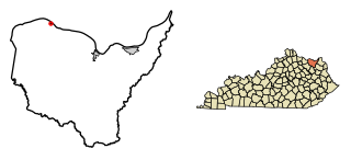
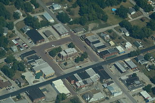
Germantown is a home rule-class city in Bracken and Mason counties in the U.S. state of Kentucky. The population was 146 at the 2020 census.

References

  1. 1 2 "2022 U.S. Gazetteer Files: Kentucky". United States Census Bureau. Retrieved May 9, 2023.
  2. 1 2 U.S. Geological Survey Geographic Names Information System: Sardis, Kentucky
  3. 1 2 "P1. Race – Sardis city, Kentucky: 2020 DEC Redistricting Data (PL 94-171)". U.S. Census Bureau. Retrieved May 9, 2023.
  4. "Census of Population and Housing". Census.gov. Retrieved June 4, 2015.
  5. "U.S. Census website". United States Census Bureau . Retrieved 2008-01-31.