McAdoo, Texas | |
|---|---|
 Small grain-handling facility in McAdoo | |
 McAdoo  McAdoo | |
| Coordinates: 33°44′02″N101°00′23″W / 33.73389°N 101.00639°W | |
| Country | |
| State | |
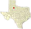
| County | Dickens |
| Physiographic region | Llano Estacado |
| Founded | 1915 |
| Elevation | 2,982 ft (909 m) |
| Time zone | UTC-6 (Central (CST)) |
| • Summer (DST) | UTC-5 (CDT) |
| Area code | 806 |
| Website | Handbook of Texas |
McAdoo is an unincorporated community in northwestern Dickens County, Texas, United States.