Related Research Articles

George Brinton McClellan was an American soldier, Civil War Union general, civil engineer, railroad executive, and politician who served as the 24th governor of New Jersey. A graduate of West Point, McClellan served with distinction during the Mexican–American War (1846–1848), and later left the Army to serve as an executive and engineer on railroads until the outbreak of the American Civil War (1861–1865). Early in the conflict, McClellan was appointed to the rank of major general and played an important role in raising a well-trained and disciplined army, which would become the Army of the Potomac in the Eastern Theater; he served a brief period as Commanding General of the United States Army of the Union Army.

Rebersburg is an unincorporated community and census-designated place (CDP) in Centre County, Pennsylvania, United States. Rebersburg is part of the State College, Pennsylvania Metropolitan Statistical Area. The population was 494 at the 2010 census and includes many Amish in the area.

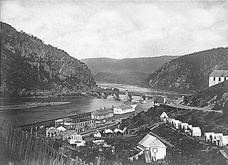
The Battle of Harpers Ferry was fought September 12–15, 1862, as part of the Maryland Campaign of the American Civil War. As Gen. Robert E. Lee's Confederate army invaded Maryland, a portion of his army under Maj. Gen. Thomas J. "Stonewall" Jackson surrounded, bombarded, and captured the Union garrison at Harpers Ferry, Virginia.

The Battle of Shepherdstown, also known as the Battle of Boteler's Ford, took place September 19–20, 1862, at Boteler's Ford along the Potomac River, during the Maryland campaign of the American Civil War. After the Battle of Antietam on September 17, General Robert E. Lee and the Confederate Army of Northern Virginia withdrew across the Potomac. Lee left a rear guard commanded by Brigadier General William N. Pendleton at Boteler's Ford. On September 19, elements of the Union V Corps dueled with Pendleton's artillery before pushing a short distance across the river at dusk. Pendleton inaccurately informed Lee that all of the artillery of the rear guard had been captured. On the morning of September 20, the Confederates counterattacked with A. P. Hill's Light Division, forcing the Union units back across the Potomac. One Union unit, the 118th Pennsylvania Infantry Regiment, did not withdraw at the same time as the others and suffered heavy losses. Lee's army continued its retreat into the Shenandoah Valley after the battle.

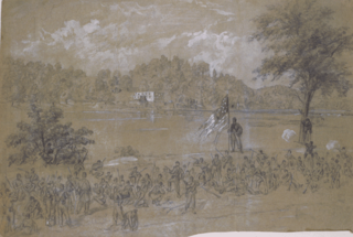
The Maryland campaign occurred September 4–20, 1862, during the American Civil War. Confederate Gen. Robert E. Lee's first invasion of the North was repulsed by the Army of the Potomac under Maj. Gen. George B. McClellan, who moved to intercept Lee and his Army of Northern Virginia and eventually attacked it near Sharpsburg, Maryland. The resulting Battle of Antietam was the bloodiest single-day battle in American history.

The Eastern Theater of the American Civil War consisted of the major military and naval operations in the states of Virginia, West Virginia, Maryland, and Pennsylvania, the District of Columbia, and the coastal fortifications and seaports of North Carolina.
Robla is a neighborhood located within the city of Sacramento, California. The borders of Robla are generally considered to be city limits on the north adjacent to Rio Linda, McClellan Park on the east, the Beltline Freeway Interstate 80 on the south, and Northgate Boulevard on the west. Robla was part of the "Unincorporated place" of Del Paso Heights-Robla, which recorded a population of 11,495 in 1960.
Valley Forge is a village in the southwest corner of Springettsbury Township, York County, Pennsylvania, United States. The community is located just to the northeast of the city of York near the intersection of US Route 30 and North Sherman Street. Harley-Davidson's York plant is nominally located in Valley Forge.
Woodbourne Heights, Baltimore is a community in northern Baltimore, Maryland. It is served by the Woodbourne Heights Community, the Woodbourne-McCabe Neighborhood and the Beauregard Neighborhood Associations.
Manatawny is an unincorporated community in Berks County, Pennsylvania. It is located at the junction on PA Route 73 and Hoch Road in Oley Township, a short distance from Pleasantville.
Horners is an unincorporated community in Westmoreland County, in the U. S. state of Virginia.
Barto is an unincorporated community situated between the boroughs of Bally and Bechtelsville in Washington Township, Berks County, Pennsylvania. Barto is part of the Delaware Valley, located near the border with Montgomery County. Its zip code is 19504 and the West Branch Perkiomen Creek flows southeast through it to join the Perkiomen Creek in the Green Lane Reservoir.
Evansville is an unincorporated community in Berks County, Pennsylvania. It is located along the shores of Ontelaunee Lake in Maidencreek Township, and is served by the Fleetwood Area School District.

Host is one of many unincorporated communities that dot the agriculture-covered landscape of Berks County, Pennsylvania. The village is located in southeastern Tulpehocken Township, along Pennsylvania Route 419. Children here attend the Tulpehocken Area School District, whose high school is located in nearby Jefferson Township.

Strasburg Road was an early road in Pennsylvania connecting Philadelphia to Strasburg in Lancaster County. The route was surveyed by John Sellers and others in 1772-3 under the colonial administration of Governor Richard Penn and completed under the new administration of the independent state of Pennsylvania. The route started at the "second ferry" on the Schuylkill River, today's Market Street in Philadelphia, and went through West Chester, East Fallowfield Township, and Gap, before ending in Strasburg. Earlier roads travelled much the same route, including a Native American path in use as early as 1620.
McDonald Heights is a residential village in York County, Pennsylvania, United States. McDonald Heights is located in the northern portion of York Township and is one of the neighborhoods of York.
Fox Run is a neighborhood of York in York County, Pennsylvania, United States. Fox Run includes both houses and apartment complexes and it is adjacent to the neighborhood of McDonald Heights.

The Federal Correctional Institution, Schuylkill is a medium-security United States federal prison for male inmates in Pennsylvania. It is operated by the Federal Bureau of Prisons, a division of the United States Department of Justice. The facility has an adjacent minimum-security satellite prison camp which also houses male offenders.
Fairview is an unincorporated community in Quincy Township, Franklin County, Pennsylvania.

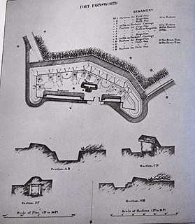
Fort Farnsworth is a former Union Army installation now located in the Huntington area of Fairfax County, Virginia. It was a timber and earthwork fortification constructed south of Alexandria, Virginia as part of the defenses of Washington, D.C. during the American Civil War. Nothing survives of the fort's structure as the Huntington Station of the Washington Metro occupies Fort Farnsworth's former hilltop site.
References
Coordinates: 39°56′49″N76°43′58″W / 39.94694°N 76.73278°W
