Cross Roads, Pennsylvania

Last updated
Cross Roads, Pennsylvania
Borough
Why they call it Crossroads, PA.jpg
Sign at intersection in Cross Roads
York County Pennsylvania incorporated and unincorporated areas Cross Roads highlighted.svg
Location in York County and the U.S. state of Pennsylvania.
USA Pennsylvania location map.svg
Red pog.svg
Cross Roads
Location of Cross Roads in Pennsylvania
Usa edcp location map.svg
Red pog.svg
Cross Roads
Cross Roads (the United States)
Coordinates: 39°48′53″N76°34′23″W / 39.81472°N 76.57306°W / 39.81472; -76.57306 Coordinates: 39°48′53″N76°34′23″W / 39.81472°N 76.57306°W / 39.81472; -76.57306
Country United States
State Pennsylvania
County York
Settled1844
Incorporated1899
Government
  TypeBorough Council
Area
[1]
  Total1.82 sq mi (4.71 km2)
  Land1.82 sq mi (4.71 km2)
  Water0.00 sq mi (0.00 km2)
Elevation
764 ft (233 m)
Population
 (2020) [2]
  Total523
  Density287.68/sq mi (111.10/km2)
Time zone UTC-5 (Eastern (EST))
  Summer (DST) UTC-4 (EDT)
ZIP code
17322
Area code 717
FIPS code 42-17416

Cross Roads is a borough in York County, Pennsylvania, United States. The population was 524 at the 2020 census. [3] The cross roads in the borough is where Church Road (SR 2050) intersects Cross Roads Avenue (SR 2079) and are joined by Century Farms Road. East of the intersection Century Farms Road is numbered SR 2050 and Church Road is unnumbered.

Contents

Geography

Cross Roads is located at 39°48′53″N76°34′23″W / 39.81472°N 76.57306°W / 39.81472; -76.57306 (39.814737, -76.573146). [4]

According to the United States Census Bureau, the borough has a total area of 1.9 square miles (4.9 km2), all of it land.

Demographics

Historical population
CensusPop.
1880 47
1900 167
1910 158−5.4%
1920 144−8.9%
1930 1536.3%
1940 17514.4%
1950 1781.7%
1960 166−6.7%
1970 163−1.8%
1980 26763.8%
1990 32220.6%
2000 51860.9%
2010 512−1.2%
2020 5242.3%
2021 (est.)528 [3] 0.8%
Sources: [5] [6] [7] [8] [2]

As of the census [6] of 2000, there were 518 people, 175 households, and 149 families living in the borough. The population density was 275.5 people per square mile (106.4/km2). There were 185 housing units at an average density of 98.4 per square mile (38.0/km2). The racial makeup of the borough was 96.14% White, 2.90% African American, 0.19% Asian, and 0.77% from two or more races. Hispanic or Latino of any race were 0.39% of the population.

There were 175 households, out of which 44.0% had children under the age of 18 living with them, 77.7% were married couples living together, 5.1% had a female householder with no husband present, and 14.3% were non-families. 10.3% of all households were made up of individuals, and 4.0% had someone living alone who was 65 years of age or older. The average household size was 2.96 and the average family size was 3.19.

In the borough the population was spread out, with 31.1% under the age of 18, 6.4% from 18 to 24, 33.6% from 25 to 44, 23.0% from 45 to 64, and 6.0% who were 65 years of age or older. The median age was 34 years. For every 100 females there were 97.0 males. For every 100 females age 18 and over, there were 96.2 males.

The median income for a household in the borough was $57,750, and the median income for a family was $60,556. Males had a median income of $40,000 versus $31,875 for females. The per capita income for the borough was $20,063. About 2.5% of families and 3.0% of the population were below the poverty line, including 3.4% of those under age 18 and none of those age 65 or over.

Education

Cross Roads Borough is served by the South Eastern School District which provides public education.

Related Research Articles

<span class="mw-page-title-main">Bement, Illinois</span> Village in Illinois, United States

Bement is a village in Piatt County, Illinois, United States. Its population was 1,484 at the 2020 census.

<span class="mw-page-title-main">Centerport, Pennsylvania</span> Borough in Pennsylvania, United States

Centerport is a borough in north central Berks County, Pennsylvania, United States. The population was 387 at the 2010 census.

<span class="mw-page-title-main">Sylvania, Pennsylvania</span> Borough in Pennsylvania, United States

Sylvania is a borough in Bradford County, Pennsylvania, United States. The population was 216 at the 2020 census. Children residing in the borough are assigned to attend the Troy Area School District.

<span class="mw-page-title-main">Lower Allen Township, Cumberland County, Pennsylvania</span> Township in Pennsylvania, United States

Lower Allen Township is a township in Cumberland County, Pennsylvania, United States. The population was 17,980 at the 2010 census.

<span class="mw-page-title-main">Wormleysburg, Pennsylvania</span> Borough in Pennsylvania, United States

Wormleysburg is a borough in Cumberland County, Pennsylvania, United States. The population was 3,070 at the 2010 census. It is part of the Harrisburg–Carlisle Metropolitan Statistical Area.
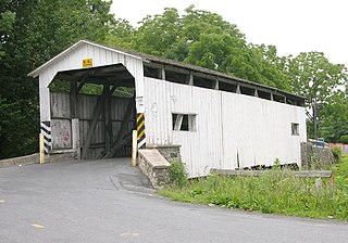
<span class="mw-page-title-main">Ephrata Township, Lancaster County, Pennsylvania</span> Township in Pennsylvania, United States

Ephrata Township is a township in northeastern Lancaster County, Pennsylvania, United States. The population was 10,391 at the 2020 census.

<span class="mw-page-title-main">New Columbus, Pennsylvania</span> Borough in Pennsylvania, United States

New Columbus is a borough in Luzerne County, Pennsylvania, United States. The population was 219 at the 2020 census.

<span class="mw-page-title-main">Cressona, Pennsylvania</span> Borough in Pennsylvania, United States

Cressona is a borough in Schuylkill County, Pennsylvania, United States. Formed in 1857 from part of North Manheim Township, it was founded by and named for John Chapman Cresson, a Philadelphia civil engineer and manager of the Schuylkill Navigation Company, President of the Mine Hill and Schuylkill Haven Railroad and chief engineer of Fairmount Park, Philadelphia. Richard J. Wright is the acting mayor of Cressona, Pennsylvania.

<span class="mw-page-title-main">East Hopewell Township, York County, Pennsylvania</span> Township in Pennsylvania, United States

East Hopewell Township is a township in York County, Pennsylvania, United States. The population was 2,416 at the 2020 census. It is served by the South Eastern School District which provides a public education.

<span class="mw-page-title-main">Loganville, Pennsylvania</span> Borough in Pennsylvania, United States

Loganville, founded in 1820 and named after Colonel Henry Logan, is a borough in York County, Pennsylvania, United States. The population was 1,427 at the 2020 census.

<span class="mw-page-title-main">New Salem, Pennsylvania</span> Borough in Pennsylvania, United States

New Salem, is a borough located in York County, Pennsylvania. As of the 2020 census, the borough had a total population of 818.

<span class="mw-page-title-main">North Hopewell Township, York County, Pennsylvania</span> Township in Pennsylvania, United States

North Hopewell Township is a township in York County, Pennsylvania, United States. The population was 2,723 at the 2020 census.

<span class="mw-page-title-main">Railroad, Pennsylvania</span> Borough in Pennsylvania, United States

Railroad is a borough in York County, Pennsylvania, United States. The population was 259 at the 2020 census.

<span class="mw-page-title-main">Shrewsbury Township, York County, Pennsylvania</span> Township in Pennsylvania, United States

Shrewsbury Township is a township in York County, Pennsylvania, United States. The population was 6,651 at the 2020 census.
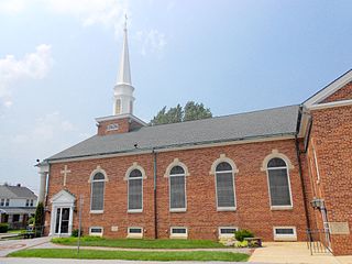
<span class="mw-page-title-main">Spry, Pennsylvania</span> CDP in Pennsylvania, United States

Spry is a census-designated place (CDP) in York County, Pennsylvania, United States. The population was 4,891 at the 2010 census.

<span class="mw-page-title-main">Stewartstown, Pennsylvania</span> Borough in Pennsylvania, United States

Stewartstown is a borough in York County, Pennsylvania, United States. The population was 2,125 at the 2020 census.

<span class="mw-page-title-main">Winterstown, Pennsylvania</span> Borough in Pennsylvania, United States

Winterstown is a borough in York County, Pennsylvania, United States. The population was 609 at the 2020 census.

<span class="mw-page-title-main">Yoe, Pennsylvania</span> Borough in Pennsylvania, United States

Yoe is a borough in York County, Pennsylvania, United States. The population was 1,058 at the 2020 census.

<span class="mw-page-title-main">Yorkana, Pennsylvania</span> Borough in Pennsylvania, United States

Yorkana is a borough in York County, Pennsylvania, United States. The population was 236 at the 2020 census. It is a linear town, spread along Mt. Pisgah Road which is called Main Street in town. The borough includes several dozen houses, two churches, and a few businesses.

<span class="mw-page-title-main">Montrose, West Virginia</span> Town in West Virginia, United States

Montrose is a town in Randolph County, West Virginia, United States. The population was 141 at the 2020 census.

References

  1. "ArcGIS REST Services Directory". United States Census Bureau. Retrieved October 12, 2022.
  2. 1 2 "Census Population API". United States Census Bureau. Retrieved Oct 12, 2022.
  3. 1 2 Bureau, US Census. "City and Town Population Totals: 2020-2021". Census.gov. US Census Bureau. Retrieved 8 July 2022.
  4. "US Gazetteer files: 2010, 2000, and 1990". United States Census Bureau. 2011-02-12. Retrieved 2011-04-23.
  5. "Census of Population and Housing". U.S. Census Bureau. Retrieved 11 December 2013.
  6. 1 2 "U.S. Census website". United States Census Bureau . Retrieved 2008-01-31.
  7. "Incorporated Places and Minor Civil Divisions Datasets: Subcounty Resident Population Estimates: April 1, 2010 to July 1, 2012". Population Estimates. U.S. Census Bureau. Archived from the original on June 11, 2013. Retrieved 11 December 2013.
  8. "Census of Population and Housing". Census.gov. Retrieved June 4, 2016.